The biggest mountain in the Caucasus. The highest mountains of Russia
The Caucasus is a mountain system located in Eurasia between the Black and Caspian seas. The mountain range extends 1100 km from the Taman Peninsula and Anapa to the Absheron Peninsula in the city of Baku.
This territory is commonly divided into several criteria: on a large and small Caucasus, as well as on the Western (from the Black Sea to Elbrus), the central (from Elbrus to Kazbek) and the East (from Kazbek to the Caspian Sea). The mining system reaches the greatest width in the central part (180 km). The mountain peaks of the Central Caucasus are the highest ones on the main Caucasian (waterstep) ridge.
The most famous mountain peaks of the Caucasus are Mount Elbrus (5642 m) and Mount Kazbek (5033 m). Both vertices are stratululkans. What, Kazbek is considered to be extinct, which cannot be said about Elbrus. Opinions of specialists on this occasion will differ. The slopes of the two highest mountains of the Caucasus are covered with snow and glaciers. The Central Caucasus accounts for up to 70% of modern glaciation. For more than a century-old observation of the Caucasian glaciers, their area has declined significantly.
To the north of the foot of the Grand Caucasus extends the inclined plain, which ends in the Kumo Manic Wpadin. Its territory dissected lateral ridges and river valleys. The largest rivers of this territory can be considered r. Kuban and Terek. To the south of the Big Caucasus there are Colchida and Kuro-Araksinskaya lowland.
Caucasian mountains can be considered young. They were formed in the Epoch of Alpine Folding approximately 28-23 million years ago. Their education is due to movement to the north of the Arabian lithospheric slab on the Eurasian. The latter, pressed by the African slab moving on several centimeters per year.
Tectonic processes in the depths of the Caucasus continue until now. The geological structure of Elbrus speaks of the great activity of the volcano in the recent past. Several powerful earthquakes occurred in the Caucasus in the XX century. The most destructive was an earthquake in Armenia, which occurred in 1988
Seismostans working throughout the Caucasus annually register several hundred underground jokes. Specialists argue that some of the sections of the Caucasian ridge "grow" for several centimeters per year.
Caucasus in Europe or in Asia?
This issue is worth considering more in political and historical aspects. Caucasian Mountains are located in the center of the Eurasian Plate, so division can only be conditional. The border between Europe and Asia was proposed by the Swedish officer and geographer F. Stallenberg in 1730. The border, which passed through the Ural Mountains and KuM-Manic Wpadin was adopted by many scientists.
Despite this at different times, several alternative proposals were proposed, which justified the division of Europe and Asia in the Caucasian Mountains. Despite the ongoing disputes, Elbrus and is now considered the highest point in Europe. The history of the region suggests the special position of the Caucasus at a crossroads between European and Eastern Asian cultures.
The highest mountains of the Caucasus
- Elbrus (5642 m). CBD, KCR. Higher point of Russia
- Dykhtau (5204 m). CBD
- Koshtatau (5122 m). CBD
- Pushkin peak (5100 m). CBD
- Dzhangitau (5058 m). CBD
- Shhara (5201 m). CBD. Higher point of Georgia
- Kazbek (5034 m). North Ossetia
- Mihirgi Western (5022 m). CBD
- Tetnuld (4974 m). Georgia
- Katyntau (4970 m). CBD
- Peak Shota Rustaveli (4960 m). CBD
- Guestla (4860 m). CBD
- Jimar (4780 m). Georgia, North Ossetia
- UMS (4690 m). Georgia, North Ossetia
- Gulchitau (4447 m). CBD
- Tabulosha (4493 m). Higher point of Chechnya
- Bazarduzyu (4466 m). High Point of Dagestan and Azerbaijan
- Shan (4451 m). Higher point of Ingushetia
- Ada-hoh (4408 m). North Ossetia
- Diclosmt (4285 m). Chechnya
- Shahdag (4243 m). Azerbaijan
- Tuffang (4191 m). Azerbaijan
- Shalbuzdag (4142 m). Dagestan
- Aragats (4094). Higher point of Armenia
- Dombay Ulgen (4046 m). KChr.
How many five thousandths in the Caucasus?
Caucasian five thousandths are called mountains, the height of which exceeds five kilometers. From the list presented above, it is clear that on Caucasus Eight Mountains "Five Thairs«:
- Elbrus. (5642 m) - Sleeping volcano and the highest mountain of Russia. The mountain consists of two vertices of Western (5642 m) and Eastern (5621 m), connected by the saddle (5416 m).
- Dykhtau. (5204 m) - Mountain peak of the Side Range of the Greater Caucasus. Mountain with two vertices (both above 5000 m) connected by a cool narrow saddler. The first ascent to the mountain took place in 1888. To date, about ten ten routes from 4a (according to Russian classification) are laid on the top of the Rohtau.
- Koshtatau (5122 m) is a mountain peak on the border of Bezeng and the Mountain District of Balkaria.
- Peak Pushkin (5100 m) - Being a part of the mountain range to the Dykhtau, is a separate vertex. Named in honor of A.S. Pushkin to the 100th anniversary of his death.
- Dzhangitau (5058 m) - mountain peak in the central part of the Greater Caucasus. In the jangitau massif, three vertices are distinguished, which everyone has a height of more than five kilometers.
- Schhara (5201 m) - The Mountain Top of the Central Caucasus is part of the Benefic Wall.
- KazBek (5034 m) - extinct stratovany, the most east five thousandth of the Caucasus. The first ascent to the mountain was committed in 1868
- Western mihirggi (5022 m) - Mountain peak as part of the Benefic Wall. The name of the mountain is translated from Karachay-Balkarsky as "connecting".
Caucasian Mountains - Great section between Europe and Asia. The Caucasus is a narrow strip of sushi between the Black and Caspian seas. It amazes an incredible variety of climate, flora and fauna.
The pride of the Caucasus is his mountains! Without the mountains, the Caucasus is not Caucasus. Mountains are unique, majestic and impregnable. The Caucasus is amazingly beautiful. He is so different. On the mountains you can watch for hours.
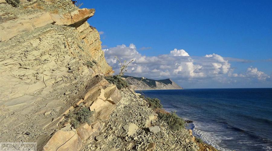
The mountain range of the Grand Caucasus is a lot of pastures, forests, as well as amazing wonders of nature. More than 2 thousand glaciers are descended by narrow gorges. A large mountain chain is almost one and a half thousand kilometers from the North-West to the southeast. The main vertices exceed 5 thousand meters and significantly affect the weather in the regions. The clouds that are formed over the Black Sea are shed with rains, praising on the mountain peaks of the Caucasus. On the one hand, the ridge is severe landscape, and on the other - stormy vegetation. Here you can meet more than 6 and a half thousand species of plants, a quarter of which, not to find anywhere else in the world.
There are many legends about the origin of the Caucasian Mountains:
Long ago, when the Earth was still very young, a huge plain extended on the site of the modern territory of the Caucasus. They lived here in the world and love huge nurts narnts. They were kind and prudent, happily met and day and night, did not know any evil, nor envy, no cunning. The ruler of this people was the gray-haired Giant Elbrus, and he had a wonderful son Beshtau, and his son had a charming bride, beautiful Mashuki. But they had an evil envious - Korean. And he decided to harm nases. He prepared a terrible potion, in which the wolf teeth mixed, the kabana's tongue and the snake's eyes. On a big holiday, he poured the potion in all drinks of narts. And, having drank it, they acquired the greed of boar, the anger of the wolf and the cunning of the snake. And since that time, the happy and carefree life of narts. He decided to beat off his son with his son a young bride and sending him to hunt, wanted to marry Mashuki forcibly. But Mashuki Elbrus resisted. And in the evil battle she lost her wedding ring. I saw Ring Beshtau and hurried to the aid of the bride. And a terrible battle has not faced a not for life, but to death, and half of the nurses fought on the side of Elbrus, and the other half - on the side of Beshtau. And the battle lasted for several days and nights, and all the narts died. Elbrus pounded his son for five parts, and the son, causing the last blow, dismembered the father's gray head into two halves. Mashuki came out after the battle on the battlefield and did not see any living soul. She approached his beloved and looked like a dagger in his heart. So the life of the Great and Old People was stopped.
And at this point now the Caucasian Mountains are now towers: the helmet from Beshtau - the Mountain of the Iron, the ring of Mashuki - the Ring Mountain, five vertices - Mount Beshtau, near the mountain Mashuk and far and far away from others - the gray-haired or just snow-free Handsome Elbrus.
Caucasian Mountains - result of convergence of two plates
Let's look at one of the most narrow seats of this grandiose mountain belt. His northern outskirts, in the predfaccise, are placed areas that belong to a solid coil, called Scythian. Next, sub-luminous (ie, stretching around the west to the east) of the Mount of the Grand Caucasus, up to 5 km high), narrow cavocal depressions - Rionian and Kurinskaya lowland - and also sub-luminous, but convex mountain ranges of the Small Caucasus in Georgia, Armenia , East Turkey and West Iran (up to 5 km high).
The south of the plains of North Arabia, which, as well as the balance of the Westerns, belong to the very strong, monolithic Arabian lithospheric plate.
Therefore, Scythian and Arabian plates - It's like two parts of giant vice, which slowly get closer, crushing everything that is located between them. It is curious that directly against the northern, relatively narrow end of the Arabian Plate, in East Turkey and West Iran, are the highest mountains compared to the mountains located west and east. They take up just in the place where the Arabian stove, as a solid wedge, the most severely squeezed fuel deposits.
They are no less known in the world than Cordillera, the mountain system, stretching along the western outskirts of North and South America for as much more than eighteen thousand kilometers long and width of 1600 kilometers, with the highest vertex of Denali in 6190 meters above sea level in North America, Also Akonkagua - 6963 meters above sea level in South America. Many countries - Mexico, Venezuela, Colombia, Ecuador, Peru, Bolivia, Argentina and Chile border Cordillera. No less known Kordiller Mountain System of Himalayas with the highest peak of Chochi - 8,611 meters above sea level at the Border of the PRC and Pakistan and from one vertex of Lhotse, exceeding a height of eight kilometers on the border of the PRC and Nepal. On the globe admire also Tibet with the highest vertex in the world in Everest - 8852 meters above sea level. However, there are other mountain systems on earth on earth on different continents, attracting attention to which thousands and thousands of bold vertices conquerors seek to climb.

From the legendary taman to the gray Caspian
The Great Caucasian Mountains are essentially two mountain systems - a large and small Caucasus in Eurasia. They stretched more than 1,100 kilometers from the north-west to southeast, and even more specifically, from the Taman Peninsula in the area and along the Black Sea coast to the Absheron Peninsula at the Sea Caspian and near the capital of Azerbaijan Baku. Maximum width of the mining system of 180 kilometers. Compared to the Cordillers, it is hardly a ninth part, but nevertheless noticeable and, which is the root cause of the appearance of a subtropical zone in Russia. In which annually recover their health and fully rest over 15 million as our fellow citizens and guests from near and far abroad. Big Caucasus is divided into three parts: Western - from the Black Sea to Elbrus; Central - from Elbrus to Kazbek and finally the East Caucasus - from Kazbek to the Caspian Sea. As for height above sea level, in Everest she is equal to 5642 meters, Kazbek 5033. The total area of \u200b\u200bthe Great Caucasian Mountains is 1400 square kilometers. In part, this is the edge of eternal snow and glaciers. The area of \u200b\u200bglaciers is offset for 2050 square kilometers. Large icing center - Mount Elbrus Plus Benefic Wall - 17 kilometers.

The edge of five dozen peoples
Great Caucasian Mountains are thick inhabited. There are in mind its foothills. Abkhaza, Ingush, Ossetians, Armenians, Azerbaijanis, Adygi (Circassians) and many other people, united by the general name - Caucasian peoples, live here. For the most part, this is Muslims. But widespread and Christians are Ukrainians, Georgians, Russians, Armenians, as well as a noticeable part of Ossetians and Abkhazians. By the way, the Armenian and Georgian churches are the oldest in the world. Thanks to many of them, these two people of the Great Caucasus have retained their originality, morals and customs. We will add to this - Caucasian peoples for a hundred years were under a foreign department - the Turks, Persians, Russians. Now they have gained independence, steel sovereign.
Twenty-five translated vertices
It is so much that they have the Great Caucasus from Elbrus to Dombay - Ulgen - 4046 meters above sea level. Alpinists are popular: Dykhtau - 5204 meters above sea level; Pushkin's peak is 5100 m., We have already mentioned Cazbek; Shota Rustaveli - 4960m., Gulchi-Tau - 4447 meters, etc.
The Great Caucasus is abundant by rivers, lakes and waterfalls
Burnting at the mountain peaks, some fall into - Bzybe, Kodor, Ingur (Inguri), Rioni, Mzymt, and others. B is the largest Kuban in the Krasnodar Territory. And in the Caspian - Kura, Samur, Terek, Suna, Baksan - all of their more than two dozen. Among the majestic Caucasian Mountains are world famous Lake Sevan (Armenia). It is located at an altitude of 1900 meters above sea level. Its area is 1240 square kilometers, depth - from twenty to more than eighty meters. 28 rivers fall into the lake, but only one follows - hedded, the influx of Araks. By the way, it will notice - and the Caspian and Black Sea essence of the remainder of the Overacter Ocean Tetis. From the oldest days of the name, the Black Sea has changed - Khazar, Sugdesta, Temurun, Kimmeria, Ahshaene, Blue, Tavrichesky, Holy and Even Ocean. The current name is associated with its color to raging storms. It really looks black. In the old days he was also called not hospitable, angry. It was received by the Caspian reservoir by the name, who had once had the tribes of Konevodov - Caspis. It was called Girkansky, Gyerazhansky, Holy, Derbent - just over seven tens of names.

And about one unique water bodice of the Great Caucasus - fantastic in the natural beauty of Waterfall Zeigalan (otherwise it is also called a large Zapeelan waterfall). It is located in North Ossetia in the Midagabindon River Valley in seven kilometers south of the village of Jimar. The height of the fall is 600 meters. Translated from Ossetian - "Falling Avalanche". It is among the ten most ambitious and famous waterfalls. It is pushing a fellow gavari in France - 422 meters high and Crim in Austria - 380 meters. Takes start from a hanging glacier at a height of 650-700 meters. The most peak of the runoff falls on the summer months of July-August. In winter, it dries and marked only by ice subkears on the rocks. The waterfall area is part of the Kazbek-Jimraja mountain assembly, the largest not only in North Ossetia, but in the whole of the great Caucasus. The place is delicious in its beauties - on the slopes of the mountains of the sea of \u200b\u200bflowers, disintegration, the aromas of alpine meadows are circling their heads. But it is necessary to warn - the waterfall is dangerous for people: stonepads happen, there are slices from the melting glacier from above. Nevertheless, the waterfall is actively visiting. Tourists take off the grandiose panorama of the waterfall on the camera or a television.
Flora and the Fauna of the Great Caucasus
As for the flora, it is represented by almost six and a half thousand flowering plants. Of these, 166 are inherent in the mountains only. Subtropics are famous for dozens of palm trees. Relic juniper grow here, pistachio; Pitsundskaya pine, oaks, graphs, mimosa, tulip tree, magnolia, bamboo - all the breed of trees and do not list. Separate oaks-patriarchs aged for a thousand years. Tourists are advised to walk in the groves of juniper. Especially those who have asthma or bronchitis. Juniper's breath in minutes kills all microbes and viruses in man. Day, another, the third walk, and you were born again! It also contributes to the sea air, densely infused in the salts of bromine, calcium, potassium, etc.

As for the fauna of the Great Caucasian Mountains, it is also rich here too and diverse. Screensy on wild boars (Beware of Mamash Dapash with Young: Fangs of males is sharp, and there were cases when a meeting with boars ended with serious injuries or worse than the death!). They are found here and sulfur, mountain goats, bears. Sometimes lived and lynx, and leopards. Asian lions and tigers. Caucasian bison extinted in 1925. The last elk killed in 1810. Great many invertebrates - only spiders for a thousand species. The Great Caucasus is also the area of \u200b\u200bhabitat of the Berkuts, which poachers are mined and sell for big money by scales. Berkcats love to hunt on the Caucasus itself, and in Kazakhstan, and in Kyrgyzstan, and in Saudi Arabia, in other regions and planet countries.
Stela of "Parenting Eagle"
She appeared in 2013 near the resort villages and Supcess, not far from the barbaria, from where he taking the beginning of the gas pipeline called "Turkish Stream", and is open as races to the day of Russia. Nine kilometers from Anapa. The authors are the sculptor V. Polekov in the Commonwealth with the architect Y. Rysin.

The monument is made of their cold bronze, guaranteeing its durability and which are not terrible any changes to weather. A soaring eagle with a wide range of wings and proudly raised to the sky head means the beginning of the Great Caucasian Mountains. Before Stel, there is a platform for vehicles. Tourists, and they are here passing to other resort villages Large and Small Utris, thousands and thousands necessarily stop and photograph or remove the monument on the camcorder. By the way, from the "steaming eagle" there is a stunning view of Anapa and the bays, in which the city has been abolished (in the distant old old old old ancient Gorgippia, and the slave trade was actively conducted, their own coins were focused, and representatives of known from different regions of the Caucasus came and sailed here behind the Belolic Brides!). In good weather, the coast is viewed up to the bank of Mary Magdalen, that the village - and where divers come and flew and fly away from all of Russia, but also from abroad. So, the Great Caucasian Mountains begins with football and, in particular, with a bald mountain height of just 319 meters above sea level, other hills and even lower. The foothills are at the very beginning of the Semisam Range, which is part of the Caucasian Mountain chain. A bald mountain is called due to the absence of any vegetation at all. No, no, herbs and flowers are found there. But not more. Recall once again - from the center of Anapa to the Bald Mountain nine kilometers, and from the outskirts of the city three times less. And hand, what is called, to file to small and. And these places are well known to tourists.

Large Utrich is one of the main attractions of the beginning of the Great Caucasus - Dolphinarium in the open sea and with the theater. In the high season is given daily by several views. Artists - marine animals. Under the curtain of a peculiar play, Dolphins-Aphlegnes deftly jump on the platform and willingly take pictures with all those who wish or removed on the tool. They can be hugging them from the soul, to kiss or swim in the water area of \u200b\u200bDolphinarium. And at this time, the seal, leaning on his tail, is excitely applauding the public with its flops. On Big Utrish, according to the legends, the hero of Prometheus was chained to one of the rocks, who gave people the sacred fire and thereby called the fierce anger from the main god of Olympus Zeus-Ruzhvyz. Zeus ordered to see the breath of the rock with strong chains, and the bloodthirsty eagle flew to the martyr to torment with sharp claws his liver. True, the inhabitants of the neighboring Sochi Anapa objected, de Prometheus was chained in the Orline Rock area at the former capital of the 2014 Winter Olympic Games. And even built a monument to the hero - it is worth the Prometheus on the grief with the chains broken in their hands, and he has a proud look of the winner! And yet, the statement of the Sochns causes doubts: the eagle rocks are located away from the sea, at the fast river. But in the open-air museum in the center of Anapa "Gorgippia" found a crypt with the frescoes of the features of another mythological hero - Hercules. And from the myths of ancient Greece, it is known for certain - from the chains of Prometheus freed heracles. He and bloodthirsty eagleproogany. Who is right who is wrong - let specialists decide. But in Anapa, which no one and half of a half thousand years, persistently consider - the rock of Prometheus is still on the Big Utrish. An irrefutable, in their opinion, and another legend - de past the rocks of a big designer in search of a golden rune sailed Argonauts led by their brave captain Jason. Here are such secrets of the Great Caucasian Mountains from Anapa and steles of the "steaming eagle".

Verses from Novorossiysk to Gelendzhik
In today five resort zones: Sochi, Gelendzhik, Tuapse, Anapa and Taman. From each of them to another, what is called hand to hand. And they all stretched along the Black Sea coast with the exception of Tamani, which has a way out also to the Azov Sea. And the Black Sea coast is mainly protected by the mountains. In addition to Anapa, which, as we noticed, the great Caucasian mountains begin, but in general the municipality comes out from the sea to steppe spaces. And only in the Novorossiysk area, as a continuation of the Semisam Range with Bald Mountain, the foothills gradually rises, moving to the Marcoth Range or on Adyg in Marcoth, stretching from Novorossiysk towards Gelendzhik to more than ninety kilometers. The highest mountain, towering over Novorossiysk - Sugar head (558 meters above sea level). Gradually rising, the Marcoth Range in some places goes to upper than 700 meters. It consists of limestone, sandstone, clay, but its main component is Mergel, which is coming to the manufacture of cement. In Novorossiysk, this is especially noticeable - the plants for the production of this type of building materials are working, and dust around the column. Marcoth Range, note, goes parallel to the south of the main Caucasian ridge. Between Novorossiysk and Anapa many attractions. In particular, the Monument of Nature is the Sheshouse Juniper Parldasshe. We were told about the healing properties of the relic juniper, therefore I will not be repeated, we emphasize that it is especially useful in the treatment of asthma and bronchi. From Anapa to Novorossiysk directly 40 kilometers, in the motorway - 52. It is possible to overcome them a little more than forty minutes. And if you drive another 14 kilometers towards Gelendzhik, then you will find yourself in the Abrauan Peninsula, in the southern end of which is a big utrety with your famous dolphinarium in the open sea and the theater. But the main chip of the peninsula is undoubtedly the place of Abrau-Durso, comfortably located among the mountains and the part of the municipality of the city resort Novorossiysk.
Specific estate of Russian sovereign
At the village of Double Name -. And this has its own reason. One village is located in the mountains, among the fantastic beauty nature. Here and the river with the same name and the largest freshwater lake in the Caucasus with the same name as the village. With a population of about three thousand living, as in paradise. Soft climate, warm winter and vineyards, vineyards, vineyards. Abrau Lake is 3100 meters long, 630 width, depth of 8 to 11 meters, by the way, there is a fish. Gorgeous embankment - with arbors, benches. In summer, the water is warm, and in the lake can be happy to swim. But you can plunge into the Black Sea. The second village of the royal estate is Durso. Today there are both the recreation centers, and the health resort, where you can relax and become.
Abrau village is known in the world with its refined taste of Russian champagne. In the origins of its production stood prince Lion Golitsyn. And the relay picked up, as it is not surprising, Joseph Stalin, who ordered to establish the release of domestic champagne in the southern regions of the country and in Abrau, in particular. And such an instruction was kept in the Government Decree of 1936. As for the production of champagne under the patronage of Golitsyn, the first of his party was produced in 1898. And two years later, in Abrau, his powerful winery appeared, from Novorossiysk to the village they laid the vehicles. Now Abrau has a museum of famous wines, as well as a corporate store in which tourists can buy Russian champagne under the brand "Abrau-Durso", dry wines and even brandy. A lot of entertainment on the coast in Durso is water attractions, "bananas", "tablets", you can rush with a breeze on the waves on water bikes. And in Abrau are popular horseback riding in local foothills, mountainous tourism, including jeep or extreme trip, but already on mountain motorcycles.

Marcoth at Gelendzhik
Until the famous no less than Anapa, the resort from Novorossiysk Distance to the Bulk Void - directly three tens of kilometers, on a tenth of kilometers more. The trip will take somewhere just over forty minutes. And now you will appear the most extended embankment in the world - 14 kilometers. With a graceful figure of a bride from a white marble, which is well visible from the height of the Marcoth Range of 762 meters above sea level. Translated from the Adygh "Marcotch" literally means "berry places", and here really delicious blackberries can be collected by buckets. Coles, however, but what is called "without difficulty caught and fish from the pond!". High vertices in the vicinity of Gelendzhik Several - Shahhan at the Zhana River (700 meters above sea level); Pshad - 741 meters by the river with the same name and 43 kilometer long, flowing into the Black Sea; Gebius - 735 meters above sea level. The Marcoth Range itself extended along the Gelendzhik Bay - charmingly beautiful from a bird's eye view, and even more so with top of the surrounding mountains. The resort is famous for its Safari Park, in which lions live in vivo, tigers, bears and other animals. Behind their lives can be observed with a chair suspended road. At the top of the Irkotkh Range - a fantastic forest - with Lesus, mermaid on the branches of a tree, Baba Yaga and other fabulous characters. From the observation deck, the yachts and other vessels in the bay, seagulls, cormorants, petrels, solving over the blue sea with white scallops of the waves.
And the mountains are all higher, and the mountains are worse!
And this is true, if you go from Gelendzhik to the large - the southern capital of Russia, stretching along the Black Sea coast for a whole hundred forty-five kilometers. In the world, only one city is the longer the former capital of the past Winter Olympic Games, in which our team won with Triumph and who struck the planet with their colorful opening and closing ceremonies - the capital Mexico Mexico - 200 kilometers. And in the native fatherland of Sochi, the length is ahead of Volgograd, stretching along the Great Volga River 90 with more than 90 kilometers. So here's about the height of the local mountains. Having overcome the distance from Gelendzhik to Sochi 246 kilometers over almost four hours (sheepskin is worth it!), You can climb, including the excursion groups, on one of the surrounding vertices. You can start with small - Mount Akhun - 663 meters above sea level. And then the height of the mountains will go on an increasing: sugar fifteen kilometers from the city - 1555 meters; PSOGISA - 2216 meters; Large weaving - 2368 meters; Achishho - 2391 meters; Peak Bazlie - 2482 meters; Turning southern - 2503 meters; Stone pillar - 2509 meters; PSHEO-SU - 2743 meters; Oshten - 2804 meters; Fisht - 2853 meters; Peak Kozhevnikova - 3070 meters; Pic needle - 3168 meters; Sugar pseashho - 3189 meters; Atheist - 3256 meters and finally the highest peak of all Cuban Tsakhvo - 3346 meters above sea level. This is not so little, if we consider that the highest peak of the great Caucasian mountains and even Europe - Elbrus height in 5642 meters above sea level.
The famous ski resort "Krasnaya Polyana"

It is located on average Mzimti mountain river that translated from Adygh - "Ramane", uncontrollable "," indomitable "- there are other interpretations. Blows into the Black Sea. 39 kilometers long. Above the gorge over it The famous pedestrian suspension bridge is the most Long in the world. From Him, extreme lovers make jumps in the abyss of the elastic cable. Here is a popular attraction - a giant swing with a sparing pendulum in Polkilometer. From the west of Mount Achishho, from the east - Aibga Ridge. Immediately in the vicinity of the top Fistt, in honor of which A stadium was named, where the opening and closing ceremonies of the Winter Olympics in 2014 were held. Red Polyana - Ski Resort, who may well compete with his fellows in the same Switzerland or in other mountain places of the planet. A year here is resting more than a million compatriots and foreign Guests. At their disposal one hundred and more kilometers of snow tracks of different difficulty levels - 6 green, 8 blue, 16 red and 6 black. Comfortable on them m Hell feel experienced skiers and beginners and children. Among the independent ski resorts - "Rosa-Khutor", "Alpika-Service", "Gorki City" and GTC Gazprom. Day in skiing, evening disco, karaoke, pleasant evenings in cafe, restaurants, casino. All accommodations are enough - hotels, hotels, guest houses, you can remove the cottage. No problems with transport. Before Adler, forty kilometers. Fly there can be direct flights from many regions of Russia. And then railway transport with famous "swallows" or by regular buses, even faster than personal cars. The road will not seem tedious to you. Especially with such fantastic natural beauties! By the way, there are enough databases on the Red Polyana with ski rental, snowboarding, sled and so on.
Arriving in Sochi to rest and treatment (he takes more than five million tourists per year, not including those who prefer snow tracks working from November and in April inclusive, and sometimes grabbing the beginning of May), be sure to visit the Olympic Park. It is located at the Black Sea itself. With Fisht Stadium and other sports facilities built to the White Olympiad. All of them are unique architecture. The Ice Palace reminds Peking Opera - as an icing drop. And the bowl of Olympic Fire! It looks like a fire-bird from the Russian folk fairy tale. In the Olympic Park - the Trus "Formula 1", and the competitions on the pilots do not leave anyone indifferent. Fans come from all parts of light and stay in a great delight. There is a "Disneyland" in the park with dozens of attractions. The souvenirs, including the mascots of games, can be purchased into local permissions. Just keep in mind - in one day the park can not get around. It covers an area almost in two hundred hectares. In Imeretin lowland. Do not go around for the day and on electric vehicles: so many attractions in it. Natural beauty Tuapse
The famous resort town is located between Gelendzhik and Sochi. From the southern capital of Russia removed by 117 kilometers - less than two hours drive. From Gelendzhik - 129 kilometers, ride just over two hours. Protecting the resort from the evil northern winds of the mountains in an average height from 1352 to 1453 meters above sea level. But there are exceptions - the peak of Shezsi ascended to the sky at 1839 meters. Among the attractions of the Mountain Semiglabia, Wolf Gorge, the rock of Alexander Kiselev, who goes into the sea and named after the artist. In the city itself - subtropical plants. In the foothills and locals and tourists with pleasure collect European blackberries. The resort area has sanatoriums, boarding houses, children's health camps. Cargo, and passenger ships are moored in the seaport. You can rent a yacht, go out on it in the open sea, to divide, swim in the purest water or sunbathe on the deck. Love tourists during maritime walks to arrange and picnics.
Republic of Adygea
It is part of the Southern Federal District with the capital of Maikop with a half-million population. Part of the North Caucasus Economic Area. From all sides is surrounded by the Krasnodar Territory. In the republic, forty-five Aules, there are villages, stages, farm. From the streets of Maikop, the main Caucasian ridge is clearly visible. Attractions are popular with Lago Naki Plateau tourists. Ten waterfalls Rufabgo - each with its name. River Kuban, White, Laba. The white river is 260 kilometers long. And nourish her mountain streams and Spring Fishe, Oshden and Abago. Granite canyon with a length of four kilometers and a depth of two hundred meters. Sakhraian waterfalls. Mountain Lake Pseudona. Frequently visited by tourists of the rock of the devil finger, mountains monk, large weaver, trident, camel, Range of un-goat. The mountains are high enough, recall, the top Fistt climbed 2868 meters above sea level. This her name received the stadium, where the opening and closing ceremonies and the closing of the Winter Olympic Games in 2014, so struck with their paintness and originality inherent in Russian mentality.

Dagestan - Country of Mountains
There is a popular saying on this. Its especially often lead in speeches on December 11, when the whole world celebrates the International Day of Mountains. And the highest vertices of the Great Caucasus here - Shalbuzdag - 4150 meters above sea level. In July and August, a real pilgrimage: the grave of the righteous of Suleiman is located here. Mountain resembles a pyramid with a toothed vertex. There is a belief if you climb it - all the desires and dreams will come true. And thousands of tourists try to do it. But the capital of Dagestan Makhachkala directly stretched along Mount Tarka-Tau - a unique natural monument from mountain monolith. It is known good and because in 1722, the Army of Peter's first entered the package. The top of the Great Caucasus named Bazarduzyu is considered the southernmost point of Russia. She ascended to a height of 4466 meters above sea level. The first ascent is committed in 1935.
You can talk about the mountains of Dagestan. But he has another unique landmark - just fifteen kilometers from Makhachkala, his capitals, the seamy Caspian is splashing - the largest water-tailed reservoir, the largest lake on the planet in Europe and Asia. Its area is 371 thousand square kilometers. The depth exceeds a kilometer. It has more than 140 species of fish, of which the most famous Beluga, with which if you meet - you will be afraid: I'm not shark? There are sturgeon, giving black caviar and such species as bream, horse, bleak, river eel, sipovka, Nalim - do not list everyone! The Great Russian River Volga River 3,530 kilometers falls to the Caspian Sea (Lake), from the coast of which Stalingrad was captured by the 300 thousand Hitler's army headed by Field Marshal Paulus. For rest to the Caspian Sea, thousands and thousands of tourists of both our compatriots and foreign ones come to the Caspian Sea. In particular, near Makhachkala, there are sanatoriums, boarding houses, and children's health camps. True, the coast of the Caspian Sea is not very much mastered, but a course is taken to create another popular resort area here. What? White shallow sand, clean water - sunbathing, swim, catch fish, Warm from her on the shore of fragrant ear!
Clear Weather Top Mountain Kesgen (4011 m) gives a unique opportunity to observe from the rich and cheerful picture of the Central Caucasus. Almost all major and secondary mountain ranges of the Chief Caucasus Range, districts Tyutyu, Adyurs, Chegema, Bezengi, Adylsu., Yus'engi. and Verkhovy Baksan GorgeAnd on top of the passes and less high peaks of GKC, long-distance perspectives are opening Svaneti. On the opposite side of the horizons, the Caucasian monarch Elbrus is a strictly end symmetrical appearance of its Eastern vertex.
The initial publication material is photographs obtained from the top of the mountain Kesgen In July 2007 and July 2009. They formed the basis two basic panoramas.
Panorama-1: - Evening Panorama (July 2007). Covers the GKC sector from the Wall of Benelli to Chatan, as well as areas of the main ridge coming in the Russian side - Chegem, Adyirs and Adylsu.
Panorama-2: - Morning Panorama (July 2009). Partially overlapping Panorama-1, represents the GKC sector from the Wall of Bezeng to Azau, the Russian sangs of the GKC - Adyirsu, Adylsu, Yusing, Cogutay and Cheget, jumper Azaou-Elbrus, as well as southeast (with the top of the terrskolak) and the East (with the top of Iritionchat ) Otrogs Elbrus.
To two main panoramas attached additional Panorama-3 (July 2007). It gives a view of the sings of Eastern Elbrus in the Subasha-Kyrtyk-Mukal sector from the pass of Russian officers (which the Kesgen vertices are 150 m below it).
Together, these three panoramas covers the entire circle of review.
Camera - Nikon 8800.
Read more about the top of Kesgen.
Kesgen is located in the highest of Eastern revolutions of Elbrus - the one pulls away from the vertices hanging over its ice fields Caucar (3898 m) To the villages Elbrus and Neutrino in the Baksan valley. The spurry has a number of left branches towards Subashi's River, Kyrgyk and Saltrans, he himself bends with the left side of the River Valley Iriktchat and - after her sign in Irik - the Valley of Irika. The main vertex in this ogge - Irikchat (4054 m), she is a little inferior Subashi (3968 m) in the north-west and equivalent duet Kesgen - Soviet warrior (4011 m) in the south-east.
Lifting to Kesgen is beautiful, pleasant and easy. The beginning of the move towards Kesegen, the Soviet warrior and Iritionchata in common - from the floodplain of the river, Iribut the herbal slope, on a very noticeable trail back. Then the paths disagree, the Kesgen trail takes to the right. Upon exit to the felon slopes, it is lost on the upper traverses, but with sufficient visibility, by the opening left of the take-off to the passage of Russian officers (tourist 1B), do not miss. Exit from the transferted saddle to the top (along the northeast ridge) is also simple - 1b climbing. (Kesgen sometimes visited by climbers within the framework of Traverse Kesgen - the Soviet warrior, who heard in Alplare Adylsu, a certain similarity of reference.)
Kesgen is the closest four-tair north of Bacsana, the tops are increasingly close to the river significantly lower. This favorable feature of its location and route unattoping make Kesgen with an excellent overview point.
Panorama, notation, decoding.
Panorama-1 (more than 800 Kb, 8682 x 850 Points) in the original form:
Panorama-1 with vertices marked on it, passes, glaciers and gorges:
Panorama-2 (more than 1.2 MB, 10364 x 1200 Points) in the original form:
Panorama-2 with vertices marked on it, passes, glaciers and gorges:
Additional Panorama-3 - View of the northeast in the Valley of the Glacier Poker:
Accepted designations and general principles.
The panorama has marked:
Mountain peaks - colored circles,
Pass - crosses,
Glaciers - rectangles,
Gorge (valleys of rivers) - Double wave.
Potals, glaciers and gorges numbering through, right to left.
All signs glaciers and gorges Blue. Signs perevalov and verkhin They painted in different colors, depending on their affiliation to this or another mountainous area.
The color differentiation of icons helps to more clearly imagine and trace the location of various mountain areas visible on the panorama, especially in the places of imposition.
Used colors:
- Green thick: for objects outside the state border of the Russian Federation,
- Red: for vertices and Potals GKC,
- Violet light: for vertices of the Bezengi district outside GKC,
- Orange: for vertices and passes in the ridge Adyurs,
- Yellow clean: for vertices and passes in Adylsu Range,
- Yellow dirty: for vertices and passes in Juñoney Ridge,
- Purple dark: for vertices and passes in the Kogutut, Dongzorun,
- Pale green: for vertices and passes of the south-east sort of Elbrus,
- Pale plum: for vertices and passengers of Elbrus-Azau jumpers,
- Brown light: for the vertices and passes of the ridge in the upper horse Irika and Iriktych,
- White: for vertices and passals of Eastern Otrogul Elbrus,
- Blue: For vertices and passes in short spits of GKC (vertex circles at the same time in a red rim), as well as in the spurs of the ridges of Adyurs (vertex circles in the orange rim) and Adylsu (vertex mugs in the yellow rim).
1. Mountains
Note. The above-mentioned heights of the vertices in some cases differ from those that leads the "classification of routes to the mountain peaks" (hereinafter "Classifier"). These heights are predominantly on the maps of the General Staff (hereinafter "General Staff"), built according to the results of methodically homogeneous measurements within the framework of the unified topographic program of Soviet times. The high-altitude data of the General Staff leads to an accuracy of 0.1 meters, but should, of course, keep in mind that such enviable accuracy could apply to cover only random measurement errors, and not systematic errors of the measuring technique itself.
1.1. The vertices located in Georgia
1 - Tetnuld, 4853 m
2 - Lights, 4117 m
3 - Asmashi, 4082 m
4 - Marianna (Marianna), 3584 m
5 - lexier (Jantuguan), 3890 m
6 - Chatin Chief, 4412 m
7 - North Ush, 4694 m
8 - South Ushba, 4710 m
9 - Cherinda, 3579 m
10 - dolra, 3832 m
11 - Staff, 3994 m
1.2. The vertices of the Chief Caucasus Range (GKC)
1 - Wall of the Benelli (details on the enlarged fragment of the panorama)
2 - Guestla, 4860 m
3 - Lalyver, 4366 m
4 - Tightengen, 4618 m
5 - Bodorca, 4233 m
6 - Bashathau, 4257 m
7 - Sarykalk, 4058 m
8 - Massif Ullutau, 4277 m
9 - Lazga, 3976 m
10 - Chegettau, 4049 m
11 - Rocks Aristova (3619 m - Kaluga Peak)
12 - Jantugan, 4012 m
13 - Bashkara, 4162 m
14 - Ullukara, 4302 m
15 - Volnaya Spain, 4200 m
16 - Brzech, 4280 m
17 - Caucasus East, 4163 m
18 - Shchurovsky, 4277 m
19 - Chatin Western, 4347
20 - Ushba Small, 4254 m
21 - Schcheld East, 4368 m
22 - Shheld Central, 4238 m
23 - Arovers (Schhelda 3rd West), 4229
24 - Schhelda 2nd Western, 4233 m
25 - Schhelda Western, 3976 m
26 - trade unions, 3957 m
27 - Physical worker, 3961 m
28 - Schhelda Small, 4012 m
29 - Ahsu, 3916 m
30 - Usengi nodal, 3846 m
31 - Gogutay, 3801 m
32 - Donguzorun East, 4442 m
33 - Dongzorun Chief, 4454 m
34 - Donguzorunica Western, 4429 m
35 - Zakratau, 4269 m
36 - Cyper, 3785 m
37 - Chiefzau, 3512 m
Verses in short sorts of GKC
1 - Hermogen, 3993 m
2 - Chewetra, 3667 m
3 - Caucasus Chief, 4109 m
4 - Western Caucasus, 4034 m
5 - Donguzorun Small, 3769 m
6 - Cheget, 3461 m
1.3. Vershins of the Neneng region
1 - Dykhtau, 5205 m (5204.7 on the Map of the General Staff, 5204 according to the classifier and Lyapin scheme)
2 - Koshtatau, 5152 m (5152.4 on the Map of the General Staff, 5150 by Classifier, 5152 according to the Lyapin scheme)
3 - Ullukuz, 4682 m (4681.6 on the map of General Staff, 4675 by classifier, 4676 according to the Lyapin scheme)
4 - thought, 4677 m (4676.6 on the Map of the General Staff, 4557 by Classifier, 4681 according to the Lyapin scheme)
1.4. The vertices of the Adyurs district
1 - Adyirsubashi, 4370 m (4346)
2 - Booters, 4369 m (4259)
3 - UNCARA, 4226 m
4 - Kichdar, 4360 m (4269)
5 - Jailyuk, 4533 m (4424)
From the array of Jalik Ridge Adyirsu is divided into two branches:
(a) Northwestern branch,
(b) northeastern branch.
The vertices of the northwestern branch of the Adyurst Range:
6a - Tyutyubashi, 4460 m (4404)
7A - Sullukov, 4259 m (4251)
8A - Steel, 3985 m
The vertices of the northeastern branch of the Adyirsa Range:
6B - Kenchat, 4142 m
7B - OLEL, 4056 m (4064)
8B - Kajart, 4082 m (4121)
9B - Kilar, 4000 m (4087)
10B - Sakashil, 4054 m (4149)
Verses in the spurs of the Adyurst Range:
ot of Adyirsubashi
A - Chemist, 4087 m
B - Moscow Komsomolets, 3925 m
C - triangle, 3830 m
From Jalik
D - Chegem, 4351 m
From Tytyubashi
E - Kulloumkol, 4055 m (4141)
F - Termen, 3950 m (3921)
From Kilar
G - Adjikol (Adzhikolbashi, Adjikolchatbashi), 3848 m (4126).
1.5. The vertices of the Adylsu district
(in brackets - heights according to the Lyapin scheme, if there is a difference)
1 - Kurschichi, 4045 m
2 - Andyrchi nodal, 3872 m
3 - Andyrtau (Andyrchi), 3937 m
4 - MNR (Peaks of the Mongolian People's Republic): Northeast 3830 m (3838), Central 3830 m (3849), South-West 3810 m (3870).
The vertices in the spurs of the ridge Adylsu towards the Valley of Adyurs:
1.6. Verses Range Yusingle
1 - Yusing, 3870 m
2 - North Yusingi, 3421 m. According to tradition, ascending, apparently, to the map of the General Staff, the names of these two vertices are confused with each other
1.7. The vertices of the Kogutaysky Schoga Donguzorunica
1 - Intercosmos, 3731 m
2 - Small Cogutay, 3732 m
3 - Big Cogutay, 3819 m
4 - Baksan, 3545 m
5 - Kakhiani (DonguzorUngitrinbashi), 3367 m
6 - dining room, 3206 m.
1.8 vertices in a jumper between GKC and Elbrus
1 - Azaubashi, 3695 m
2 - Ullulukbashi, 3762 m
1.9 The vertices of the South-Eastern Otroga Elbrus
1 - Terekol, 3721 m
2 - Terkolac, 3790 m
3 - Sarykolbashi, 3776 m
4 - artykaya, 3584 m
5 - Teheneklibashi, 3502 m
1.10 The vertices of the ridge in the upper gorge of Irik and Irikty
1 - Achkerlyolbashi (Askerbashi), 3928 m
2 - Red Buds, 3730 m
1.11 The vertices of the Eastern Otroga Elbrus
1 - Irique Western, 4046 m
2 - Irique Central, 4030 m
3 - East Irique, 4020 m
4 - Soviet warrior, 4012 m
1.12 Verses in the northeast (aside of the Mukal Glacier)
Showing separately on Panorama-3
Islamekt (3680 m)
Shukambashi (3631 m)
Jaurgen (3777 m)
Sumark (3712 m)
Kyrtyk (3571 m)
Mukal (3899 m)
2. Pass
1 - Hunala South, 2B - connects the valleys of the Hunalechat (Sakashilsu's influx) and Kajart (L. Kajart)
2 - Kajart Zap, 2a - between the peaks of Kilar and Adzhikov
3 - Kajart, 1B - between the vertices of Kajart and Kilar
4 - Sternberg, 2a - between the tops of the Olya and Kaaryta
5 - Kilar, 1b - between the peaks of Kenchat and the Olya
6 - Waterfall, 1B - in the Northern Squeege of Peak Steel
7 - Sullukov, 1B - in the western spoke of the peak steel
8 - Olympics, 2a * - between the array of Tyutyubashi and the top of the Olympics
9 - Kulloumkol, 1b - between the array of Tyutyubashi and the peak of Kullumkol
10 - Tyutu-Jalyuk, 3A - between the top of the jayl and the array of Tyutyubashi
11 - Chegemsky, 2B - in the shoulder of Kichdar
12 - Kichdar, 2b - between the vertices of the Unclear and Kichdar
13 - Freshfield, 2B - between the vertices of the guns and the unclear
14 - Golubev, 2a - between the vertices of Adyrusubashi and the bumps
15 - Pomegranate, 1A - in the Northern Ochogogo Peak Navy
16 - Curma, 1A - in the Northern Ochogogo Peak Navy
17 - Dzhalovach, 1b - between the peaks of the physical consultancy and the Navy
18 - Mesalsky, 2a - between the vertices of Ullutau and Sarykol
19 - Churlenis Vosta, 3a * - between the peak of Yesenin and the shoulder of the guests
20 - Lights, 3A - between the vertices of the FLO and that
21 - Jantuguran, 2B - between the top of Jantigan and the cliffs of Aristov
22 - Marianna, 3a - between the tops of Marianne and Flatar
23 - Bashkara, 2B * - between the vertices of Bashkara and Jantugan
24 - Victory, 3b - between the vertices of Ullukar and Bashkara
25 - Kaskhatash, 3a * - Between the peak of free Spain and the top of Ullukar
26 - Double, 3A - between the peak of the Caucasus Vost and the top of Brzheder
27 - Caucasian saddle, 3a - between the peaks of the Caucasus GL and EAS
28 - Krenkel, 3A - between the peaks of the Caucasus GL and Zap
29 - Chalaat, 3B - between the vertices Chatin Zap and M. Ushba
30 - Ushbinsky, 3a - between the arrays of the seams and Schheld
31 - Bivatny, 2B * - Between the peaks of physical consultancy and trade unions
32 - Yusingi, 2B - between the vertices of Yusing and Yusing North
33 - Middle, 2b - between the top of the Small Schhelda and the peak of the physical consultancy
34 - Motherland, 2a (when moving on counterfour from the Valley of the Yusingi Valley) - Between the vertices of Yusing and Yusing
35 - Akhsu, 2a - between the vertices of the nodal and ahsu
36 - Becho, 1B - in the ridge of GKC between the vertices of 3506 and 3728, it is the lowest pass on the GKC plot between the Donguzoruden and the Yusingi Ridge and the closest to the top of the nodes.
37 - Becho False, 1b - in the crest of the GKC to the west of the top 3506 and east of the lane. Olympian
38 - Yusingi Plot, 1B - Ice Moves through the Short Eastern Spur Top Gogutay
39 - High debt, 2a - at the approach of GKC from the vertex to the verth. Donguzorun under the vertex Gogutay.
40 - Pastened (Okhotsk), 1a - binds the yusingi gorge with the head of coguetki
41 - Vladimir Korshunova, 1B - between the top of the big coguta and the peak of Baksan
42 - Pearl of Primorye, 1B * - Between the tops big and small claw
43 - Cogutay, 1b - between the peak intercosmos and the top of a small claw
44 - seven, 3b * - between the tops of the clutch and Donguzorunica Western
45 - Donguzorunica False, 1B - Middle to the top of the Chip (from the West) pass through the GKC
46 - Dongzorun, 1a - the simplest and low pass through the GKC to the west of the top of the closet, is located west of Donguzorun's pass.
47 - SUACKALAR, 1B * - between the vertices of Arttykaya and Sarykolbashi
48 - Sarytalk (conditional name), 1B * - between the peaks of Sarykolbashi and Tercholac
49 - Cyper, 1B * - Middle to the top of the chip Pass through the GKC between the tops of the chip and Chief
50 - ChiPelezau, 1a - Middle to the top of Chief Male Pass through the GKC between the vertices of the chipper and Chief
51 - Azaau, 1A - between the tops of Chiefasau and Azaubashi
52 - Hasancoisyurulgen, 1B - between the vertices of Azaubashi and Ullulukbashi
53 - Terkolac, 1B - in the crest under the top of the terrskolak north of it
54 - TERSKOL, 1B * - between the top of the terrskol and the Ice slopes of Elbrus
55 - Assol, 1B - more southern out of neighbors, connecting the Irick Glacier and a small "inner" glacial circus between the upper reaches of the Gorge Irik and Iriktych
56 - Fleeze Grant, 1B - Pass in the same vertex circus as the lane. Assol (№55), north of him
57 - Irik-Iricot, 2a - in the ridge between the Irik glaciers and the south of the top of the achcherianolbashi
58 - Chat Elbrussky, 1B * - In the ridge between Irik glaciers and the ridge of the west of the top of Achcherianolbashi
59 - Iriquet, 1B * - between the Glacier Irikchat and the Top
Passages in the northeast, in the side of the Mukal Glacier (without numbering, are shown separately on Panorama-3):
Mukal-Mkära, 1B
Mukal-smear false, 3a
Warpet, 1A.
Riten, 1b.
Bauman, 2A.
Hibiny, 1b.
Earthlowers, 1B.
3. Glaciers
1 - Kajart West (No. 485-b)
2 - Oralay (№ 485 - a)
3 - Sullukov (№ 491)
4 - Yun North (№ \u200b\u200b487-d)
5 - young (№ 487-b)
6 - Nitrogen (No. 492-b)
7 - Curbs East (No. 498)
8 - Adyirsa East (No. 493)
9 - Bashkara (No. 505)
10 - Kaskhatash (No. 508)
11 - Brzeduch (№ 509)
12 - Ushbinsky Land
13 - Schcheldinsky (№ 511)
14 - Ahsu (No. 511-b)
15 - № 511-A
16 - Yusingi (№ 514)
17 - № 515-B
18 - Ozengi (№ 515 - a)
19 - № 517-B
20 - Cogutay East (№ 517 - a)
21 - Coguntay Western
22 – № 518
23 – № 519
24 – № 520
25 – № 538
26 - № 537-B
27 - № 537 -
28 – № 536
29 - Big Azau (№ 529)
30 - Garabashi
31 - Terekol.
32 - Irik (№ 533)
33 - Irikchat
Mukal Glacier - see Additional Panorama-3
4. River basins (gorge)
1 - Kulloumcol
2 - Sullukov
3 - Waterfall (these three rivers: 1, 2, 3 - Right tributaries R. Adyirsu)
4 - Schhelda (Flow Adilsu)
5 - Yusingle
6 - Kogutayka (these two rivers: 5 and 6 - Right Functions of Baksan)
7 - Irick
8 - Irique (two last rivers - 7 and 8 - Left tributaries of Baksan)
Increased fragments of major panoramas.
a) Tyutu Bashi and Jalik.
Array Tyutu-Bashi. (4460 m) on this fragment of the panorama turn to us with the Western end, so that all five of his vertices are built in one line: Western (4350 m), Second western (4420 m), Central (4430 m), the main (4460 m) and Eastern (4400 m). The array is breaking into the gorge of Tyutu-Su (in the image to the left) northern wall with routes to category 6a.
The right of the tuteu is located Jalik (4533 m), the highest vertex of the ADIRSU Ridge and, notice, the third highest in the Baksan valley and Elbrus, after Elbrus (5642 m) and east (4710 m). Right from the jayer looks Chegem (4351 m), famous for complex rock walls up to category 6a. Under Chegem, they usually visit through the Chegem Gorge, located between the Baksansky and Razengian gorges in parallel to the first.
In the foreground in the center of the Sulluk Glacier. In the picture you can also see the passals of the Tyutu-Jalik (3a), it is between the vertices of Jalik and Tyutu-Bashi, and Kullumkol (1B), between the vertices of the Tyutu-Bashi and Kulloumcol (4055 m), the latter is visible under the jayuk on his background. All of them are marked on a common panorama.
b) Koshtartau and Dykhtau.
In the picture from the left Before us Koshtatau (5152 m), or just a cat. This is the top of the "Technical Caucasus" - the highest in the Caucasus Mountain with the route of the sixth category of complexity, 6a on the left side of the central counterfort of the northern wall. The route was first passed in 1961 by the team of Baumanians (MWU, Moscow, head of Arnold Simonik), who dedicated his flight Herman Titov, "Cosmonaut Number Two". A slightly higher vertex of the Six "six" is not classified. Traverse Dykhtau-Koshtan was "six", but at times it was stripped. The cross-smoke traverse with a climb to the cat on the 6a is completely illogical, and on the roof of the Caucasus - Elbrus - "six" no, if not talking about the rise on the top after passing the wall Kücürthu - what, you see, the illogical option is also.
To the left of the northern ridge on the northern ridge leads the "British" Great 4B (Vulley, 1889), this is the easiest way to the top. (The name of the voyage is called Peak in the GKC north of the peak of Shchurovsky. It is curious that Hermann Woolley - Hermann Wooley, in some sources Woolley came to mountaineers, being already a football player and a boxer). At the bottom of the ridge, a characteristic hump - Ice gendarme is visible. The lowest, most complex part of the route - the rise from the Mihirggy glacier to the northern ridge of Katana - hidden behind the peak Panoramic (4176 m), which is in ogge Ullukuza (4682 m). The cat's approaches from this side are extremely mooring, you have to pass all the steps of the Mihirggy icefall, which only before the night "3900" there are three, and there is also a zone of cracks located above. The first two steps pass along the Morane and then on the ice, following the left (along) the board of the glacier, and the third bypass on the left and go overnight stays "3900", the highest in the area.
In the foreground of the picture - an array Adyirsubashi (4370 m). To the left, to Golubev's pass (2a, 3764 m), the northeast crest with many gendarmes stretches from it. Lifting to Adyrsubashi on this ridge is a very long "five A". Golubev's pass himself remained to the left behind the scenes, it is located in a downgrade between the tops of Adyrusubashi and the guns and combines the Verkhovy Adyirsu and Chegema, serving the faith and the truth to one of the popular tourist routes.
Adyirsubashi is a nodal vertex of the Adyir Range. Her western sorry argues himself tops Chemist (4087 m), Lake (4080 m), Moscow's comsomolets (3925 m) and Triangle (3830 m), for this vertex - descent toward Alpalage "Ullutau". The vertices are chemist and lakes - these are two snowstores with cliff outers, in the picture they are the left and below Adyirsubashi. With a lake (right chemist and closer to us) in the Coulunumkol Valley (left) flows a small nitrogen glacier. This is the "chemical" name he received by the name of Alpalage, acting (since 1936) from the EDC of the Chemical Industry of the same name. In 1939, eight (!) Alpilatera acted in Adyirsu's gorge. The fate of "nitrogen" has developed the most successful, now it is Alpalage "Ullutau".
To the north-west of the top of the lake in our side, boding the Glacier of Nitrogen, leaves the spur, in which the peak is traced Panoramic, he is peak Winter (3466 m), who received such a name in the use of Alpalage "Ullutau" as an object of low climbing in the winter shift of the camp. Another ridge branch of the peak of the lake (the right in the picture) leads to a peak of the Moscow Komsomolet, whose vertex falls exactly on the right cut of this fragment. In the Far Plan array Mihirgi. C is distinguishable Eastern vertex (4927 m). Western Mihirgi (5025 m) and second Western Mihirgi, better known as peak Borovikova (4888 m), are almost no distinguishable in the ridge coming from Eastern Mihargi to Dykhtau.
On the right picture Before us array Dykhtau. (5205 m), or just breathing. In the foreground at the left cut of a fragment - Peak Moscow Komsomolets, from which the ridge crest stretches to a low peak of the triangle below in the center of the frame (both peaks mentioned above in the comments on Khtalthau). There are two vertices, more often attributed to the Chegema region: Huge Tightengen (4618 m), standing in the GKC between the vertices of the orthocara and the kitlod, and - a little closer, on his background - a vertex facing it a snowy slope Bodorku (4233 m), also located in GKC.
c) Bezengian Wall.
In this fragment, about the profile is visible the entire Benefic Wall, stretched out the arc from Schhara to Laller. This non-traditional perspective can even be pressed even the experienced connoisseurs of the district, it hurts "successfully" with the Bezengian wall of Guestla.
On the left in the picture is visible a long sv-crest of "classic" lifting on Schharu (5069 m) on 5a - route D.Kokkina (J.G.Cockin, 1888). For the first time, he was passed by the British-Swiss Troika U. Almer, J. Cockin, C. Roth as part of the Expedition of the British Royal Geographical Society under the start of Douglas Freshfield. The photographer in this and subsequent expeditions of the 1890s was Vtorio Sell, who received St. Anna's Cross from Nicholas II for his photographs of the Caucasus Mountains. In honor of him, the Glacier and Peak Sello are named (4329 m), which is on the approach to the top of the Mihirggy in the upper Eastern branch of the Benefic Glacier. For technical complexity, the Kokkin route on Schharu is unlikely to pull even on 2b, but he is dangerous, which relaxes, although it is reliably insured on a long snowy crest with eaves to one, then there are almost no one to the other side, and there were cases of breaking whole ligaments. In some sources (eg, A.F.Naumov, "Chegem Adyurs") the route is categorized as 4b. The category can raise to the fifth, wanting to reduce the stream of climbers with a cut-off of those whom the KCCU Anguenga officially on the "four" already produces, and there are no five on the top five. Cokkina route - in use "Crab": Rock outputs resemble a crab with the downstream. This crab (on the panorama it is not read) well distinguish from the duck-kosha in the bottom of the ridge, above the "pillows".
The crest is clearly visible to the ice gendarme and the eastern vertex of Schhara. There are no classified routes to it, it is practically walking along the way to the main top of Schhara. From Eastern Schhara GKC leaves us southeast, even closer to the south, and passes through the peak Ushguley (4632 m), known as southeastern Schhara. Peak is named by the name of the ancient village of Ushguli. Located in the Svan Valley at an altitude of 2200 m, it is considered the most high-altitude European settlement of permanent residence (i.e., minus ski resorts and meteorological stations). At the top of the Ushguli there are several "five" from the Georgian side, as well as super long 2a, the technical simplicity of which is compensated by the length of the approaches: two days from the Alpalage of Bezengi or from Alpalage Aylama in Svaneti.
The most beautiful and logical route on Schhara is perhaps "Austrian" 5b Tomashek-Muller (1930 g) - lifting from the Bezengian Glacier in the forehead along the Northern Rebra (it is on the picture on the boundary of light and shadow). In the days of the Stalinsky USSR of foreign expeditions in our mountains, it was no matter how it should have had, however, a small diaspora of the Austrian Communists in the early 1930s has found shelter and, judging by the records of its route achievements, I didn't waste time in vain (look at Caucasian routes at leisure of that period with German last names).
Inconspicuous top West Schhary (5057 m) worth mentioning that there are only two routes from the north on it (Anatoly Blankovsky, 1980 and Yuri Razumov, 1981), and both are very strong and objectively dangerous, rarely visited "six". They appeared in the early 1980s, thanks to progress in ice equipment - first of all, the appearance of cat platforms for ice and icebreets in the USSR (previously insured with carrots ice hooks, which had to hammer in ice for a long time).
Right from Western Schhara Comb Walls Walls gradually decreases in the direction of a small rocky peak tip Shota Rustaveli (4860 m), hidden for closer to us Guestla (4860 m). Rustaveli peak for the first time in 1937, Georgians, from the south along the route 4a. Recently, he is often visited from the north, because in a decrease in the wall at the place of the peak, the relatively secure "Board of Laletina" displays - a monotonous ice route passed in 1983 by St. Petersburg team A.laletina. In full-time class of the championship of Russia in the Alpinnism of 1995, the two-time departures have managed to slip this route to the top to 10 o'clock in the morning!
Another of the left in the panorama is visible to the cold, the Jangi-Tau array: Dzhang East (5038 m), the main (5058 m) and Western (5054 m). The route to the eastern Dzhangi in the swamp is the easiest on the Bezengian wall, it is easier to only routes to the extreme mountains of the wall, Schhara (technically light 5a) and a henol (4a with a rise through peak 4310). In addition, SV Comb (counterfour) of East Dzhangi is an objectively the least dangerous version of the lifting on the wall from the north, and it is often used as a trigger after lifting to the Dzhangi massif (including the main Dzhangi), Western Schhara or Rustaveli Peak. Eastern Dzhangi, like Schhara, printed in 1888 a group of Kokkin.
To get the "Star Bezengi" icon, it is not necessary to climb the main duck (the only route to it from the north - dangerous ice collaps 5a), quite the top of Dzhangi - first of all, simpler and safe eastern. There is no classified routes from the north to the Western Dzhang (except within the framework of the walls of the wall), and they are unlikely to appear soon: the beautiful and logical line on this vertex on this side is not viewed, but the objectively dangerous ice discharges are visible. But from the Georgian side, two 5b are classified on Western Dzhangi. I wonder when they were last walked? ..
Approximately the same ice "vegetable" looks from the north and Katyn. (4974 m), from which a huge and even Katyn plateau stretches to the guestside. Katyn was also first passed in 1888 by the participants of the British Expedition, but the simplest route on it from the north - 4b LS (Hollarder, 1888) is objectively more dangerous and less beautiful than St. Dzhangi is the same category of complexity.
The Line of the GKC passes along the edge of the Benefic Wall through the arrays of Schhara and Dzhangi, Katyn, Guest and Lalyver, and a long comb, outgoing from a guest to the southwest (in a picture of the right) and partially hiding the Katyn Plato, brings to the top located in Georgia Tetnuld. (4853 m). In this fragment, the panoramas is not visible (it is right), but it is on the general panorama. At the top of the Tetnuld in the 1990s, Georgians brought a metal cross characteristic, as in the Georgian flag, forms. The easiest way to Gestol (4860 m) from the north - it is 3b through peak Lalyver (4350 m), with a lifting to Lalyver for technically simple 2b and the subsequent simple traverse through the peak 4310 and the shoulder of the histrol. This route (passed for the first time in 1903) is categorized as 3B, perhaps exclusively for height and length. There is an option to reduce this Chinese campaign - cut off the way on the peak 4310 with a climb on it not through Lalyver, but in the forehead with the western branch of the Benefianic Glacier. This option of the route to the henase is categorized as 4a (A.Germanov, 1932), although technical difficulties are not checked on it to 3a (carefully in the upper part - destroyed rocks).
The story with the name of the groove in the ridge of the Benefica Wall is the backstage of the bearer of the Bezengian. This slight increase in the crest has previously "passed" as peak 4310. or nameless peak. The last name did not give rest to the rename activists, and in the 1990s, two plates were placed on this peak in the neighborhood, one in approval peak Yesenin, other - peak 50th anniversary of the CBD. The "jubilee" version of the title seems to sound a weighter of the poetic impulse of the Yesenian admirers, because the name "50 years of the CBD" was due to the mass climb of 2b through Lalyver with the support of the authorities from Nalchik. But in the technical descriptions, this vertex, as a rule, still passes as "4310". It is clearer: how none call it, the height will not change :)
Peak 4310 shares two passes in the Benefic Wall, Churlenis East and Western. On the enlarged fragment of the panorama marked Churlenis East, it between the peak of 4310 and the shoulder of the histrol. Vertex Basil (4257 m) - in the picture on the background of Lalver - is the west of the district of Bezengi and applies to the region of Chegemsky Gorge.
A few words o the height of the vertices of the Benefic Wall and her highest point.
The fact that Shhara is the highest point of the wall, all sources are converging. But they determine the heights of the Benefica vertices they are different. So, for the Schhara, the main one can meet not only the traditional value of 5068 m, but also more "prestigious" 5203 m, and for Dzhang main - the values \u200b\u200bof 5085, 5074 and 5058 m (Lyapina map). We rely on the data of the General Staff as more homogeneous (at least within the same detached area) and for higher points Schhary and Dzhangi We accept values, respectively, 5069 M. (5068.8 for the General Stand) and 5058 M.. Immediate visual assessments also give preference to Shhara. When looking at the Bezengyan wall from the northern massif, as well as when looking at Schhara with Dzhangi (and on the contrary), Shhara always impress the dominant vertex of the wall.
Finally, O. the curvature of the "arc" of the Benegi wallapparently in the picture. The visual impression of her great curvature on the plot of Schhara - Guestla is illusory, it is a clean effect of a large increase in the snapshot, in which the picture of cushing distant objects is stretched in azimuth, but it does not move into depth. So it seems that a slim comb visible from the end and wags with his sides. With reference to this picture: If you recalculate the visible angular distance between Shharra main and roller (or Dzhangi Western), then it will turn out to be six (!) It is less than the real distance from Schhara to the main to histnol, and it seems that they are about the same.
(d) Svaneti Mountains and Jantuguran Pass.
The main characters of this fragment - dominant Svethar. (4117 m) and, right, modest Marianne (3584 m), a bunch-twice ending the collar stretching from the east (left). In the soft evening lighting of the Sun, their rock slopes are affected by a variety of color shades. Marianna lined up in a number of vertices asmashi Rangewhich are identified very uncertain at this end perspective. All this mountain range would be of great interest to mountain tourists and climbers, be it open to a visit from the Russian side. It is enough to say that most of the perspectives of the district - Asmashi, Marianna, Svethar, the one - category 3a.
A few words about the Jantugugan Plateau and the Passage of Jantugan (3483 m, Tourist 2B), which dominate the middle plan of the fragment. The Jantugugenian Plateau is one of the western branches of the huge ice complex lexier (lexiry), the largest of the south side of the GKC. It is formed by the system of glaciers framing the GKC on the plot from Cascastas's Pass in the West to the Vertine District of Basilia in the upper reaches of the Chegemsky Gorge in the East. These glaciers are adjacent to the passes connecting the regions of Adylsu, Adyirsu and Chegem with Svanetia. The Jantugan Plateau resembles the apple who has fallen from the inside: his entire inside is interrupted by wide bottomless cracks, and only a narrow outdoor rim is edible. Any reasonable movement on the Liser line - Bashkara - Jantugan - the rocks of Aristov - Gumachi - Chegettau - Lazga is possible only near the slopes of these vertices.
The glacier at take-off to the jantugugan's pass is strongly broken, but in recent years there is a path of ease of bergs and cracks, which takes it to the head of the cliffs of Aristov (red spots in the picture). The pass himself somewhat puzzles: you do not see an explicit inflection in any direction, everything is hollow, and only by passing the meters of 50-70 to the south and bolding in faults, you understand that the overall decrease in Georgia has come. (At the same time, the red-white border stick sticks out only twenty meters above the breakdown in our, the north side.) Near the vertex of Gumachi there is another pass-out of the passage - East Jantugan, he is false humachi (3580 m, tourist 2B) . The rise on him from the ADIL-SU gorge is not more difficult to 1b, but for descending from him to Svaneti (in the tricky iceman, which determines the category of both passages), it is necessary to bypass the plateau on the right and, it means to follow the passage of Jantugan. So for routes from Adil-Su to Svanetia, it is clearly preferable. There is another option to rise to the Jantuguan Plateau in the middle between these two passes, through the central decrease in the chain of the cliffs of Aristov.
Rocks Aristov Named in memory of Oleg Dmitrievich Aristovstanding at the origins of Soviet mountaineering. In 1935, his group one of the first "diluted" the vertices over the Jantuguan Plateau in the simplest way and made several pioneers - Jantuguran on 2a, guess 3a, Traverse Gadyl-Bashkara (4a). This summer, the 1st All-Union Alpiniad of Trade Unions worked in Adyl-Soo's gorge, and 24-year-old Aristov led the school instructor on it. Oleg died at the peak of communism on September 13, 1937. He was appointed head of the assault group, which had an order to bring Bust Stalin to the Peak of Communism (then - Stalin's peak). Oleg walked with frostable legs and slipped, having broken down already at the top of the top.
Lifting to the Jantugugan Plateau from the side of Adyl-Soo passes through the Giancath Glacier, which is chosen by glaciologists for research on the processes occurring in valley glaciers. The thickness of this typical valley glacier is 40-50 meters in the iceflocks and 70-100 meters at the plots. Like other Caucasian glaciers, Dzhankath in recent decades quickly retreats. At his tip, in the glade with a seductive name with the seductive name "Green Hotel" - houses of the Glyciological station of Moscow State University. In early June, a backcountry-camp, focused on beginner and advanced riders, is sometimes arranged here. In the summer of students are students. In winter, the houses are convenient to use for the night, they save from the winds from the passage, feeding the glow during the descent into a wide plain part of the gorge below the jankatic glacier.
From the jantuguan plateau, it is convenient to make radial climb on the surrounding peaks. In the eastern direction they are simple - to the tops Gumachi. (3826 m) 1B (on foot) and Chegettau (4049 m) 2B. This twice-b is the oldest route of the district and all of Elbrus (excluding Elbrus himself) - Douglas Freshfild, 1888. In the western direction from the Jantuguan Plateau, it is convenient to climb Jantugan on 2a and 3a, as well as on the Bashkar on 3b, gone on 3a and leakyr Jantuguan (1B).
Peak Jantugan (4012 m) At the right cut of a fragment of panorama, a beautiful and simple route 2a leads to it from the pass. Jan is facing here to us with its northern side, on which three three-b is classified, one of them (according to CB Edge) is clearly visible - this is a rib, discarding the shadow. By walking the peak from the plateau, you can climb the jumper between it and its Western neighbor, the top of the Bashkara. Route 3a on Djan (according to the ridge) route begins near this jumper, and a beautiful ridge route 3b leads to Bashkar.
Massif Bashkara-ghadel borders the Jantugan Plateau from the West. With the plateau it is clearly seen that the peaks Bashkara (4162 m) and Gadyl (4120 m) - the tip of one array. He is simply addressed to Svaneti "Gadyl" sideways, and to Balkaria "Bashkarsky", because of what and received different names from the corresponding observers. Traverse Bashkara-Gadyl (4a) is one of the oldest routes of the district (K. Egger, 1914). On a panoramic picture from Kezgen, the vertex was not visible, closed by Bashkara, which in all its severity is presented on an enlarged fragment (photo on the left). Bashkara is breaking towards the same glacier to the same northern wall, which pass two routes 6a, technically the most difficult in Adyl-Su. Snow "Pillow" to the right of Bashkara - the victory pass, one of the most complex in the area (3b along the tourist classification). Pass Bashkara, which between Bashkara and Jantugan is substantially simpler. From the northern slopes of Bashkars, the Bashkar glacier descends, from the melting of which the Bashkarian lake was formed, threatening with a breakthrough and a village down the Gorge of Adylsu.
e) from Cascastas's pass to the east.
The same area with the designations of vertices, passages and glaciers.
|

(Recall, the peaks of the GCC are marked with solid red circles, passals of GKC - red cross).
From left to right:
Top 14 - Ullucara (4302 m), located in the GKC, is broken by a wall of complexity 5b to the rover of the Kaskhatash glacier.
Top 1 against Ullukary - Peak Germogenova (3993 m) in the Ollukary sprog. From the middle course of the Caschatash glacier to the top stretches the comb, which passes the route 2B - one of the longest "twists b" in the area (along with the "Two B" on the Eastern Dongzorian on the ridge of the GKC). Groups of beginners usually go this route with overnight.
Pass 25 - Kaskhatash, 3A * - located in the GKC between the vertices of Ullukary and Free Spain.
Glacier 10 - Cascastas Glacier, referring to the Adylsu's pool, the influx falls opposite the lower houses of Alpalage "Jantugan".
Top 15 - Peak Free Spain (4200 m), located in GKC. The route to the top of the Eastern Comb from Passage - Category 4a. Ice route 4b along the wall of the Rock Tower (Alexey Osipov Alekskiy, 1995) is recommended as a winter version, it is rocked in the warm season. On the rocky tower several "fives b" are laid. The rocky gendarme in the east ridge is sometimes called the peak of Gogol, and the gendarme in the Western ridge - the peak of Lermontov (I remember the peak of Yesenin, mentioned in the description of Bezeng next to the top of Lalyver). In the climbing plan, it's still gendarmes, they do not lead independent routes, but topologically "gendarme Lermontov" - no matter how cool, it is a nodal vertex of the GKC. From her, the ridge of a dollyer will be born, which leads to the south in Svaneti and shares the glaciers lebris and Chalaat there.
Top 16 - Brzeduch (4270 m), located in GKC. The snowy slopes of the jumper between the tops of free Spain and the Bzchuch are the simplest, but dangerous collapse the path of descent from free Spain, in use, referred to as "bark".
Glacier 11 - Brzheduch, refers to the Swelda pool.
Pass 26 - double, 3a - located in the GKC between the peak of the Caucasus East and the top of Brzechuch.
Top 17 - Peak East Caucasus (4163 m), nodal vertex GKC. Here the main ridge turns in the direction of us, to the peaks of volatile and Shchurovsky, and the rest of the peaks of the Caucasus are already in his outstand, which goes to the Schheldy Valley.
Pass 27 - the saddle of the Caucasus, 3a - is located in the deck of GKC between the peaks of the Caucasus Chief and East.
Top 3 - Peak Western Caucasus, Located in the Ochogo GKC.
Pass 28 - Krenkel, 3a - located in the Ochogo GKC between the peaks of the Caucasus Western and the main.
Top 4 - Peak Caucasus Chief (4037 m), located in the Ochogo GKC.
From the Western Chatan in Svaneti, there is a short, but powerful sorry with the top Chatin Chief. He shares the two branches of the Chalaat glacier, breaking on the Chatan plateau - the southern circus of the main, the eastern branch of the glacier - its famous northern wall with solid "six". The approach from Russia to the Chatan Plateau under the routes to the northern wall of Chatin - Up the Gorge of Schheldy through the Chatin South Gorge, he also Chatin False (2B). (For more information about this pass, see Catalog Oleg Fomichev's tops, reference to it at the end of the article among other useful links.) From the side of Georgia, go to the Chatan Plateau without a very strong desire it is difficult for this, for this you need to either pass through the additional passage of the Dalla-Bark in the southern sorts of GKC, or go through Up through the complex icefloods of the Chalath Glacier, which is extremely problematic even if there is equipment.
Near the small ears from the GKC in Svaneti, there is an even more impressive short spoon with the pearl of the Caucasus - an array of ears and his tops Northern Ushba (4694 m) and South Ushba (4710 m).
The main passes of the PCC in this node:
Pass 29 - Chalaat, 3b - between the vertices Chatin Western and Small Ushba, the passage of academician Alexandrov, 3b - between Chatin and Peak Shchurovsky projected on the same pass
Pass 30 - Ushbinsky, 3a - between the arrays of the seams and Schheld.
f) Schkelda Array.
Vertine heights Schcheldinsky massif (from left to right):
Eastern - 4368 M.
Central - 4238 M.
peak Aristova - 4229 M.
peak The science - 4159 M.
2nd Western - 4231 M.
Western - 3976 M.
By the way, in 1974, the Titanic traverse of Schhelda was passed (all the vertices) - Ushba - Mazeri (Agravansky, A.Vesner, V.Gritsenko and Yu.U.Ustinov, 14.07-5.08 1974). The obligatory set of traverse of all vertices of Schhelda includes five out of six, named above: Schkelda western, located on a distant periphery, is already on the cage already on the approaches to the peak of trade unions.
The rest of the array of Schheldy is considered gendarmes. The gendarm rooster is highlighted - the high-rolled rock phallus next to the eastern tower of Schheld.
g) Malaya Schheldy district.
Not particularly noticeable, but interesting to its topology and rich in the surrounding mountain knot around Small Schheldy (4012 m). GKC enters the frame on the left side of the peak adjacent to Schcheld Trade unions (3957 m) and, moving with a small southern roll to the West through a lowering of the Bivar's pass (3820 m, 2b *), climbs on the peak Physical culture (3961 m, not to be confused with the peak of the day of the physical consultancy, that in the ridge of Adil-Su), turns from him 90 degrees and the North-Western move, bypassing the passage of the average (3910 m), rises to the top of M. Schheldy, the highest point of the area. Further, almost without changing the course, the GKC passes along the double scallop of Akhsu (3916 m), which from Kezgen is visible from the rib and seems to be an end snowy slope with an easily recognizable Berg at the base. Going along this slope (Route 2a), GKC turns strictly to the West and, slipping the lane. Ahsu (2a, 3764 m), comes to a low and completely simple when approaching from any side of the vertex Yus Things Knotovaya (3846 m). Here, the GKC says goodbye to us and leaves for the right slice of the frame towards the Passo's pass, and in the north-east direction (left and on us) from the nodal ridge of the Yusingi Ridge. More than a kilometer he leads a wide and flawlessly smooth snowy ridge (the vertex output of the AHSU glacier), at the same time it is imperceptibly accessed by the region of the Rodina's pass (2a, 3805 m) and reaches its highest point on top Yus'engi. (3870). Further, he goes down to the Baksan Valley for a long time (in a picture on the ridge in our direction).
Both vertices of Yusingi and the Pass of the Motherland give gorgeous species towards Elbrus and Donguez, the greater species Elbus-Dongzovsky Prostor, you will not give any other point of observation. The peak of Malaya Schhelda is a wonderful point of review of the entire surrounding Georgian sector, and the peak of the physical consultancy gives an amazing close view of the ligament of Schhelda - Ushba - Maizers and the Ushbinsky Glacier in the pit between them.
Lifting on a peak athletics with feathers. The average is 6-8 minutes. Lifting from there to the top of a small Schheldy - Nasty 2a for old fragile rocks. The rocky traverse M. Schhelda - Ahsu is already classified as 2B, and more extended traverse in the other side - M. Schhelda - Peak Physical Center - Trade Union Peak - like 3a.
The vertices marked on the snapshot form a chain over the Circus of the AHSU glacier, open (not listed by moraine nanos) throughout its current from the sources to the place of sign into the Schkeldy glacier. There is no longer stretched section of the open glacier in the Gulgs from Adyurs to Azaau.
h) Array of Donguzorunica and Chip.
When you look at the Donguzorian array with Cut (4269 m) from the terkola, surprise: Well, why did this cover named the neck and generally called, if it is nothing more than the appendages really serious and the developing Mountain Donguzorun? When you stand in the upper gorge of Yusingi and look at the bottom up on the monumental eastern wall of Donguez under the age-old glacial shell, surprise even more: and where is the false and where is it, this non-feasible baby? But when you look at the Array of Dongza from Kesegen, the global picture becomes clear. The Western Top of Donguez is the center of the right three-pointed star. From her to the southeast (left in the picture) the Ridge of Donguez stretches, it is he who constitutes the main part of the complex - the actual array of Donguzorunica with its three adjacent vertices: Donguzorun East (4442 m), Main (4454 m) and West (4429 m). From the Western Top right on us, the Northeast Spar of Donguez is descended, which at an intermediate peak Intercosmos (3731 m, in the photo from Kesegen, this is a common snow-covered pyramid) is divided into two branches, a very short northern, which gracefully descends to the river Donguzorun above the Chegte Polyana, and the one that is authentic - Eastern, Coguttaya (we see a shameless flat on the palms The snowy bowl of the western circus is coherent). In this branch above the glacial circuit, two similar triangular versions are clearly visible - Big Coguta (3819 m), it is left, and Small Kogutay (3732 m). The main ridge from the Western Top of Donguez leaves to the West (right), immediately puts on the tower of the Neck and then gracefully goes to the hospitable Pass Donguzorun (1A, 2302).
Nevertheless, it would be great injustice - and the actual mistake - to consider the flip of not an independent vertex, but only a side appendage of Donguez. The fact is that it is to her, and not to the dominant neighbor, with the south adjoins ridge Zalgmyl, which is very long in itself and to which, as a rod, are attached to numerous sidegings, filling the extensive space, circled by the Inguri River (from the South) and its primary slices (from the west) and the liar (from the East). Only a small inner region submitted to himself Donguzorun - the thing that occupies a modest and short ridge Dolzasheltered three kilometers to the GKC and adjacent to the main top of Donguez.
The topology of the Donguzorun-false array is interesting. There is a common long and monotonous unknown rise from the South, Georgian side, where the Multi-current Glacier Kvish (and from where to the heights of Donguez, the routes of Merzbahher, 1891 and R. Gellabling were laid at the top of the DonGuez, 1903 - both 2a ), And then, at the exit to the border comb, everything is sharply cut down, in Russia, the eastern and northern walls of the array, glorious with their difficult climbing routes (categories from 4B to 5B). And immediately for the discharge of the eastern and northern walls of Donguez - greens and the Chegte-Tercole charms of civilization.
In connection with such an extraordinary topology in the winter of 1989, in Dongouz, this is what story. As part of the climbing championship on the northern wall of Donguzoruna (strong route 5b Hergiani), two from Kiev rose, but soon after the release of the top, they did not come to communicate and disappeared. They did not have products (dropped even on the rise). Winter, February, Frost, bad weather. Found them only on the 8th day ... at Minvod (!). .
i) Elbrus.
Observer on the top of Kezgen Elbrus. Folding mine Eastern vertex (5621 m), and the maximum symmetrically in terms of the central axial line and sidelines. The Western Top Mountain (5642 m) is completely closed eastern.
On the eastern vertex in its right part on the background of the sky, the rocks are distinguished, they are the 20-meter wall beaten the vertex crater. The highest dome dome is located on the southern (left in the picture) edge of the crater. This vertex crater is revealed to the East, in the direction of us, and on the slope in a semi-kilometer, the side crater gaps under it, and the Achkerkolsky lava flow (ALP) is stretched under it downward under it downwards - the chain of the felous rocks of volcanic origin. This flow descends to the ice fields of East Elbrus, giving the beginning of the rivers Irik and Irikty.
On the North (right to the viewer), the slope of Elbrus against the background of the sky, two spots of rock outlets can be seen - approximately at 4600 and 5100 m. The top of them is rocks Lenza, named so in honor of the member of the Expedition of General Emmanuel: ".. Enjoyed from academicians - Mr. Lenz - rose to a height of 15,200 feet. The full height of Elbrus above the level of the Atlantic Ocean is determined by the value of 16,800 feet" (quoted). Each of these high-altitude values \u200b\u200bwas obtained by more than a 10% error, but their relationship suffers from errors is much less and with reference to the adopted height of Elbrus (5642 m) allows you to estimate the height of the 5100 m's heights achieved by Lenz. Rock outputs.
A few words about the historic route of Douglas Freshfield to East Vertain Elbrus (1868). The classifier of routes to the mountain peaks leads Freshfield through the shelter-11, but it went to another way (in detail described in his best-selling "mastering the Central Caucasus"). The group came out of the village of Urusbiev (Upper Baksan) and the first day on horseback was moving along the Baksan valley, and the second - climbed up the gorge of the Terekol, from where the Dome of Elbrus appeared, and got to the beer site at the Ice Base. To the top of the group came out in the third hour of the night. Hollowing on the glacier, went to the cone in bundles to the cone and first reached the height from which the sobs were opened towards the distant steppe, and then, already at the beginning of the lift on the cone, met the sun. By half the eighth at an altitude of 4800 m, the group reached the cliffs of the upper part of the cone and 10H40M came to the top in the area of \u200b\u200bthe current obelisk.
"This vertex was at the end of the horseshoe-shaped ridge, crowned with three elevations and a snow plateau framed from three sides, open to the east. We passed - rather even, ran - in the ridge until the very end, passed two significant decreases and visiting all three vertices. ... [At the same time], we naturally looked out for whether there was no second top, but there was no one anywhere. It seemed to us that the western slope sharply breaks down to Karachah and that tight clouds that could hide the top of about the same as our height, was not. But we were mistaken: Western, a little higher peak was completely hidden with a haze ... We need to remember that before this climb, we never seen Elbrus and, therefore, had only a vague idea of \u200b\u200bthe structure of the mountain. "
Constructed on the top of the "stone man", the group at the beginning of the twelfth began to descend along the way of lifting, in the evening I went to the valley and the next day I returned to the Urusbiev, where he was met with greetings and treats.
"We fell under cross-flames of questions about how there, on top, and we had to register to report that we did not see a giant rooster there, who lives in the embroidery and welcomes the scream and slamming wings of the sunrise, and the uninvited guests meets the beak and claws, wanting to protect the treasure from people. "
Routes routes, but in the case of Elbrus, it is impossible to teach about his own biography. Why is the main Caucasian ridge like as the main one, and its cult vertices - Elbrus and Kazbek - somewhere on the side? Because they are volcanoes. At the Greater Caucasus, volcanism is associated with crushing of the earth's crust at the late stage of the city. Volcano Elbrus was formed in the side ridge on the watershed of the Ries of Malki, Baksan and Kuban, and it is dedicated to the place of crossing the longitudinal tyrnyaeuz fault zone and the transverse elbus fault. In the southwestern part of the mountain, the remains of the oldest craters were preserved in the form of the cliffs of the most ancient crater. Now the double-headed volcano is imposed on the upper part of the ancient crater - highly raised pedestal (basement) from the ancient rocks of granites and crystalline slates.
Elbrus as a volcano was born about 2 million years ago. All mountains of this area rose then low hills, and powerful eruptions with rich gases of magma formed first volcanic cone (His remnants in the area of \u200b\u200bthe pass Iricotch). Through many hundreds of thousands of years volcano earned again - about his power says almost a kilometer break Kücürthlu. On the context of this wall, it is clearly visible as the layers of volcanic bombs, slags, tuffs and ashes alternate with frozen lava flows. Explosive eruptions and outpacing thick and viscous lavs alternated many times, and when the volcano began to sink, hot gases and solutions were still penetrated through the thickness of volcanic rocks. Due to this, the sulfur assaults were formed, yellowing now on a dark red background of Kücürthu cliffs.
Now the wall routes on Kücürthu are considered one of the most difficult in the Caucasus.
Third phase of activity Volcano, about 200 thousand years ago, was restrained. The outpouring of the lava once again went to the Baksan Valley. Slowly cooled lava was reduced in volume and crackdown, and it formed the wonderful columnar structures that we see the walls standing on the road from the village. Terekol to the observatory, as well as forming the left side of the gloomy Azau gorge.
The fourth phase of activity Volcano - 60-70 thousand years ago - was extremely stormy. The explosions embroidered from Zherla Volcano The plug of frozen ancient rocks, and the volcanic material swayed to tens of kilometers (found near Tyrnyaeza, in the Chegem Valley). At that time was formed Western Top Elbrus. The eruptions formed a loose crowd from volcanic bombs, tuffs and other products, mainly in the West and Northern slopes. When the volcanic energy decreased, the outpouring of Love began - now in the upper shovel of the ancient valley of the Malka, and not to the Baksan.
Elbrus district from space - on Google maps.maps:
The topology of the western and eastern vertices of Elbrus close-up.
The highest point of the eastern vertex is visible in the southern part of the vertex dome. Being on the eastern vertex is not always obvious, where is the highest point ...
Kezgen's campaign of 2007, in which photographic materials were obtained for Panorama-1, described in the 2nd part of the article Igor Pasha ... The photo materials themselves are presented there, in a significantly larger volume ..
We also give a number of basic references on the subject of publication:
http://caucatalog.narod.ru. - Base of passages, vertices, valleys, glaciers and other Caucasus objects with photos (more than 2,200 objects and 7400 photos for January 2010), reports on mountain campaigns. The author of the site Caucatalog - Mikhail Golubev (Moscow).
The authors will be grateful for the design comments, the indication of admitted actual inaccuracies and the provided additional information. All this will be taken into account with gratitude when updates of the article!
Geographical position of the Caucasian Mountains
The Caucasus Mountains are between Azov, Black and Caspian seas. In addition, this territory can be called multinational, because The Caucasus is part of the Russian Federation, Abkhazia and South Ossetia, as well as Armenia, Azerbaijan, Georgia and.
Caucasian Mountain Relief Characteristics
In the orographic plan, this region is a system of mountains consisting of the main ridge, the Caucasus and the Transcaucasus (Northern and South Caucasus). The relief of the Pre-Caucasus is highlighted by the plains and foothills: Kuban, Taman Peninsula, Stavropol elevation. The Transcaucasian District is represented by greater areas, which relate to South Ossetia and Abkhazia, Armenia and Azerbaijan, Georgia and Eastern Turkey. In addition, the Caucasus is divided into 2 mountain systems: a large and small Caucasus. The Big Caucasus stretches between the Caspian and the Black Sea by 1100 km. In the highest point of the Caucasus - Mount Elbrus (5642 m), the width of the mountain range reaches 180 km. In addition, the Big Caucasus is divided into three areas: Western, Central and East. The Small Caucasus is a mining system of the Transcaucasian region, which in the West is limited by Colchida, and in the East - Kurinskaya Vpadina. The maximum height of the Small Caucasus is 3724, the length is only 600 km. The Lichsky Range area is a place connecting the mountain systems of the Greater and Small Caucasus. 
Natural and climatic features of the Caucasus
The mountain relief led to climate change and the amazing landscape diversity of the Caucasus. So, the lowlands of the Transcaucasus are isolated by subtropical landscapes, where various climatic conditions allow you to grow citrus, tea, cotton and other cultures. High in the mountains, in the Elbrus area, the landscape changes dramatically - the many years of ice and snow reign here. It should be noted that the geographical law of the altitudinal explanation (zonality) is weakly expressed in the mountains with small heights.
The Caucasus Mountains can be bolded to call the open-air museum, so environmental protection activities are actively developed here. So, on the territory of the Caucasus, 3 national parks and 5 reserves are distinguished.
Tourism development in the Caucasus
The Caucasian region stands out to a variety of recreational resources that attract tourists. These can natural objects: gorges, canyons, caves, waterfalls; Mineral sources and climate; Historical and cultural monuments. In addition, the Mountains of the Caucasus of Extreme Fans of Extreme: Rafting, Canyoning, Climbing, Speletotourism, is far from a complete list of extreme tourism directions. 
Mountain Tourism in the Caucasus
The most affordable and practically safe way to enjoy the landscapes of the Mountain Caucasus is mountainous tourism. The most popular and well-developed areas of mountain tourism include the Western Caucasus, where a network of tourist routes of various categories of complexity runs. For beginners it is desirable to choose simple routes laid in a lowland western part (Arkhyza district). The routes that go to the sea are particularly popular: an extreme journey ends with swimming and beach holidays. It should be noted that tourists who are first visited by the Caucasus Mountains, it is desirable to use the services of experienced accompanying, even if there is an experience of climbing in other mountainous areas.
Canyoning in the Caucasus
Canyoning is a type of extreme tourism associated with overcoming canons without the use of kayaks, canoeing, inflatable boats and other plasters. There are several types of canigning: technical, hiking and game.
The Adygea area has allocated wonderful conditions for the development of this type of extreme rest. Many routes pass along the Canyon Roufabgo River and Big Ruffaggo. In addition, there are routes passing through the Gorge of the Mesh River and in the University Waterfall area.
Rafting on the Rivers of the Caucasus
Unlike Canyoning, rafting, on the contrary, actively uses catamarans, kayaks and inflatable rafts for alloy on mountain rivers. Routes for rafting in the Caucasus distinguish the complexity category: the second category for beginners, and the sixth is the most difficult. Although, the rafting of the third category is already dangerous enough.
Rafting fans prefer alloy on the Zelenchuk River or Big Zelechuk, which can be attributed to 3 categories. Extreme travel lasts 5-7 days, but the weather change must be taken into account. In addition to Zelenchuk, another mountain river is of interest, which takes the beginning at the Central Caucasian Range. The alloy takes only 3-4 days. 
Speleotourism in the Caucasus
Spelotourism is very popular with young people. He involves visiting various caves, mines, wells and labyrinths. In the Caucasus, the optimal conditions for speleotoots are on the Lagonakian highlands. Here are a wide variety of shapes of spewaleranel. These are extensive mines, wells, horizontal galleries that stretch for kilometers. Lagonak cavities are suitable for both newcomers (ordinary beless-free routes) and speleological professionals (5 complexity category).