Regional characteristics of the world. Foreign Europe
Foreign Europe
Geographic specifics
Europe from the Greek "Zurope" is the country of the West, from the Assyrian "YEREB" \u200b\u200b- darkness, "Sunset", "West" (Asia from "ASU" - "Sunrise").
- Features of the geographic location
- The territory of foreign Europe (without CIS countries) is 5.1 million km 2, and the total is about 10 million km 2. The length from the north to the south (from about. Spitsberegin to about. Crete) - 5 thousand km, and from west to east - more than 3 thousand km.
- Relief "mosaicity" of its territory: 1: 1 - lowlands and sublime areas. Among the mountains of Europe most of the middle height. The boundaries take place mainly in such natural turns that do not create obstacles for transport links.
- High degree of cutting coastline.
- The seaside position of most countries. Average distance from the sea is 300 km. In the western part of the region, there is no place remote from the sea by more than 480 km, east at 600 km.
- "Depth" of the territory of most countries is small. So in Bulgaria and Hungary there is no place that would be removed from the borders of these countries by more than 115-120 km.
- Neighboring position favorable for integration processes.
- Favorable position in terms of contacts with the rest of the worlds, because Located at the junction with Asia and Africa, far advanced in the ocean - "Big Peninsula Eurasia".
- A variety of natural resources, but non-complex placement by country, many deposits are largely developed.
Conclusion: Favorable EGP, good prerequisites for the development of the economy.
Political map of Europe
Until the mid-80s - 32 sovereign states, including microstation. Since the beginning of the 90s - about 40 states.
6 largest in the territory: France, Spain, Sweden, Norway, Germany, Finland.
Political and administrative and territorial structure of Europe countries
Most are sovereign states, 34s, 14 - monarchies.
Principality: Monaco, Liechtenstein, Andorra.
Duchy: Luxembourg.
Kingdom: United Kingdom, Netherlands, Belgium, Norway, Spain, Sweden.
All of them are constitutional monarchies.
Theocratic monarchy: Patex - Vatican.
Federation: FRG, Belgium, Austria, Freed, Spain.
Confederation: Switzerland.
The Ancient Republic is San Marino (from the XIII century), the Swiss confederation has existed since the end of the 13th century.
Main Political and Economic Unions
The vast majority of the UN member countries. Switzerland entered the UN in September 2002
NATO members (14 countries): Denmark, Iceland, Norway, Belgium, United Kingdom, Luxembourg, Netherlands, Germany, Greece, Italy, Portugal, Hungary, Poland, Czech Republic. At the Prague Summit in November 2002, 7 new members were invited to Alliance: Slovakia, Slovenia, Romania, Bulgaria, Estonia, Latvia, Lithuania. But they can become full members only in 2004
EU members (15 countries): Denmark, Finland, Sweden, Austria, Belgium, United Kingdom, Ireland, Luxembourg, Netherlands, Germany, Greece, Spain, Portugal, Italy, Austria. Since January 2002, the number of countries in the EU will increase. Since January 2004, the number of countries in the EU may increase by Poland, Lithuania and other countries.
Differentiation of countries in terms of socio-economic development
Most countries belong to the group of industrialized. Four countries: Germany, United Kingdom, France and Italy are part of the "big seven of the West countries". Special place in the economic map of the region is occupied by post-socialist countries or countries with economies in transition.
NATURAL RESOURCES
Natural Worldwide Resources
Coal:
- Common stocks: 3rd place in the world after Asia and America
- Stone coal: 3rd place in the world after Asia and America
- Provocated stocks: 3 place after Asia and America
- Stone coal - 2 place after Asia
- Brown coal - 3 place after America and Asia
- On stone corner: Czech Republic, Germany, Poland, United Kingdom
- On the brown corner: Germany, Eastern Europe
Mining and chemical raw materials (potash salts): Germany, France
Recreational resources: Southern Europe, France, etc.
Natural Resources Regional
Forest
3rd place in the world after South America and the CIS
Forestability - 32% - divides 3rd place with Cube. Asia, giving way to Latin America and the CIS.
The most wooded: Finland (59%), Sweden (54%)
Fish
Northern Europe (Norway, Iceland)
Mineral
- Uranium ores: France, Sweden, Spain
- Iron Ore: France, Sweden
- Copper ores: Poland, Finland, former. Yugoslavia
- Oil: United Kingdom, Norway, Romania
- Gas: Netherlands, United Kingdom, Norway
- Mercury ores: Spain, Italy
- Boxites: France, Greece, Hungary, Croatia, Bosnia and Herzegovina
- Sere: Poland.
- Graphite: Czech Republic
Hydropower resources
Resources of full river flow per capita - 6 thousand m 3 year, less only in Asia
Hydropotential - in the penultimate place (below in Australia and Oceania). But high degree of rally - 70% - 1 place in the world.
Agroclimatic resources
Mediterranean, Middle and Eastern Europe
Land resources
World Land Fund: 134 million square meters. km. Of these, foreign Europe accounts for 5.1 million square meters. km (last place in the world). Per capita - 1 hectare
The structure of the European Land Fund in%: 29/18/32/5/16 (referentially: the structure of the Land Fund of the World in%: 11/23/30/2/34).
For the share of processed lands - 1st place (29%)
The share of lands occupied by pastures (18%) are lower than the world (23%), and the share of land engaged in forests (32%) above (30%).
Most of all in the world, the share of land employed under the settlements: 5%
In less than other parts of light, the share of low-product lands - 16%
Security of a lot of per capita - 0.28 hectares with a medium-level indicator - 0.24-0.25 hectares
POPULATION
Table 1. Demographs and socio-economic indicators of the world, foreign Europe and subregions of Europe
| Indicators | The whole world | Foreign Europe | Northern Europe | Western Europe | Southern Europe | Eastern Europe |
| Square, thousand km 2 | 132850 | 5014 | 1809 | 1108 | 1315 | 782 |
| Population in 1998, million people | 5930 | 516,2 | 93,6 | 183,1 | 144,3 | 95,2 |
| Fertility, ‰ | 24 | 11 | 13 | 11 | 11 | 11 |
| Mortality, ‰ | 9 | 11 | 11 | 10 | 9 | 12 |
| Natural increase | 15 | 0 | 2 | 1 | 2 | -1 |
| Life expectancy, m / w | 63/68 | 70/77 | 74/70 | 74/81 | 74/80 | 62/73 |
| Age Structure, up to 16 / over 65 | 62/6 | 19/14 | 20/15 | 18/15 | 18/14 | 62/73 |
| The share of urban population in 1995,% | 45 | 74 | 84 | 81 | 65 | 64 |
| GDP per capita in 1995, $ | 6050 | 1500 | 18500 | 19470 | 13550 | 5260 |
In Europe, 100 women account for 96 men.
Urbanization
Most countries of foreign Europe are high-tubed - Belgium (97%), the Netherlands and the United Kingdom (89%), Denmark (85%). Only Portugal (36%), Albania (37%), Bosnia and Herzegovina (49%) refer to medium-dated countries (the share of urban population does not exceed 50%).
Europe's largest agglomerations: London, Paris, Rhine-Rurassic.
Megalopolis: English, Rhine.
Characteristic process - suburbanization.
Migration
Centers of international immigration: France, United Kingdom, Germany, Switzerland, in which more than 10% in the total number of employed are foreign workers. Emigration areas - Southern Europe countries: Italy, Portugal, Spain, Serbia; Turkey, North Africa countries.
National composition
Most countries in Europe belong to the Indo-European family.
- State Types for National Food:
- sneondation (i.e., the main population is over 90%). Them most in Europe (Iceland, Ireland, Norway, Sweden, Denmark, Germany, Poland, Austria, Bulgaria, Slovenia, Italy, Portugal),
- with a sharp predominance of one nationbut with more or less significant minorities (United Kingdom, France, Spain, Finland, Romania);
- binary (Belgium);
- multinational countries, with a complex and heterogeneous ethnicity of the composition (Russia, Switzerland, Sir, Latvia, etc.).
In many countries there are complex problems of interethnic relations: United Kingdom, Spain (Basque), France (Corsica), Belgium, Cyprus, etc.
Religious composition of the population
The dominant religion is Christianity.
- Southern Europe - Catholicism
- North - Protestantism
- Average - Protestant and Catholicism
- Eastern - Orthodoxy and Catholicism
- Albania, Croatia - Islam
Economy: Place in the world, differences between countries.
Foreign Europe, as a holistic region, ranks first in the global economy in the size of industrial and agricultural production, on the export of goods and services, in the reserves of gold and currency, on the development of international tourism.
The economic power of the region primarily define four countries that are included in the "greater seven" countries of the West - Germany, France, the United Kingdom and Italy. It is these countries that have the widest complex of various industries and industries. But the ratio of forces between them has changed over the past decades. The role of the leader moved to Germany, the economy of which on the ways of reinductitia is developing more dynamically. The United Kingdom, the former "workshop of the world", has lost their own former positions.
Of the remaining countries of foreign Europe, Spain, the Netherlands, Switzerland, Belgium and Sweden have the greatest economic weight. In contrast to the four main countries, their economy specializes primarily on certain sectors who have conquered, as a rule, European or world recognition. Small and medium countries are particularly widely drawn into world economic relations. The highest level of the economy has reached in Belgium and the Netherlands.
A special place in the economy map of the region is occupied by the countries of Eastern Europe, where from the late 80s. There is a transition from the former system of social property and centralized planning to a system based on market principles. These post-socialist countries, for a long time, in their socio-economic development, focused primarily on the Soviet Union (and the Baltic countries were included in it), now more "watching" is not east, but to the West of Europe. Such a change of orientation has a great impact on the sectoral and territorial structure of their farm, to the direction of foreign economic relations.
Industry: main industries.
The region produces more metalworking machines, industrial robots, accurate and optical instruments, cars, tractors, petroleum products, plastics, chemical fibers than the United States.
Mechanical engineering - The leading industry in the industry of foreign Europe, which is his homeland. This industry accounts for 1/3 of all industrial products of the region and 2/3 of its exports.
Especially great development received automotive industry. Marks of cars like "Renault" (France), "Volkswagen" and Mercedes (FRG), Fiat ("Italian Torino Factory"), "Volvo" (Sweden), "Tatra" (Czech Republic) Buses "Ikarus" (Hungary). In the UK, Belgium, Spain, other countries are equipped with Ford Motor.
Mechanical engineering, oriented primarily on labor resources, a scientific base and infrastructure, most of all to major cities and agglomerations, including the capital.
Chemical industry In foreign Europe, ranks second after mechanical engineering. In particular, this refers to the most "chemished" country is not only of this region, but also in the whole world - Germany.
Until World War II, the Chemical Industry was focused mainly on the stone and brown coal, potash and cook salts, pyrites and was placed in areas of their production. The reorientation of the industry for hydrocarbon raw materials led to the fact that it moved "to oil." In the western part of the region, this shift found an expression primarily in the emergence of large petrochemical centers in the estuary of the Thames, Seine, Rhine, Elbe, Rhines, where this industry is combined with oil refining.
The largest node in the region of petrochemical industries and the refinery was formed in the estuary of the Rhine and Shelda in the Netherlands, in the Rotterdam area. In fact, he serves all Western Europe.
In the eastern part of the region, the shift "to oil" led to the creation of refinery and petrochemical plants on the high-end oil and gas pipelines.
The main refineries and petrochemical enterprises of the Czech Republic, Slovakia, Poland, Hungary were built on the highway of the international oil pipeline "Friendship" and gas pipelines for which oil and natural gas from the Soviet Union. In Bulgaria for the same reason, the petrochemistry "shifted" to the coast of the Black Sea.
IN fuel and energy Most countries of foreign Europe leading place occupied oil and natural gas, mined both in the region (North Sea) and imported from developing countries from Russia. Mining and consumption of coal in the UK, Germany, France, the Netherlands, Belgium declined sharply. In the eastern part of the region, the orientation for coal is still preserved, and not so much on the stone (Poland, Czech Republic), how much to the brown. Perhaps all over the world there is no other area where brown coal would play such a big role in the fuel and energy balance.
Most TPPs are focused on coal pools. But they are also built in seaports (on imported fuel) and in major cities. An increasing impact on the structure and geography of electric power industry - especially in France, Belgium, Germany, Great Britain, the Czech Republic, Slovakia, Hungary, Bulgaria - has the construction of nuclear power plants, which in the region are already more than 80. On the Danube and his tributaries, on Ron, Upper Rhine, Duero built hydroelectric power plants or entire of their cascades.
But still in most countries, with the exception of Norway, Sweden and Switzerland, the HPP is now playing auxiliary role. Since the hydroresources of the region are used already on 4/5, recently more economical GESS are built. In Iceland, geothermal energy is used.
Metallurgical industry Foreign Europe mainly formed before the start of the RF era. Black metallurgy was developed primarily in countries with metallurgical fuel and (or) raw materials: Germany, Great Britain, France, Spain, Belgium, Luxembourg, Poland, Czech Republic.
After World War II, large combines were built or expanded in seaports with the orientation of imports of a higher-quality and cheap iron ore and scrap metal. The largest and most modern of the combine, built in seaports, is located in Taranto (Italy).
Recently, not large plants are built predominantly, but mini-plants.
The most important sectors of non-ferrous metallurgy - aluminum and copper industry. Aluminum production It originated both in countries with respects of Boxitov (France, Italy, Hungary, Romania, Greece) and in countries where there are no aluminum raw materials, but a lot of electricity is produced (Norway, Switzerland, Germany, Austria). Recently, aluminum plants are increasingly focused on raw materials from developing countries by sea.
Copper industry Received the greatest development in Germany, France, Great Britain, Italy, Belgium, Poland, Yugoslavia.
Forest industryFirstly, primarily on sources of raw materials, has become a branch of the International Specialization of Sweden and Finland, which have long formed the main "forest shop of the region".
Light industryWith which the industrialization of foreign Europe began, largely lost its former value. Old textile areas that have formed at the dawn of the industrial revolution (Lancashire and Yorkshire in the UK, Flanders in Belgium, Lyon in France, Milansky in Italy), and also emerged in the XIX century. The Lodz region of Poland exists today. But recently, the light industry is shifted to South Europe, where there are also reserves of cheap labor. So, Portugal has become hardly at the main "garment factory" of the region. And Italy for the production of shoes is inferior only to China.
In many countries, rich national traditions in the production of furniture, musical instruments, glass products, metal, jewelry, toys, etc. are also preserved.
Agriculture: Three main types.
According to the main types of agricultural products, most countries fully ensure their needs and are interested in selling it in foreign markets. The main type of agricultural enterprise is a large high-mechanized farm. But in Southern Europe, landowners and fine land use of tenant peasants are still dominated.
The main branches of agriculture of foreign Europe are crop production and animal husbandry that are common everywhere, combining each other. Under the influence of natural and historical conditions, three main types of agriculture have developed in the region:
1) North European, 2) Middle Eastern and 3) South European.
For north European TypeCompleted in Scandinavia, Finland, as well as in the UK, is characterized by the predominance of intense milk animal husbandry, and in the serving crop production - fodder crops and gray breads.
Middle Eastern Type It is distinguished by the predominance of animal husbandry of dairy and dairy-meat direction, as well as pig breeding and poultry. A very high level has reached animal husbandry in Denmark, where it has long become a branch of international specialization. This country is one of the world's largest manufacturers and exporters of oil, milk, cheese, pork, eggs. It is often called the "dairy farm" of Europe.
Crops not only satisfies the basic needs of the population in food, but also "works" on animal husbandry. Significant, and sometimes the predominant part of arable land is engaged in feed crops.
For south European Type A significant predominance of crop production is characterized, while animal husbandry plays a minor role. Although grain crops are occupied by the main place in the crops, the international specialization of southern Europe is determined primarily by the production of fruits, citrus, grapes, olives, almonds, nuts, tobacco, essential oil cultures. The coast of the Mediterranean Sea is the main "garden of Europe".
The entire Mediterranean coast of Spain and especially the Valencia district is usually called "Werta", i.e. "Garden". There are various fruits and vegetables, but most of all are oranges, the collection of which continues from December to March. According to the export of oranges, Spain ranks first in the world. In Greece, more than 90 million olive trees. This tree has become a kind of tree for the Greeks of a native symbol. From the time of the ancient Eldla Olive branch - the sign of the world.
In many cases, agricultural specialization acquires a narrower profile. So, France, the Netherlands and Switzerland are famous for the production of cheese, the Netherlands - flower, Germany and the Czech Republic-Growing barley and hops and brewing. And on the production and consumption of grape wines France, Spain, Italy, Portugal is allocated not only in Europe, but also around the world.
Fisheries has long been a branch of international specialization in Norway, Denmark and especially in Iceland.
Non-production sphere
Transportation: Main highways and nodes.
Regional transport system of the region belongs to western European Type. For the range of transport, it is much inferior to US and Russia systems. But the provision of the transport network is far ahead, ranking first in the world. Relatively small distances stimulated the development of road transport, which now plays the main role in transportation not only passengers, but also goods. The railway network in most countries is reduced, and large new buildings in the 50-70s. Characterized only for some Eastern European countries (Poland, Yugoslavia, Albania).
The configuration of the region's land transport network is very complex. But its main framework form highways of latitudinal and meridional directions that have international importance. The main latitudinal trans-European highways pass as follows: 1) Brest - Paris - Berlin - Warsaw - Minsk - Moscow, 2) London - Paris - Vienna - Budapest - Belgrade - Sofia - Istanbul.
River paths also have a Meridional (Rhine) or a latitudinal (Danube) direction. Especially great transport value of the Waterway Rain - Main - Danube.
Danube - "Transnational Strela": Germany, Austria, Slovakia, Hungary, Croatia, Fry, Bulgaria, Romania, Ukraine
Rhine: Switzerland, Liechtenstein, Austria, Germany, France, Netherlands.
Drava: Italy, Austria, Slovenia, Croatia, FRY
Tisa: Ukraine, Romania, Slovakia, Hungary, FRY
In places of intersection of land and inland waterways, large transport hubs have arisen. Essentially, these nodes are marine ports serving primarily international transport. Many world yurts (London, Hamburg, Antwerp, Rotterdam, Havre) are located in the mouths-estuariums of rivers that connect them with deep areas. They all actually turned into uniform porto-industrial complexes. They are characterized by the development of sectors and especially the so-called "port industry", working on imported, overseas raw materials. The largest of them - Rotterdam. The cargo turnover of the Rotterdam port is about 300 million tons per year. Located on one of the Rhine sleeves, 33 km from the sea, it serves as the main marine gates for many European countries. With deep districts, it is connected by waterways along the Rhine and Mosel, iron and highways, oil and gas pipes.
Western Europe is a good example of how even large natural barriers cease to be an insurmountable obstacle to transport links. Numerous iron, road roads and pipelines cross the Alps. Ferry crossings associate the shores of the Baltic, North, Mediterranean seas. Road bridges are thrown through the Bosphorus, through Big Lest. Completed "Project of the Century" - the construction of a railway tunnel through the strait of La Mans.
Science and Finance: Technoparks, Technopolis and Banking Centers.
According to the example of "Silicon Valley" in the United States in Europe, many research parks, technopolis, which, already largely determine the geography of the science of a number of countries. The largest of them are in the vicinity of Cambridge (United Kingdom), Munich (Germany). In the south of France, in the area of \u200b\u200bNice, the so-called "Valley of High Technology" is formed.
In foreign Europe there are 60 of the 200 largest world banks. The standard of the banker country has long been Switzerland for a long time: in the safes of its banks lie half of all securities of the world. The "Economic Capital" of Zurich countries is especially allocated. Recently, Luxembourg and Frankfurt am Main turned into a banker country. But still London remains the largest financial center.
Recreation and tourism
Foreign Europe was and remains the main area of \u200b\u200binternational tourism. All types of tourism have been developed here, a very high level reached the "tourism industry". Spain, France and Italy are also invariably acting as leading countries in international tourism. The most popular countries to attract tourists are also the United Kingdom, Germany, Austria, Switzerland, Greece, Portugal, Czech Republic, Hungary. And in such microcut states as Andorra, San Marino, Monaco, tourist service has long served as the main source of income. Here, for each resident there is a hundred tourists.
Environmental Protection and Environmental Problems
As a result of the high density of the population, the long-standing industrial and agricultural development of the territory, the natural environment of foreign Europe has mostly become the geographical environment of human society. All types of anthropogenic landscapes are widespread here. But at the same time it led to the exacerbation of many environmental and environmental problems.
Some of them are associated with open extraction, combustion and chemical processing of highly voltage (primarily brown) coal. Others - with the placement of a number of cities and agglomerations, metallurgical, oil and gas processing and petrochemical plants, NPPs on the banks of the Rhine, Elba, Danube, Vistula, on sea coasts, third with the propagation of acid rain. Fourth - with an increasing "car density", which in a number of urban agglomerations already reaches 250-300 cars for 1 km 2. The fifth - with the spontaneous development of tourism, which has already led to a significant degradation of the natural environment, both in the Alps and on the Mediterranean coast. Sixth - with a huge danger to the natural environment, which is created by the catastrophes of supertankers, often incurred, especially on the approaches to La Mansu.
All countries of the region conduct state environmental policies and take more and more decisive measures to protect the environment. Strict nature and security laws were published, mass community organizations and the Green Party emerged, propaganda use of bicycles was underway, a network of national parks and other protected areas was expanded.
All this led to the first positive results. But nevertheless, in many countries, the environmental situation still remains difficult. First of all it applies to the UK, Germany, Belgium, Poland, the Czech Republic.
In general, the ecological situation in the eastern part of foreign Europe is much worse than in Western.
Geographical drawing of resettlement and economy.
"Central Axis" development is the main element of the territorial structure of the region.
The territorial structure of the population and the economy of foreign Europe mainly developed in the XIX century, when it was almost the main factor of accommodation was the natural resource, and when the coal-metallurgical regions of Great Britain, France, Germany, Belgium, Poland, the Czech Republic, and other countries arose. After World War II, the factors of labor resources and benefits of EGP were the greatest impact on this structure, and recently also - high-tech and ecological.
In total, there are approximately 400 urban agglomerations and about a hundred industrial districts. The most significant of them are within the "central axis" of development extending through the territory of eight countries. It is the "main street of Europe" - line Rhine Rhone. The borders of this "axis" lives 120 million people, and concentrated about half of the entire economic potential of the region.
In foreign Europe, you can select a few more similar "axes" smaller. This is an industrial and urban belt stretching along the common borders of Poland, the Czech Republic and Germany, the Danube "Axis", the strips along the main oil pipelines, some seaside zones.
Highly developed areas: examples of London and Paris.
The most striking examples of highly developed areas that focus the latest industries, infrastructure, science, culture, services, services can serve as the capital regions of Big London and Greater Paris.
Both London and Paris grew first of all as the administrative and political centers of their countries that they serve for more than eight centuries. Both capitals are large industrial centers in which high-tech high-tech industries are widely represented, and in Paris, there is also a release of the so-called "Parisian products" (sewing, jewelry, etc.), thanks to which he has already speaking in the role of the modes for everything World. But even more importantly, the largest banks and exchanges, headquarters of monopolies, leading scientific institutions, as well as the residence of many international organizations are concentrated here. In accordance with regional programs, unloading the central parts of both metropolitan regions is carried out.
Eight built in the vicinity of London, in the vicinity of Paris - five satellite cities.
Examples of other highly developed areas of foreign Europe can serve: South FRG area with centers in Stuttgart and Munich, "Industrial Triangle" Milan - Turin - Genoa in Italy, Industrial and City Agglomeration Randstad ("Ring City") in the Netherlands. All of them are within the central axis of development.
Starind industrial areas.
None in any other region of the world there is no such number of old industrial areas with the predominance of basic industries, as in foreign Europe. The largest of them arose on the basis of coal pools. But among such districts, Ruri is especially allocated, which for many decades is rightfully considered to be the industrial heart of Germany.
Within the Ruhr pool and the area adjacent to it, the Ninenean-Ruhr agglomeration has emerged. Here on the square of 9 thousand km2 lives 11 million people and is concentrated about a hundred cities, including 20 large. There is no other such accumulation of large cities in one territory, perhaps anywhere in the world. In some parts of the agglomeration, the population density reaches 5 thousand people per 1 km2. Its part of it forms a complex urban array almost without breaks, which is usually called "Rurstadt", i.e., the city of Rur. In fact, this is a truly uniform city, the Western gate of which is the Duisburg, Eastern - Dortmund, "Capita" - Essen, and the main "safe" - Düsseldorf.
Recently, the industry has several thousand enterprises, has undergone significant reconstruction. In the 50th b0 eh. Rur was considered hardly a classic depressive area. But nowadays it would be wrong to take it to this category. In the Ruhr region, a large environmental program was carried out. Rhine, who has not yet been called the wastewall of Europe, became cleaner, a fish appeared again in it.
Examples of other old-industrial areas can serve Lankashire, Yorkshire, Western Midland, South Wales in the UK, the Northern District, Alsace and Lorraine in France, Saar, who is often called the "Small Rouger", in Germany, the Upper-Silesian district in Poland, Ostrava in the Czech Republic . But most of them relate to the category of depressive.
Backward agrarian areas.
In foreign Europe there are still a lot of rather backward, mostly agricultural districts. A vivid example of this kind is the south of Italy, which occupies 40% of the country's territory, concentrates more than 35% of the population and only 18% employed in industry. The income per capita is almost twice as lower here than in the north. After World War II, due to the relative agrarian overpopulation, more than 5 million people emigrated from the south.
The state holds regional policies aimed at lifting the south. It led to the construction of large metallurgical, petrochemical combines, other enterprises here. As a result, the south has already ceased to be a purely agricultural area. However, the plantations are almost not related to the surrounding area, as they work on imported raw materials, and their products are exported to other areas of the country and other countries.
Examples of other backward agrarian areas of foreign Europe can serve: the western part of France, the central and south-western part of Spain, Portugal and Greece. All of them are located outside the "central axis". The problem of lifting backward areas is relevant for many countries of Eastern Europe.
Areas of new development.
For the long-term territory of foreign Europe, the areas of new development are generally not characteristic. Usually they were delivered only to the northern part of Scandinavia. But the discovery in the early 60s. A large oil and gas pool in the north sea water area has changed the situation.
By the beginning of the 90s. On this "golden day", more than 250 fields of oil and natural gas were revealed. In addition, in the Netherlands not far from the coast, one of the world's largest gas deposits is located. The North Sea area satisfies 1/3 of the needs of foreign Europe in oil and 2/3 of natural gas needs. Nowadays, the sea is literally "stupid" drilling platforms, on the bottom it is laid several thousand kilometers of pipelines. But in this regard, a considerable ecological threat arises, not to mention the fisheries, which caused irreparable damage.
The impact of international economic integration into the territorial structure of the economy.
The favorable prerequisites for the development of international economic integration in the region include territorial proximity, high development of the territory, a high level of socio-economic development, good transport security, the long-standing traditions of economic ties. During the existence of the EU, all this has already led to the further splicing of the territorial structures of the economy of individual countries, especially within the "central axis" of development. There is a formation of border integration areas: between FRG and France, between France and Belgium, France and Italy, etc.
Figure 1. Subregions of foreign Europe.
Table 2. What are producing and exporting some countries of foreign Europe.
| Country | Products of industrial production and exports |
| Sweden | Cars, aircraft, sea vessels, weapons, equipment for forest and pulp and paper industry, paper, cellulose, iron ore, medicines, animal husbandry products. |
| Finland | Timber, paper, cellulose, equipment for the forest and woodworking industry, sea ships, dairy products. |
| Great Britain | Machines and equipment, airplanes, cars, tractors, weapons, oil, chemicals, fabrics, light industry products. |
| France | Cars, aircraft, sea vessels, armaments, equipment for nuclear power plants, ferrous metals, aluminum, fabric, clothing, perfume, wheat, dairy and meat products, sugar, wines. |
| FRG | Cars, machines, industrial equipment, electrical engineering and electronics, weapons, chemicals, light industry products. |
| Spain | Cars, sea vessels, electrical equipment, chemicals, metal ores, lightweight products, citrus fruits, olive oil, wines. |
| Italy | Cars, sea ships, electrical equipment, weapons, chemicals, refrigerators, washing and desktop machines, textile and sewing products, shoes, vegetables, fruits, citrus fruits, wines. |
| Poland | Machines and equipment, sea ships, stone coal, copper, sulfur, medicines, textiles, agricultural products. |
| Bulgaria | Electrical engineering and electronics products, lifting equipment, agricultural machinery, non-ferrous metals, sewing and tobacco products, canned food, wine, rose oil. |
Characteristic of the FRG
Geographical location, overall review
Territory - 356.9 thousand km 2. Population - 81.6 million people. (1995). Capital - Berlin.
FRG - state in Central Europe. It borders with the Netherlands, Belgium, Luxembourg, France, Switzerland, Austria, Czech Republic. Poland, Denmark.
In the development of the country, EGP features played an important role in the center of Europe surrounded by economically highly developed states, at the intersection of large transport highways, the seaside position.
In modern borders, Germany was formed by uniting in October 1990 of the two states - Germany and GDR, 5 lands of the GDR and East Berlin were included in the FRG. The territory of the country as a result of this increased by 43%, and the population is 27%.
FRG - Parliamentary Republic. According to the territorial and political device, a federation consisting of 16 lands.
The executive branch in the country belongs to the federal government, the president performs mainly executive functions.
Natural conditions and resources.
Natural conditions of the country are diverse. The surface rises mainly from north to south. According to the nature of the relief in it, 4 main elements are distinguished: Severogherman's lowland, middle-breeding mountains (Schwarzvald, Swabian Alb, Franconian Alb, Rhine Slant Mountains). Bavarian platea and Alps. The relief of the country had the impact of glaciation and marine transgression.
Among the countries of foreign Europe, the Federal Republic of Germany is allocated by the reserves of coal (1st place) - mainly in Rour, Sahar, Aachen basins.
Fully large fields of natural gas are in the north of Germany.
Iron ore reserves are available, but its quality is low. In the north of the German lowland, there are significant deposits of the stone salt. There are reserves of potassium and magnesium salts.
Climate transition from maritime to continental, favorable for the residence of the population and management of the economy.
A lot of economic importance has rivers: Rhine, EMC, Weser, Elba, Danube.
About 30% of the territory are covered with forests, but these are secondary forests, primary forests in the country are practically preserved.
POPULATION.
In terms of population, Germany ranks first in Western Europe. The country is characterized by a decrease in fertility and the natural growth of the population (especially in Eastern lands). Fertility and mortality rates are equal (about 1%), but the population is growing at the expense of the influx of immigrants from Southern Europe, Asia (Turkey).
Average density - 227 people / km 2.
Figure 2. Age-sex Pyramid of Germany.
(To enlarge the image, click on the picture)
The overwhelming majority of residents are Germans, immigrants by the country's reunification time numbered more than 5 million people, their number increases.
The prevailing religion is Christianity (Catholicism and Protestantia); From other religions is common Islam.
Urbanization level - 87%.
Farm
FRG is one of the most developed countries of the world. In terms of GDP and industrial production, it is inferior only to the United States and Japan.
The role of Germany in the IHRT determines its industry, specializing in the production of high-quality products.
The sectoral and territorial structure of the FRG economy was strongly influenced by a forty-larger development of Germany and GDR. Territorial disproportions, in the country are very high: Oriental lands in 1994 were given about 4% of industrial products, although about 20% of the FRG population lives.
In general, the structure of the industry is very high, the proportion of manufacturing industries (more than 90%), the share of extractive sectors is reduced, the proportion of high-tech grows.
Energy. FRG more than 1/2 of their needs provides due to imports (oil, gas, coal). Oil and gas are played in the fuel base, and the share of coal is about 30%. Electricity generation structure: 64% - on TPP, 4% - on HPP, 32% - NPP. The TPP on the corner works in the Ruhrian and Saari basins, in the port cities, on natural gas - in the north of Germany, on fuel oil - in oil refining centers, other TPPs on mixed fuel. NPPs are built outside of coal basins. HPPs work mainly in the south of the country (on mountain rivers).
Ferrous metallurgy - One of the most important sectors of German specialization, but is currently in crisis. The main plants are concentrated in Riere and the Lower Rhine; There is also in Saare and in the Eastern lands of Germany. Excellers and rental enterprises are located across the country.
Non-ferrous metallurgy - It works mainly on imported and secondary raw materials. Over the smelting of aluminum FRG in foreign Europe is inferior only by Norway. Main plants - North Rhine-Westphalia, in Hamburg and Bavaria.
Mechanical engineering and metalworking - the industry of Germany specialization in the IHRT, it accounts for 1/2 industrial products and exports. The largest centers: Munich, Nuremberg. Mannheim, Berlin, Leipzig, Hamburg. Bavaria is leading in the electrical industry. Highly developed automotive, maritime shipbuilding, optical-mechanical, aerospace industry.
Chemical industry Presented, first of all, the products of fine organic synthesis, drug production, etc., the chemical industry is especially developed in Western lands (Concerns BASF, Herst), in the East - turned out to be in a state of crisis.
Agriculture - uses about 50% of the territory; The contribution of the industry in the country's GDP - 1%, more than 60% of all products give animal husbandry, where large cattle and pig breeding is distinguished. The main grain crops are wheat, rye, oats, barley. Grain FRG provides himself completely. Potatoes are also grown, beet; According to the valleys of the Rhine and its tributaries - viticulture, gardening, tobacco farms.
Transport. In the thickness of the transport routes of Germany, it takes one of the first places in the world; The basis of the transport network is the railways. In total cargo turnover, the main role belongs to road transport (60%), then rail (20%), inland water (15%) and pipeline. External shipping and aviation transport, which play the main role in the external relations of the country are of great importance.
Non-production sphere Presented in Germany, as in the post-industrial country, a wide range of various activities: education, health care, management, finance. The 50 largest banks of the world include eight German. Frankfurt am Main is a fast-growing German financial center.
Foreign economic relations.
According to the total volume of foreign trade, Germany ranks second in the world after the United States. The main trade partners of the FRG - the EU countries have recently been mastered the markets of Eastern Europe and Russia.
Basic concepts: Western European (North American) type of transport system, porto-industrial complex, "Ax of development", metropolitan region, industrial belt, "false urbanization", Latifundy, Shipstayyshnz, Megalopolis, "Technopolis", "Pole of growth", "Growth Corridors"; Colonial type of sectoral structure, monoculture, apartheid, subregion.
Skills: To be able to evaluate the effect of EGP and PGP, the history of settlement and development, the peculiarities of the population and labor resources of the region, the country on the industry and territorial structure of the economy, the level of economic development, the role in the MGR of the region, the country; identify problems and predict the prospects for the development of the region, the country; allocate specific, defining the features of individual countries and give them an explanation; Find the traits of similarities and differences in the population and the economy of individual countries and give them an explanation, draw up and analyze the cardas and cartograms.
Vladimir Pavlovich Maxakovsky
Geographic picture of the world
Book II.
Regional characteristic of the world
Theme 1 foreign EUROPE
1. Foreign Europe in the modern world
Europe ... This geographical name is primarily reminiscent of an ancient Greek myth about the daughter of the Phoenician Tsar Agenor, the ruler of Sidon, Europe. According to myth, Europe was abducted by the Almighty Zeus, who accepted the image of the White Bull. On the back of this bull, she slept on the Mediterranean Sea from Phenicia to about. Crete (remember the famous picture of Valentina Serov "Abduction of Europe").
However, toponymists usually produce name"Europe" from the Assyrian "YEREB" \u200b\u200b- "darkness", "Sunset", "West" (as opposed to Asia, whose name is associated with the word "ACS" - "sunrise"). At first, the name "Europe" was only applied to the southern part of the Balkan P-Wa, but gradually spread to the entire territory of this part of the world.
Europe ... This geographical name also reminds of a huge contribution to the world civilization, which began in the era of ancient Greece and Ancient Rome, was continued in the era of the revival and great geographical discoveries, and then in the era of industrial coups and social revolutions - and so to the present day. The largest German geographer of the XIX century. Karl Ritter wrote that in historical terms Europe was destined to develop much better and beneficial than Asia and Africa, richer by nature. So the smallest part of the world became the most powerful, ahead of others and in material, and in spiritual terms. "She dominates them," Karl Ritter writes, "the European imprint puts on them, just as herself itself, although only partly, it was subordinate to the dominion of the East. Europe is the center of the enlightened and educated world. The beneficial rays in all the ends of the globe come from it. "
Probably, in this panegyric Europe, something can be challenged. And in relation to spiritual superiority, and in relation to only "benefactor rays." Do not forget about endless bloody wars, which were conducted in Europe: centenary, thirty-year-old, seven-year-old and hundreds of others. The World War I began in Europe. The Second World War, which covered the 9/10 of its population, broke out here. But nevertheless, "old european stones" is really the greatest heritage of not only European, but also the whole world civilization. It is generally accepted that the European civilization is one of its main owners.
Europe occupies areaabout 10 million km 2. Including 5 million km 2, now falls on foreign (with respect to the CIS) Europe, which is less than 4% of the entire area of \u200b\u200bthe survivable land. The territory of foreign Europe is stretched from north to south (from Svalbard to Crete) about 5 thousand km from the west to the east (from the Atlantic coast of Portugal to the Black Sea coast of Romania) by about 3100 km.
Population of foreign Europein 1900-2007 It has increased from almost 300 million to 527 million people. But its share in the world population during this time decreased from almost 18 to 8%, which is explained by a noticeable decrease in the pace of population reproduction. For many centuries and even thousands of years, foreign Europe was inferior in the number of inhabitants of only foreign Asia; Now, on this indicator, Her is ahead of both Africa and Latin America.
For physical Card of Foreign Europemany features are characterized, of which two are particularly worth noting.
First, it is "MosaicHee" of the structure of its territory,which are interspersed with lowlands, hilly and mountainous areas; In total, the ratio between the plains and the mountains is approximately 1: 1. MSU physico-geographers allocate in foreign Europe of 9 pysical and geographical countries with a division of them into 19 regions and 51 district. But at the same time, in contrast, let's say, from Asia or America - it is not "faded with" high mountain chains. Among the mountains of Europe are medieval, not representing irresistible barriers for economic and other relations. Through their numerous passes, transport highways have long been laid.
Secondly, it seaside positionmost countries of foreign Europe, many of which are located on the islands and peninsulas, close to the lively sea routes from Europe to Asia, Africa, Australia and America. Navigation, Maritime Trade has long been playing a big role in their development. Especially conducive to this is the cutting of the coastline. Back in 1914, Osip Mandelstam wrote in the poem "Europe":
Its alive shores,
And Peninsula Air Bulk,
A little feminine bays outlines,
Biscayi, Genoa lazy arc.
Indeed, the coastline of Europe, including the islands, is 143 thousand km. In foreign Europe, there are almost no places that would be removed from the sea by more than 600 km, the average distance is 300 km. And on most of the UK there are no settlements that are located on the coast further 60-80 km.
We add to it that the natural landscapes of foreign Europe over the past millennia experienced the greatest anthropogenic changes. Even in the bronze era, there were leading farming, hunting, gathering, began domestication of livestock. Nomadic cattle breeding was added to the antique era, nomadic cattle breeding was added, and the forests of forests under arable land increased in Southern Europe. In the Middle Ages, extensive farming and animal husbandry played a major role, the extension of the processed lands occurred. And today it is a region of intensive farming and animal husbandry, widespread agricultural proliferation. Of all parts of the world, it is Europe that the most "hardening": only 2.8% of its territory is free from the trace of human activity.
Political Map of Foreign Europealso distinguished by peculiar "mosaic." In the mid-1980s. There were 32 sovereign states here (including Microg states - Andorra, San Marino, Monaco, Vatican and Liechtenstein). In the early 1990s In connection with the allocation of the USSR of the Baltic countries, the collapse of the SFRA and Czechoslovakia, the number of such countries has increased markedly. The most important change in the political map of the region was also the association of Germany in 1990
Most countries of foreign Europe are relatively small in size. Not to mention Microg states, Luxembourg and Malta, nine of them have an area of \u200b\u200bup to 50 thousand km 2: Belgium, the Netherlands, Denmark, Switzerland, Slovakia, Slovenia, Macedonia, Albania and Estonia (for comparison we will remind that the Moscow region takes 47 thousand. km 2). Eleven countries have a territory from 50 thousand to 100 thousand km 2: Iceland, Ireland, Austria, Hungary, Czech Republic, Latvia, Lithuania, Croatia, Serbia, Bosnia and Herzegovina, Portugal. Ten countries have a territory from 100 thousand to 500 thousand km 2: Norway, Sweden, Finland, United Kingdom, Germany, Italy, Poland, Romania, Bulgaria, Serbia, Greece. And only the area of \u200b\u200bthe two countries - France and Spain - exceed 500 thousand km 2.
To understand the "scale" of countries of foreign Europe, it is also very important to acquaint them with their linear dimensions. Norway is more elongated (1750 km), then Sweden (1600), Finland (1160), France (1000), United Kingdom (965), Germany (876 km). In countries such as Bulgaria or Hungary, the greatest linear distances do not exceed 500 km, and in the Netherlands - 300 km. Therefore, the "depth" of the territory in most of them is not very high. For example, in Bulgaria and Hungary there are no places that would be removed from the borders of these countries by more than 115-120 km. Such borderness can be considered as an important favorable prerequisite for the development of integration processes.
Finally, it is impossible not to say that the foreign Europe was and remains one of the largest centers of the global economy.Its total GDP is more than 15 trillion dollars, or about 22% of the world. This region ranks first (40%) in world trade. He also owns leadership in the field of gold and foreign exchange reserves and foreign investment. Most countries of foreign Europe entered the post-industrial stage of development. They are characterized by a high and very high level of quality of life of the population.
Special radical transformationsan occurred in foreign Europe in the late 1980s - early 1990s. In the western part of it, they were bound primarily to education unified European Economic Spacebased on 15 countries of the European Union (EU). In the eastern part of it, they found an expression in the change of a social system and the transition from the centralized state economy to the market economy. It is single political spaceforeign Europe, which contributes to the fact that in the second half of the 1990s. In most countries, the "right" conservative parties of the Social Democrats and Socialists came to the conservative parties. The formation of a single political (geopolitical) space occurs as a result of the activities of international organizations. Two of them are especially of great importance.
First, it is Organization for Security and Cooperation in Europe (OSCE),which occupies a central place in the European Security system. Created in 1975, it proceeds from the fact that the basis of interstate relations in Europe should be: respect for the sovereign equality of states, their territorial integrity, the inviolability of the boundaries, the non-use of the force or the threat of force, the peaceful settlement of disputes, non-interference in internal affairs, respect for human rights . In 1999, the OSCE adopted the Charter of European Security, which became a kind of "Code of Conduct" of European States and Organizations. The OSCE structure includes many permanent organs (meetings, tips, committees, bureaus, missions, etc.). In 2008, this organization included 56 states (with the United States, Canada, Japan, CIS countries and some others).
Secondly, it Council of Europe (CE)created in 1949 as a consultative political organization promoting integration processes in the field of human rights, fundamental freedoms and parliamentary democracy. The main bodies of the Council of Europe are the Committee of Ministers (at the level of foreign ministers), the Parliamentary Assembly (PACE) - a deliberative body with advisory functions and the Congress of local and regional bodies of Europe. The Council of Europe Secretariat is located in Strasbourg (France).
Recently, more and more often write about a single European ideaabout problems european Education,which should contribute to the spiritual rapprochement of European peoples. It includes and forming european consciousnessthe residents of the region aimed to realize themselves not only by the Germans, the French or the British, but primarily Europeans who bind the community of Western European civilization with many unique features inherent in it. This means that the young generations of Europeans should be brought up in accordance with the principle of "double loyalty" - to their country, and to united Europe.
Along with this at the turn of the XX and XXI centuries. In foreign Europe, there were such changes that affected the international political landscape and broke the current collective security system. First of all, this refers to the desire of the North Atlantic Union to extend its influence on the post-socialist countries of Central-Eastern Europe. So, in 1999, Poland entered NATO, Czech Republic and Hungary. In 2004, three countries of the Baltic States, Romania, Bulgaria, Slovakia and Slovenia were adopted in NATO. This meant the approach of the boundaries of the block directly to the Russian border and was perceived negatively, at least in a psychological plan, in Russia, which does not pose a threat to NATO. This also applies to NATO claims on a major role in the process of making important political decisions bypassing the largest international organizations to maintain peace and security.
Russia - as a European country - takes an active part in all European affairs. It consists of a member of the OSCE and in 1996 was adopted in the Council of Europe, becoming his 39th member. In 1997, the fundamental act on mutual relations, cooperation and security was concluded between Russia and NATO. It noted that Russia and NATO do not consider each other as opponents, and their common goal is to overcome the remnants of previous confrontation and rivalry and strengthen mutual trust and cooperation. The Russia-NATO Permanent Council was also created. In 1999, relations between them were noticeably overshadowed in connection with NATO military action in Yugoslavia. Then they began to gradually improve and especially strengthened after the terrorist act in the United States on September 11, 2001 and the creation of a wide anti-terrorist coalition, which includes Russia. In 2002, the new relations between Russia and NATO were officially established in the form of the so-called "twenty" (19 countries of NATO and Russia). However, in mid-2008, in connection with the decision to accommodate in the Czech Republic and Poland, the elements of American pro and especially after the military action of Georgia in South Ossetia, the relationship between Russia and NATO deteriorated sharply.
2. Political map and subregions of foreign Europe
The political map of Europe is the greatest fragility, and this is quite explained. After all, it is Europe for two thousand years of our era who plays the role of the most important political, economic and cultural center of the entire planet. From this "Euro-centrism" follows the features of the political map of the region, as its greatest "maturity", "a tendency to change and change", the emergence and approbation of most of the majority of the main forms of the state device.
Throughout almost our era, the political maps of Europe were characterized two main features.The first one is instability,which was associated both with external invasions during the great resettlement of peoples, Arab, Tatar-Mongolian, Turkish (Ottoman) conquests, and with infinite concrete (for example, Napoleonic at the beginning of the XIX century), internecine (for example, between the scarlet and white rose In England in the XV century), dynastic (for example, for the Austrian, Polish, Spanish inheritance in the XVIII century), liberation (for example, Russian-Turkish in the XVIII-XIX centuries) wars. The first pan-European War historians consider a thirty-year war in the XVII century. Finally, it was Europe that became the main arena and the first, and the second world wars. It is clear that all these wars could not not lead to large quantitative and qualitative changes in the political card. Second main feature - fragmentationwhich was particularly clearly manifested in the Middle Ages and in a new time, but preserved until the newest time, despite the overall tendency to strengthen centralization.
In the XX century Great changes on a political mapEurope was associated with three epochal events: 1) of the First World War, 2) of World War II and 3) the collapse of the global socialist system.
World War II 1914-1918, which arose as a result of exacerbation of the contradictions between the two coalitions of imperialist powers - the Entente and the Triple Union, could not help but lead to great changes in the political map of Europe. The main ones were that the defeated participants of the Triple Union led by Germany were forced to go on significant territorial concessions. And the countries of the Entente (England, France and Russia), which won in this war, together with several more states, gained increment to them. The war also led to the breakdown of Austria-Hungary and education as independent states of Austria, Hungary, Czechoslovakia, Yugoslavia. After the revolution in Russia in 1917 they received the independence of Poland, Finland, Latvia, Lithuania, Estonia. These transformations of the European political map, as it were, combined and quantitative, and high-quality changes related to fundamental changes in public strictly of some countries.
World War II 1939-1945 He led to new quantitative changes on the European map associated with a substantial crossroads of state borders, the occupation of the Allies on the Anti-Hitler coalition of the territory of defeated Germany. And the main qualitative changes occurred in the Central-Eastern part of foreign Europe, where, as a result, eight socialist states were formed, and then the socialist revolutions were formed: Poland, German Democratic Republic (GDR), Czechoslovakia, Hungary, Romania, Bulgaria, Yugoslavia and Albania . So there was a bipolar system of socialist and capitalist states of Europe, which were two of the military-political bloc opposed each other - the organization of the Warsaw Agreement (ATS) and the North Atlantic Union (NATO).
The collapse of the USSR - and together with him and the entire world socialist system - at the turn of the 80-90s. XX century Led to new very significant changes in the political map of Europe. First, they were to unite the two German states - Germany and GDRs - and recreating a single German state after the forty-year period of its political split. This union has passed several stages and ended in September 1990. Secondly, they found an expression in the collapse of the two Eastern European federal states - Czechoslovakia, divided into the Czech Republic and Slovakia, and SFRA, from which Yugoslavia, Croatia, Slovenia, Slovenia, Bosnia And Herzegovina and Macedonia. This "divorce in European" in the first case was carried out in democratic, civilized forms, and in the second, accompanied by a sharp exacerbation of interethnic problems. Thirdly, they manifested themselves in the "velvet revolutions" of the antito-generalitarian orientation, which occurred in most Socialist countries in Eastern Europe, leading to the rapid reorientation of their political, economic and military priorities from the east to the west. Finally, fourthly, they were associated with the exit from the Soviet Union of Latvia, Lithuania and Estonia, which became independent states. In 2003, Yugoslavia was transformed into a confederation called Serbia and Montenegro, and in 2006, Montenegro became an independent state.
As a result, in the composition of foreign Europe, there are 39 sovereign states and one ownership of Great Britain - Gibraltar. At the form of the Board among the sovereign states of the republic (their 27) prevail over monarchies (12). In turn, among the republics dominate the republics of parliamentary type, characteristic of states with established democratic traditions (for example, Germany, Italy), but there are presidential republics (France). Among the monarchies of foreign Europe, there are also kingdoms and principalitys, and great duchy, and the absolute theocratic monarchy - the Vatican (see Table 9 in the book I). By the nature of the administrative and territorial unit, unitary states are dominated in foreign Europe, but there are both five federal (Table 10 in the book I). Among them, Switzerland is held at a special place, which is a confederation, a pedigree of which goes back to the end of the XIII century. V. A. Kolosov highlights even special, Swiss, federation type arising from an ethnolinguistic basis. He also notes that in the 70s-80s. XX century In many countries of foreign Europe, the reforms of administrative and territorial division began to be carried out, aimed at the consolidation of administrative units - both lower (commune) and larger ones.
Foreign Europe's division on subregionsoddly enough at first glance, it causes considerable difficulties associated with the use of various criteria and approaches. Usually either twisted or four-plated geographical structuring of this region.
In the first case, foreign Europe is most often subdivided into Western and Eastern. Such membership was fully justified before the early 1990s, since it had a clear geopolitical basis in the form of capitalist and socialist states opposed each other. Now it, although continues to be applied, has become somewhat more amorphous. On the other hand, attempts to the division of the entire region appeared in geographical literature european northand european South,as the basis of which is accepted both geographical and even greater degree of cultural and civilizational approaches. In fact, German languages \u200b\u200band Protestantism are dominated in the European Northern, in the south - Romanesque languages \u200b\u200band Catholicism. The North is generally more developed in economically, more urbanized, and more rich than the south. Interestingly, almost all countries with a monarchical form of government are located in the northern part of the region.
The four-plated division of foreign Europe is also very widely used in geographic literature. Before the early 1990s. It was accepted by traditional membership of her for four subregion: Western, North, South and Eastern Europe. But in the 1990s. The scientific use includes a new concept about Central-Eastern Europe (CEE), which covers 16 post-socialist countries from Estonia in the north to Albania in the south. All of them form a single territorial array of nearly 1.4 million km 2 with a population of about 130 million people. Central-Eastern Europe occupies an intermediate position between the CIS countries and subregions of Western, North and Southern Europe.
Considering this issue, it is impossible to bypass the same classification that is officially applied - in relation to all of Europe - the United Nations (Table 1).
Table 1
European subregions by UN Classification
Such a classification cannot be ignored by geographers at least because it underlies all UN statistical materials. But it should not be noticed that the assignment of Great Britain and Ireland and the Baltic countries to Northern Europe in domestic geography has never been accepted.
The forecasts of most political scientists are reduced to the fact that in the foreseeable future, the political map of foreign Europe will, apparently, be in a state of relatively sustainable equilibrium, so that any fundamental changes on it, in general, are unlikely. At the same time, centripetal trends towards one Europe, obviously will increase even more. Although centrifugal trends - especially in states with strong nationalist and separatist movements, can also be preserved.
3. European Union: Integration Lessons
The European Union (EU) is the most striking example of regional economic integration. However, this integration is called economic not quite accurately, since it is both currency and political, and cultural. The fundamental documents of the EU clearly recorded that the Union is intended to promote a balanced and sustainable economic and social progress of member countries, especially by creating space without internal borders, which its goal is to hold a common foreign policy and security policy, development of cooperation in the field of Justice and internal affairs. In a word, we are talking about creating really completely new Europe, Europe without borders. It is known that at one time V. I. Lenin sharply opposed the idea of \u200b\u200bthe United States of Europe. It seems that however, that in our days she gained quite visible features.
In its formation, the modern European Union has passed several stages,who first reflected it, so to speak development of wrench.
The formal date of the origin of the EU can be considered 1951, when it was established European coal and steel(EOOS) as part of six countries: Germany, France, Italy, Belgium, the Netherlands and Luxembourg. In 1957, the same six states concluded two more agreements: about European Economic Community(UES) and about European Atomic Energy Community(Euratom). The first expansion of the community, which in 1993 was renamed the European Union, occurred in 1973, when Great Britain, Denmark and Ireland entered its composition, the second - in 1981, when Greece entered him, the third - in 1986 ., When Spain and Portugal were added to all these countries, the fourth - in 1995, when Austria, Sweden and Finland also entered the EU. As a result, the number of EU member countries increased to 15.
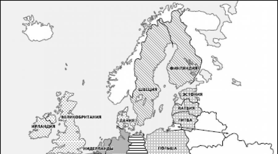
In the 1990s, especially after the collapse of the global socialist system, the European Country Tracting to join the European Union has increased even more, which primarily refers to countries in Eastern Europe. After long negotiations and approvals in May 2004, Poland, Czech Republic, Slovakia, Hungary, Slovenia, Lithuania, Estonia, and Cyprus and Malta were full members of this organization. Consequently, the EU countries have already become 25. And in early 2007, Romania and Bulgaria were joined to them (Fig. 1). In the future, the expansion of the composition of the EU apparently will continue. Already in 2010, Croatia can enter it, and there will be a turn of Macedonia, Albania, Bosnia and Herzegovina, Serbia, Montenegro. Turkey has long been applied for entry into the EU long ago.
Simultaneously with the development of the European Union, Weshre occurred and his developing deep intowhich passed about the same stages. At the initial stage of the existence of an integration group, the main task was to create the customs union and the common market of goods, so it was usually called it in everyday life Common market.By the mid-1980s. This task was mainly fulfilled, and the general market, which began to call single domestic market(Heb), provided free movement not only goods, but also services, capital, people. After that, in 1986, the member countries signed Unified European Akt.and preparation for the transition from EU to the economic, currency and political union of EU countries began.
There are significant successes on this path.
First, actually already created unified European Economic Space29 countries. If in the late 1990s. The share of intraregional trade in the EU exceeded 60%, now it is even higher.
Secondly, the Schengen Agreement is actually created and unified European visa-free space,within which there are no border guards, and to visit any of the countries it is enough to get only one existing visa everywhere. The Schengen Agreement has been operating since March 1995. First, ten countries have joined him - Belgium, the Netherlands, Luxembourg, France, Germany, Austria, Italy, Spain, Portugal and Greece, in March 2001, five more states of Northern Europe - Finland, Sweden, Norway, Denmark and Iceland, and in early 2008 there are still eight countries of Eastern Europe and Malta, on the borders of which were the countries of checkpoints. Residents of the rest of the countries, including Russia, should receive a visa for entry into the EU.
Thirdly, which is especially important, from January 1, 1999 in the EU countries was introduced unified currency system,meaning the transition to a common currency - euro.True, at the first stage, only 12 of the 15 EU countries entered the euro zone (the United Kingdom, Denmark and Sweden remained outside it), but their population was more than 300 million people, exceeding the number of US inhabitants. Together 12 countries have already formed economic and currency union(EEC), which in the literature is often referred to as the EUROPEnd or Eurozone. At the same time, the Unified Central Bank began to work.
After the introduction of a single currency of the euro, its transfer rate relative to the national currencies of the eurozone countries was recorded by administratively at the constant level. This means that Belgian and Luxembourg francs, German Brand, Spanish Pesting, French Frank, Irish Pound, Italian Lira, Dutch Gulden, Austrian Shilling, Portuguese Escudo and Finnish brand began to translate into euros on a strictly fixed rate. And for non-eurozone countries, a floating rate was established, the quotations of which with respect to the dollar and other currencies are subject to daily changes.

Fig. 1. Expansion of the European Union
So it lasted until the beginning of 2002, after which the cash new bills and coins of the euro completely replaced national currencies of 12 countries. In proportion to their transfer rate, all market prices, wages, pensions, taxes, bank accounts, etc. In 2008, the number of the euro zone has reached 15. At the same time, about 25 countries and territories included in the euro zone, most of them were In the Franca zone, for example, six Overseas Departments of France and 14 former possessions in Africa. The new currency was also adopted in the Microg states of Europe - Andorra, Monaco, San Marino and Vatican.
It can be added that in connection with the already mentioned coming to power in most countries of the EU socialist and social democratic parties, more attention was paid not only to financial and economic, but also purely humanitarian issues. So, with the EU, the Committee on Education is valid, whose tasks include coordination of the content and methods of school education. Paris has a special European Institute for Education and Social Policy. There are also a center for pedagogical research and innovation, the European Institute for University Education Research, the European Center for Vocational Education. In order to eliminate the Language Barrier, international programs "Lingva" and "Erasmus" are carried out. The first of them began to be implemented back in 1989 in 12 countries. It is aimed at learning ten state languages: English, French, German, Italian, Spanish, Portuguese, Dutch, Danish, Greek and Irish. Since 1987, the Erasmus program is also embodied, the main goal of which is to expand the exchange of students between the countries of the Union.
To date, it has already been fully developed institutional structureThe European Union, a mechanism for its functioning, which includes both interethnic and supranational authorities. The main one includes: 1) European Parliament (European Parliament)- The main body of the EU, 626 deputies of which are elected by a direct universal vote for a period of 5 years. National quotas in the European Parliament are enshrined in countries in accordance with the number of their population. 2) Council of European Union(It should not be confused with the Council of Europe mentioned above), which is formed by officials from the Government of the EU member states and also has the right of legislative initiative. 3) European Commission- The chief executive body of the EU, which is responsible for the execution of decisions adopted by the European Parliament and the Council of the European Union. four) European Court- the highest judicial authority of the EU.
The sessions of the European Parliament occur in Strasbourg and Brussels. Meetings of the Council of the European Union occur in Brussels. The main institutions of the European Commission are also posted in Brussels, and the European Court is based in Luxembourg. In the 1980s. Forest and basic eU symbolism:the official anthem of him became the ode "to joy" from the ninth Symphony of Beethoven, and the flag is a blue cloth with 15 golden stars. But the European Constitution, the adoption of which was planned in 2003, was not adopted so far.
Now, as already noted, the European Union acts as one of the leading centers of the global economy,presenting great impact on all the world economy. Its share in global GDP and industrial production exceeds 1/5, and in world trade is almost 2/5. In economic literature, this center is sometimes compared with two other leading centers of the world economy - the United States and Japan. It turns out that the EU is ahead of two other world centers in many leading indicators - and in the share of the GDP of all OECD countries, and in terms of world trade and foreign exchange reserves. EU countries occupy important positions not only in the production of traditional industrial products (machines, cars), but also in many high-tech industries. They conduct a single regional policy - and industry (especially in the agricultural sector), and territorial. On average, in the EU countries, the share of the tertiary sector in the structure of GDP is 65%, and in some of them more than 70%. This indicates the post-industrial structure of their economy.
However, all these achievements do not mean that the EU countries do not face quite complex geopolitical and socio-economic problems. Some of these problems follow from the fact that according to their economic power, the states in the EU state differ very strongly, because this is the Union of Great Powers and Small countries (Table 2). It is easy to calculate that the volume of GDP is ten small countries of the EU less GDP of one Germany. In addition, they grow into integration processes, as they are called, "with different speeds".
The European Union as an integration region has close economic ties with other parts of the world economy. Among its partners - the United States, Japan, China, Latin America, Africa, other regions. EU economic agreements of the EU countries are associated with 60 other states. To this, it is necessary to add that, in accordance with the Lomestical Convention (concluded in the capital of the city of Lome), the EU has long been included as associated members of 69 countries in Africa, the Caribbean and the Pacific (Country Act). Since the action of the said Convention was completed in 1999, a new multilateral agreement was concluded instead.
For Russia, economic and other relations with the European Union are of particular importance, because the share of the EU countries account for more than 1/2 of its foreign trade, and almost 3/5 of all investments in the Russian economy also comes from the states of the European Union. After several years of negotiations in 1997, an agreement on partnership and cooperation (ATP) between the EU and Russia was entered into force, in accordance with which the Committee of Parliamentary Cooperation and the Cooperation Council were established. For ten years, ATP actions were made very large work on the development of in-depth relations in the political, trade and economic, financial, legal and humanitarian fields, to identify the main objectives and cooperation mechanisms. In 2008, preparation began to conclude a new basic cooperation agreement between Russia and the EU.
table 2
Some data on EU countries (2007)

4. Useful fossils of foreign Europe: the size of reserves and the patterns of placement
Foreign Europe has a rather diverse set of fuel, ore and non-metallic minerals. However, reserves of only a few of them in their meaning can be attributed to the categories of global or at least pan-European. So, according to estimates of Geographers of Moscow State University, in world stocks, this region is most distinguished by coal (20%), zinc (18%), lead (14%), copper (7%). Its share in world reserves of oil, natural gas, iron ore, bauxite is 5-6%, and the remaining types of mineral raw materials are presented in foreign Europe by smaller resources. When characterizing the resource base region, it is necessary to take into account the fact that most of its pools and deposits of mineral raw materials in foreign Europe have been mastered long ago and are currently very exhausted. Therefore, the region very significantly depends on the import of many types of mineral raw materials - oil, natural gas, manganese and nickel ore, copper, bauxite, uranium concentrates, etc.
The placement of minerals in the territory of foreign Europe is distinguished by significant unevenness, which is predetermined by geological - primarily tectonic - characteristics of the structure of the region. It usually distinguishes five major tectonic structures: the Baltic Shield, the Belt of Caledonian Foldness, the North-Western European Wpadin, Epigerzin Platform and Alpine Folded Area. However, with a more generalized approach, they can be combined into two main groups that coincide with the Northern and southern parts of the region (Fig. 2).
main feature northern regionit is that it has a predominantly platform structure, although not homogeneous. The most ancient and stable territory within its limits, folded by crystalline rocks, forms, as it is known, the Baltic Shield. In the East, a very ancient, Precambrian Eastern European platform, covered with a powerful case of sedimentary rocks, is also located within the east. Most of the rest of the territory occupies a smaller, so-called epigigzinsk platform, formed on the site of the Hercinsky folding, which proceeded into the coal and Perm periods. It is characterized by a mosaic combination of platform sites with intermongal depressions and regional deficiencies. These features of the tectonic structure are primarily determined by the composition and placement of minerals. Summarizing, it can be apparently argued that they are genetically connected, firstly, with a crystal foundation of the platform, secondly, with its sedimentary case and, thirdly, with regional and interguric deficits.
Minerals associated with the crystal foundation of the platform and having a pronounced magmatic origin are most characteristic of the Baltic Shield. As an example, an iron ore deposit in Northern Sweden - Kirunavar, Gallovare, and others, and others are stretched here from the surface to a depth of 2000 m, and the iron content in ore reaches 62-65%. Within the same shield on the territory of Finland, Sweden and Norway there are also non-ferrous metals deposits. A variety of ore deposits of magmatic and metamorphic origin are found within the epigigzin platform in the territory of FRG, France, Spain and some other countries.
Minerals obliged by their origin the sedimentary cover of the platform is even greater and varied. So, in Paleozoic (Perm), medical basins of Poland and Germany were formed.
In the Polish Lower Silesia, the deposits of copper ore were opened in 1957. The average copper content in multist sandstones, which occur at a depth of 600-1000 m, is 1.5 °%; In addition, ores contain silver, nickel, cobalt, lead, zinc and other metals. Common stocks of copper ores are estimated at 3 billion tts, which is equivalent to more than 50 million tons of metal. This puts Poland to the first place in Europe and the fourth place in the world. With the deposits of the Permian age left by the so-called shopstein sea, numerous stone salt deposits (salt domes) in Poland are also associated with potash salt deposits in Germany and French Alsace.
In the Mesozoic (Yura) in the Multi-shaped decreases on the territory of Lorraine (France), an iron ore deposits were arising from 4 billion tons. However, the iron content in the Larring ore is rather low (25-35%), and it also contains an admixture of phosphorus. All this is only partly compensated for a shallow occurrence, which allows you to make extraction in the open way.
The main mineral of the Cenozoic age associated with the sedimental cover of the platform is the brown coal that reached us in the form of numerous pool pools of Paleogenic and Neogenous age in the territory of the Federal Republic of Germany (Nineneinsky, Lauzitsky), Poland (BelKhatuv), the Czech Republic (North Czech).
Among the minerals, coal, oil and natural gas are played by land, oil and natural gas. Coal basins of the region form a kind of latitudinal axis stretching from Great Britain through the pools of Northern France and South Belgium, Ruhrian and Saari Pools of the Federal Republic of Germany to the Ostrava Basin of the Czech Republic, the Upper Silesian and Lublin Poland basins. (I will add that further to the east on the same axis there is a Donetsk pool.) Such a location of coal inland pools, forming one of the largest in the world carnation belts,it is explained by the fact that the northern edge deflection of the epigaigzin platform was held in the coal period. Therefore, in structural and tectonic terms, the pools of this belt are found to be highly similarity, which can be illustrated on the examples of the largest of them - Ruruga (the total reserves of about 290 billion tons, an area of \u200b\u200b5.5 thousand km 2) and the Upper Silesian (120 billion tons, 4, 5 thousand km 2).
Both of these basins belong to the type of paralytic, formed in large tectonic depressions. During the entire coal period, there was a gradual bending of these depadies, accompanied by intense sedimentation, as well as repeated marine transgression.

Fig. 2. The main features of the tectonic structure of the territory of foreign Europe
However, the formation of coal is connected only with the deposits of the upper carbon, which in the Ruhr basin reach the capacity of 5000-6000 m, and in the Upper Silesian 3000-7000 m. This means that the mining and geological conditions of the occurrence of coal in the Upper Silesian basin are more favorable. In addition, the depth of development in it is less than in Rour. However, in terms of the quality of coal and, in particular, in the share of coals of coking brands, the Ruhr pool stands ahead of the Upper Silesian.
Oil and gas pools, explored in the northern part of foreign Europe, are usually very small in size. Genetically, they are associated with small intermountain depressions of the epigerzin platform. The only large basin of this region is Northwestern. It originated within the limits of North Caucasia, where the thickness of sediment sediments of Paleozoic, Mesozoic and Cenozoic age reaches the capacity of 9000 m. This thickness is characterized by an abundance of oil collectors and oil and gas tires.
main feature southern regionit is that it is located within the geologically much more young folded zone that is part of the extensive European-Asian geosynclinal belt. Differences of this part of the region from Northern: a significantly younger geological age of most minerals, the origin of which is connected mainly with the era of the Alpine City formation; the predominance of ore fossil magmatic and metamorphic origin; Ligger territorial concentration of mineral resources.
Ore swimming pools and fields of the southern part of the region (chrome, copper, polymetallic, mercury ores) have a magmatic origin and mostly associated with volcanic intrusions. The exception is boxites, whose deposits form a wide Mediterranean belt extending from France to Greece. They were formed here in the lake and maritime conditions under the domination of a wet subtropical climate and are associated with eluvial red-colored rocks - latheitis (from lat. Later - brick).
In sedimentary sediments, deposits and pools of coal, oil and gas, sulfur sulfur were also formed. Among the coals are dominated by the pools of brown coal, first of all the lowest high view of his lignite (for example, Kosovo in Serbia, East Maritz Kiy in Bulgaria). In most cases, they were formed in small intergressive and intricant depressions in the conditions of lake sedimentation. Small oil and gas pools also occurred in intermountain and intricant depressions, and the largest of them - the preparpactual pool in Romania - was formed within the limits of extensive edge deflection, stretching along the southern and eastern carpathians. More than 70 oil and gas deposits in the deposits of Cenozoic and Mesozoic are explored in this basin. However, oil production began here in the middle of the XIX century, and now the deposits are very exhausted. The exploration and production of oil has long been directed not so much "styling", how much "deep into", and the depth of well reaches 5000-6000 m.
Foreign European countries can serve as a visual example of "noncompleteness" of a set of minerals. So, in Poland, the reserves of stone coal, copper ores, sulfur, but there are almost no oil, natural gas, iron ore. In Bulgaria, on the contrary, there is no stone coal, although the reserves of lignites, copper ores, polymetals are quite significant.
5. Polders and Dams in the Netherlands
The name "Netherlands", translating the "lowland country", very accurately characterizes the main feature of the structure of its surface, a significant part of which (according to various sources from 1/3 to 2/3) is located below sea level. Yes, and almost the rest of its territory does not rise above the zero mark of more than 1 m; Only in the extreme southeast of the country there are more sublime areas.
Prior to the start of active human intervention, coastal lowlands were extensive amphibious spaces consisting of watts fill in the sea with each riding, and marches that were subjected to flooding only at the highest tides and storms. Even at the beginning of our era, the Roman historian Pliny Senior wrote: "The bare tribe lives here suited its settlements on natural heights or artificially popted hills, whose vertices rise above the crests of the biggest waves, which still have been observed. When the water floods the neighborhood, these huts resemble the court forgotten in the sea. "
Proximity to the sea determines the entire life of the Netherlands over the Millennium. In the XVII century This country has become the strongest marine and shopping power of Europe. She had the world's largest fleet, made a great contribution to great geographical discoveries, created one of the first colonial empires, achieved great success in science and technology (invention of the chronometer, telescope, sextant), in cartography (Mercator). It was in the Netherlands that were born by international maritime terms as a sailor, boots, skipper, kubrick, ladder, Barcas, Nord-West, Nord-Ost.
But at the same time the history of this country is the story of the incessant struggle of people with the sea. True, the very same nature came to help a person here, defending part of the coast of a rather wide belt of sand dunes. But this belt was unpaid, and besides the sand waved by the winds. Then people began to strengthen the dunes with various landings, and in places of breaks to build earthen dams and dams. The same dams and dams they began to erect on rivers. From here, by the way, numerous geographical names occur with the end of the "ladies" (dam, dam), such as Amsterdam ("Dam on the river. Amstel") or Rotterdam ("Dam on R. Rotte"). Nowadays, the overall length of the continuous chain of dams and the fortified dunes exceeds 3000 km! Yes, and build them no longer from sand and stone, but from reinforced concrete and steel structures.
Intrunning from the sea, the Dutch began to creating Polders.This is also a Dutch term, denoting the land died by the sea, protected from all sides by the dams and used to resettle people and various forms of management. Even more Polderov began to occur at the site of the drained lakes and peatlands turned into fertile fields. Already in the 60s. XX century At the place of one of the dried lakes to the south of Amsterdam, the main international airport of the country - Schiphol, one of the largest in Europe. In the Middle Ages, windmills were used to pump water, in the XIX century. steam pumps began to apply, and in the XX century. - Electric pumps. Towards the beginning of the XXI century. There were already 2.8 thousand large and small poekers with a total area of \u200b\u200b20 thousand km 2, which corresponds to approximately 1 / 2 territory of the country.
The main district of the creation of Polders in the Netherlands was and remains about h. E Y S C E L M E R, arising at the site of the Bay of the North Sea Zyudsez.
The historical documents suggest that in 1282 the Northern Sea swallowed in several places in several places broke through dunes and, having connected with OZ. Flevo, formed an extensive sea bay Zyuderz. Such an extension of the coastline Dutch skillfully used. On the shore of the Gulf, a large port of Horn (Horn) arose, from where many expeditions of Dutch navigas were sent to swim. It is curious that the southern tip of the mainland of South America was called Cape Horn in honor of this Dutch city: the Cape In 1616, Villem Schauten was from Horn. Another famous Dutch navigator was born here - Abel Tasman. But over time, maritime injuries cut off the mountain from the sea, and he lost its meaning. (We note that the same fate has suffered the Belgian port of Brugge, the Italian port of Adria in the mouth of the river. According to, some other seaports.) And the lack of living space felt more and more.
At the end of the XIX century. The young engineer Cornelius Leli put forward a very bolder at the time, the draft drainage of the Bay Zyudsez, but then he was not approved. The project began only in the 20s. XX century, and under the guidance of the same K. Lelie. At first, the dam was built, which separated the bay from the water area of \u200b\u200bthe North Sea and turning it into Oz. Eiselmer. This dam, having a length of 32.5 km, is listed in the Guinness Book of Records as the largest marine dam from all existing in the world. Then, in accordance with the project, the discharge of Oz. Eiselmer and the creation of five Polders (Fig. 3).

Fig. 3. Polders in the Netherlands
The first, even in the late 1920s, was an allegedly Polder Veringermer, where more than 500 farms were created. (However, in April 1945, before the end of the war, the German troops, feeling the approach of surrender, blew up a protective dam, and after 48 hours the entire Polded was hidden under the five-meter water layer. Restoration was completed only in a few years.) Then the North East Polder, and in 1950-1960s. Polders East and South Flevoland. And nowadays, work on the largest Polder - Markerward continues. The total area of \u200b\u200bfive Polders exceeds 220 thousand hectares. Their absolutely smooth surface crossed by numerous channels is used primarily for agriculture. Small, but completely modern towns are built. After creating the Eastern and South Flavolanda, a new, twelfth, country province was formed on the territory of these Polders, the province of the country - Flevoland. And Lelystad became the administrative center ("Leli City").
The creation of such large Polders is an exceptionally complex and time consuming. First you need to burn part of the lake high and durable embankment - dam. Then the water is pumped out water from the entire territory of Pollera. Further, all the soil is removed by special machines, since it is salinated with sea water, and all the space falls asleep with new earth. When these operations are manufactured, cane and other crops, draining and strengthening soil are carried out using airplanes and helicopters. Drainage pipes are also paved. While there is a formation of soil horizons, Polder is in the hands of the state. And only ten years later, when roads, farms and small villages are also built, the well-kept land is leased to farmers. Apparently, this is exactly the very process that received in geography the name "Construction of the Landscape".
The second direction of the activities of the Dutch, associated with the curb of the marine element, is fighting floods.It also found an expression primarily in one main project that received the name "Delta Plan".
Large hugging (from the sea) floods in the Netherlands are not uncommon. For example, already in the XX century. They took place in 1906, 1912, 1916. But the flood that occurred at the very end of January - early February 1953, in its strength, exceeded most of the previous ones. An extremely unfavorable combination of a 10-point storm with the strongest wind and a midday tide led to the fact that the water of the coastal part of the sea rose by 3.5 m. Protective dams were broken in 67 places, and seawater straightened the joint Delta of the Rhine, Maas And shelda. As a result, almost 1500 km of 2 lands were flooded, about 2,000 people and tens of thousands of livestock were killed, almost 50 thousand buildings, roads, bridges were destroyed. In general, at least 750 thousand people suffered from flood, and the material damage from it was estimated at $ 1 billion in a word, it was a national tragedy. For the restoration of the destroyed dam (in which the old concrete caissons preserved in England were used, intended for landing of the Allied Troops in Normandy in 1944) left for about a year.
But in the same 1953, a capital project was born, who had the goal of the full deliverance of the inhabitants of Zealand and the Northern Brabant from the threat of such catastrophic floods. This project received the name "Delta-Plan", and his meaning was to overoint the mouth of the rivers flowing into the North Sea to the south of Rotterdam, Dambami and Dam, turning them into fresh reservoirs. In the course of the implementation of the plan were built: gateway barriers to protect Polders, five primary dams, closed Maas and Shelda estuary (Fig. 4), five auxiliary dams located east, as well as many channels, gateways, bridges, roads. The total length of the dam was about 30 km, and they reduced the length of the coastline almost 700 km, straightening it along the seashore.

Fig. four. Delta-Plan project in the Netherlands (according to A. B. Avakyan)
Almost the most responsible and complex part of the entire "delta plan" was the overlap of a wide estuary of the Eastern Shelda. At first it was assumed to build a deaf dam here, but it would be impossible to water exchanges between the sea and the reservoir formed. Therefore, instead of a dam in the mouth of the eastern shelda, a special antonymic barrier with a height of 30 to 50 m was elevated, which consists of powerful concrete supports with steel gates-shutters between them, which in the threat of flooding can be quickly closed. On October 4, 1986, the Queen of the Netherlands Beatrix by pressing the button lowered all 62 steel shutters (each width of 45 m), thereby commissioning a giant hydraulic structure worth 2 billion dollars. And the access of ships to the Belgian port of Antwerp is provided on Western Shelda.
In the Netherlands, another largest project was developed, the aim of draining the Baddense water area separating the Western Frisian O-Wa from the mainland. To do this, it is necessary to build main dams with a length of 100 km and additional, dismembering freshwater lake into several pools, 150 km long. It is impossible to disagree with a well-known specialist in the geography of the Netherlands L. R. Silver, who believe that technically this project will be implemented (although it will require huge funds and 50 years of work), but it would force the irreparable harm to fish resources, the Netherlands population of seals and a multitude of valuable birds.
6. Foreign Europe: problems of population reproduction
Foreign Europe - a region with a very difficult and general an unfavorable demographic situation.On the global background, it is distinguished by the lowest birth rate and the lowest natural increase in the population, the word, state of "demographic winter". The proof of this thesis can serve as the data given in Table 3.
Consider first indicators fertility.After a relatively short "baby-boom" characteristic of the end of the 40-50s. XX century and who was a peculiar demographic consequence of World War II, in most countries of the region showed a clear tendency to reducing the birth rate.As a result, in 2006, the average for the region fell to 10 people per 1000 inhabitants, i.e., it was 2 times lower than the average (20/1000). This indicator corresponds to such a level of fertility (fertility), in which a woman during the reproductive period produces an average of 1.5 children; With it, extended reproduction is not provided.
The reasons for such a decrease in the birth rate are diverse. The main among them should be obviously considered to be natural demographic processes: an increase in the average life expectancy, gradual aging of the population, entry into the new stage of the demographic transition. However, such socio-economic factors should also be taken into account as a sharp increase in the "child prices", the influence of various kinds of economic and political upheavals, the fraudity of the family and etc.
Table 3.
Reproduction of the population in foreign Europe in 2006, a person per 1000 inhabitants
Table 3, those countries that have a lowest birth rate are particularly particularly attracted within 8-9 people (8-9b), Latvia, Lithuania, Czech Republic, Italy, Slovenia, FRG, Austria, Croatia. It is in these states that the general demographic situation is characterized by a special complexity, and the level of fertility is the lowest. It can be added that the birth rates in them are also the lowest in the world.
Table 3 also testifies to a rather high level mortalitywhich on average for the entire region is also 10 people per 1000 inhabitants, i.e. exceeds the average. An explanation of this fact should be searched primarily in the same general processes to increase the average life expectancy, aging of the population, violation of sexual composition during the periods of two world wars. But it is impossible not to take into account such reasons such as occupational diseases, industrial injuries, accidents, the influence of alcoholism, smoking, drug addiction. For example, more than 100 thousand people die on the roads of foreign Europe every year and about 2 million are injured and injured. Since all this is primarily refer to the male part of the population, mortality among men is usually significantly higher.
Finally, a peculiar result of the analysis of Table 3 can serve as a column of column natural increasepopulation that allows you to draw the following conclusions. Firstly, that all countries of foreign Europe belong to the first type of reproduction of the population.Secondly, that in our days only in several states of the region (Albania, France, Ireland, Iceland, Norway, Bosnia and Herzegovina, Macedonia) really ensures more or less expanded reproduction of the population. Third, that in most countries of foreign Europe is reproduction or extremely narrowed (United Kingdom, the Netherlands, Denmark, Switzerland, Poland, Serbia), or "zero", which does not even provide direct replacement of generations (Belgium, Sweden, Finland, Spain, Greece, Slovakia, Slovenia). Fourth, that the largest group form 11 countries with negative natural population growth(Austria, Bulgaria, Hungary, Italy, Latvia, Lithuania, Romania, Germany, Croatia, Czech Republic, Estonia), actually already entered the stage of depopulation. A visual illustration of what was said can be Figure 5.
As a result, the average natural growth rate for modern foreign Europe turns out to be almost "zero." Back in 1950, the absolute annual increase in the population was almost 5.5 million people, but already in 1990 he fell to 1.3 million, and in 2000 it turned out to be completely insignificant. Yes, and the entire population of the region from 1990 to 2007 increased only from 488 million to 527 million people. Accordingly, the share of foreign Europe in the world population decreased, as already noted, from 15.5% in 1950 to 8% in 2007.
Of great interest is the analysis of the main demographic indicators of foreign Europe in the context four of her subregions(Table 4).
From Table 4, it clearly imply that the worst demographic situation has developed in Eastern Europe. It is for them that the lowest birth rates are characterized, the highest mortality rate, a negative natural population increase, the greatest infant mortality ("Recordsman" of Europe in this regard, except for Albania - Romania with an indicator 17/1000), the lowest fertility of women (In Bulgaria, the Czech Republic - 1.3 children per woman per reproductive period) and, finally, the lowest life expectancy (men 62 and in women of 74 years). Such a demographic situation, in addition to purely demographic factors, is explained by socio-economic difficulties accompanying the transition from one social system to another, and in some countries (former Yugoslavia) also long-term political instability.
Table 4.
The main demographic indicators for subregions of foreign Europe in 2006


Fig. 5. Natural population growth in foreign countries in 2006,%
In the countries of Western, South and Northern Europe, the demographic situation is also quite difficult: it is enough to recall the countries listed above with zero and minus natural growth in the population. We add that at the beginning of the XXI century. In these subregions, he also became zero or minus.
It is not surprising that most countries of the region seeks to conduct demographic politicsaimed at raising birth rate and natural population growth. Before the early 1990s. The countries of Eastern Europe were most actively and even tightly, now the countries of the European Union, for example, France, Germany. But its results are not very significant. Thus, in Germany, the age of marriage even increased: women up to 28, and men under 30 years old.
Perhaps the most controversial was the question of the prohibition or legalization of abortions. In Romania, when Ceushesski mode, abortions allowed only women who had five or more children, and for illegal abortion, doctors threatened imprisonment. In Poland, the prohibition of abortions was introduced only in early 1993 in most countries of Southern Europe with the predominance of Catholicism abortions legatively prohibited, and in the Protestant countries of Western and Northern Europe, on the contrary, legalized. It gave rise to a kind of "abortion tourism": women for this purpose specially come to the country with more liberal legislation. A very curious example of relations to abortion can be Belgium, where for a long time under pressure from the Catholic Church they were prohibited. And when in 1990, in Parliament discussed the issue of their legalization, King Boduena I to avoid confrontation with the Vatican and not put pressure on his subjects, took a truly unprecedented decision for a short time (39 hours) ... renounce the throne. In the late 1990s. In the top ten countries of the world, in terms of the number of abortions, a thousand women aged 15 to 44 years from the countries of foreign Europe included: Romania (78), Belgium (68), Serbia (55), Estonia (54) and Bulgaria (52).
Table 5.
Forecast of residents in selected countries of foreign Europe for 2025, million people

The video tutorial is dedicated to the topic "Foreign Europe. Composition, political map. This topic is the first not only in the section of lessons dedicated to foreign Europe, but also first in regional grade 10 geography. You will get acquainted with the old woman in Europe, which continues to play a leading role in the modern economy due to its financial, geopolitical influences and features of the economic and geographical position. The teacher will tell in detail about the composition, borders, history, countries of foreign Europe.
Topic: Regional characteristics of the world. Foreign Europe
Lesson:Foreign Europe. Composition, political map
Europe is part of the light, which has an area of \u200b\u200babout 10 million km² (of which foreign Europe, in relation to the CIS countries, accounts for 5.1 million km²) and the population of 740 million people (about 10-11% of the population of the Earth). The average height is about 300 m, the maximum - 4808 m, Mount Mont Blanc.
Fig. 1. Mount Mont Blanc
Features of the geographic location:
1. The length from the north to the south (from O. Svalberena to about. Crete) - 5 thousand km, and from west to east - more than 3 thousand km.
2. Relief "mosaic" of its territory: lowlands and elevated territories. Among the mountains of Europe most of the middle height. The boundaries take place mainly in such natural turns that do not create obstacles for transport links.
3. High degree of cutting coastline.
4. The seaside position of most countries. Average distance from the sea is 300 km. In the western part of the region, there is no place remote from the sea by more than 480 km, east at 600 km.
5. "Depth" of the territory of most countries is small. So in Bulgaria and Hungary there is no place that would be removed from the borders of these countries by more than 115-120 km.
6. Neighboring position favorable for integration processes.
7. Favorable position in terms of contacts with the rest of the worlds, because Located at the junction with Asia and Africa, far advanced in the ocean - "Big Peninsula Eurasia".
8. A variety of natural resources, but non-complex placement by countries, many deposits are largely developed.
Europe is usually divided into northern and southern, western and eastern, it is quite conditionally, especially since not only purely geographical, but also political factors come into effect.
In foreign Europe, there is a single economic, political, financial space.
The vast majority of the UN member countries. Switzerland has entered the UN in September 2002, NATO members - 14 countries, EU members - 15 countries. Most countries belong to the group of industrialized. Four countries: Germany, United Kingdom, France and Italy are part of the "big seven of the West countries". Special place in the economic map of the region is occupied by post-socialist countries or countries with economies in transition.
Council of Europe - an international organization promoting cooperation between all European countries in the field of standards of law, human rights, democratic development, legality and cultural interaction. Being founded in 1949, the Council of Europe is the oldest international organization in Europe. The most well-known bodies of the Council of Europe are the European Court of Human Rights, acting in accordance with the European Convention on the Protection of Human Rights and Fundamental Freedoms, and the Commission of the European Pharmacopoeia.

Fig. 2. Emblem of the Council of Europe
After the collapse of the socialist modes, the situation changed significantly. Most countries of the former "socialist camp" reoriented to Western structures. Currently, more than half of European countries are part of the European Union and NATO, almost everyone else declare the desire to join these organizations.
The following events were most on the formation of a political maps of Europe, the following events were provided: the First World War, the Second World War, the collapse of the USSR and the entire global socialist system. Until the mid-80s - 32 sovereign states, including microstation. Since the beginning of the 90s - about 40 states.
Currently, states in Europe are more than 40. Most states in the form of government - republic, 12 monarchies. According to the administratively territorial device, all countries (except Belgium, Germany, Austria and Switzerland) unitary. The largest countries in Square: France, Spain, Sweden, Germany, Finland. The largest countries in the population: Germany, France, United Kingdom, Italy. Four countries of foreign Europe are members of a large seven: France, Germany, Italy, United Kingdom. Germany is considered to be the main economy of Europe.

Fig. 3. Political map of Europe
Homework
Topic 6, p.1
1. What are the features of the geographical and economic and geographical location of the countries of the Foreign Europe?
2. What regions (subregions) are allocated in foreign Europe?
Bibliography
Basic
1. Geography. A basic level of. 10-11 CL: Textbook for general education institutions / A.P. Kuznetsov, E.V. Kim. - 3rd ed., Stereotype. - M.: Drop, 2012. - 367 p.
2. Economic and social geography of the world: studies. for 10 cl. general education institutions / V.P. Maksakovsky. - 13th ed. - M.: Enlightenment, Moscow Tutorials JSC, 2005. - 400 p.
3. Atlas with a set of contour cards for 10th grade Economic and social geography of the world. - Omsk: FSUE "Omsk Martographic Factory", 2012 - 76 p.
Additional
1. Economic and social geography of Russia: a textbook for universities / ed. prof. A.T. Khrushchev. - M.: Drop, 2001. - 672 C.: Il., Cards.: Col. incl.
Encyclopedias, Dictionaries, Directory and Statistical Collections
1. Geography: reference book for high school students and entering universities. - 2nd ed., Act. and drab. - M.: AST-PRESS School, 2008. - 656 p.
Literature for preparing for GIA and EGE
1. Thematic control of geography. Economic and social geography of the world. Grade 10 / E.M. Ambarcumova. - M.: Intellect-Center, 2009. - 80 s.
2. The most complete publication of typical options for real tasks EGE: 2010: Geography / Sost. Yu.A. Solovyov. - M.: Astrel, 2010. - 221 p.
3. Optimal assignment bank to prepare students. Single State Exam 2012. Geography. Tutorial. / Sost. EM. Ambarcumova, S.E. Dukov. - M.: Intellect-Center, 2012. - 256 p.
4. The most complete publication of typical options for real tasks EGE: 2010: Geography / Sost. Yu.A. Solovyov. - M.: AST: Astrel, 2010.- 223 p.
5. Geography. Diagnostic work in the format of EGE 2011. - M.: MCNMO, 2011. - 72 p.
6. EGE 2010. Geography. Collection of tasks / Yu.A. Solovyov. - M.: Eksmo, 2009. - 272 p.
7. Geography tests: Grade 10: to the textbook V.P. Maksakovsky "Economic and Social Geography of the World. Grade 10 "/ E.V. Branches. - 2nd ed., Stereotype. - M.: Publisher "Exam", 2009. - 94 p.
8. Textbook on geography. Tests and practical tasks in geography / I.A. Rodionova. - M.: Moscow Lyceum, 1996. - 48 p.
9. The most complete publication of typical options for real tasks EGE: 2009: Geography / Sost. Yu.A. Solovyov. - M.: AST: Astrel, 2009. - 250 s.
10. Single State Exam 2009. Geography. Universal materials for the preparation of students / FIPI - M.: Intellect-Center, 2009 - 240 p.
11. Geography. Answers on questions. Oral exam, theory and practice / V.P. Bondarev. - M.: Publishing House "Exam", 2003. - 160 p.
12. EGE 2010. Geography: thematic training tasks / O.V. Chicherina, Yu.A. Solovyov. - M.: Eksmo, 2009. - 144 p.
13. EGE 2012. Geography: typical examination options: 31 option / ed. V.V. Barabanova. - M.: National Education, 2011. - 288 p.
14. EGE 2011. Geography: standard exam options: 31 option / ed. V.V. Barabanova. - M.: National Education, 2010. - 280 p.
Materials on the Internet
1. Federal Institute of Pedagogical Measurements ().
2. Federal portal Russian education ().
6. Organization for security and co-operation in europe ().
Foreign Europe extends from north to south by 5 thousand kilometers, and from west to east - 3 thousand kilometers. Its territory generally occupies 5, 4 million square kilometers, and the population is 520 million people.
General Information about Foreign Europe
Foreign Europe is one of their foci of world civilization, and is incomparable for world politics, economy and culture.
It is located 40 sovereign states that are interconnected by historical past, close cultural and political relations.
If we talk about the economic and geographical location of the countries, it is determined by two main criteria. The countries of foreign Europe are relatively closely located to each other, they are either closely bordered by natural turns, or there is a slight distance between them, which does not affect the convenience of transport links.
The second main criterion is the seaside position. Most countries that are interconnected by the countries and other continents are maritime traits.
Countries such as Italy, Spain, Portugal, United Kingdom, Norway, Denmark, the Netherlands from the most long-old time are related to the sea.
Political picture of foreign Europe
The political picture of foreign Europe has significantly changed three times throughout the 20th century.
The first and second world wars significantly changed it, as well as at the end of the century there were significant changes associated with the social democratic parties that came to power.
As for the device of states in this territory, there are republics, unitary states, monarchical and federative countries in foreign Europe.
By the 21st century, the Organization for Safety and Cooperation - the OSCE, the composition of which is represented by 56 countries (it also includes the United States, Canada and the CIS countries).
Natural conditions and resources
In the territory of foreign Europe there are many minerals. The northern part includes ore and fuel minerals.
And hydropower resources fall on the territory of the Alps, Dinar and Scandinavian mountains. Forestry is developed in Sweden and Finland, for which forest landscapes are typical.
Population of foreign Europe
The number of residents of this part of the world increases very slowly, a rather complicated demographic situation is fixed in foreign Europe. The territory is a focus of world labor emigration, there are about 20 million foreign workers here.
It is important to note that most European countries are highly ribanized, the highest rates of urbanization belong to Belgium, Great Britain and the Netherlands.
European countries refer to the Indo-European family, distinguish between the four main types of states on national composition. This is one-demonst (Iceland, Norway, Sweden, Denmark), with a sharp predominance of one nation (United Kingdom, France, Finland), binary (Belgium) and multinational (Switzerland, Latvia).
Foreign Europe
Europe occupies a leading place in the world economy in terms of agricultural and industrial production, to develop tourism and exports of goods and services.
The most powerful countries are called the United Kingdom, France, Germany and Italy. They have the most developed complexes of various industries, unlike other countries, which are highly developed by one or two industries.
Europe ... This geographical name is primarily reminiscent of an ancient Greek myth about the daughter of the Phoenician Tsar Agenor, the ruler of Sidon, Europe. According to myth, Europe was abducted by the Almighty Zeus, who accepted the image of the White Bull. On the back of this bull, she slept on the Mediterranean Sea from Phenicia to about. Crete (remember the famous picture of Valentina Serov "Abduction of Europe").
However, toponymists usually produce name"Europe" from the Assyrian "YEREB" \u200b\u200b- "darkness", "Sunset", "West" (as opposed to Asia, whose name is associated with the word "ACS" - "sunrise"). At first, the name "Europe" was only applied to the southern part of the Balkan P-Wa, but gradually spread to the entire territory of this part of the world.
Europe ... This geographical name also reminds of a huge contribution to the world civilization, which began in the era of ancient Greece and Ancient Rome, was continued in the era of the revival and great geographical discoveries, and then in the era of industrial coups and social revolutions - and so to the present day. The largest German geographer of the XIX century. Karl Ritter wrote that in historical terms Europe was destined to develop much better and beneficial than Asia and Africa, richer by nature. So the smallest part of the world became the most powerful, ahead of others and in material, and in spiritual terms. "She dominates them," Karl Ritter writes, "the European imprint puts on them, just as herself itself, although only partly, it was subordinate to the dominion of the East. Europe is the center of the enlightened and educated world. The beneficial rays in all the ends of the globe come from it. "
Probably, in this panegyric Europe, something can be challenged. And in relation to spiritual superiority, and in relation to only "benefactor rays." Do not forget about endless bloody wars, which were conducted in Europe: centenary, thirty-year-old, seven-year-old and hundreds of others. The World War I began in Europe. The Second World War, which covered the 9/10 of its population, broke out here. But nevertheless, "old european stones" is really the greatest heritage of not only European, but also the whole world civilization. It is generally accepted that the European civilization is one of its main owners.
Europe occupies areaabout 10 million km 2. Including 5 million km 2, now falls on foreign (with respect to the CIS) Europe, which is less than 4% of the entire area of \u200b\u200bthe survivable land. The territory of foreign Europe is stretched from north to south (from Svalbard to Crete) about 5 thousand km from the west to the east (from the Atlantic coast of Portugal to the Black Sea coast of Romania) by about 3100 km.
Population of foreign Europein 1900-2007 It has increased from almost 300 million to 527 million people. But its share in the world population during this time decreased from almost 18 to 8%, which is explained by a noticeable decrease in the pace of population reproduction. For many centuries and even thousands of years, foreign Europe was inferior in the number of inhabitants of only foreign Asia; Now, on this indicator, Her is ahead of both Africa and Latin America.
For physical Card of Foreign Europemany features are characterized, of which two are particularly worth noting.
First, it is "MosaicHee" of the structure of its territory,which are interspersed with lowlands, hilly and mountainous areas; In total, the ratio between the plains and the mountains is approximately 1: 1. MSU physico-geographers allocate in foreign Europe of 9 pysical and geographical countries with a division of them into 19 regions and 51 district. But at the same time, in contrast, let's say, from Asia or America - it is not "faded with" high mountain chains. Among the mountains of Europe are medieval, not representing irresistible barriers for economic and other relations. Through their numerous passes, transport highways have long been laid.
Secondly, it seaside positionmost countries of foreign Europe, many of which are located on the islands and peninsulas, close to the lively sea routes from Europe to Asia, Africa, Australia and America. Navigation, Maritime Trade has long been playing a big role in their development. Especially conducive to this is the cutting of the coastline. Back in 1914, Osip Mandelstam wrote in the poem "Europe":
Its alive shores,
And Peninsula Air Bulk,
A little feminine bays outlines,
Biscayi, Genoa lazy arc.
Indeed, the coastline of Europe, including the islands, is 143 thousand km. In foreign Europe, there are almost no places that would be removed from the sea by more than 600 km, the average distance is 300 km. And on most of the UK there are no settlements that are located on the coast further 60-80 km.
We add to it that the natural landscapes of foreign Europe over the past millennia experienced the greatest anthropogenic changes. Even in the bronze era, there were leading farming, hunting, gathering, began domestication of livestock. Nomadic cattle breeding was added to the antique era, nomadic cattle breeding was added, and the forests of forests under arable land increased in Southern Europe. In the Middle Ages, extensive farming and animal husbandry played a major role, the extension of the processed lands occurred. And today it is a region of intensive farming and animal husbandry, widespread agricultural proliferation. Of all parts of the world, it is Europe that the most "hardening": only 2.8% of its territory is free from the trace of human activity.
Political Map of Foreign Europealso distinguished by peculiar "mosaic." In the mid-1980s. There were 32 sovereign states here (including Microg states - Andorra, San Marino, Monaco, Vatican and Liechtenstein). In the early 1990s In connection with the allocation of the USSR of the Baltic countries, the collapse of the SFRA and Czechoslovakia, the number of such countries has increased markedly. The most important change in the political map of the region was also the association of Germany in 1990
Most countries of foreign Europe are relatively small in size. Not to mention Microg states, Luxembourg and Malta, nine of them have an area of \u200b\u200bup to 50 thousand km 2: Belgium, the Netherlands, Denmark, Switzerland, Slovakia, Slovenia, Macedonia, Albania and Estonia (for comparison we will remind that the Moscow region takes 47 thousand. km 2). Eleven countries have a territory from 50 thousand to 100 thousand km 2: Iceland, Ireland, Austria, Hungary, Czech Republic, Latvia, Lithuania, Croatia, Serbia, Bosnia and Herzegovina, Portugal. Ten countries have a territory from 100 thousand to 500 thousand km 2: Norway, Sweden, Finland, United Kingdom, Germany, Italy, Poland, Romania, Bulgaria, Serbia, Greece. And only the area of \u200b\u200bthe two countries - France and Spain - exceed 500 thousand km 2.
To understand the "scale" of countries of foreign Europe, it is also very important to acquaint them with their linear dimensions. Norway is more elongated (1750 km), then Sweden (1600), Finland (1160), France (1000), United Kingdom (965), Germany (876 km). In countries such as Bulgaria or Hungary, the greatest linear distances do not exceed 500 km, and in the Netherlands - 300 km. Therefore, the "depth" of the territory in most of them is not very high. For example, in Bulgaria and Hungary there are no places that would be removed from the borders of these countries by more than 115-120 km. Such borderness can be considered as an important favorable prerequisite for the development of integration processes.
Finally, it is impossible not to say that the foreign Europe was and remains one of the largest centers of the global economy.Its total GDP is more than 15 trillion dollars, or about 22% of the world. This region ranks first (40%) in world trade. He also owns leadership in the field of gold and foreign exchange reserves and foreign investment. Most countries of foreign Europe entered the post-industrial stage of development. They are characterized by a high and very high level of quality of life of the population.
Special radical transformationsan occurred in foreign Europe in the late 1980s - early 1990s. In the western part of it, they were bound primarily to education unified European Economic Spacebased on 15 countries of the European Union (EU). In the eastern part of it, they found an expression in the change of a social system and the transition from the centralized state economy to the market economy. It is single political spaceforeign Europe, which contributes to the fact that in the second half of the 1990s. In most countries, the "right" conservative parties of the Social Democrats and Socialists came to the conservative parties. The formation of a single political (geopolitical) space occurs as a result of the activities of international organizations. Two of them are especially of great importance.
First, it is Organization for Security and Cooperation in Europe (OSCE),which occupies a central place in the European Security system. Created in 1975, it proceeds from the fact that the basis of interstate relations in Europe should be: respect for the sovereign equality of states, their territorial integrity, the inviolability of the boundaries, the non-use of the force or the threat of force, the peaceful settlement of disputes, non-interference in internal affairs, respect for human rights . In 1999, the OSCE adopted the Charter of European Security, which became a kind of "Code of Conduct" of European States and Organizations. The OSCE structure includes many permanent organs (meetings, tips, committees, bureaus, missions, etc.). In 2008, this organization included 56 states (with the United States, Canada, Japan, CIS countries and some others).
Secondly, it Council of Europe (CE)created in 1949 as a consultative political organization promoting integration processes in the field of human rights, fundamental freedoms and parliamentary democracy. The main bodies of the Council of Europe are the Committee of Ministers (at the level of foreign ministers), the Parliamentary Assembly (PACE) - a deliberative body with advisory functions and the Congress of local and regional bodies of Europe. The Council of Europe Secretariat is located in Strasbourg (France).
Recently, more and more often write about a single European ideaabout problems european Education,which should contribute to the spiritual rapprochement of European peoples. It includes and forming european consciousnessthe residents of the region aimed to realize themselves not only by the Germans, the French or the British, but primarily Europeans who bind the community of Western European civilization with many unique features inherent in it. This means that the young generations of Europeans should be brought up in accordance with the principle of "double loyalty" - to their country, and to united Europe.
Along with this at the turn of the XX and XXI centuries. In foreign Europe, there were such changes that affected the international political landscape and broke the current collective security system. First of all, this refers to the desire of the North Atlantic Union to extend its influence on the post-socialist countries of Central-Eastern Europe. So, in 1999, Poland entered NATO, Czech Republic and Hungary. In 2004, three countries of the Baltic States, Romania, Bulgaria, Slovakia and Slovenia were adopted in NATO. This meant the approach of the boundaries of the block directly to the Russian border and was perceived negatively, at least in a psychological plan, in Russia, which does not pose a threat to NATO. This also applies to NATO claims on a major role in the process of making important political decisions bypassing the largest international organizations to maintain peace and security.
Russia - as a European country - takes an active part in all European affairs. It consists of a member of the OSCE and in 1996 was adopted in the Council of Europe, becoming his 39th member. In 1997, the fundamental act on mutual relations, cooperation and security was concluded between Russia and NATO. It noted that Russia and NATO do not consider each other as opponents, and their common goal is to overcome the remnants of previous confrontation and rivalry and strengthen mutual trust and cooperation. The Russia-NATO Permanent Council was also created. In 1999, relations between them were noticeably overshadowed in connection with NATO military action in Yugoslavia. Then they began to gradually improve and especially strengthened after the terrorist act in the United States on September 11, 2001 and the creation of a wide anti-terrorist coalition, which includes Russia. In 2002, the new relations between Russia and NATO were officially established in the form of the so-called "twenty" (19 countries of NATO and Russia). However, in mid-2008, in connection with the decision to accommodate in the Czech Republic and Poland, the elements of American pro and especially after the military action of Georgia in South Ossetia, the relationship between Russia and NATO deteriorated sharply.