The names of the forms of the earth. Earth shape and sizes
The problem of the shape of the earth worries people many millennia. This is one of the important issues not only for geography and ecology, but also for astronomy, philosophy, physics, history, and even literature. Many works of scientists of all eras, especially antiquity and enlightenment devoted to this issue.
Hypotheses of scientists about the form of earth
So Pythagoras in the 6th century BC already believed that our planet had the shape of the ball. His statement was divided by Parmenid, Anaximandr Miletsky, Eratosthen and others. Aristotle conducted various experiments and was able to prove that the earth had a round form, since during the eclipse of the moon the shadow is always in the form of a circle. Considering that at that time there were discussions between supporters of absolutely two opposite points of view, some of which claimed that the land is flat, others - that round, then the theory of balloon, although he was adopted by many thinkers, but needed a significant revision.
The fact that the figure of our planet differs from the ball, Newton said. He was inclined to the fact that it is rather an ellipsoid, and in order to prove it, he conducted various experiments. Further, the form of the Earth was devoted to the work of Poincaré and Cleros, Guygens and D'Alber.
Contemporary concept of the form of the planet
Many generations of scientists conducted fundamental studies to establish the form of the Earth. Only after the first flight to the space it turned out all myths. Now the point of view is accepted that our planet has the form of an ellipsoid, and it is far from the perfect form, flattened with poles.
For various studies and educational programs, the Earth model has been created - the globe, which has the shape of the ball, but it is all very conditional. On its surface, it is difficult to depict absolutely all geographic objects of our planet on the scale and ratio. As for the radius, the value of 6371.3 kilometers is used for various tasks.
For cosmonautics and geodesy tasks in order to describe the figure of the planet, use the concept of ellipsoid of rotation or geoid. However, at different points, the land differs from the geoid. To solve various tasks, various structures of earth ellipsoids are used, for example, a reference ellipsoid.
Thus, the form of the planet is a difficult question even for modern science, which has worried people since ancient times. Yes, we can fly into space and see the form of the Earth, but there are not enough mathematical and other calculations to accurately depict the figure, since our planet is unique, and has no simple shape as geometric bodies.
Earth, with an average distance 149 597 890 km from the Sun, is the third and one of the most unique planets in the solar system. It formed about 4.5-4.6 billion years ago and is the only planet that is known to support life. This is associated with a number of factors, for example, atmospheric composition and physical properties, such as the presence of water, occupying about 70.8% of the surface of the planet, allow life to flourish.
The land is also unique in that it is the largest of the planets of the earth group (Mercury, Venus, Earth and Mars), consisting of a thin layer of rocks, in comparison with gas giants (Jupiter, Saturn, Neptune and Uranus). Taking into account the mass, density and diameter, the land is the fifth largest planet in the entire solar system.
Earth size: mass, volume, circle and diameter
Planets of the earth group (Mercury, Venus, Earth and Mars)
As the largest of the planets of the earth group, the Earth has an estimated mass of 5.9722 ± 0.0006 × 10 24 kg. Its volume is also the largest of these planets and is 1.08321 × 10¹² km³.
In addition, our planet is the most dense of the planets of the earth group, as it consists of bark, mantle and core. The Earth Cora is the most subtle of these layers, while the mantle is 84% \u200b\u200bof the volume of land and extends 2900 km below the surface. The core is the component that makes the ground is the tight. This is the only planet of the earth's group with a liquid outer core surrounding a solid, dense inner core.
The average density of the Earth is 5.514 × 10 g / cm³. Mars, the smallest of the land-like planets of the solar system, has only about 70% of the density of the Earth.
Earth is also classified as the largest of the planets of the earth group around the circle and diameter. Equatorial circle of Earth is 40,075.16 km. It is slightly smaller between the northern and southern poles - 40,008 km. The diameter of the land at the pole is 12,713.5 km, and at the equator - 12,756.1 km. For comparison, the largest planet in the solar system, Jupiter, has a diameter of 142,984 km.
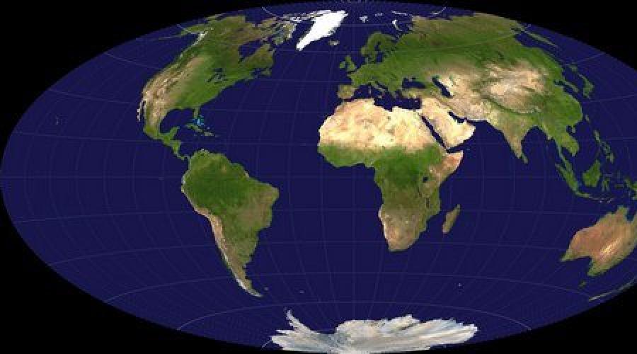
Form of land

Projection Hammer-Aitova
The circle and the diameter of the Earth differ, because its form represents a flattened spheroid or ellipsoid instead of the true sphere. The planet's poles are slightly flattened, which leads to convexity at the equator and, therefore, to a greater circle and diameter.
Equatorial bulge of the Earth is 42.72 km and is caused by the rotation and gravity of the planet. The gravity itself causes the planets and other celestial bodies to shrink and form the sphere. This is due to the fact that it pulls the whole mass of the object as close as possible to the center of gravity (the earth's core in this case).
Since the planet rotates, the sphere is distorted by the centrifugal force. This is the force that causes objects to move from the center of gravity. When the Earth rotates, the highest centrifugal force at the equator, so it causes a small outer convexity, giving this region a large circle and diameter.
Local topography also plays a role in the form of Earth, but globally is minor. The greatest difference in local topography worldwide is Mount Everest, the highest point above sea level - 8,848 m and Mariana Wpadina, the lowest point below sea level - 10,994 ± 40 m. This difference is only about 19 km, which is very slightly in a planetary scale. If we consider the equatorial convexity, the highest point of the world and the place most distant from the center of the Earth is the top of the Chimbora's volcano in Ecuador, which is the highest peak near the equator. Its height is 6,677 m.
Geodesy

To properly study the size and shape of the Earth, geodesy is used, the science industry responsible for measuring the size and shape of the Earth through surveys and mathematical calculations.
Throughout history, geodesy was an important branch of science, as early scientists and philosophers tried to determine the form of the Earth. Aristotle is the first person who is attributed to an attempt to calculate the size of the Earth and, therefore, early geodesist. Then the Greek philosopher Eratosthenes followed, an estimated circle of Earth at 40 233 km, which is only a little more adopted in our day measurements.
To explore the Earth and use geodesy, the researchers often refer to the ellipsoid, geoid and reference ellipsoid. The ellipsoid is a theoretical mathematical model that shows a smooth, simplified view of the surface of the Earth. It is used to measure distances on the surface without taking into account factors such as changes in the height and form of relief. Taking into account the reality of the earth's surface, the geodesists use the geoid - the model of the planet, which is built using the global average sea level and, therefore, takes into account the height differences.
The basis of geodesy today is the data that act as guidelines for global geodesic works. Today, technologies such as satellites and global positioning systems (GPS) allow geodesists and other scientists to make extremely accurate measurements of the earth's surface. In fact, they are so accurate that they allow to obtain data on the surface of the earth with an accuracy of centimeters, providing the most accurate measurements of the size and shape of the Earth.
If you have found a mistake, please select the text fragment and click Ctrl + Enter..
On June 19, Greek mathematician, astronomer and geographen Eratosthen Kirensky, who lived from 276 to 194 to our era, calculated the radius of the Earth. He was not the only one who made an invaluable contribution to the study of the planet. Of course, since that time immemorial, humanity made not one scientific breakthrough, expanding and even turning the idea of \u200b\u200bthe blue planet. On the way from the "shield on the backs of the elephants" to the geoid, the land in the minds of our ancestors was flat, and disco-shaped, and convex in the poles. Perhaps many will be surprised by learning that she is not round at all, and never was. This conclusion came scientists thanks to the latest research. How actually looks like a planet on which we live? Just about it and it will be discussed.
Errors of ancient scientists
It is noteworthy that some time ago most people, among whom were scientists, rejected the idea that the earth could be spherical. For example, in the third century, the famous writer and philosopher of lactations wrote that only the most mischievous dreamer can imagine that there is a man walking down his head, trees growing from top to bottom and hail falling in the opposite direction. The goat of Indicopolov, who wrote the book "Christian Topography" and criticism.
Greek poet Homer depicted a planet in the form of a circle, and Anaximander, a student of the Falez philosopher - as a cylinder. There were versions that the earth has the shape of Cuba, boats, a high mountain ... Despite this, truth still struck the path through a huge number of false data.
To date, it is difficult to imagine that in 1876, a brochure was published on the territory of St. Petersburg with the name "Land still". It included a lecture proving that the planet does not rotate around his own axis, nor around the Sun. The author of the work became the German specialist Dr. Shepfer, who spoke with the appropriate report in Berlin.

The Greek philosopher Aristotle in the IV century BC is one of the first to prove that the earth has a ball shape. As a confirmation of its theory, the scientist led the simple and at the same time an irrefutable fact: during the lunar eclipses, the planet discarded the satellite exactly a round shadow.
Gradually, the idea that the Earth is a ball hanging in space, spread wider. Thousands of years, the famous physicist and mathematician Isaac Newton complemented this information, stating that the planet is not a spherical, and a sick-like shape, shoved on the poles. This was confirmed by another case fixed in 1672. From Paris in Guiana, astronomical clock were transported, which eventually began to lag behind. Later, scientists found out that the pendulum of the mechanism swinging more intensively near the equator, and on the poles, on the contrary, slows down his movement.

In the XIX century, gravity measurements in different regions have also shown that the shape of the Earth is not the ellipsoid of rotation, but something more complex. In many of the islands, attraction turned out to be much more than in the continent. In connection with this specialists had to agree that the water level in the seas and oceans may be unequal.
In the course of further research, the experts adopted the term "geoid", describing the unique form of the planet.
The aforementioned word from the ancient Greek is translated as " earth-like". This is a convex closed surface, parallel to the surface of the water in the seas and oceans, when they are in calm state, and perpendicular to the strength of gravity at any point. Such a concept and its description proposed a German mathematician Johann Benedict Listing in 1873.
On March 17, 2009, the GOCE satellite was sent to the Earth's orbit, which existed until November 11, 2013. The device using an electrostatic gravitational gradiometer studied the gravitational field of the planet and its form - geoid. The small shape of the housing allowed the device to maintain the orientation and reduced the braking in the upper layers of the atmosphere. Thanks to the information received from GOCE, employees of the European Space Agency were able to understand some points in the ocean behavior, study hazardous volcanic regions and more accurately comprehend the shape of the Earth.

Modern scientist managed to find out that another object was previously existed in the orbit - a space body called Tayya. About 4.5 billion years, it crashed into the planet, as a result of which the moon was formed. The fact that this theory may well be truth, testifies that the current satellite of the Earth is too large for it and contains the same isotopes.
Some researchers argue that the planet has one more body, rotating around it. This is a small object, whose diameter does not exceed the meter. It is called the "Temporary Moon", as it is regularly replaced by similar fragments of planets and asteroids. At the same time, at least one miniature satellite is always in the orbit of the Earth.
Specialists are confident that millions of years ago planet could not be green and purple. Ancient microbes, according to scientists, used not chlorophil, and retinal - a molecule that protects them from sunlight. These elements and attached to the land of such a shade. At that time, gigantic mushrooms were almost disappeared with her, which were predecessors of trees and shrubs.

One of the features of the globe is also the fact that life on it existed without oxygen. When the element appeared here, about 99% of organisms were extinct, giving way to new inhabitants. According to experts, in a short time, the same fate can comprehend and humanity. The fact is that at some point in the atmosphere it will be too few carbon dioxide, which is why plants will not be able to carry out photosynthesis and allocate oxygen.
Many specialists have already begun to prepare for the resettlement of people into space. There are regular searches and research of planets with at least minor similarities from Earth. In this case, there is a risk to detect alien civilization. Whether it will be configured hostile or friendly, while it is unknown, however, to prepare for the meeting, in 2010 the UN appointed the official ambassador to be the first to come into contact with the aliens, and later to negotiate with them.
Also a fairly interesting fact about Earth is that annually it becomes 1,000 tons harder. This is due not only to the population of living organisms, but also with the fact that cosmic dust falls on its surface almost without stopping. Various asteroids and other relatively small bodies, approaching the Sun, are destroyed, thereby polluting the atmosphere and the surface of nearby planets. Researchers believe that this fact should not greatly worry and frighten humanity, as in the air, which breathes living organisms, and so contains a huge amount of various substances. Among them are nitrogen, oxygen, argon, methane, helium, neon, carbon monoxide and a number of other elements.
Scientists note that the true form of the Earth has differences and from the geoid - too high differences between the temperatures, the salinity of the seas and atmospheric pressure ... perhaps new satellites will help to solve this mystery, and humanity will forget about the shag-like globes.
Igor Ryzhakov
Our planet is one of 9, which rotate around the Sun. Even in deep antiquity, the first ideas about what the shape and size of the Earth appeared.
How did the ideas about the form of the Earth changed?
Antique thinkers (Aristotle - 3 V. BC, Pythagoras - 5 V. BC. E. et al.) Many centuries ago expressed the idea that our planet had a spherical shape. Aristotle (in the photo below), in particular, taught after Evdox, which is the center of the Universe of the Earth Sharotka. The proof of this he saw in the character, which have lunar eclipses. With them, the shadow dropped by our planet to the moon has a rounded shape around the edges, which is possible only under the condition of the shag-likeness.

Astronomical and geodesic studies conducted in subsequent centuries gave us the opportunity to judge what the form and dimensions of the Earth are in reality. Today, that she is round, know from Mala to Great. But there were times in history when it was believed that the planet Earth is flat. Today, thanks to the progress of science, we have no doubt that it is round, and not flat. Indelible proof of this - space photographs. The shag-likeness of our planet leads to the fact that the earth's surface is heated unevenly.

But in fact, the shape of the earth is not quite such as we used to think. This fact is known to scientists, and it is currently used to solve problems in the field of satellite navigation, geodesy, cosmonautics, astrophysics and other related sciences. For the first time, the idea of \u200b\u200bhow in reality the form of the Earth was expressed by Newton at the turn of the 17-18th centuries. He theoretically substantiated the assumption that our planet under the influence of her strength of gravity should be compressed in the direction of the axis of rotation. And this means that the shape of the Earth is either a spheroid or an ellipsoid of rotation. The degree of compression depends on the angular velocity of rotation. That is, the body rotates faster, the more flattened the poles more. This scientist proceeded from the principle of global gravity, as well as from the assumption of a homogeneous liquid mass. He allowed that the Earth is a compressed ellipsoid, and determined, depending on the rotational speed, the size of the compression. After some time, McLoreren proved that if our planet is compressed in the poles with an ellipsoid, then the equilibrium of the oceans covering the earth is really provided.
Is it possible to assume that the earth is round?
If the planet Earth will be viewed from afar, it will seem almost perfect round. An observer who is not important to the accuracy of measurements may well consider it such. The average radius of the Earth in this case is 6371.3 km. But if we, having received the idea of \u200b\u200bour planet for the ideal ball, will make accurate measurements of the various coordinates of the points on the surface, we will not work. The fact is that our planet is not an ideal round ball.
Various ways to describe the shape of the Earth
The form of the planet Earth can be described by two main, as well as several derived methods. It can be adopted in most cases or for the geoid, or for the ellipsoid. Interestingly, the second option is mathematically easily described, but the first is not described in principle, since to determine the exact form of the geoid (and, therefore, the Earth) are carried out practical measurements of gravity at various points of the surface of our planet.
Ellipsoid rotation
Everything is clear with the ellipsoid of rotation: this figure resembles a ball that is dropped from below and on top. The fact that the shape of the Earth is an ellipsoid, quite explained: centrifugal forces arise due to the rotation of our planet in the equator, while they are not on the poles. As a result of rotation, as well as centrifugal forces, the land "split": the diameter of the planet on the equator is more about 50 km than the polar.
Features of the figure called "Geoid"

An extremely complex figure is a geoid. It exists only theoretically, but in practice it can not be fascinated or to see. You can imagine a geoid in the form of a surface, the power of the earth's attraction at each point is directed strictly vertically. If our planet was the right ball filled with evenly by any substance, then the plumbing at any point would look at the center of the ball. But the situation is complicated by the fact that the density of our planet is inhomogeneous. In some places there are heavy rocks, in other voids, mountains and depressions are scattered over the entire surface, the plains and the sea are unevenly distributed. All this changes the gravitational potential at each specific point. The fact that the shape of the globe is a geoid, the air wind is also to blame, which blows our planet from the north.
Who studied geoids?
It should be noted that the very concept of "geoid" was introduced by the Johann Listing (in the photo below), a physicist and mathematician, in 1873.

Under it meaning translated from the Greek "form of the Earth", the figure formed by the surface of the World Ocean, as well as seas, communicating with it, with an average water level, the absence of perturbations from tides, flows, as well as atmospheric pressure differences, etc. . When they say that there is such a height over the sea level, it means height from the geoid surface at this point of the globe, despite the fact that there is no sea in this place, and it is located a few thousand kilometers from him.
The concept of geoid was repeatedly clarified. Thus, the Soviet scientist M. S. Molodnian created his theory of determining the gravitational field and the figure of the earth for measurements performed on its surface. To do this, he has developed a special device, measuring gravity - spring gravimeter. It was he who also proposed the use of a quasigoid, which is determined by the values \u200b\u200btaken by the potential of gravity on the surface of the Earth.
Read more about Geoyida

If the gravity is measured 100 km from the mountains, then the plumb (that is, the weight on the thread) will deviate in their direction. Such a deviation from the vertical of our eye is unnoticed, however, it is easily detected by the instruments. A similar picture is observed everywhere: the deviation of the plumb is somewhere more, somewhere they are less. And we remember that always perpendicular plumbing is the surface of the geoid. Hence it becomes clear that the geoid is a very complex figure. In order for the best to imagine it, you can do the following: cut out a ball from clay, after which it is squealing from two sides to form a drop-down, then make your fingers on the resulting ellipsoid bugs and dents. Such a flattened rummed ball will be quite realistic to show the shape of our planet.
Why do you need to know the exact form of the Earth?

Why do you need to know so exactly her form? What does not satisfy scientists a spherical shape of the Earth? Should the geoid and ellipsoid of rotation be complicated? Yes, there is an urgent need for this: the shapes close to the geoid helps to create coordinate grids that are the most accurate. Neither astronomical studies, nor geodetic surveys, nor various satellite navigation systems (GLONASS, GPS) cannot exist and are carried out without determining the fairly accurate form of our planet.
Different coordinate systems
In the world, several three-dimensional and two-dimensional coordinates with world import coordinates are currently operating, as well as several dozen local. Its form of land is accepted in each of them. This leads to the fact that the coordinates that were identified by different systems are somewhat different. Interestingly, in order to calculate them from points located on the territory of one country, the most convenientness will take the form of the Earth for the reference ellipsoid. It is installed now even at the highest legislative level.
Ellipsoid Krasovsky
If we talk about CIS countries or Russia, then on the territory of these states the form of our planet is described by the so-called Ellipsoid of Krasovsky. It was determined back in 1940. Domestic (PZ-90, SK-63, SK-42) and foreign (AFGOOYE, HANOI 1972) The coordinate systems were created on the basis of this figure. They have been used in practical and scientific purposes to this day. Interestingly, GLONASS relies on the PZ-90 system, which exceeds with its accuracy accepted as the basis of the GPS similar to the WGS84 system.
Conclusion
Summing up, let's say again that the form of our planet is different from the ball. The land is approaching in its form to the ellipsoid of rotation. As we have noted, it is not at all idle is this question. The exact definition of which land has a form, gives a powerful tool to scientists to calculate the coordinates of celestial and earth bodies. And this is very important for space and navigation, during construction, geodesic works, as well as in many other areas of human activity.
No, probably, on our beautiful planet of a person who, at least once in his life, did not ask himself a question: "What a form of the earth?"
This question was worried and many scholars of minds throughout the history of mankind. Studying the history of our planet, we come to the conclusion that the idea of \u200b\u200bthe form of the Earth was evidenced by different peoples in different ways. But now it is very difficult to determine what kind of people this representation was the most correct. Significant ancient documents studying this moment have been preserved very and very little. For the most part, these are legends, legends, myths.
The most common legend is the representation of the ancient Indians. They imagined the land flat lying on the backs of the elephants.
Valuable written documents of residents of ancient Babylonia are preserved, whose age is more than 6 thousand years. As you know, Babylonians inherited their culture from other peoples, more ancient. These nations see the land in the form of a mountain. On one of whose slopes, or rather on Western, Babylonia. They knew exactly that in the south of Babylonia there are the sea, and on the eastern side of the mountain. The ancients were afraid to cross these majestic mountains, so it seemed to them that Babylonia was on the western slope of the mountain "World". Around the mountain of the sea, and the sky is based on the sea (solid in nature) - the Heavenly World. The heavenly world had the form of a tipped bowl. And there, too, has its own land, air and water. Heavenly sushi is the constellation of the zodiac. All of them are twelve. On the heavenly land, the sun is moving, which happens in each of the constellations about a month, the moon and five more planets. Under the ground is the hell - the abyss, the souls of dead people, animals, birds are descended there. When in Babylonia night, the sun is in the dungeon, falls there in the West, and starts his way from the eastern edge. Ancient Babylonians their ideas about the land were based on nature observations. But correctly explained.
Ancient Jews who lived on the plain represented the land of the plain on which there are mountains. These ideas were evolving the fact that the Jews lived in the flat territory. They divided the sky to the upper and lower belt. In the upper belt of the sky lived in the sky (snow, rain, hail), in the lower zone - winds. Under the ground there were water that had rivers and lakes.
However, the Greeks made the greatest contribution to the development of ideas about the form of the Earth. In the representation of Homer, the Earth convex disk resembling a warrior shield. Susha was washed by the ocean river. Above the Earth - the copper arch on which the sun is moving. The sun rises from the ocean every day and falls into the water in the West. These performances are very well described in the poems of Homer "Iliad" and "Odyssey".
The universe is liquid mass, inside there is a huge bubble, which has the shape of the hemisphere. The concave surface is the heavenly arch, and the lower ocean, the earth is floating on the surface of the plug. So represented the structure of the world Philosopher Falez (VI century BC. E.).
According to Anaximandra Meltssky - the land segment of the column, on one of the foundations of which is located life.
Making distant travel people gradually came to the conclusion that the earth is convex. The bulge of the Earth was confirmed by observations of removing ships. Gradually, people came to the conclusion that the earth is spherical.
Pythagoras (p. Ok. 580 - mind. 500 BC) and his followers, perhaps, the first began to consider the land and other planets with balls.
Aristotle (IV century. BC), watching the lunar eclipses noticed that the shadow from the ground falling on the surface of the moon is always round. He also noted that it was the ball discarded the round shadow.
Aristarh Samos, who lived at the end of the IV - the first half of the III century to our era, suggested that the Earth and all the planets rotate around the Sun, contrary to the existing opinion that the shining and all the planets move around the Earth. However, he could not confirm his assumption facts. And so, it took another 1,700 years before the Polish scientist Copernicus managed to prove this assumption.
If our planet was in equilibrium, established under the influence of gravity, did not have rotation around their own axis and consisted of a homogeneous substance. Then it would be possible to say that our planet has a spherical shape. But the Earth rotates. A centrifugal force arises, a polar compression appears under its influence. The earth takes the form of spheroid, or rather the ellipsoid of rotation.
Having studied the law of the world, in the late XVII early XVIII centuries, I. Newton theoretically substantiated the compression of the Earth. Then it was proven practically by the difference in the pendulum swing on different latitudes.
Numerous geodesic measurements were carried out, various values \u200b\u200bof the size of the earth's form were proposed. In Soviet times, from 1946, the Ellipsoid F. N. Krasovsky was adopted, the amount of which: the equatorial radius is 6378245m, the polar radius 6356863m, the polar compression 1: 298.3. The difference between the equatorial and polar radii of the Earth is only 21382 meters. If you carefully look at these sizes, it becomes clear why in geography the shape of the Earth is considered to be spherical.
However, back to our reasoning. The substance from which the Earth is inhomogeneously consists, the mass is unevenly distributed. So the figure of the Earth is deviated from the correct form of spheroid, in addition it is not necessary to forget about the action of the gravitational field of the galaxy. A new designation of the form of the Earth is a geoid.
The term "geoid" in relation to the designation of the figure of the Earth, proposed in 1873 by the German mathematician Johann Benedict Listing. This geometric figure most accurately reflected the form of the Earth than the ellipsoid.
The geoid is a figure that coincides with the average surface of the world ocean (this is a level surface). At each point of this figure, the direction of gravity is perpendicular to its surface. Due to the fact that the earth's crust is heterogeneous, the geoid has raised and lowering. Regarding the ellipsoid of the Krasovsky raising does not exceed 136 meters, lowering 162 meters. Raise are located above oceanic depressions, dives are equal to the continents. The heavy ocean basalt bark deflects gravity towards the oceans from the easier mainland granite bark. Raise and lower the geoid mirrors in relation to the actual relief of the Earth.
When studying the movement of artificial satellites of the Earth, the polar asymmetry of the earth's ellipsoid is established. Due to this, new ideas about the form of the Earth appeared. The land has a heart shape, the north pole is raised, compared with the southern pole, about 30 meters. The cardioid is called such a form of land. And again the reason is the effect of the gravitational field of the galaxy.
Thus, the physical surface of solid land deviates from the surface of the ellipsoid. The maximum height of the physical surface over the ellipsoid 8848 meters (Jomolungma), the maximum depth of 11022 meters (Mariana Vadina).
So what is the form of the earth? The figure of the Earth depends on the distribution of masses and densities in its body, the exact mathematical expression does not have this figure. It is impossible to accurately determine it, which is why in geodesic measurements in Russia and some other countries the name of the quasEgoid is used. This is an approach to geoid. QuasEgoid is determined by the measurement results, coincides with the geoid on the territory of the world ocean. On land approaching the shape of a geoid. Deviations range from several centimeters on the plain and up to two meters in the mountains.