The physico-geographical features of the Sea of \u200b\u200bAzov. Azov Recreation District
Read also
In the fall and winter on the weather of the Azov Sea, Siberian has an influence. As a result of its impact, the winds of the northeastern and eastern directions are predominantly blowing. The average speed is 4 - 7 m / s. During this period, powerful storms are observed, the speed of which reaches over 15 m / s. In this case, there is a sharp decrease in temperature. The average temperature in January is about - 2 - 5 ° C. The storm periods decreases to - 25 - 27 ° C.
In the spring and summer on the climatic conditions of the Sea of \u200b\u200bAzov, the Azores will have an influence. With its impact, winds of various directions are observed. Their speed is quite small - 3 - 5 m / s. The warm season is observed full shot. Summer in the Sea is quite high. In July, the air is on average warming up to + 23 - 25 ° C. In the spring, less often in summer, the sea is in power. At the same time, the winds of the South-West and Western directions are observed. The speed of these winds is 4 - 6 m / s. During cyclones there are also short livne. In the spring-summer period, solar, with high temperatures prevailing.
Two big waters carry their waters in the Azov: and Kuban and about 20 small rivers. Small rivers are preferably falling into the northern part of the sea. The river stock of the Azov Sea is determined by the volume of water that carry the Kuban and Don rivers. Waters that give small rivers are spent on evaporation. On average, over the year, the sea receives about 36.7 km 3.
The largest amount of water gives Don (more than 60%), which flows into the Taganrog bay in the north-eastern part of the sea. Kuban brings their waters to the southeastern part of the sea. Kuban water make up 30% of the total. Most of the river water enters the eastern part of the sea, there is no mainland on the rest of the territory. The greatest amount of fresh water the sea receives in the spring-summer period. After the river Kuban and Don began to be regulated, the seasonal distribution of the mainland has changed. Before this spring, the river was brought about 60% of the total flow, in the summer - 15%. After creating on the rivers, the hydrauses began to be 40%, and the proportion of summer increased to 20%. There is an increase in winter and autumnal runoff. A larger change was rendered on the Don than to Kuban.
Water exchange between Azov and occurs through. During the year, the Sea of \u200b\u200bAzov gives about 49 km2 of water, the Black Sea is about 33.8 km 3 of water. In the middle of the water of the Black Sea for the year increase their volume due to the Azov Sea by about 15.5 km 3. River stock and sea water exchange are closely related. If a decrease in river flow occurs, then there is a decrease in the waterway of the Sea of \u200b\u200bAzov and an increase in the inflow of the Black Sea water. The water of the Azov Sea interacts with the waters through the shed thin. During the year, the sea gives about 1.5 km 3, and it receives about 0.3 km 3 from Sivas.

On average, the Azov Sea loses and receives about the same amount of water. The water of the sea is fueled by the river drain (about 43%) and the waters of the Black Sea (40%). During the year, the Sea Sea loses its waters as a result of water exchange with the Black Sea (58%) and evaporation from the surface (40%).
On the aqueous expanses of the Azov Sea every year ice is formed. Due to the fact that winter here is short and frosts are inconsistently, ice formation is irregular. During the winter, the ice undergoes various changes: it appears and disappears again, becomes drifting, and then freezes to a fixed state. In late November, the first ice begins to appear in the Taganrog Bay. In early December, ice covers the northeast and northwest parts of the sea. Only in mid-January, ice appears in the southwestern and southern regions. The deadlines for the formation of ice may vary depending on the specific year. The largest thickness that ice can reach is 80 - 90 cm. On average, ice thickness can be about 20 cm, with relatively non-surteria winter.

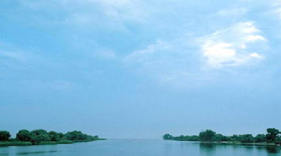
Sea of \u200b\u200bAzov (photo Mikhail Manayev)
In mid-February, ice gradually weakens. At the end of February, he begins to collapse near the coast in the southern part of the sea. By the beginning of March, ice is destroyed in the northern part, and in mid-March - in the Taganrog bay. Fully, the sea is released from ice from the middle of March - April.
In the Sea of \u200b\u200bAzov, the economic activity of man is widely developed. Fish fishing is well developed here. Here produce a large number of valuable species of fish (especially sturgeon) a large number of different marine products. Currently, the volume of fisheries is reduced due to the decrease in the number and variety of the sea fauna. In the bowels of the Azov Sea there are stocks. On the waters of the sea produce various goods. Also on the sea coast there are resort areas for recreation.
Azov today
Modern Azov is a quiet, very green and cozy city with a population of just over 80 thousand people. The industrial complex is made behind the accommodation neighborhoods, and the center has become an excellent place for walking and studying history.
At the shore of Don, the shafts of the Azov Fortress, ditch, Alekseevsky Gate were preserved. The powder cellar is preserved here - a monument of the Military Engineering Art of the XVIII century, and a small fragment of the wall of the Italian Tana factor, and a large port. But perhaps the most bright pearl in this necklace remains the Azov local history museum, allowing you to look at the Azov with completely different eyes, soaring in the spirit of respectful respect for the glorious history of this incredible southern city.
History
In the I-III centuries. AD At the site of Azov were the settlements of Mets, forming fortified settlements around the ancient Greek settlement - in ancient times, it was conquered by Mithridate Pontic; Then, in turn, they owned: Sarmati, Hunnes, Khazars and Pechenegs. In the X-XII centuries. There was a Slavic settlement on the site of Azov, which was part of the Old Russian Tmutarakan principality, and about 1067 it was conquered by Polovtsy. In these places, the Polovtsian Prince Azun was killed (as suggested by the name of which the Russian name "Azov" occurred). In the XIII century. Here arose the city of Azak (toponym of the Turkic "Azak" - the mouth of the river), through which the "Great Trade Way" took place. At the same time, Azov switched to the Genoesers, was strengthened with stone walls and towers and became a folding point for their Indo-Chinese trade. In 1395, the city was destroyed by Tamerlane, but in 1400 Azov was again rebuilt with the Genoese.
There are many bright pages in the history of the city. One of them is the famous (1637 - 1642), when in 1641 the fortified Cossack fortress with five thousand Cossacks 93 days and night was withstanding the onslaught of 250-thousand Turkish troops. Turkey in May 1641 moved to Azov's army led by Pasha Huseyn-Delhi to knock out the Cossacks. The forces of the Turks were enormous - more than two hundred thousand people with hundreds of siege guns. Crimean Khan and Halior and Haling. Cossacks in Azov was a lot of - thousands of fifteen, and the Cossack women were hundred eight. Cossacks with desperate courage reflected the Turks.
Turks and Tatars carried losses and requested help from Sultan. Having received a reinforcement, Hussein-Delhi decided to experience the last tool to take possession of the Azov, to fall asleep all the defenders of his land. Hasted earthworks began, in which the main managers were Italian and German engineers; In a few days, the most urban walls came the shaft of embroidered 7 sages. Having installed mighty heavy artillery on it, the Turks began to beat the city from all the day and night. Shooting this last 16 days. Cossacks were defended with desperate courage. And sustained. In the end, the Turks were forced to remove the siege and get away. In panic fear, they fled, leaving under azov from 50 to 70 thousand corpses.
Hike Peter I under the Azov, undertaken in 1695-96 and crowned with the Taking Turkish fortress, opened the "gate" to the South Sea to the Russian state.
The city of Azov was the center of the Azov province (1775-1782). In the XIX century, Azov was posing by Ekaterinoslav province. Only in 1926, Azov again became the city.
During the Great Patriotic War, the city of six more than a month was occupied by the fascists. About 600 people were shot. More than 5,000 Azovican was vigorously in Germany. The city has suffered significant damage.
Its current basic development of Azov received in the 60-80s of the XX century due to the intensive development of industry.
Geographical position
Azov is located in the southwestern part of the Rostov region, on the left bank of the Don River. Located 15 km from Don to Taganrog Bay of the Azov Sea and 36 km from Rostov-on-Don. With the regional center connected by rail, automotive and river transport.
The Azov Sea is a shelf half-plated with a reservoir, and it belongs to the Mediterranean system in general, this natural reservoir is a mixture zone of Black Sea and river waters, so some researchers consider it as a bay (shallow) black sea or spacious, extensive river Limin.
From this article, you can learn how the area of \u200b\u200bthe Azov Sea, about its location, the origin of the name and MN. Dr.
Sea of \u200b\u200bAzov: general information
This reservoir is the northeast pool of the Black Sea. Connects them among themselves
According to its morphological features, Azov belongs to flat types and is a shallow water reservoir with not very high shores of the coast.
There is a fairly small area and depth of the Azov Sea (the last no more than 14 meters, and its depth is only about 8 meters). Moreover, more than 1/2 part of the territory has a depth of up to 5 meters. And this is the main feature.
Custom and Sivash Sea Azov has an elliptic form stretched to the south-west from the north-east. In the ocean, this is the smallest natural reservoir.
Two great rivers flow into it - Kuban and Don - and many (more than 20) smaller, which mostly flow from its northern shore.
Parameters of the Azov Sea: Area
The pool of the Sea of \u200b\u200bAzov has an area of \u200b\u200babout 570 thousand square meters. km. The length of its largest 343 km, and the widest part is 231 km. 2686 kilometers - the length of the entire coastline.

Square of the Azov Sea in square. km. It is about 37600 (here does not include the area of \u200b\u200bthe islands and braids, occupying 107.9 square meters. km). The average volume of all water is 256 km 3. As noted above, approximately 43% of the territory falls on the depth areas from 5 to 10 meters.
origin of name
Its modern, relatively new, the name of the sea received several centuries ago from the name of the Turkish city of Azov. The latter, in turn, is due to the name of the local feudal (azak or a lot).
But even earlier, the ancient Greeks called him "Motis Limne", which means "Lake Mets" (peoples inhabited on the shores). The Romans called it ironically - "Palus Meotis", which means "Moloto Motov". And it is not surprising for the Azov Sea. Square, and especially the depth of it, not very large.

Arabs called "Baral-Azov" and "Nitschlach", and Turks - Bahr-Assak (sea dark blue) and Boryal-Assak. Many other names were in antiquity, everything is not counting.
Azov in Russia became famous in the 1st century. er, and his name was given - the blue sea. After it was formed called Russian. Then the sea was renamed repeatedly (Mautis, Salakar, Samakush, etc.). In the 13th century, the sea was approved with the name of the Saxian Sea. The conquerors of Tatar-Mongolian gave him the name "Chabak-Dengiz" (Beshechye or Chabacier) and "Balyk-Dengiz" (translated - "Fish Sea"). As a result of the transformation of the last name (Chabak - Dzybach - Bunch - Azak - Azov) and today's name arose (dubious version). All assumptions about origin is impossible to describe here.
Types of animals, water volumes, area: comparisons of the Sea of \u200b\u200bAzov with other seas
On the area more Azov almost 2 times, and black - almost 11 times, and, accordingly, it is more than 1678 times in water volumes.
Nevertheless, two European states could be accommodated in this area, such as Luxembourg and Belgium.
It is curious to compare the number of types of Mediterranean plants and animals in different seas, considering from the West to the East. In the Mediterranean - more than 6,000 species of various organisms, in black - 1500, in Azov - about 200, in Caspian - about 28, and only 2 types of organisms live in Aralska. This explains the fact that all of them once in the long past gradually separated from the sea of \u200b\u200bMediterranean.

Water expanses of the Sea of \u200b\u200bAzov, the area of \u200b\u200bthe coastline territories contain a huge number of diverse animal species.
On the shores there are many diverse waterfowl: ducks, geese, steppe kelits, centers, chibisov, Swans-Shipunov, CHEK-Chernogolovka and MN. Dr. in the sea and in the mouth of the rivers flowing into it, as well as in the limits of everything inhabit 114 species (along with subspecies) of fish. This reservoir is called the sea of \u200b\u200bmollusks.
And on the productivity of the biological, it takes the 1st place in the world.
Sandy relief
Slend the bottom of the sea. The depths here mainly increase gradually as removal from the shores, and naturally, the deepest places are in the very center. Practically flat bottom at Azova.
All the territory of the Azov Sea arose due to major bays. The islands of large on it are not. There are small shallows (turtle islands, turquoine, etc.).
Climate
The area of \u200b\u200balmost the entire surface of the water is already quickly warming up in April. From June to September, the average water temperature is greater than 20 ° C, and in July-August reaches 30 ° C. And in the sivache (for comparison), water is heated and up to 42 degrees.

Bathing season lasts 124 days. At this favorable period, only a few days are relatively low or very high water and air temperature.
Due to the small size of the Sea of \u200b\u200bAzov (area, depth, volume), its influence on the climate of the sushi surrounding it, is pretty poorly and slightly noticeably only in a narrow strip (coastal).
Water here quickly heats up in summer and is cooled in the same way in winter. Fully the sea freezes only in the most severe winters. And throughout the winter ice is formed and pulls out several times, since in these places there are often thaws.

In conclusion about some curious facts
There are several very interesting and curious facts from history.
1. Sea many millions of years was part of a huge ocean, called the geologists of Tetis. His endless smooth stretched from America Central through the Atlantic Ocean, part of Europe, black, Mediterranean, Caspian and Aral Sea and further east through India to the most Pacific Ocean.
2. Russian Prince Gleb in 1068 measured the distance from Kerch to Taman on Ice. The inscription indicates that the distance from Kortchev to Tmutarakani (the ancient name, respectively, Kerch and Tamani) was about 20 km. It turns out that in 939 years the distance it increased by 3 km.
3. The water of the sea contains little salt (one more feature). In this regard, the water quite easily freezes. Therefore, the sea is uncomfortable since the end of the year (December) until mid-April.
The inner Azov Sea is located in the south of European Russia. It is connected by narrow (up to 4 km), small (4-5 m) Kerch Strait with the Black Sea. The border between the seas is held along the line m. Takil - m. Panagia.
The Sea of \u200b\u200bAzov is the smallest and one of the smallest seas of the world. Its area is 39 thousand km 2, the volume of water is 290 km 3, the average depth is 7 m, the greatest depth is 13 m.
Azov Sea
The sea has a relatively simple outline. North shore - smooth, incisive, with wicked sandy braids. In the west Kos Arabat
The arrow separates from the sea Sivash Bay, connecting with the sea with a bright strait. In the southeast stretches for 100 km of Kuban Delta with extensive floats and numerous ducts. Kuban falls into the top of the open Temryuk bay. In the northeast, goes into the land of 140 km the largest bay of the sea - Taganrog, whose vertex is Done Delta.
Hydrology
Almost all river stock in the sea (more than 90%) give Don and Kuban. The overwhelming part of the runa comes from the spring-summer season.
The main exchange of the Sea of \u200b\u200bAzov takes place through the Kerch Strait with the Black Sea. According to the average miniature data, from the Azov Sea, the surface stream flows about 49 km 3 of water annually, and about 34 km 3 of the Black Sea water flows into it. The resulting flow of water from the Azov Sea into black is approximately 15 km 3 / year.
Climate
The climate is deeply flowing into the land of the Azov Sea differs in continentality. It is characterized by cold winter, dry and hot summer. In the autumn-winter season, the weather is determined by the influence of the sang of the Siberian anticyclone with the predominance of Eastern and northeastern winds at a speed of 4-7 m / s. Strengthening the impact of this spray causes strong winds (up to 15 m / s) and is accompanied by the invasions of cold air. The average monthly January temperature is -1- 5 °, during the northeastern storms it decreases to -25-27 °.
Spring and summer prevails warm, clear weather with weak winds. In July, the average monthly temperature across the sea is 23-25 \u200b\u200b°, and the maximum one is more than 30 °. In this season, especially in the spring, the Mediterranean cyclones are often trained over the sea, accompanied by Western and South-Western winds at a speed of 4-6 m / s, and sometimes squalls.
The amount of atmospheric precipitation on the east coast of the sea is 500 mm per year, on West - about 300 mm.
Small sizes and small depths of the sea contribute to the rapid development of wind unrest. A few hours after the start of the wind, the excitement reaches the steady state and also quickly fades when the wind stops. Waves are short, steep, in the open sea reach a height of 1-2 m, sometimes up to 3 m.
Inter-divided sea level fluctuations, determined by long-term changes in the constituent water balance, make up several centimeters. Seasonal level changes are mainly dependent on the river drain mode. The annual level of the level is characterized by its increase in the spring-summer months and a decrease in autumn and winter, the range of oscillations on average 20 cm.
The winds prevailing over the sea cause significant savory levels of levels. The most significant levels of levels were marked in Taganrog - up to 6 m. In other points, the arrivals 2-4 m (Genichesk, Yeisk, Mariupol) are possible, in Kerch Strait - about 1 m.
With sharp changes in atmospheric pressure and wind in the Azov Sea, sewage can occur - free standing level fluctuations. On the waters of the ports are excited by saushie from periods from a few minutes to several hours. Sea marked sewage with a daily period of 20-50 cm.
Relief DNA
Shallow shores of the sea are moving into a flat flat bottom. Depths are smoothly incremented with removal from the shores. The greatest depths are located in the central part of the sea, the depths in the Taganrog Gulf - from 2 to 9 m. In the Temryuk bay, mud volcanoes are known.

Relief of the bottom and the flow of the Sea
Flow
The flows into the sea are initiated mainly by the wind. The slope of the level created by the wind is caused by compensation currents. In the predominium areas of Don and Kuban trace flows.
Under the influence of Western and South-Western winds, the water circulation is formed against the clockwise. Cyclonic circulation is excited at the eastern and northeastern winds, which are stronger in the northern part of the sea. With the same winds, but stronger flow in the southern part of the sea have anticyclonic character. With weak winds and calm, minor flows of variable directions are noted.
Since weak and moderate winds are dominated over the sea, the greatest repeatability have flows with speeds up to 10 cm / s. With strong winds (15-20 m / s) of flow rates are 60-70 cm / s.
In the Kerch Strait in the winds of the northern directions, there is a flow from the Azov Sea, and with winds with the southern component - the flow of the Black Sea water in the sea. The prevailing velocities of flows in the strait increase from 10-20 to 30-40 cm / s in the narrow part of it. After strong winds in the Strait, compensation flows are developing.
Arcity
At the Sea of \u200b\u200bAzov annually, ice is formed annually, and icecome (area occupied by ice) strongly depends on the nature of winter (harsh, moderate, soft). In moderate winters by the beginning of December ice is formed in the Taganrog Bay. During December, the soldiers are installed along the north shores of the sea, and a few later - the rest of the banks. The width of the strip falling - from 1.5 km in the south to 6 - 7 km in the north. In the central part of the sea, only at the end of January - the beginning of February there appears floating ice, which is then melt into the ice fields of large cohesion (9-10 points). The greatest development of ice cover reaches in the first half of February, when its thickness is 30-40 cm, in the Taganrog bay - 60-80 cm.
Ice conditions for winter are distinguished by instability. When changing the cold and warm air masses and wind fields over the sea, it repeatedly breaks and the drift of ice fields, the formation of torosa. In the open sea, the height of the torosa does not exceed 1 m, and the Arabat arrow can reach up to 5 m. In mild winters, the central part of the sea is usually free from ice, it is observed only along the shores, in the bays and limans.
The cleansing of the sea from ice in moderate winter occurs during March, first in the southern regions and the mouths of the rivers, then in the north and later in the Taganrog bay. The average duration of the ice period is 4.5 months. In abnormally warm and harsh winters, the deadlines for the formation and melting of ice can shift for 1-2 months and even more.
Water and salting temperature
In winter, almost all over the water area, the water temperature on the surface is negative or close to zero, only the Kerch Strait rises to 1-3 °. In the summer, the temperature on the surface is homogeneous - 24-25 °. The maximum values \u200b\u200bin July - August in the open sea up to 28 °, and the coast can exceed 30 °.
Severence of the sea contributes to the rapid propagation of wind and convective stirring to the bottom, which leads to the alignment of the vertical temperature distribution: its differential in most cases does not exceed 1 °. However, in the summer, a layer of temperature jump is formed at a strap, limiting exchange with bottom layers.

Sea temperature and salinity on the surface of the Azov Sea in the summer
The spatial distribution of salinity in the conditions of the natural inflow of river waters was rather uniform, horizontal gradients were observed only in the Taganrog bay, at the output of which the salinity prevailed 6-8. At the open sea, the salinity was within 10-11. Vertically, almost all districts, gradients were observed episodically, mainly due to the receipt of the Black Sea Waters. Seasonal changes did not exceed 1, only in the Taganrog bay, they increased under the influence of the intra-cost distribution of the drain.
Since most of the water area of \u200b\u200bthe sea does not observe significant differences in water and salinity, the aqueous masses do not stand out here. The Taganrog Bay is filled with fresh and saltwaters, the boundary between which approximately determines the salinity 2.
In the 60s - 70s. In the pool of the Azov Sea, freshwater seizures have increased for economic purposes, which led to a reduction in the river flow in the sea and, accordingly, an increase in the receipt of the Black Sea Waters. It coincided with a period of reduced moisture in the Waterborum Basin of the Sea, and under the influence of all factors since 1967 an increase in salinity began. In 1976, the average salinity in the sea reached the maximum value - 13.7. In the Taganrog bay, it increased to 7-10 ‰ at the outlet of the bay - to 12. The spatial unevenness of salinity was tangible, in the Prisonian region, especially in low-water years, its values \u200b\u200bincreased to 15-18 ‰, i.e. Up to magnitude, never observed in the sea since the beginning of the century.

Salt crafts in the bay of Sivash
The increase in the propagation of Black Sea water in the bottom layers of the sea led to the growth of vertical gradients of salinity and density, worsened conditions for mixing and ventilation of the bottom waters. The likelihood of the formation of a deficiency of oxygen (hypoxia) and the creation of frozen conditions for organisms has increased.
However, in the 80s. Stoke Don increased, which has favorably affected salinity. By the end of the 80s. Salon decreased again, and at present the catering of the Azov Sea does not happen.
Economic importance and environmental problems
With natural water mode before the beginning of the 50s. The Azov Sea was distinguished by extremely high biological productivity. With a river flow in the sea, a large amount of nutrients came, and 70-80% was introduced with a spring flood.
It ensured the abundant development of phytoplankton, zooplankton and benthos. The area of \u200b\u200bfloodplain and lifric spawns in the lower reaches of Don and Kuban reached 40 - 50 thousand km 2. These factors, as well as good heating of the sea, low salinity, sufficient saturation of water with oxygen, long-term vegetation period, the rapidly turnover of nutrients determined favorable conditions for the life of ichthyofauna with 80 species. No wonder the ancient Greeks called the Azov Sea Meotida, which means "cormalitsa".
In the 30s. The XX century The total fish catch in the Azov Sea reached 300 thousand tons, and more than half have accounted for valuable types of fish (sturgeon, pike perch, bream, etc.).
Regulation in 1952 Done (the creation of the Tsimlyan reservoir), the reduction of the flow rate of 13-15 km 3 / year, other consequences of economic activities in the pool of the sea caused serious negative changes in the ecosystem of the sea.
Reducing the annual flow of don by 30%, a significant reduction in the volume of the flood was caused by a decrease in sporses of spawns, violated the conditions for reproduction of freshwater species of fish.
The quantity and composition of the biogenic substances entering the sea are strongly changed, their distribution during the year. Most of the suspended substances settle in the Tsimlyan reservoir; Significantly reduced their number introduced into the sea in the spring and early summer; The flow of mineral forms of phosphorus and nitrogen has decreased and the number of organic forms has sharply increased, more difficult to organisms. The biogenic substances reaching the sea are mainly consumed in the Taganrog bay and in small quantities are taken out into the open sea.
Rose pollution of river and sea waters with various harmful chemical substances - pesticides, phenols, in some areas of the sea - petroleum products. The greatest pollution is observed in the national regions of Don and Kuban and on the waters adjacent to major ports. These environmental changes led to a sharp drop in the biological productivity of the sea. Several times the feed base of the fish decreased, the total catches were reduced in the main valuable species of fish.
The water situation in the pool of the sea is very tense. Currently, the sea comes on average about 28 km 3 river water per year. With this volume of the drain, it is possible to preserve its salinity in the range of up to 13-14. The further increase in water consumption in the reservoir basin is invalid, as this will cause an irreversible growth of salinity to the level of Black Sea and will lead to the deterioration of conditions for habitat of the most valuable marine organisms.
higher professional education
"SOUTH FEDERAL UNIVERSITY"
Faculty of "Sociology and Political Science"Department of Sociology
abstract
In the course "Sociology of international relations"
On the topic: "The socio-economic characteristics of the Azov district and the city of Azov"
Performed: Student Ozo 5 Course
Fomenko T. S.
Checked: teacher. Gugiev D.A.
Rostov-on-Don
2012 G.
Socio-economic characteristics of Azov
Geography
Azov is located on the southwest of the Rostov region, at the mouth of the Don River on the left bank, 42 \u200b\u200bkm from Rostov-on-Don.
The occupied area is 67.5kv. KM
History
The first fortified settlements were formed on the Azov land more than two thousand years ago. Officially, the city is officially leading from 1067, when the Don River Delta captured the Polovtsy and gave settlement the name of Azak. The Azov Fortress was on the way from Europe to Asia, she gave way to the sea, so the struggle was constantly accomplished and the fortress turned out of hand into his hands, she was often devastating defeat.
There are many bright pages in the history of the city. One of them is the famous Azov siege sitting, when in 1641 the fortified Cossack fortress with five thousand Cossacks 93 days and night was withstanding the onslaught of 250-thousand Turkish troops. And not only sustained. Turks were forced to remove the siege and get out away. Hike Peter I under the Azov, undertaken in 1695-96 and crowned with the Taking Turkish fortress, opened the "gate" to the South Sea to the Russian state.
The city of Azov was the center of the Azov province (1775-1782). In the XIX century, Azov was posing by Ekaterinoslav province. Only in 1926, Azov again became the city.
During the Great Patriotic War, the city of six more than a month was occupied by the fascists. About 600 people were shot. More than 5,000 Azovican was vigorously in Germany. The city has suffered significant damage.
Its current basic development of Azov received in the 60-80s of the XX century due to the intensive development of industry.
Administrative and territorial division
The city of Azov is a city of regional subordination, an independent municipality.
The city is also the center of the Azov district.
Population and labor resources
Population of more than 82 thousand people. More than 20 nationalities live in the city. The most numerous are: Russians - 94%, Ukrainians - 3.1%, Belarusians - 0.5%. About 55% of the population is in working age. The number of people employed in the economy is: 34.0 thousand people. Of these, in material production - 23.8 thousand people, in the non-productive sphere - 10.2.
Industry
The basis of the economy of the city is Mechanical Engineering (7 enterprises) and the Food Industry (6 enterprises). The development of the food industry is due to local natural resources, which are favorable for the production of agricultural products, requiring processing: production of bakery and confectionery, elevator, meat and dairy production, production of canned fish. Sustainable demand finds products of the Azov sewing factory.
There are 27 large and medium-sized industrial enterprises in Azov. More than half of enterprises, including the largest industrial units, have a mixed form of ownership, mainly open joint-stock companies (OJSC). In private property there are 9 small enterprises. The state form of ownership has retained the same large industrial enterprise of the city - the Production Association "Azov Opto-Mechanical Plant" (FSUE "AOMZ"). Another enterprise is the training and production enterprise "Lighting Engineering" of the All-Russian Society of the Blind, is owned by public associations.
Small and medium businesses
As of the beginning of the third millennium, more than 400 small enterprises and about 4,000 entrepreneurs were registered in Azov.
Transport
Thanks to its favorable geographical location today, the G. Azov is a developing international seaport with all the necessary infrastructure, which is processing about 1 million tons of various goods in a year entering both the sea and internal ways on ships of 3000t - 5000t type " -More "With a draft of up to 4 meters. In addition to the already current 7 berths in 2002, the construction of several grain terminals, a port elevator, terminals for transshipment of forest and technical alcohols, terminal for bunkering of ships began.
The Azov Railway Station is located from Bataysk nodal station at a distance of 30km. The electric train or bus from the regional center to Azov can be reached in one hour, a taxi router in 40 minutes, a ship in 30 minutes.
Culture and art
The network of cultural institutions includes the Palace of Culture, the city park, the youth and cultural center, 7 libraries.
The ensemble of the song and dance of the Don Cossacks, the ensemble "Guliai, Russians", the Ballroom Dance Ensemble "Nadezhda" speak with concerts as in the cities of our country and far beyond. Young Azovichane learn in the children's school of art and children's music school.
Education
Azov Institute of Technology of the Don State Technical University, Azov Institute of Management, Business and Rights of the Rostov State Economic Academy, Branch of the Rostov State University, Branches of universities from other cities of Russia, Music and Pedagogical College, Humanitarian and Technical College, Three Vities and Technical Schools , as well as medium, special and pre-school educational institutions.
Monuments and museums
Azov included in Russian and international tourist routes. His historical monuments have international significance.
The fortress trees of the Turkish fortress with the Alekseev gate of the XVIII century, the powder cellar, the ruins of the Genoese wall on the site of the medieval Tana facter. The Museum of Local Lore and the Museum of the First Director of the Arctic Institute of Natives Azova R.L. Samoilovich. A monument to Peter I was established to the three hundred prototation of the Russian fleet in 1996.
In the Azov Museum of Museum are unique paleontological, archaeological and historical exhibits:
- Skeleton of the Trunterium Elephant (600 thousand years),
Products made of gold, silver, copper and ceramics of the seizion period
Antique coins, collection of clothes and female needlework XIX - the first half of the XX centuries.
Guests of the city of Azov can settle in the hotels of Azov and Sunny, located a few dozen meters from the staircase to the suspension bridge across the Azovsky River.
Socio-economic characteristics of the Azov district
The area is located in the southwest of the Rostov region in the Don River Delta. In the north-west, the territory of the area is washed by the waters of the Taganrog Bay of the Azov Sea.In close proximity to the area is located in Rostov-on-Don and Bataysk, the small distances are separated from Novocherkassk and Taganrog. By virtue of its geographical location, the Azov district was provided with a developed transport infrastructure, including an extensive network of automotive and railway highways, and including the federal significance routes connecting the central part of Russia with the North Caucasus.
Favorable natural and climatic conditions have long contributed to the development of agriculture. The Azov district traditionally is among the leaders of the region for a whole complex of crop and animal production indicators, for example, on the yield of grain crops.
Significant the employment potential of the area.
In the population, it is one of the largest in the area: in the area of \u200b\u200b2862 km? 91.1 thousand people live, including 50.9 thousand able-bodied population.
The unique natural conditions of the Done delta and the coast of the Taganrog Bay, the richest history of the Azov region are the basis for the transformation of the area to one leading tourist centers of the Southern region.
Geographical position
The Azov district is located in the south-west of the Rostov region in the Don River Delta. The northwestern part of the area is washed by the waters of the Taganrog Bay of the Azov Sea.The geographical position of the district is exceptionally beneficial, which is due, first of all, with its proximity to the largest cities of the region. In the north he borders with Neklinovsky and Myasnikovsky districts and Rostov-on-Don, in the East - with Bataysky and Kagalnitsky district, in the south and west - with the Krasnodar Territory. The distance from the administrative center of the city of Azov to Rostov-on-Don is 25 km, to Taganrog - 92 km. Bataysk is 28 km from Azov, Novocherkassk - 66 km.
Area of \u200b\u200bthe Azov district - 2862 km?. Population density - 30.9 people / km?.
The distance from Azoz to Krasnodar is 257 km, to Volgograd - 500 km, to Moscow - 1115 km.
Transport
Developed transport infrastructure is the most important feature of the Azov district and one of the components of its economic well-being. The territory of the district crosses several transport highways of state importance at once. The main ones are the automotive highway M-4 "Don" and the Moscow-Baku railway line, connecting the center of the European part of Russia with the North Caucasus.The federal value motorway M-4 "Don" crosses the eastern part of the territory of the Azov district from north to south. The administrative center of the city of Azov is connected to it a 21-kilometer highway of regional importance. In addition, in the area there are five roads of regional importance: "Azov - Aleksandrovka - Starominskaya (up to the border of the Krasnodar Territory)", "Anname from Rostov-on-Don (from M-4" DON ") - Azov to Bataysk, East Bypassing Azov, "Azov - Vasilyevo-Petrovskoe - Samara", Rostov-on-Don - Rogozhkin.
The total length of the network of roads of various forms of ownership in the Azov district is 1151.3 km. Of them - Federal property (M-4 DON) - 31.4 km, roads of regional importance - 264.3 km, roads to rural settlements - 663.2 km, including the length of high-end road roads with solid coated - 433 km; Municipal (Azov district) - 192.4 km., 95% make up roads with a solid coating.
The railway line connects the city of Azov with G. Bataysky - one of the largest transportation hubs of the south of Russia. In addition to the line "Moscow-Baku", the railway line connects the city of Bataysk and, accordingly, G. Rostov-on-Don, with the village of Starominskaya and the city of Krasnodar Territory.
In the city of Azov there is an international seaport. River port and Rostov-on-Don airport is 25 km, the international seaport of Taganrog - 92 km.
Natural conditions and resources
The territory of the Azov district is a combination of various natural landscapes: the South Russian steppe, seaside districts, protected areas of the Don Delta. Since 1884, there is an Alexander Forest on its territory (formerly atamine forestry).The area is rich in various minerals. However, not all deposits found in the area are valid. So, the north of the farm Obukhovka has a major oil and gas field, the main part of which lies in the neighboring Mysnikovsky district. The deposit is assessed as promising, however, for its development requires attraction of significant funds. The right bank of the Taganrog Bay is richly on a tight shell, which serves as a good material for the sinking of roads in the villages and farms Dance Delta. However, the shell ridge comes out by a thin twenty-salted layer, which eliminates the possibility of the preemring of the sewer on an industrial scale and its subsequent wide practical application. The main wealth of the area is the acting sand deposits at the villages of Kagalovka, Kuleshovka, Samara, Pavlovka, Novomargarito and Port Caton. The oldest of them, Azov, explored in the middle of the twentieth century and has an assessment margin of about 10 thousand tons. In addition, in the area there are deposits of clay, mergel, hydrogen sulfide mud.
The coast of the Taganrog Bay and Dance Delta are very attractive territories for the development of tourism. The duration of the bathing period on the Azov coast is 120-140 days. The most favorable for swimming July and August, when the water temperature is above 22 ° C. The thalassotherapy season ends at the end of September. The beaches of the area are folded with sand with a shell. His beaches are famous for the valley of the lower don.
Economic situation
The main branch of the Azov district economy is agriculture.In the Azov region of 243.4 thousand hectares of agricultural land, including 236.9 thousand hectares of farmland, of which 190.7 thousand hectares of Pashnya.
Azov district is one of the major producers of agricultural products.
In different years, the gross collection of grain crops is 300 thousand tons. And more. In 2008, this figure amounted to 369.0 thousand tons with an average yield of 41.2 c / ha, in 2009 - 327.0 thousand tons and 39.2 c / ha, respectively, in 2010 - 353.3 thousand. Tons with medium yield 39 c / ha. In individual farms, grain yield is 55-60 c / ha.
In the past three years, the district ranks first in the Rostov region on the yield of early grain and leguminous crops, sunflower is grown here. Annually Sunflower Square is reduced, and gross production is growing. In 2005, gross production - 60.0 thousand tons, yield 15.8 c / ha; In 2009 - 65.0 thousand tons and 17.3 c / ha.
In 2009, individual agricultural enterprises and to (f) x, using modern technologies and seeds of high-yielding hybrids, received 29-34 c / ha oiling.
The area is seriously engaged in cultivating sugar beet. In 2009, 4.0 thousand hectares were sown. The average yield of 350.0 c / ha was obtained. Purchased 16 new complexes on the cultivation and cleaning of sugar beets. In 2009, the crop of sugar coats was 113.2 thousand tons, in 2010 - 140.8 thousand tons.
The Azov district has 15 thousand hectares of artificially irrigated land and therefore vegetable cultures and potatoes occupy an important place in the production structure.
In 2009, gross collection of vegetable crops amounted to 100.0 thousand tons with an average yield of 263.2 c / ha, in 2010 - 103.7 thousand tons, the average yield - 246.5 c / ha. On an area of \u200b\u200babout 1500 hectares, vegetables are grown on drip irrigation. Five years in a row, the Azov area on the gross production of vegetable crops and yields ranks first in the region among 43 districts. In addition to vegetable growing in the open soil, the area began to cultivate vegetables in a protected soil. In the village of Samara, the first stage of the greenhouse complex "APK XXI Century" was built worth 160 million rubles, where vegetables are grown all year round and apply the most modern cultivation technologies. In 2009, 1.5 thousand tatoms and cucumbers were produced in closed soil.
Gross production of food potatoes in 2009 increased to 40.0 thousand tons, with yields of 132.3 c / ha. In 2010, the area is engaged in the cultivation of potatoes of chipse varieties. The company "Frito Lei Manufacturing" in the city of Azov in 2009 commissioned a factory for the production of potato chips. This factory will recycle 200 tons of potatoes per day. For agricultural producers, a guaranteed market of sales of chipse potatoes on mutually beneficial conditions has opened.
The fruit industry has been preserved in the area. In 2010, 1038 tons of fruit were produced. Every year there is a calculation of old-age, perennial plantings and bookmark of young gardens and berries.
The average annual production of seed, bone and berries is 5.1 thousand tons, the area of \u200b\u200bbookmarking perennial plantations in 2009 was 70 hectares. An increase in the production of all crops in the area is achieved through the introduction of surface moisture-saving soil processing technology, the use of new promising varieties and hybrids.
In the area, a lot of work is carried out on the introduction of new technologies in animal husbandry, reconstruction of livestock premises, updating the uterine population to more productive breeds and crossings, high-performance livestock equipment is purchased.
In the next three years, the Azov district will be further developed to develop an agricultural industry and an increase in the production of all types of agricultural products by increasing the yield of crops and animal productivity, an increase in livestock and bird livestock in all categories of farms, improving other qualitative indicators.
It is planned that by 2013 the production of grain in all categories of farms will be 338.5 thousand tons, growth by 2007 63.6%; Sunflower 66.8 thousand tons, height 44.8%; sugar beets 147.4 thousand tons, growth of 1.8%; potatoes 52.7 thousand tons, growth 1.2%; vegetables 109.2 thousand tons, growth 17.4%; fruits and berries 9.1 thousand tons, growth of 60.6%. Receive further development of the livestock industry. The production of meat increases by 29% and will be 18.0 thousand tons in 2013, milk is 17.1% and will be 59.6 thousand tons, eggs by 17.4% and will be 60.0 million. pieces The marketability of crop and livestock products will increase.
Investment activities
Azov district is one of the municipalities of the Rostov region with the highest investment potential
In the development of the production of the area, the agro-industrial complex plays a dominant role - this is largely due to the favorable natural and climatic conditions.
The prospects for the development of the Azov district are associated with the creation of the Novoaleksandrovsko industrial park, where investment projects of such companies are being implemented as "Coca-Cola Aichbisie Eurasia" (plant for the production of soft drinks), "Bol Pekinging Europe" (production of aluminum cans for drinks), Danone-Unimilk (Milk Combine), "Aston" (production of starch products and glucose-fructose syrups), "Rostov combine of champagne wines" (production of alcoholic beverages), "regatta" (production and logistics complex).
The Koka-Kola company in 2010 of the volume of products of the shipped products of its own production in 986.6 million rubles, which amounted to 72% in the total amount of shipment of large and medium-sized enterprises. The monthly release of the factory shipped products is more than 100 million rubles. In 2011, it is planned to produce products three times more.
Azov district is an active participant in the priority national project "Development of APK". The implementation of the largest project is carried out by Bataysky OJSC. At present, pigsties are fully built in the project, 565 million rubles were mastered.
Investment attractiveness for the development of the district represents the development of the territory along the Federal Highway M-4 "Don", the implementation of projects in the field of construction industry and housing, energy. It is also planned to build a port on transshipment of mixed goods.
In the area there is a positive dynamics of housing input. In 2009, 443 residential buildings were commissioned with a total area of \u200b\u200b46.3 thousand m?., In 2010 - 460 houses with a total area of \u200b\u200b47.8 thousand sq.m. With the development of the Novoaleksandrovsky Industrial Park, there is a need for large-scale construction of housing and social infrastructure facilities. To this end, the Azov district contains the construction of housing villages "Belovodier", "South", "Priazovia".
About 500 enterprises of trade and over 100 catering enterprises operate in the Azov district. The turnover of retail trade in 2009 amounted to 3177.8 million rubles, in 2010 - 3860 million rubles, the turnover of public catering - 232.9 million rubles.
The average monthly salary at the enterprises of the region in 2010 amounted to 11254 rubles, including in the field of agricultural production - 10518 rubles, on the manufacturing (food production) - 25484 rubles.
Engineering infrastructure
Since 1998, a program for gasification of settlements has been actively implemented in the Azov district. By the beginning of 2011, 71.2% of the territory was gasified.Gasification work continues. In 2009, 6 settlements were gasified (36.8 km of gas networks). (For reference: 2007, 12 settlements, 68 km of gas networks, 2008 - 3 settlements, 44.06 km of gas networks). In 2010, 57.6 km of gas networks were laid, 10 settlements were gasified, 4 submarine gas pipelines were built and one intracotor.
The telephone connection is secured 100% of the area of \u200b\u200bthe area.
Labor potential
Azov district is one of the largest population in the field. Currently, 91.1 thousand people live in it, including 50.9 thousand able-bodied population.Population of the Azov district, thousand people.
Among the working-age population of the district, agricultural workers, manufacturing and social institutions of the social sphere prevail. The level of registered unemployment in the region of 2009 is 1.46%, in 2010, 1%.Migration remains the main source of population population.
Representatives of more than 20 nationalities live in the area. There are three large compact residents of national groups: Turks (599 people), Koreans (544 people) and Azerbaijanis (179 people).
Social sphere
The system of formation of the Azov district is one of the most developed in the field. It unites 44 secondary schools, 25 branches of schools, 4 institutions of additional education of children, 38 municipal pre-school educational institutions, etc. The pedagogical team of the formation of the district has about 1,100 employees, 4 of them have the title of "Honored School Teacher of the Russian Federation."As part of the implementation of the National Priority Project "Education", 4 teachers became the winners of the competition "Best Teacher of Russia". The area has accumulated a rich experience in military-patriotic education of young people. Every year a military sports game "Zarnitsa" is held in the Alexandrovsky Forest.
The network of health care institutions of the Azov district includes 2 district hospitals, 4 precinct hospitals, 8 medical ambulatory, 50 faces. In terms of health institutions in 2009, the Azov district took a 2 rank place out of 43 regions of the region.
The area for three years is considered the best in the implementation of the National Project "Health".
The cultural institutions of the district are represented by 51 houses of culture and clubs, 44 libraries, 6 art schools, music school. More than 10.5 thousand cultural and leisure activities for residents of the Area are held annually. The creative teams of the district are the permanent participants of the regional, All-Russian festivals, reviews, competitions, where they occupy worthy prizes.
Physical education and sports are actively developing. On the territory there are 205 sports facilities, of which 37 gyms, there is a swimming pool, as well as the Azov district children's and youth sports school.
In 2010, five athletes of the Azov district were awarded the title "Master of Sports of Russia", prepared five candidates for the master of sports. A new modern sports center is built in the village of Kuleshovka.
Nature and climate of the priazia contribute to the development of tourism. Azov district is one of the rarest municipalities, which are located at once on two continents. The Don River divides him to the "European" and "Asian" parts. The territory of the Azov region has long attracted the attention of nomadic peoples: Kimmerians, Scythians, Savromat, Mets ... In the twentieth century, a great silk path took here.
Azov district refers to territories about which they say: "Here at every step history." The objects of the Eneolyta era are found on its territory. The Epoch of the Iron Age is represented by unique finds near the village of Elizabetinskaya, where the magnificent monument of the ancient era is currently located - Elizavetovskoe fortish. A part of the exhibits found on the territory of the Azov district is kept in the Azov Museum of Museum, the Paleontological Collection of which has 2739 items. The central place in the exposition is occupied by the skeleton of the Trountary Elephant of Mammuthus Trogonterii (199 bones) found in the Kagalnitskian career. His age is about 600 thousand years.
Azovia is rich in its natural landscapes. South Russian Steppe, seaside areas, reserved areas of the Don Delta are adjacent here. On the territory of the district there is a natural park "Donskoy", his plot "Delta Don". The territory of the district is also represented by forest vegetation - this is the Alexander Forest, which was planted in 1884. In the village of Sela Platono Petrovka there is a lake Pelenkinino, famous for his healing mud. In the summer months in the Azov district you can find holidaymakers from all regions of Russia: a warm climate, a long beach season, the sandy bottom of the Taganrog Bay of the Azov Sea - an ideal place for beach holidays
Don Industrial Parks
Rostov region is one of the best places in the Russian Federation to accommodate new plants and factories. Multinational companies like Coca-Cola, PepsiCo, Guardian, Fondital, Alcoa and others have already chosen the Rostov region to implement their industrial projects.In the region, there are both valid and virtual industrial parks (specially selected for the placement of industrial projects of the territory to which it is possible and cheaper to sum up engineering communications in the shortest possible time, where there is a complete clarity regarding the cost of engineering and land).
Causes of choice in favor of Don Industrial Parks:
- Comfortable logistics, transport accessibility
availability of engineering networks, reducing infrastructure expenses;
easier and cheaper permit and agreed procedures
solving problems with recruitment for new industries (thanks to the proximity of parks to major cities);
The possibility of implementing projects on the terms of public-private partnership.
- Azov Industrial Park
Novoaleksandrovsky Industrial Park
Grushevsky Industrial Park (Aksayi district)
Krasnosulinsky industrial park
Novoaleksandrovsky Industrial Park
- Status - valid
The living volume of investments on the industrial projects already localized here is over $ 620 million
"Pioneer" among the Don Industrial Parks - Novoaleksandrovsky - has the perfect plain relief, located 20 km from Rostov-on-Don, in the Azov district. The first phase of the park today is 100% filled with residents.
There are all communications. Created infrastructure
Coca-Cola Hellenic in Russia (Plant for the production of drinks up to 600 million liters per year has been commissioned), Ball Packaging Europe (Plant for the release of aluminum banks), "Danone -Unimilk" (dairy production Products), "Aston" (the production of food ingredients - starch products and glucose-fructose syrups), "regatta" (production of alcoholic beverages), "Rostov plant of champagne wines" (champagne production).
Azov Industrial Park
- Status - valid
The total volume of investments on the projects already localized here - over $ 570 million
Located in the boundaries of the Rostov agglomeration, on the southern outskirts of the city of Azov.
Among the residents of PepsiCo (Frito Lay) - a factory for the production of food volume of $ 110 million (Lays potato chips, Cheetos corn sticks, XpusTeam bread crackers) with a capacity of up to 50 thousand tons of products per year (in 2010) and commissioned) and Plant for the production of beverages with the volume of investments $ 140 million (Memorandum of construction signed in October 2010); Fondital - construction of the plant for the production of aluminum radiators, "Nevva-Plast" - the production of polymer pipes and shaped products to them.
Krasnosulinsky industrial park
Krasnosulinsky Industrial Park is located in the "Golden Triangle" of the East Donbass, between the cities of Mine, Novoshakhtinsk and Red Sulin.- Status - valid
Rostov-on-Don is 75 km away.
One of the first residents of the park - the company GUARDIAN - №3 in the world of float glass production, the claimed volume of investment in the project - $ 260 million May 13, 2011 The solemn ceremony of laying the first stone in the construction of the GUARDIAN INDUSTRIES CORPORATION glass plant in the city of Red Sulin . The power of the future production is 900 tons of glass per day, which allows you to call the Don Plant by the largest enterprise Guardian in the world.
- Status - in the formation stage
Plain relief, environmentally friendly
Accessibility of engineering networks
Located in the boundaries of the Rostov agglomeration (to Rostov-on-Don - 27 km, Novocherkassk - 10 km)
Near (1 km) - Federal Magistral M-4
The total volume of investments on projects implemented here is over $ 450 million
- Status - valid
Located in the central part of the Oktyabrsky district, adjoins the southeast outskirts of the city.
Distance to Rostov-on-Don -70 km.
Distance to the Federal Trace "Don" (M 4) - 10 km.
Excess labor resources.