The most destructive volcanoes in the history of mankind. The largest volcanic eruption in human history
Read also
There are about two hundred different volcanoes in our country. Most of them are located on the territory of Kamchatka and the Kuril Islands, and they include 8.3% of the total number of active volcanoes on the planet. Here are 10 of them that have erupted in the last 10 years.
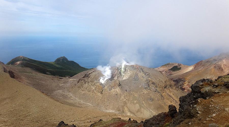
Volcano Berga (Last eruption: 2005).
This is an active volcano located on Urup Island, in the middle of the Great Range of the Kuril Islands. It is part of the Kolokola mountain group. The absolute height is 1040 m. The Berg eruptions in 1946, 1951, 1952, 1970, 1973 and 2005 are known and recorded in history. Currently, thermal and fumarolic activity is recorded on it. The flora and fauna of the volcano are quite scarce, alder bushes grow on its slopes, and cormorants and gulls nest.
Chikurachki (Last eruption: 2008).
A complex stratovolcano with a summit crater, formed 40 to 50 thousand years ago. It is located on the northern tip of the Karpinsky Ridge. The absolute height is 1816 m. One of the most active volcanoes of the Kuril Islands. Eruptions in 1853 and 1986 were the strongest (Plinian type). Between eruptions, the volcano is in a state of weak fumarolic activity.
Sarychev Volcano (Last eruption: 2009).
Stratovolcano of the somma-vesuvius type on the island of Matua of the Greater Kuril Ridge; one of the most active volcanoes of the Kuril Islands. The absolute height is 1446 m. The strongest volcanic activity occurred from 12 to 15 June 2009. It manifested itself in the gathering of pyroclastic flows, pyroclastic waves, and outflow of lava flows. Pyroclastic flows reached the sea and in some places its coast receded by 400 meters. These flows covered snowfields in the southeastern part of the volcano, which caused intense snowmelt and, as a result, lahars. As a result of this eruption, the area of the island increased by 1.5 sq. km, and the surface of the volcano sank by 40 mm and moved to the north by about 30 mm. For areas up to 30 sq. km vegetation has died.
Ebeko (Last eruption: 2010).
Complex stratovolcano with several summit craters. Located in the north of the island; in the northern part of the Vernadsky Ridge. The absolute height is 1156 m. One of the most active volcanoes of the Kuril Islands. During an eruption in September 1859, thick sulfuric fumes covered the neighboring island of Shumshu, causing nausea and headaches among the inhabitants.
Plosky Tolbachik (Last eruption: 2012).
Tolbachiksky is a volcanic massif in the east of Kamchatka, in the southwestern part of the Klyuchevskaya group of volcanoes. It includes Ostry Tolbachik (3682 m) and Plosky Tolbachik (3140 m), located on the pedestal of an ancient shield volcano. A new fissure eruption began on November 27, 2012 with the opening of a fissure about 5 km long, a few kilometers south of the caldera. The lava flow of the South Center flooded the IV&S FEB RAS station located at the foot of the volcano (the former base "Leningradskaya"), as well as the building of the base of the natural park "Volcanoes of Kamchatka".
Kizimen (Last eruption: 2013).
Located on the western slope of the southern tip of the Tumrok ridge, 115 km from the village of Milkovo, 265 km from the city of Petropavlovsk-Kamchatsky. The absolute height is 2376 m. During the eruption in 2009, some geysers became more active in the valley of geysers. Before the eruption, there was an extrusive lava plug in the crater. On May 3, 2009 at 9:00 am, Kizimen became more active and the lava plug literally split into small volcanic rocks, as a result of which the ash scattered over most of the Kronotsky Biosphere Reserve.
Nameless (Last eruption: 2013).
Volcano in Kamchatka, near Klyuchevskaya Sopka, about 40 km from the village of Klyuchi, Ust-Kamchatsky region. The absolute height of this volcano is 2882 m. The most famous Bezymyanny eruption occurred in 1955-1956. The height of the eruption cloud reached a height of about 35 km. As a result of the eruption, a horseshoe-shaped crater with a diameter of 1.3 km was formed, open to the east. At the eastern foot of the volcano on an area of 500 sq. km trees and shrubs were broken and knocked down in the direction from the volcano.
Klyuchevskaya Sopka (Last eruption: 2013).
Stratovolcano in the east of Kamchatka. It is the highest active volcano on the Eurasian continent. The age of the volcano is approximately 7000 years, and its height varies from 4750 to 4850 m and more above sea level. The last eruption began on August 15, 2013. On August 26, the first lava flow was recorded on the southwestern slope of the volcano, followed by four lava flows. On October 15-20, the culminating phase of the volcanic eruption was observed with the rise of the ash column up to 10-12 km. The ash plume stretches southwest of Klyuchevskoy volcano. Ashfall took place in the villages of Lazo and Atlasovo, the thickness of the fallen ash is about two millimeters.
Karymskaya Sopka (Last eruption: 2014).
The volcano is located in Kamchatka, within the Eastern Range. Refers to stratovolcanoes. The absolute height is 1468 m. A very active volcano, more than 20 eruptions have been recorded since 1852. Near Karymskaya Sopka, in the caldera of a nearby ancient volcano, there is Karymskoye Lake. With a powerful underwater explosion in 1996, almost all living things died in the lake.
Shiveluch (Last eruption: March 2015).
Volcano on the Kamchatka Peninsula within the Eastern Range. The northernmost active volcano in Kamchatka. The absolute height is 3307 m. On June 27, 2013, early in the morning, Shiveluch threw out a column of ash up to 10 km above sea level, in the village of Klyuchi located 47 km from the volcano, an ash fall took place, the streets of the village were powdered with a layer of red ash up to a millimeter thick. On October 18, following the Klyuchevskaya Sopka volcano, Shiveluch threw out a column of ash 7600 meters high. February 7, 2014 threw a column of ash over 11,000 meters high. On May 13, 2014, the volcano threw out three columns of ash to a height of 7 to 10 km.
10 largest and most dangerous volcanoes on Earth.
A volcano is a geological formation that arose due to the movement of tectonic plates, their collision and the formation of faults. As a result of collisions of tectonic plates, faults are formed, and magma comes to the surface of the Earth. As a rule, volcanoes are a mountain, at the tip of which there is a crater, which is the place where the lava comes out.
Volcanoes are divided into:
- operating;
- sleeping;
- extinct;
Active volcanoes are those that have erupted in the short term (approximately 12,000 years)
Dormant volcanoes are called volcanoes that have not erupted in the near historical perspective, but their eruption is practically possible.
Extinct volcanoes include those that have not erupted in the near historical future, however, the top has the shape of a crater, but such volcanoes are unlikely to erupt.
List of the 10 most dangerous volcanoes in the world:
1. (Hawaii, USA)
Located in the islands of Hawaii, it is one of the five volcanoes that make up the islands of Hawaii. It is the largest volcano in the world in terms of volume. It contains over 32 cubic kilometers of magma.
The volcano formed about 700,000 years ago.
The last volcanic eruption occurred in March 1984, and it lasted more than 24 days, causing great damage to people and the surrounding area.
2. Taal Volcano (Philippines)

The volcano is located on the island of Luzon, belonging to the Philippine Islands. The crater of the volcano rises 350 meters above the surface of Lake Taal and is located almost in the center of the lake.
The peculiarity of this volcano is that it is located in the crater of a very old extinct mega volcano, now this crater is filled with lake water.
In 1911, the most powerful eruption of this volcano occurred - then 1335 people died, within 10 minutes all life around the volcano died at a distance of 10 km.
The last eruption of this volcano was observed in 1965, which led to 200 human casualties.
3. Merapi Volcano (Java Island)
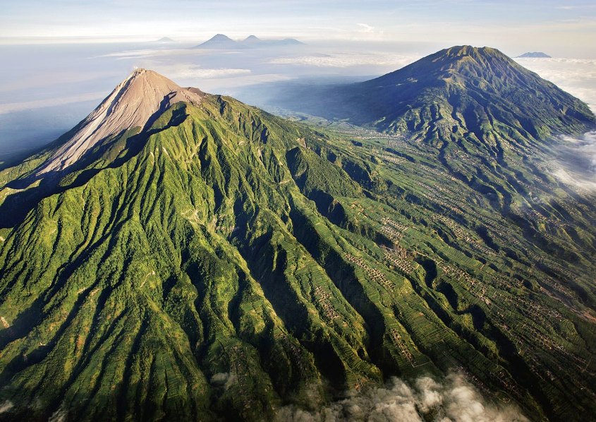
The name of the volcano in the literal sense is the Mountain of Fire. The volcano has been systematically erupting over the past 10,000 years. The volcano is located near the city of Yogyakarta, Indonesia, the population of the city is several thousand people.
It was the most active volcano among the 130 volcanoes in Indonesia. It was believed that the eruption of this volcano led to the decline of the Hindu Kingdom of Matarama. The peculiarity and horror of this volcano is the speed of magma propagation, which is more than 150 km / h. The last volcanic eruption occurred in 2006 and claimed 130 lives and made more than 300,000 people homeless.
4. Santa Maria Volcano (Guatemala)

It is one of the most active volcanoes of the 20th century.
It is located at a distance of 130 kilometers from the city of Guatemala, and is located in the so-called Pacific. Ring of Fire. The Santa Maria crater was formed after it erupted in 1902. About 6,000 people died then. The last eruption occurred in March 2011.
5. Volcano Ulawun (Papua New Guinea)

Ulawun volcano, located in the region of New Guinea, began to erupt from the beginning of the 18th century. Since then, eruptions have been recorded 22 times.
In 1980, the largest volcanic eruption occurred. The ejected ash covered an area of more than 20 square kilometers.
Now this volcano is the highest peak in the region.
The last volcanic eruption occurred in the year 2010.
6. Volcano Galeras (Colombia)

The Galeras volcano is located near the border of Ecuador in Colombia. One of the most active volcanoes in Colombia, it has been systematically erupting over the past 1000 years.
The first documented volcanic eruption occurred in 1580. This volcano is considered the most dangerous because of its sudden eruptions. Along the eastern slope of the volcano is the city of Paphos (Pasto). Paphos is a residence for 450,000 people.
In 1993, six seismologists and three tourists died during a volcanic eruption.
Since then, the volcano has erupted every year, claiming thousands of lives and making many people homeless. The last volcanic eruption occurred in January 2010.
7. Volcano Sakurajima (Japan)

Until 1914, this volcanic mountain was located on a separate island in the immediate vicinity of Kyushu. After a volcanic eruption in 1914, a lava flow connected the mountain to the Ozumi Peninsula (Japan). The volcano was named as Vesuvius of the East.
It serves as a threat to the 700,000 people of Kagoshima City.
Since the year 1955, eruptions have occurred every year.
The government even built a refugee camp for the people of Kagoshima so they could find shelter during the volcanic eruption.
The last volcanic eruption occurred on August 18, 2013.
8. Nyiragongo (DR Congo)

It is one of the most active, active volcanoes in the African region. The volcano is located in the Democratic Republic of the Congo. The volcano has been monitored since 1882. Since the beginning of observations, 34 eruptions have been recorded.
The crater in the mountain serves as a holder for the magma fluid. In 1977, there was a major eruption, neighboring villages were burned by hot lava flows. The average speed of the lava flow was 60 kilometers per hour. Hundreds of people died. The most recent eruption occurred in the year 2002, leaving 120,000 people homeless.

This volcano is a caldera - the formation of a pronounced rounded shape with a flat bottom.
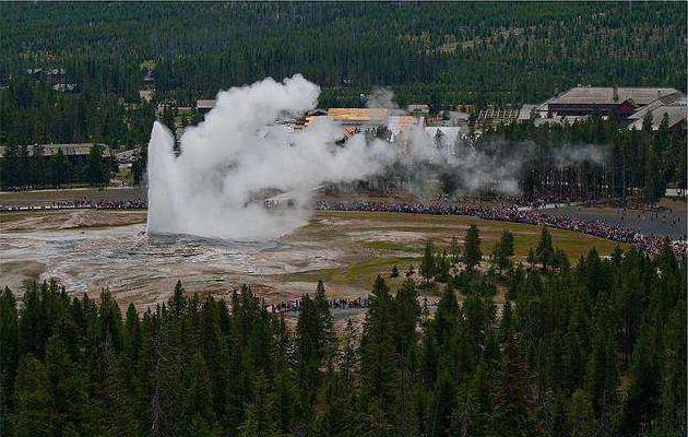
The volcano is located in the Yellow National Park of the United States.
This volcano has not erupted for 640,000 years.
The question arises: How can it be an active volcano?
There are claims that 640,000 years ago, this super volcano erupted.
This eruption changed the terrain and covered half of the US in ash.
According to various estimates, the volcanic eruption cycle is 700,000 - 600,000 years. Scientists expect this volcano to erupt at any time.
This volcano could destroy life on Earth.
Today, there are about 600 active volcanoes and up to 1000 extinct volcanoes on the Earth's surface. In addition, about 10,000 more hide under water. Most of them are located at the junctions of tectonic plates. About 100 volcanoes are concentrated around Indonesia, in the territory of the western American states there are about 10 of them, the accumulation of volcanoes is also noted in the area of Japan, the Kuril Islands and Kamchatka. But they are all nothing compared to the one megavolcano that scientists fear the most.
The most dangerous volcanoes
This or that danger is represented by any of the existing volcanoes, even sleeping. Not a single volcanologist or geomorphologist undertakes to determine which of them is the most dangerous, since it is impossible to accurately predict the time and strength of the eruption of any of them. The name "the most dangerous volcano in the world" is simultaneously claimed by the Roman Vesuvius and Etna, the Mexican Popocatepetl, the Japanese Sakurajima, the Colombian Galeras, located in the Congo Nyiragongo, in Guatemala - Santa Maria, in Hawaii - Manua Loa and others.
If the danger of a volcano is judged by the expected damage that it can cause, then it would be wise to turn to history describing the consequences of the most dangerous volcanic eruptions in the world in the past. For example, the well-known Vesuvius carried away in 79 AD. e. up to 10 thousand lives and wiped out two large cities from the face of the Earth. The eruption of Krakatoa in 1883, which was 200,000 times more powerful than the atomic bomb dropped on Hiroshima, echoed across the Earth and took the lives of 36,000 islanders.

The eruption in 1783 of a volcano called Laki led to the fact that a huge part of the livestock and food stocks was destroyed, due to which 20% of the population of Iceland died of starvation. The following year, because of Lucky, became a poor harvest for the whole of Europe. All this shows what large-scale consequences can turn out for people.
Destructive supervolcanoes
But did you know that all the biggest dangerous nothing compared to the so-called supervolcanoes, the eruption of each of which thousands of years ago brought truly catastrophic consequences for the entire Earth and changed the climate on the planet? The eruptions of such volcanoes could have a force of 8 points, and ash with a volume of at least 1000 m 3 was thrown to a height of at least 25 km. This led to prolonged sulfuric precipitation, the absence of sunlight for many months, and the covering of vast areas of the earth's surface with huge layers of ash.

Supervolcanoes are distinguished by the fact that at the site of the eruption they do not have a crater, but a caldera. This cirque-shaped hollow with a relatively flat bottom is formed as a result of the fact that after a series of strong explosions with the release of smoke, ash and magma, the upper part of the mountain collapses.
The most dangerous supervolcano
Scientists are aware of the existence of approximately 20 supervolcanoes. On the site of one of these awesome giants is today Lake Taupa in New Zealand, another supervolcano is hidden under the one located on the Long Valley in California, Wallis in New Mexico and Ira in Japan.
But the most dangerous volcano in the world is the Yellowstone supervolcano, located on the territory of the western American states, which is the most “ripe” for an eruption. It is he who makes volcanologists and geomorphologists in the United States, and indeed the whole world, live in a state of growing fear, forcing them to forget about all the most dangerous active volcanoes in the world.
Location and size of Yellowstone
The Yellowstone Caldera is located in the northwestern United States, in the state of Wyoming. She was first noticed by satellite in 1960. The caldera, which measures approximately 55*72 km, is part of the world famous Yellowstone National Park. A third of the almost 900,000 hectares of parkland is located on the territory of the volcano's caldera.
To this day, a giant magma bubble with a depth of about 8,000 m rests under the Yellowstone crater. The temperature of the magma inside it approaches 1000 0 C. Due to this, a lot of hot springs rage on the territory of the Yellowstone Park, clouds of steam and gas mixtures rise from cracks in the earth's crust.
Also there are many geysers and mud pots. The reason for this was a vertical stream of solid rock heated to a temperature of 1600 0 C 660 km wide. Under the territory of the park at a depth of 8-16 km there are two branches of this stream.
Yellowstone eruptions in the past
The first eruption of Yellowstone, which occurred, according to scientists, more than 2 million years ago, was the largest catastrophe on Earth in its entire history. Then, according to the assumption of volcanologists, about 2.5 thousand km 3 of rock were thrown into the atmosphere, and the upper mark reached by these emissions was 50 km above the earth's surface.
The largest and most dangerous volcano in the world began a second eruption more than 1.2 million years ago. Then the volume of emissions was approximately 10 times less. The third eruption occurred 640 thousand years ago. It was then that the walls of the crater collapsed and the caldera that exists today was formed.
Why You Should Be Afraid of the Yellowstone Caldera Today
In light of recent changes in the territory of Yellowstone National Park, it is becoming clearer to scientists which volcano is the most dangerous in the world. What is going on there? Scientists were alerted by the following changes, which were especially intensified in the 2000s:
- In the 6 years leading up to 2013, the ground covering the caldera has risen by as much as 2 meters, while in the previous 20 years the rise was only 10 cm.
- New hot geysers bubbled up from underground.
- The frequency and strength of earthquakes in the area of the Yellowstone caldera is increasing. In 2014 alone, scientists recorded about 2,000 of them.
- In some places, underground gases make their way through the layers of the earth to the surface.
- The water temperature in the rivers has risen by several degrees.
This frightening news alarmed the public, and especially the inhabitants of the North American continent. Many scientists agree that the supervolcano will erupt in this century.
Consequences of the eruption for America
No wonder many volcanologists believe that the Yellowstone Caldera is the most dangerous volcano in the world. They assume that its next eruption will be as powerful as the previous ones. Scientists equate it to the explosion of a thousand atomic bombs. This means that within a radius of 160 km around the epicenter, everything will be completely destroyed. The territory covered with ash, stretching for 1600 km around, will turn into a "dead zone".
The eruption of Yellowstone can lead to eruptions of other volcanoes and the formation of powerful tsunamis. There will be a state of emergency for the United States and martial law will be introduced. Information comes from various sources that America is preparing for a disaster: building shelters, making more than a million plastic coffins, drawing up an evacuation plan, drawing up agreements with countries on other continents. Recently, the United States prefers to remain silent about the true state of affairs on the Yellowstone caldera.

Yellowstone Caldera and the End of the World
The eruption of the caldera, located under the Yellowstone Park, will bring trouble not only to America. The picture that can unfold in this case looks sad for the whole world. Scientists have calculated that if the release to a height of 50 km lasts only two days, then the “cloud of death” during this time will cover an area twice as large as the entire American continent.
In a week, emissions will reach India and Australia. The sun's rays will drown in thick volcanic smoke and a long one and a half year (at least) winter will come to Earth. The average air temperature on Earth will drop to -25 0 C, and in some places it will reach -50 o. People will die under debris falling from the sky from red-hot lava, from cold, hunger, thirst and inability to breathe. According to assumptions, only one person in a thousand will survive.

The eruption of the Yellowstone caldera can, if not completely destroy life on earth, then radically change the conditions for the existence of all life. No one can say for sure whether this most dangerous volcano in the world will begin its eruption in our lifetime, but the existing fears are really justified.
Volcanoes have always been dangerous. Some of them are located on the seabed and when lava erupts, they do not cause much damage to the surrounding world. Much more dangerous are such geological formations on land, near which large settlements and cities are located. We offer for review a list of the deadliest volcanic eruptions.
79 AD. Volcano Vesuvius. 16,000 dead.
During the eruption, a deadly column of ash, dirt and smoke rose from the volcano to a height of 20 kilometers. Erupted ashes flew even to Egypt and Syria. Every second, millions of tons of molten rock and pumice came out of the vent of Vesuvius. A day after the start of the eruption, streams of hot mud mixed with stones and ash began to descend. Pyroclastic flows completely buried the cities of Pompeii, Herculaneum, Oplontis and Stabiae. In places, the thickness of the avalanche exceeded 8 meters. The death toll is estimated at at least 16,000.
Painting "The Last Day of Pompeii". Karl Bryulov
The eruption was preceded by a series of tremors of magnitude 5, but no one responded to natural warnings, since earthquakes are a frequent occurrence in this place.
Last eruption Vesuvius It was recorded in 1944, after which it calmed down. Scientists suggest that the longer the "hibernation" of the volcano lasts, the stronger its next eruption will be.
1792. Volcano Unzen. About 15,000 dead.
The volcano is located on the Japanese peninsula Shimabara. Activity Unzen recorded since 1663, but the strongest eruption was in 1792. After the volcanic eruption, a series of tremors followed, which caused a powerful tsunami. A deadly 23-meter wave hit the coastal zone of the Japanese Islands. The number of victims exceeded 15,000 people.
In 1991, at the foot of Unzen, 43 journalists and scientists died under the lava when it rolled down the slope.
1815. Volcano Tambora. 71,000 casualties.
This eruption is considered the most powerful in the history of mankind. April 5, 1815 began the geological activity of the volcano, located on the Indonesian island Sumbawa. The total volume of erupted material is estimated at 160-180 cubic kilometers. A powerful avalanche of hot rocks, mud and ash rushed to the sea, covering the island and sweeping away everything in its path - trees, houses, people and animals.

All that remains of the Tambora volcano is a huge caledera.
The roar of the explosion was so strong that it was heard on the island of Sumatra, which was located 2000 kilometers from the epicenter, the ash flew to the islands of Java, Kilimantan, Molucca.

The eruption of the Tambora volcano in the representation of the artist. Unfortunately the author could not be found.
The release of huge amounts of sulfur dioxide into the atmosphere has caused global climate change, including such a phenomenon as "volcanic winter". The next year, 1816, also known as the "year without summer", turned out to be abnormally cold, unusually low temperatures were established in North America and Europe, a catastrophic crop failure led to great famine and epidemics.
1883 Krakatoa volcano. 36,000 deaths.
The volcano woke up on May 20, 1883, it began to release huge clouds of steam, ash and smoke. This continued almost until the end of the eruption, on August 27, 4 powerful explosions thundered, which completely destroyed the island where the volcano was located. Fragments of the volcano scattered over a distance of 500 km, the gas-ash column rose to a height of more than 70 km. The explosions were so powerful that they could be heard at a distance of 4800 kilometers on the island of Rodrigues. The blast wave was so powerful that it went around the Earth 7 times, they were felt after five days. In addition, she raised a tsunami 30 meters high, which led to the death of about 36,000 people on nearby islands (some sources indicate 120,000 victims), 295 cities and villages were washed into the sea by a powerful wave. The air wave tore off the roofs and walls of houses, uprooted trees within a radius of 150 kilometers.

Lithograph of Krakatau volcano eruption, 1888
The eruption of Krakatoa, like Tambor, affected the climate of the planet. The global temperature during the year fell by 1.2 degrees Celsius and recovered only by 1888.

The force of the blast wave was enough to lift such a large piece of coral reef from the bottom of the sea and throw it several kilometers away.
1902 Mont Pele volcano. 30,000 people died.
The volcano is located in the north of the island of Martinique (Lesser Antilles). He woke up in April 1902. A month later, the eruption itself began, suddenly a mixture of smoke and ash began to escape from the crevices at the foot of the mountain, lava went in a red-hot wave. The city was destroyed by an avalanche Saint Pierre, which was located 8 kilometers from the volcano. Of the entire city, only two people survived - a prisoner who was sitting in an underground solitary cell, and a shoemaker who lived on the outskirts of the city, the rest of the city's population, more than 30,000 people, died.

Left: Photograph of ash plumes erupting from the Mont Pele volcano. Right: a surviving prisoner, and the completely destroyed city of Saint-Pierre.
1985, Nevado del Ruiz volcano. More than 23,000 victims.
Located Nevado del Ruiz in the Andes, Colombia. In 1984, seismic activity was recorded in these places, clubs of sulfur gases were emitted from the top and there were several minor ash emissions. On November 13, 1985, the volcano exploded, releasing a column of ash and smoke over 30 kilometers high. Erupted hot streams melted the glaciers at the top of the mountain, thus forming four lahars. Lahars, consisting of water, pieces of pumice, fragments of rocks, ash and dirt, swept away everything in their path at a speed of 60 km / h. Town Armero was completely washed away by the stream, out of 29,000 residents of the city, only 5,000 survived. The second lahar hit the city of Chinchina, killing 1,800 people.

The descent of the lahar from the summit of Nevado del Ruiz

The consequences of the lahara - the city of Armero, demolished to the ground.