Geography of Africa. Etymology of names of physical and geographical objects in africa gulf of aden
Africa is the second largest continent, located in all four hemispheres. The area of Africa is 30 million km2.
Extreme points of Africa:
- northern: Cape Ras Engela (38 ° N, 10 ° E);
- southern: Cape Agulhas (35 ° S, 20 ° E);
- western: Cape Almadi 1 (5 ° N, 17 ° W);
- eastern: Cape Ras Khafun (11 ° N, 51 ° E).
From the west, Africa is washed by the waters of the Atlantic Ocean, from the east - by the Indian, from the north - by the waters of the Mediterranean Sea, from the northeast - by the Red Sea. Previously, it was connected by an isthmus with a width of 120 km, now the Suez Canal passes through it. It is separated from the mainland by the Strait of Gibraltar.
The African coast is relatively weakly indented, there is a large Gulf of Guinea in the west and Aden in the east, a large peninsula - peninsula. A number of islands are located in: Madeira, Canary Islands, Cape Verde, etc. There is a large island in the east of the mainland - besides it, there are clusters of small islands - the Comoros, etc.
The specificity of the relief of Africa lies in the large number of plains and plateaus. Most of the north of the mainland is occupied by the Sahara Desert with the Ahaggar and Tibesti highlands. There are two notable mountain ranges: the Atlas Mountains in the north and the Cape Mountains in the south. In the east of Africa there is a large East African plateau. This structure of the relief is explained by the fact that most of the mainland is located on a single ancient African-Arabian platform, which in ancient times separated from the common continent - Gondwana. The northern and southern ridges are formed in the collision zone of this platform with other large plates.
Lakes in Africa are quite large, formed in rock faults and therefore are very narrow, long and deep: Tanganyika (maximum depth - 1400 m), Nyasa (700 m). The lake, on the other hand, is shallow, it feeds mainly on precipitation, and its area is greatly reduced during dry periods.
Since most of the mainland is located in the tropical, subequatorial and equatorial zones, it is warm here. Summer and winter mean monthly temperatures differ insignificantly, the seasons differ in the amount of precipitation: the rainy season is in summer, while drought sets in in winter. There are tropical forests - the basin, the east coast of Africa, where falls up to 3000 mm. precipitation. There are arid areas - savannas, deserts.
Natural zones of Africa are expressed quite clearly and are located accordingly. At the equator and in the basin of the Congo River, a zone of humid equatorial forests has formed. There is a huge variety of trees and shrubs, well-expressed tiering. Red ferralite soils are forming. Monkeys, small ungulates, and many birds live in the forests.
Equatorial forests almost immediately turn into savannas - a special kind of steppes with lonely trees found. This natural area in Africa occupies a vast area. There are many herbs, acacia trees and baobabs are found among the trees. The soils are red-brown. There are many large hoofed animals (giraffes, buffaloes, antelopes, zebras, rhinos), there are also predators (lions, cheetahs, hyenas).
An equally large natural zone is tropical deserts, represented by two large deserts: Namib in the south and Sahara in the north. The Sahara Desert is a huge desert located in the northern part of the mainland. The dry trade winds prevailing here raise sand particles, so sand storms are not uncommon for the desert, literally paralyzing all living things. even in the shade it rises to + 50 ° С, the sand heats up to + 70 ° С. At night, the temperature drops sharply, it can drop to 0 ° C. In this regard, survival in the desert is very difficult, people live exclusively in oases that arise due to the proximity of groundwater. Most of the animals are nocturnal, hiding in burrows during the day.
The zone of subtropical rigid-leaved evergreen forests stretches in two narrow strips on the northern and southern coast of the mainland. Beech trees, oaks, citrus fruits, many conifers and shrubs grow here. The animals are mostly small: foxes, small deer, wild boars.
In the XIX-XX centuries, Europeans actively destroyed the unique nature of Africa, cutting down valuable forests, exterminating animals. Many species became extinct themselves due to the destruction of their natural habitat. This led to the fact that the territories occupied by forests are sharply reduced, but the territories of deserts, on the contrary, are increasing. To preserve and increase populations of wild animals, many of them have become world famous - Kruger, Serengeti.
Architectural structures of incredible beauty, mysterious ancient necropolises, vast reserves with many rare animals and plants, squares of historical cities and sights, the history of which still raises many questions. Where can you see all these unique objects? In Africa! On a continent that most tourists associate exclusively with the Sahara Desert and the sweltering heat. Literally every African country has amazing sights that deserve the attention of curious tourists. The continent is rich in incredibly beautiful natural reserves, many ancient cities have survived, and the pyramids of Giza are considered one of the most recognizable landmarks in the world. Anyone looking for an unforgettable African adventure should definitely visit the unique World Heritage Sites.
In the southeast of Algeria, among the lifeless landscapes of the Sahara, there is the unique Tassilin-Ajer plateau. The main value of this place is the petroglyphs, some of which date back to the 7th millennium BC. At present, the plateau, which is about 500 meters long, is part of the large national reserve Tassilin-Ajer, the total area of which is more than 70,000 square meters. meters. In addition to incredible archaeological sites, the plateau is also remarkable for its original geological formations.
For thousands of years, under the influence of the wind, incredibly beautiful and harmonious stone arches were formed from sandstone, and geologists also managed to establish that once upon a time turbulent rivers flowed through these places. Visitors to the attraction will have the opportunity to see more than 300 unique geological formations, look into hidden caves, and stroll through some of the world's most valuable archaeological areas.
In 1909, vivid rock paintings were discovered on the plateau, which depicted people, animals, and various scenes from life. They are another great confirmation that the once desert area was full of life. Here rivers flowed, along the banks of which there were fertile soils, herds of domestic animals grazed on spacious meadows. In total, more than 15,000 rock paintings were discovered on the territory of the plateau, some of them are about 8 thousand years old, and the latest drawings were applied in the first centuries of our era. The Tassilin-Ajer Plateau is one of the world's largest accumulations of rock art, which makes it a landmark of world importance.
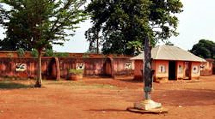
 In the Benin city of Abomey, there is a unique historical complex - beautiful royal palaces, which are a reminder of the times of the reign of the Dahomey kings. In total, there are 12 palaces in the complex, with an interesting cultural tradition associated with the history of their construction. With each change of ruler, it was decided to build a new one next to the old palace, a large-scale complex was included in the UNESCO World Heritage List in 1985.
 Travelers who love to explore unusual sights should head to The Gambia. Here, in the Senegambia region, there are mysterious circles of megaliths, the purpose and history of the appearance of which scientists from all over the world have been arguing for hundreds of years. Scientists managed to find out that the mysterious rings were built in the period from the 8th to the 12th century, with a more thorough study of the area, they discovered burials of earlier periods.
 Ghana has an amazing object that will surely appeal to fans of unusual architectural attractions. These are the traditional buildings of the Ashanti people located in the Asante area. The complex of 13 buildings is incredibly beautiful, it is the only reminder of the once powerful and prosperous state of Ashanti. The heyday of the state fell on the 18th century, and from the beginning of the 19th century, a delight of destructive wars fell upon it.
 The Theban necropolis is one of the most important sights of Egypt, here travelers can see the unique burials of the pharaohs, surviving memorial temples and other historical buildings, one way or another connected with the culture of the ancient Egyptian city of Thebes. Among the memorial temples, the most interesting temple of Queen Hatshupsut, located in the Deir el-Bahri region, is also interesting to visit the memorial temple of Ramses III.
 Travelers who find the Theban necropolises not enough should visit the ancient Egyptian city of Memphis and get acquainted with its unique sights. The history of this once mighty city lasted more than 3,000 years and ended in the 5th century AD, today Memphis is a unique open-air museum. Not a single building has survived on the territory of the ancient city, for many years its entire territory has been in constant development of archaeologists.
 In the center of the Sinai Peninsula, there is a unique religious landmark - the Monastery of St. Catherine. This monastery was founded in the 4th century and has been operating continuously for over one and a half thousand years, it is one of the oldest in the world. The monastery was built by order of the Emperor Justian, it was originally called the Monastery of the Transfiguration, and acquired its current name only in the 11th century. For many hundreds of years, the monastery has remained a traditional place of Christian pilgrimage, the main artifact hidden within its walls is the relics of St. Catherine.
 Perhaps the most unusual nature reserve in Africa is the Sangha Forest. It is so vast that it is located on the territory of three states at once - Cameroon, the Central African Republic and the Congo. For this reason, Sanga Wildlife Sanctuary is often referred to as the Forest of the Three Nations. A significant part of the reserve is covered with evergreen rain forests, which are a place for not only tourist excursions, but also important scientific research.
 Kenya is home to one of the world's most important natural attractions - Lake Turkana, which is also known by another name - Lake Rudolph. This lake is located in the Great Reef Valley, its depth is relatively shallow and averages about 30 meters. At the same time, the scale of the lake is quite impressive, its length is about 290 km, and its width is about 32 km, the total area of the reservoir is 6 405 square meters. meters.
 In the Congo, nature lovers can visit the Okapi reserve, it is located in the northeastern part of the state, the area of the reserve is about 13.7 thousand square meters. km. The main value of the national reserve is the rare animals living on its territory, some of which are on the verge of extinction. There are 13 species of monkeys alone on the territory of the reserve, forest elephants are also found in the park, and the main inhabitants of the park are okapi. Use the atlas map and travel around the globe. start from the western coast of South America, head east
 strictly along the parallel of 20 degrees S. Determine what geographic objects you met along the way
Help please, otherwise I forgot the card at school (I am an evil teacher (Use the atlas map and travel around the globe. start from the western shores of South America, follow straight east along the parallel of 20 degrees S. Determine what geographic objects you met along the way
The mountains
Lowlands
Plateau
Ocean
Mainland
Island
Ocean
Mainland
Desert
The mountains
Sea
Ocean
Islands
I have always been attracted by the Arctic, - said the first geographer.
- And I study the mountains, it's a pity that there is not a single active volcano on my continent, - said the second.
“I also study mountains, only“ eight-thousanders ”,” said the third scientist.
“Come to me at the cold pole,” exclaimed the fourth.
- Better to me, on the shores of the Pacific Ocean, - added the fifth.
The sixth geographer was silent, but from the statements of the first five one can precisely
determine where who works. And the sixth scientist is working on the remaining mainland.
Determine which continent each geographer is exploring. Each of them studies the nature of one continent. Write in detail your reasoning. What mountains does he study
second geographer, and what third geographer?
An employee of a well-known travel company was entrusted with a responsible task - to compile a list of world and continental record holders, indicating their nationality. He immediately turned to the Internet for help, but a large amount of conflicting information did not allow him to complete the task correctly. Help the performer of this task: according to the characteristics provided, determine the geographical record holders and indicate the countries in which they are located. Fill out the answer in the form of a table.
Geographic record characteristics:
1. The highest alpine navigable lake in the world.
2. The largest river island on the Earth.
No.
Geographical object name
Nationality
The longest mountains on earth.
4. The largest island in the world by area.
5. The river that flows through the largest number of countries in the world.
6. The largest highlands of the Earth.
7. The driest desert in the world.
8. The lowest absolute mark of the earth's land.
9. The longest river in Eurasia.
10. The largest peninsula in Africa.
11. The largest peninsula in Australia.
12. Highest peak in Antarctica.
Africa is a part of the world with an area with islands of 30.3 million km 2, this is the second place after Eurasia, 6% of the entire surface of our planet and 20% of the land.
Geographical position
Africa is located in the Northern and Eastern Hemisphere (most of it), a small part in the Southern and Western. Like all large fragments of the ancient mainland of Gondwana, it has massive outlines, large peninsulas and deep bays are absent. The length of the continent from north to south is 8 thousand km, from west to east - 7.5 thousand km. In the north it is washed by the waters of the Mediterranean Sea, in the northeast by the Red Sea, in the southeast by the Indian Ocean, in the west by the Atlantic Ocean. Africa is separated from Asia by the Suez Canal, and from Europe by the Strait of Gibraltar.

Main geographic characteristics
Africa lies on an ancient platform, which determines its flat surface, which in some places is cut by deep river valleys. On the coast of the mainland there are few lowlands, the northwest is the location of the Atlas Mountains, the northern part, almost entirely occupied by the Sahara Desert, is the Ahaggar and Tibetsi highlands, the east is the Ethiopian Highlands, the southeast is the East African Plateau, the extreme south is the Cape and Draconic mountains. The highest point in Africa is Kilimanjaro Volcano (5895 m, Masai Plateau), the lowest is 157 meters below sea level in Lake Assal. Along the Red Sea, in the Ethiopian Highlands and to the mouth of the Zambezi River, there is the world's largest fault in the earth's crust, which is characterized by frequent seismic activity.

Rivers flow through Africa: Congo (Central Africa), Niger (West Africa), Limpopo, Orange, Zambezi (South Africa), as well as one of the deepest and longest rivers in the world - the Nile (6852 km), flowing from the south to north (its origins are on the East African Plateau, and it flows into the Mediterranean Sea, forming a delta). The rivers are rich in water exclusively in the equatorial belt, due to the large amount of precipitation there, most of them are distinguished by high flow rates, have many rapids and waterfalls. In lithospheric faults filled with water, lakes formed - Nyasa, Tanganyika, the largest freshwater lake in Africa and the second largest lake after Lake Superior (North America) - Victoria (its area is 68.8 thousand km 2, length 337 km, max depth - 83 m), the largest saline drainless lake - Chad (its area is 1.35 thousand km 2, located on the southern edge of the greatest desert in the world of the Sahara).

Due to the location of Africa between two tropical belts, it is characterized by high total indicators of solar radiation, which gives the right to call Africa the hottest continent of the Earth (the highest temperature on our planet was recorded in 1922 in El-Azizia (Libya) - + 58 С 0 in the shadow).

On the territory of Africa, such natural zones are distinguished as evergreen equatorial forests (the coast of the Gulf of Guinea, the Congo depression), in the north and south turning into mixed deciduous-evergreen forests, then there is a natural zone of savannas and light forests, extending to Sudan, East and South Africa, to Sevres and southern Africa, savannas are replaced by semi-deserts and deserts (Sahara, Kalahari. Namib). In the southeastern part of Africa there is a small zone of mixed coniferous-deciduous forests, on the slopes of the Atlas Mountains - a zone of rigid-leaved evergreen forests and shrubs. Natural zones of mountains and plateaus are subject to the laws of altitudinal zonation.
African countries

The territory of Africa is divided between 62 countries, 54 are independent, sovereign states, 10 dependent territories belonging to Spain, Portugal, Great Britain and France, the rest are unrecognized, self-proclaimed states - Galmudug, Puntland, Somaliland, the Sahara Arab Democratic Republic (SADR). For a long time, the countries of Asia were foreign colonies of various European states and gained independence only by the middle of the last century. Africa is divided into five regions depending on its geographical location: North, Central, West, East and South Africa.
List of countries in Africa
Nature
 Mountains and plains of Africa
Most of the African continent is plain. There are mountain systems, highlands and plateaus. They are presented:
- The Atlas Mountains in the northwestern part of the continent;
- the highlands of Tibesti and Ahaggar in the Sahara desert;
- The Ethiopian Highlands in the eastern part of the mainland;
- Drakensberg mountains in the south.
The highest point in the country is Kilimanjaro Volcano, 5,895 m high, belonging to the East African Plateau in the southeastern part of the mainland ...
 Deserts and savannas
The largest desert zone of the African continent is located in the northern part. This is the Sahara Desert. On the southwestern side of the continent is another smaller desert, the Namib, and from it inland to the east is the Kalahari Desert.
The savannah territory occupies the main part of Central Africa. In area, it is much larger than the northern and southern parts of the mainland. The territory is characterized by the presence of pastures typical of savannahs, low shrubs and trees. The height of herbaceous vegetation varies depending on the amount of precipitation. These can be practically desert savannas or tall-grass, with a grass cover from 1 to 5 m in height ...
 Rivers
The longest river in the world, the Nile, is located on the territory of the African continent. The direction of its flow is from south to north.
In the list of large water systems of the mainland, Limpopo, Zambezi and the Orange River, as well as the Congo, flowing through the territory of Central Africa.
On the Zambezi River, there is the famous Victoria Falls, 120 meters high and 1,800 meters wide ...
 Lakes
Lakes
The list of large lakes on the African continent includes Lake Victoria, which is the world's second largest freshwater body of water. Its depth reaches 80 m, and its area is 68,000 square kilometers. There are two more large lakes of the continent: Tanganyika and Nyasa. They are located in the fractures of lithospheric plates.
There is Lake Chad on the territory of Africa, which is one of the world's largest closed relict lakes that have no connection with the world's oceans ...
 Seas and oceans
The African continent is washed by the waters of two oceans at once: the Indian and the Atlantic. Also on its shores are the Red and Mediterranean Seas. On the side of the Atlantic Ocean in the southwestern part of the water they form the deep Gulf of Guinea.
Despite the location of the African continent, coastal waters are cool. This is influenced by the cold currents of the Atlantic Ocean: the Canary in the north and the Bengal in the southwest. The currents from the Indian Ocean are warm. The largest are Mozambican, in the northern waters, and Igolnoye, in the southern ...
 Forests of africa
Forests from the entire territory of the African continent make up a little more than a quarter. There are subtropical forests growing on the slopes of the Atlas Mountains and the valleys of the ridge. Here you can find a stone oak, pistachio, strawberry tree, etc. High in the mountains, conifers grow, represented by Aleppo pine, Atlas cedar, juniper and other types of trees.
Closer to the coast there are forests of cork oak, in the tropical region there are evergreen equatorial plants, for example, mahogany, sandalwood, ebony, etc.
 Nature, plants and animals of Africa
The vegetation of the equatorial forests is diverse, about 1000 species of various types of trees grow here: ficus, ceiba, wine tree, oil palm, wine palm, banana palm, tree ferns, sandalwood, mahogany, rubber trees, Liberian coffee tree, etc. ... It is home to many species of animals, rodents, birds and insects that live right in the trees. Live on earth: bristle-eared pigs, leopards, African deer - a relative of the okapi giraffe, large apes - gorillas ...
40% of Africa's territory is occupied by savannas, which are huge steppe areas covered with forbs, low, thorny shrubs, milkweed, and free standing trees (treelike acacias, baobabs).

Here there is the largest concentration of such large animals as: rhino, giraffe, elephant, hippo, zebra, buffalo, hyena, lion, leopard, cheetah, jackal, crocodile, hyena dog. The most numerous animals of the savannah are such herbivores as: bubal (antelope family), giraffe, impala or black-footed antelope, various types of gazelles (Thomson, Grant), blue wildebeest, in some places there are still rare springbok antelopes.

The vegetation of deserts and semi-deserts is characterized by poverty and unpretentiousness, these are small thorny shrubs, separately growing bunches of grasses. The oases are home to the unique Erg Chebbi date palm, as well as drought and salt tolerant plants. The Namib Desert is home to unique velvichia and nara plants, which feed on porcupines, elephants and other desert animals.

Of the animals, various species of antelopes and gazelles live here, adapted to the hot climate and able to travel great distances in search of food, many species of rodents, snakes, turtles. Lizards. Among mammals: spotted hyena, common jackal, maned ram, Cape hare, Ethiopian hedgehog, Dorcas gazelle, saber-horned antelope, Anubis baboon, wild Nubian donkey, cheetah, jackal, fox, mouflon, there are constantly living and migratory birds.
Climatic conditions
 Seasons, weather and climate of African countries
The central part of Africa, through which the equator line passes, is in an area of low pressure and receives sufficient moisture, the territories to the north and south of the equator are in the subequatorial climatic zone, this is a zone of seasonal (monsoon) moisture and arid desert climate. The extreme north and south are in the subtropical climatic zone, the south receives precipitation brought by air masses from the Indian Ocean, the Kalahari Desert is located here, the north is the minimum amount of precipitation due to the formation of a high pressure area and the peculiarities of the trade wind movement, the largest desert in the world is the Sahara, where the amount precipitation is minimal, in some areas it does not fall at all ...
Resources
 Natural resources of Africa
In terms of water resources, Africa is considered one of the poorest continents in the world. The average annual volume of water is only enough to meet the primary needs, but this does not apply to all regions.
Land resources are represented by areas of significant area with fertile lands. Only 20% of all possible land is cultivated. The reason for this is the lack of adequate water volume, soil erosion, etc.
The forests of Africa are a source of timber, including valuable species. The countries in which they grow, the raw materials are sent for export. Resources are being used unwisely and ecosystems are gradually being destroyed.
There are mineral deposits in the bowels of Africa. Among those exported: gold, diamonds, uranium, phosphorus, manganese ores. There are significant reserves of oil and natural gas.
Energy-intensive resources are widely represented on the continent, but they are not used due to the lack of proper investment ...

Among the developed industrial spheres of the countries of the African continent, one can note:
- the mining industry, which sends minerals and fuels for export;
- the oil refining industry, distributed mainly in South Africa and North Africa;
- the chemical industry specializing in the production of mineral fertilizers;
- as well as the metallurgical and engineering industries.
The main agricultural products are cocoa beans, coffee, corn, rice and wheat. In the tropical regions of Africa, the oil palm is grown.
Fishing is developed insignificantly and constitutes only 1 - 2% of the total volume of agriculture. Livestock indicators are also not high and the reason for this is the infection of livestock with tsetse flies ...
Culture
 The peoples of Africa: culture and traditions
The 62 African countries are home to some 8,000 peoples and ethnic groups, for a total of about 1.1 billion people. Africa is considered the cradle and ancestral home of human civilization, it was here that the remains of ancient primates (hominids) were found, which, according to scientists, are considered the ancestors of humans.
Most of the peoples in Africa can number as many as several thousand people, and several hundred, living in one or two villages. 90% of the population are representatives of 120 peoples, their number is more than 1 million people, 2/3 of them are peoples with a population of more than 5 million people, 1/3 are peoples with a population of more than 10 million people (this is 50% of the total population of Africa) are Arabs , Hausa, Fulbe, Yoruba, Igbo, Amhara, Oromo, Rwanda, Malagasy, Zulus ...
There are two historical and ethnographic provinces: North African (predominance of the Indo-European race) and Tropical-African (the majority of the population is a Negroid race), it is divided into such areas as:
- West Africa... Peoples speaking the languages Mande (Susu, Maninka, Mende, Vai), Chad (Hausa), Nilo-Saharan (Songhai, Kanuri, Tubu, Zagawa, Mawa, etc.), Niger-Congolese languages (Yoruba, Igbo, Bini, nupe, gbari, igala and idoma, ibibio, efik, kambari, birom and jukun, etc.);
- Equatorial Africa... Inhabited by Buanto-speaking peoples: Douala, Fang, Bubi (Fernandians), Mpongwe, Teke, Mboshi, Ngala, Como, Mongo, Tetela, Cuba, Congo, Ambundu, Ovimbundu, Chokwe, Luena, Tonga, Pygmies, etc .;
- South Africa... Rebellious peoples, and speaking the Khoisan languages: Bushmen and Hottentots;
- East Africa... Bantu, Nilot and Sudanese groups;
- Northeast africa... Peoples speaking Ethiosemitic (Amhara, Tiger, Tiger.), Kushite (Oromo, Somalis, Sidamo, Agau, Afar, Konso, etc.) and Omotic languages (Ometo, Gimirra, etc.);
- Madagascar... Malagasy and Creoles.
In the North African province, the main peoples are the Arabs and Berbers, belonging to the southern European minor race, mainly professing Sunni Islam. There is also an ethno-religious group of Copts who are direct descendants of the Ancient Egyptians, they are Christians-Monophysites.
S. I. RUNKOV
NATURAL EARTH OBJECTS. AFRICA:
GEOGRAPHIC NOMENCLATURE AND METHODS
Saransk 2010
AFRICA
CAPES
NEEDLE
https://pandia.ru/text/78/225/images/image003_1.jpg "align =" left "width =" 125 "height =" 120 src = "> S lat., 19 ° 59" E. etc.). It is located on the territory of the Republic of South Africa, 155 km southeast of the Cape of Good Hope.
RAS-HAFUN
 Khafun, a cape on the Somali Peninsula, the easternmost point of the African continent (10 ° 26 "N and 51 ° 23" E).
https://pandia.ru/text/78/225/images/image014.gif "width =" 19 "height =" 40 ">. gif" alt = "(! LANG: Signature:" align="left" width="316" height="130 src=">.jpg" align="left" width="94" height="64"> Эль-Абьяд, мыс на побережье Средиземного моря, в 13 км к северо-западу от г. Бизерта (Тунис). Самая северная точка Африки (37° 21° с. ш. и 9° 45° в. д.).!}
BAYS AND BAYS
 CIDRA (LARGE SIRT)
https://pandia.ru/text/78/225/images/image021_0.jpg "align =" left "width =" 106 "height =" 83 src = "> Sidra (source of Great Sirte) is a large bay of the Mediterranean Sea off the coast of Libya, up to 1374m deep, up to 465km wide (at the entrance to the bay).
GABES
https://pandia.ru/text/78/225/images/image023.jpg "align =" left "width =" 136 "height =" 112 src = "> ![]() Gabes is a gulf of the Mediterranean Sea off the northern coast of Africa, in ancient times it was called Small Sirte. Washes the territory of Tunisia. It stretches over 100 km and has a depth of about 50 m. Djerba Island is located in the southern part of the entrance to the bay, and Kerkenna Island in the northern part.
Gabes is a gulf of the Mediterranean Sea off the northern coast of Africa, in ancient times it was called Small Sirte. Washes the territory of Tunisia. It stretches over 100 km and has a depth of about 50 m. Djerba Island is located in the southern part of the entrance to the bay, and Kerkenna Island in the northern part.
TUNISIAN
https://pandia.ru/text/78/225/images/image029.jpg "align =" left "width =" 232 "height =" 96 src = "> The Gulf of Tunis is a large gulf of the Mediterranean Sea off the northern coast of Africa, it washes the territory of Tunisia On the southern coast of the gulf, where the capital of Carthage was formerly located, the city of Tunisia is now located.
GUINEAN
https://pandia.ru/text/78/225/images/image031_0.jpg "align =" left "width =" 126 "height =" 86 src = ">
Gulf of Guinea is a gulf of the Atlantic Ocean off the coast of Equatorial Africa. It juts out into land between Capes Palmas in the northwest (Liberia) and Palmeirinhas (Angola) in the southeast. The constituent parts of the Gulf of Guinea are the bays of Benin (in the north) and Biafra (in the east).![]() BENIN
BENIN
https://pandia.ru/text/78/225/images/image034.jpg "align =" left "width =" 131 "height =" 102 src = "> Benin is a bay in the Atlantic Ocean on the southern coast of West Africa, an integral part of the Gulf of Guinea, stretching 640 km east from Cape St. Paul (Ghana) to the mouth of the Niger River, the waters of the Benin Gulf wash the coasts of Ghana, Togo, Benin, and Nigeria.
BIAFRA
https://pandia.ru/text/78/225/images/image037_1.jpg "align =" left "width =" 104 "height =" 81 src = "> Biafra is a bay in the Atlantic Ocean, part of the Gulf of Guinea. Water The gulfs are washed by the coasts of Nigeria, Cameroon, Equatorial Giveni and Gabon.
ADENSKY
https://pandia.ru/text/78/225/images/image039.jpg "align =" left "width =" 298 "height =" 169 src = ">
The Gulf of Aden is part of the Arabian Sea of the Indian Ocean. Length 890km. The northern coast of the gulf is the Arabian Peninsula (state of Yemen). The southern and western shores of the Gulf make up the African continent (states of Somalia and Djibouti). In the west, the Tajura Bay is distinguished, in the southeast, the bay is separated from the rest of the Indian Ocean by the Socotra Islands (Yemen). The bay is connected to the Red Sea by the Bab el-Mandeb Strait.
STRAITS
GIBRALTAR
https://pandia.ru/text/78/225/images/image042.jpg "align =" left "width =" 148 "height =" 102 src = "> The Strait of Gibraltar is an international strait between the southern tip of the Iberian Peninsula and the north - the western coast of Africa, connecting the Mediterranean Sea with the Atlantic Ocean, 65 km long, 14-44 km wide.
BAB EL MANDEB
https://pandia.ru/text/78/225/images/image045.gif "align =" left "width =" 186 "height =" 165 src = "> Bab al-Mandeb Strait - the strait between the south-west the tip of the Arabian Peninsula (the state of Yemen) and Africa (the states of Djibouti and Eritrea). Connects the Red Sea with the Gulf of Aden of the Arabian Sea. The smallest width is 26.5 km, the smallest depth in the fairway is 182 m.
 MOZAMBICAN
https://pandia.ru/text/78/225/images/image048_0.jpg "align =" left "width =" 123 "height =" 102 src = ">
OCEAN CURRENTS
CANARY
https://pandia.ru/text/78/225/images/image051_0.jpg "align =" left "width =" 172 "height =" 161 src = "> Canary current - cold and, subsequently, moderately warm sea current in the northeastern Atlantic Ocean The Canary Current draws most of its water from the Azores and Portuguese currents, as well as rising from the depths and rich in minerals.It first flows south and southwest along the northwest coast of Africa and past the Canary Islands ...
BENGEL


MOZAMBIKSKY


 https://pandia.ru/text/78/225/images/image059.gif "width =" 20 "height =" 112 "> DIV_ADBLOCK50">
https://pandia.ru/text/78/225/images/image062_0.gif "width =" 64 "height =" 115 "> 
https://pandia.ru/text/78/225/images/image065.jpg "align =" left "width =" 294 "height =" 198 src = "> The Amirant Islands are an archipelago in the western Indian Ocean to the north east of Madagascar, about 300 km south-west of Seychelles, part of the Republic of Seychelles, covering an area of 83 square kilometers.
https://pandia.ru/text/78/225/images/image067.jpg "align =" left "width =" 88 "height =" 69 src = ">. jpg" align = "left" width = "148 "height =" 115 src = ">
|
 Ascension Island is a volcanic island located in the Atlantic Ocean 1600 km west of the African coast. It is part of the British overseas territory of Saint Helena, from which it is located 1287 kilometers to the northwest.
 CANARY
https://pandia.ru/text/78/225/images/image072.jpg "align =" left "width =" 112 "height =" 76 src = ">. jpg" align = "left" width = "100 "height =" 76 src = ">
GREEN CAPE
https://pandia.ru/text/78/225/images/image076.jpg "align =" left "width =" 100 "height =" 76 src = ">. jpg" align = "left" width = "100 "height =" 76 src = "> The Cape Verde Islands are a cluster of 10 large and 8 small islands in the North Atlantic Ocean, west of Senegal, divided into the Leeward and Windward groups.
Madeira
https://pandia.ru/text/78/225/images/image081.gif "align =" left "width =" 142 "height =" 172 src = "> DIV_ADBLOCK51">
ST. ELENA
https://pandia.ru/text/78/225/images/image084.jpg "align =" left "width =" 98 "height =" 69 src = "> 148" height = "40" style = "vertical- align: top "> Saint Helena is located in the Atlantic Ocean 2800 km west of Africa and belongs to Great Britain. Also, Saint Helena is an overseas possession of Great Britain, which, in addition to Saint Helena itself, includes the Ascension Islands and the Tristan da Cunha archipelago, as well as small islets and rocks.
COMOR
https://pandia.ru/text/78/225/images/image088.jpg "align =" left "width =" 208 "height =" 88 src = "> Comoros, Union of the Comoros (SKO) on the archipelago of -vov (Anjouan (Njuani) - 424 sq. km, Grand Comore (Ngazidzha) - 1146 sq. km, Mayotte (Maore), Moheli Island state off the southeast coast of Africa. Located in the Mozambique strait of the Indian Ocean between the east coast of Africa and northwestern Madagascar.
SEYCHELLES
https://pandia.ru/text/78/225/images/image091.jpg "align =" left "width =" 89 "height =" 100 src = "> The Republic of Seychelles is an island state in the western part of the Indian Ocean, slightly south of the equator, about 1600 km east of the African mainland, north of Madagascar. The republic includes more than 100 islands and islets, only 33 are inhabited. The largest island is Mahe (142 sq. km.). On it is the capital of the state - Victoria Other large islands are Silhouette, Praslin, La Digue.
MASKAREN
https://pandia.ru/text/78/225/images/image093.jpg "align =" left "width =" 124 "height =" 84 src = ">. gif" width = "43" height = "137 "> PEMBA
https://pandia.ru/text/78/225/images/image098.jpg "align =" left "width =" 100 "height =" 76 src = "> Pemba, a coral island in the Indian Ocean, off the eastern coast of Africa , separated from the mainland by the Strait of Pemba. Area 984 sq. km. Part of Tanzania. Height up to 99 m. Equatorial-monsoon climate. Precipitation up to 1000 mm per year. Clove and coconut trees are cultivated.
https://pandia.ru/text/78/225/images/image102.jpg "align =" left "width =" 132 "height =" 89 src = "> Zanzibar is an archipelago in the Indian Ocean, off the coast of Tanzania, which The largest islands are Pemba and Unguja, also commonly called Zanzibar.
https://pandia.ru/text/78/225/images/image104.gif "width =" 96 "height =" 78 ">. jpg" align = "left" width = "112" height = "85 src = "> .gif" width = "31" height = "106">  Madagascar is the fourth largest island in the world, located in the Indian Ocean, off the eastern coast of Africa, separated from it by the Mozambique Channel. The area of the island is 590 thousand sq. km. Length - about 1600 km, width - over 600 km. The state of the Republic of Madagascar is located on the island.
SOCOTRA

 Socotra is a small archipelago of six islands in the Indian Ocean off the coast of Somalia, about 350 km south of the Arabian Peninsula.
Gulf of Guinea
https://pandia.ru/text/78/225/images/image116.jpg "align =" left "width =" 184 "height =" 116 src = "> The largest islands are Bioko, Sao Tome, Principe, Annobon. Bioko is an island in the Gulf of Biafra (part of the Gulf of Guinea) of the Atlantic Ocean, the largest of the islands belonging to the Equatorial
Guinea; ocean.
PENINSULA
SOMALIA
https://pandia.ru/text/78/225/images/image118.jpg "align =" left "width =" 125 "height =" 107 src = "> Somalia (Horn of Africa) is a peninsula in the east of the African continent. From the north it is washed by the waters of the Gulf of Aden, from the east - by the Indian Ocean.The territory of the peninsula is part of the state of Somalia, partly - part of Ethiopia.
RIVERS
https://pandia.ru/text/78/225/images/image120.gif "width =" 97 "height =" 59 "> NILE
https://pandia.ru/text/78/225/images/image123.jpg "align =" left "width =" 92 "height =" 63 src = "> The Nile is a river in Africa, one of the two longest rivers in the world.The river originates in the East African Plateau and flows into the Mediterranean Sea, forming a delta.In the upper reaches, it receives large tributaries - Bahr el-Ghazal (left) and Achva, SOBAT, Blue Nile and Atbara (right). Below the mouth of the right tributary of the Atbara, the Nile flows through a semi-desert, having no tributaries for the last 3000 km. The length of the Nile (with Kagera) is about 6700 km (the most commonly used figure is 6671 km), but from Lake Victoria to the Mediterranean Sea it is about 5600 km. The basin area, according to various sources, is 2.8-3.4 million square meters. km. (fully or partially covers the territories of Rwanda, Kenya, Tanzania, Uganda, Ethiopia, Eritrea, Sudan and Egypt).
ATBARA
Atbara (Arabic Bahr el-Aswad) is a river in Africa (in Sudan and Ethiopia), the right tributary of the Nile (flowing into the Nile near the city of Atbara in Sudan). The source is located near Lake Tana in Ethiopia. It flows mainly over the Sudanese plateau.
BLUE NIL
The Blue Nile is much shorter than the White Nile, but it plays a much larger role in the formation of the Nile regime below Khartoum. The Blue Nile originates from the Abyssinian Highlands, flowing from Lake Tana.
WHITE NIL
 Below Sobata, the river receives the name White Nile (Bahr el-Abyad), leaves behind an area of marshes, and then quietly flows in a wide valley through a semi-desert area to Khartoum, where it merges with the Blue Nile. From here to the Mediterranean Sea, the river is called the Nile (El-Bahr). The distance from Khartoum to the Nimule gorge is approximately 1800 km; to Lake Victoria - about 3700 km.
 KAGERA
Kagera - a river in East Africa, flows through the territory of Rwanda, Tanzania and Uganda, as well as partly along the borders between them. It is the longest tributary of the Nile. Formed at the confluence of the rivers Nyavarongo and Ruvuvu near Lake Rweru, from where its length to the mouth is 420 km; if we count from the source of the Rukarara River, which is located in Burundi near the northern edge of Lake Tanganyika and is the most distant point of the Kagera river system from the mouth, then its length is about 800 km.
CONGO
https://pandia.ru/text/78/225/images/image130.gif "width =" 13 "height =" 62 "> Lualaba is the local name for the upper reaches of the Congo River, described by foreign researchers as the main tributary of the Congo. It flows from the source on the Shaba plateau to Stanley Falls in the Congo. The length is about 2100 km. A hydroelectric power station was built in the upper rapids. In the middle reaches, the river is navigable (644 km).

LUAPULA
The upper reaches of the "href =" / text / category / verhovmze / "rel =" bookmark "> the upper reaches of the Congo River). Some researchers consider it the main source of the Congo River (Zaire). The length (from the Chambeshi source) is over 1500 km, the basin area is 265.3 thousand sq. km It originates south of Lake Tanganyika, flows into Lake Bangweulu in several branches, then flows through Lake Mweru, below which it is called Luvua.
LOVUA
https://pandia.ru/text/78/225/images/image134.gif "width =" 186 "height =" 12 ">
LUKUGA
CROWBAR
Lomami is a river in Africa, on the territory of the Democratic Republic of the Congo, the left tributary of the Congo. The length is 1,450 km, the area of the basin is about 110,000 sq. km. The river originates on the Katanga plateau, flows northward, forming numerous waterfalls and rapids.
https://pandia.ru/text/78/225/images/image139.jpg "align =" left "width =" 256 "height =" 255 src = "> UBANG
Ubangi, a river in Central Africa, the largest right tributary of the river. Congo (Zaire); flows along the borders of the Republic of Zaire with the Central African Republic and the People's Republic of the Congo. Formed by the merger of the river. Node and Mbomu. The length from the source of the Knot is about 2300 km (according to other data, about 2500 km), the basin area is 772.8 thousand square meters. km.

 Kwango
 Kwango River in Angola and the Democratic Republic of the Congo. The Kwango River is a left tributary of the Kassai River. Its length is 1,100 kilometers. The sources are located in the highlands of central Angola, the river flows mainly to the north. In its middle course, the Kwango forms the state border between Angola and Congo, overcomes the Shute Tembo waterfall, then flows through the territory of the Congo and below the city of Bandundu flows into Kasai.
Kasai
Kasai, the river to the Center. Africa, the largest left tributary of the river. Congo, the runoff is 20% of the Congo runoff. Length 2153 km, basin area 880.2 thousand sq. km. It starts on the Lunda plateau, descends from its northern slope, forming picturesque rapids and waterfalls; separates Angola and Congo. The main tributaries on the right are Lulua, Sankuru, Fimi-Lukenie, on the left - Kwango.
RUFIGI
https://pandia.ru/text/78/225/images/image145.gif "align =" left "width =" 208 "height =" 165 src = "> Rufiji is a river in Tanzania. The river is formed at the confluence of the Kilombero rivers and Luwegu, originating in the mountains east of Lake Nyasa (Malawi). Length - about 600 km, source in the southwestern part of Tanzania. In the upper reaches of a typical mountain river. Below the Shuguli falls, it flows through lowlands in a wide valley. It flows into the Indian Ocean. near Mafia Island, about 200 km south of Dar es Salaam Basin area 178 thousand sq. km Main tributary is the Great Ruaha.
RUVUMA
Interstate structures "href =" / text / category / mezhgosudarstvennie_strukturi / "rel =" bookmark "> between the states of Tanzania and Mozambique. The length is about 800 km, the basin area is 145 thousand sq. Km. It originates in the mountains to the east of the lake Nyasa (Malawi) flows into the Indian Ocean, the largest tributary is the Luzhenda River (right).
ZAMBEZI
https://pandia.ru/text/78/225/images/image149.gif "width =" 125 "height =" 55 "> Zambezi is the fourth longest river in Africa. Basin area - 1 sq. km, length - 2,574 km The source of the river is in Zambia, the river flows through Angola, along the border of Namibia, Botswana, Zambia and Zimbabwe, to Mozambique, where it flows into the Indian Ocean.
QUANDO
https://pandia.ru/text/78/225/images/image152.gif "width =" 172 "height =" 38 "> Luangwa
DIV_ADBLOCK56 ">
![]() LIMPOPO
LIMPOPO
https://pandia.ru/text/78/225/images/image156.jpg "align =" left "width =" 220 "height =" 162 src = "> Limpopo is a river in South Africa. It flows through the territory of South Africa, Botswana, Zimbabwe, Mozambique Originates on the slopes of the Witwatersrand, flows into the Indian Ocean River length 1600 km, basin area sq. Km Large tributaries: Shashe, Ulyphants, Shangan.
ORANGE
https://pandia.ru/text/78/225/images/image158.jpg "align =" left "width =" 160 "height =" 147 src = ">. gif" width = "116" height = "47 ">  Shari, a river in Central Africa (CAI, the Republic of Chad and along the border of the latter with Cameroon). Formed by the merger of the river. Ouam and Gribingi; flows into the lake. Chad. The length, according to various sources, is 1400-1500 km (from the source of the Uam River), the basin area is about 700 thousand square meters. km.
NIGER

 The Niger is the most important river in West Africa. The length is 4 180 km, the area of the pool is 2 118 thousand sq. km, the third in these parameters in Africa after the Nile and Congo. The source is in Guinea, then the river flows through Mali, Niger, along the Benin border, then flows through Nigeria and flows into the Gulf of Guinea. The main tributaries of the Niger: Milo, Bani (right); Sokoto, Kaduna and Benue (left).
BENUE
https://pandia.ru/text/78/225/images/image165.jpg "align =" left "width =" 80 "height =" 88 src = ">. gif" width = "96" height = "50 "> 
 Senegal is a river in West Africa and forms the natural border between the states of Senegal and Mauritania. The length of the river is about 1970 km. The river basin area is 419,575 sq. km. The main tributaries are Falem, Karakoro and Gorgol.
GAMBIA


https://pandia.ru/text/78/225/images/image173.jpg "align =" left "width =" 158 "height =" 151 src = ">
LAKES
VICTORIA
 Victoria is a lake in East Africa, in Tanzania, Kenya and Uganda. It is located in the tectonic trough of the East African platform, at an altitude of 1134 m. The area is 68.870 thousand square meters. km, length 320 km, maximum width 275 km. The high-water Kagera river flows in, the Victoria-Nile river flows out. The northern coast of the lake crosses the equator.
RUDOLF

https://pandia.ru/text/78/225/images/image180.gif "width =" 78 "height =" 58 "> Kyoga is a large shallow lake, more precisely a complex of lakes, in Uganda, with an area of about 1720 sq. km, Located 914m above sea level, the White Nile flows into Kyogu on its way from Lake Victoria to Lake Albert.
SLEEVE


Rukwa, an endless shallow salt lake in East Africa, in the southwest. Tanzania. Lies in a tectonic depression at an altitude of 792m.
https://pandia.ru/text/78/225/images/image185.gif "width =" 16 height = 16 "height =" 16 ">
![]() NYASA
NYASA
https://pandia.ru/text/78/225/images/image188.jpg "align =" left "width =" 220 "height =" 112 src = "> Malawi (Nyasa) is a lake in Central-East Africa. The lake runs from north to south, length 560 km, depth 706 m.
BANGWEULU
https://pandia.ru/text/78/225/images/image191.gif "width =" 137 "height =" 66 ">  .jpg "align =" left "width =" 148 "height =" 132 src = "> Mweru is a fresh mountain lake on the border of Zambia and DR Congo. Located at an altitude of 917m above sea level southwest of Lake Tanganyika. Maximum length 110 km, width 45 km, depth up to 27 m Navigable Bream and tilapia are found in the lake Described by David Livingstone.
https://pandia.ru/text/78/225/images/image196.gif "width =" 19 "height =" 123 "> 
 .gif "width =" 275 "height =" 34 "> TANA
https://pandia.ru/text/78/225/images/image201.jpg "align =" left "width =" 315 "height =" 78 src = "> Tana, Tsana, Dembea, a lake in Ethiopia, in Ethiopian highlands, at an altitude of 1830 m. Length 75 km, width up to 70 km. Area 3100-3600 sq. km. Depth up to 70 m.
CHAD
https://pandia.ru/text/78/225/images/image204.jpg "align =" left "width =" 127 "height =" 86 src = "> The surface of the lake is not constant: usually occupying about 27 thousand square meters km, the lake in the rainy season overflows up to 50 thousand, and in the dry season - shrinks to 11 thousand square kilometers. from the east - the shallow Bar-el-Ghazal.
ASSAL
https://pandia.ru/text/78/225/images/image206.jpg "align =" left "width =" 122 "height =" 100 src = ">" Livingstone Falls "- a system of rapids and rapids in the lower course Congo rivers, located on the territory of the Democratic Republic of Congo (DRC) in western equatorial Africa Named after the Scottish explorer of Africa D. Livingstone, the "waterfall" system is a rapids section of the river with a length of 350 km with a total dip of 270 m.
VICTORIA
DIV_ADBLOCK59 ">
GONIER
In the upper reaches of the Zambezi. flows along the Barotse plain, having a slight dip (over 1200 km on average 0.2 m per km). 100 km below the confluence of the river. Luangingi has a series of rapids and waterfalls, including the Gonye Falls.
 STANLEY
Stanley waterfalls, waterfalls in the upper reaches of the river. Congo (Zaire), between Ubundu and Kisangani, on the territory of the Republic of Zaire. 7 significant rapids, separated by stretches, at a distance of about 150 km; the total fall is about 40m.
STANLEY
Stanley waterfalls, waterfalls in the upper reaches of the river. Congo (Zaire), between Ubundu and Kisangani, on the territory of the Republic of Zaire. 7 significant rapids, separated by stretches, at a distance of about 150 km; the total fall is about 40m.
Merchison
https://pandia.ru/text/78/225/images/image210.jpg "align =" left "width =" 222 "height =" 155 src = ">  Atlas Mountains, mountain system in the north. Africa; to the west. parts of Morocco - three parallel. chains: middle (Vys. Atlas or Idrar-in-Deren with the summit of Jebel-Ayashi. 4500 m., southern Anti-A. and north. Er-Rif; in Algeria and Tunisia, two chains: on S. Mal. Atlas or Tell , on the south the Big Atlas (2300m.), between them the plateau of the Shots (1100m.).
SUGAR ATLAS
 Sahara Atlas, a system of mountain ranges and massifs in the south of the mountainous country Atlas within Algeria. Height 1200-1500 m, individual peaks over 2000 m (Mount Aisa up to 2336 m).
ANTIATLAS
https://pandia.ru/text/78/225/images/image223.jpg "align =" left "width =" 124 "height =" 89 src = "> Ethiopian (Abyssinian) highlands - mountain system in the north-east Africa in Ethiopia, Eritrea, and in the north of Somalia Average height m The highest point is Mount Ras Dashen 4533 m, the fourth highest in Africa.
MITUMBA, MOUNTAINS
 Mitumba, a mountain range in the center. h. East African plateau, in the southeast. and V. Congo (formerly Zaire). It is composed of young volcanic and ancient crystalline rocks. Length from north to south apprx. 400km, height up to 3305m. Flat tops at several levels predominate. North. part of the ridge extends along a tectonic depression occupied by lakes Edward, Kivu and Tanganyika.
DRAGON MOUNTAINS
https://pandia.ru/text/78/225/images/image229.gif "width =" 113 "height =" 77 ">
CAPSE MOUNTAINS
Cape Mountains, mountains in southern Africa, in South Africa, between Port Elizabeth in the east and the mouth of the river. Olifants in the west. The length is about 800 km. Consist of several parallel ridges. The average height is 1500m, the highest is 2326m.
RAS-DASHAN, MOUNTAIN
Ras Dashan, the highest peak in the Semien Mountains in the Ethiopian Highlands. Height 4620m.
KENYA

 Kenya is the highest mountain in Kenya and the second highest mountain in Africa (after Kilimanjaro). The highest peaks are Batianm), Nelionm) and Point Lenanam). The mountain is located in the central part of the country, just south of the equator, 150 km north-north-east of Nairobi.
KILIMANJARO, VOLCANO
https://pandia.ru/text/78/225/images/image234.jpg "align =" left "width =" 173 "height =" 120 src = "> Somalia is a plateau bordered in the southeast and north by coastal Lowlands Rivers - Jubba, Webi-Shebeli Most of the territory - desert.
DARFUR, PLATO
 https://pandia.ru/text/78/225/images/image238.gif "width =" 98 "height =" 51 ">
  High plateaus is the general name for intermontane semi-desert plateaus in the Atlas. Height m in the west, 700-800m in the east. Located between the Tel Atlas ridges in the north and the Sahara Atlas in the south.
BOTTLES-VESSELS
BODELE
https://pandia.ru/text/78/225/images/image241.jpg "align =" left "width =" 115 "height =" 80 src = "> Qattara is a waterless depression in Egypt in the north of the Libyan desert in Africa .Area, sq. Km.
KALAHARI
Kalahari, a depression in the central part of South Africa, coinciding with the eponymous syneclise of the African Platform. Located in Angola, Zambia, Namibia, Botswana, Southern Rhodesia and South Africa. The area is about 630 thousand square meters. km.
DESERT
ARABIAN
https://pandia.ru/text/78/225/images/image243.gif "width =" 44 "height =" 70 ">  Arabian Desert, northeast h. Sahara (Egypt) between the Nile valley and the ridge. Etbay, stretching along the Red Sea. In the south (at 22 ° N lat.) It passes into the Nubian Desert. The plateaus descend from east to west to the Nile Valley from 1000 to 200 m, and are intensively dissected by valleys with dry channels (wadis).
https://pandia.ru/text/78/225/images/image246.jpg "align =" left "width =" 149 "height =" 114 src = "> NUBIAN
Nubian Desert, in Africa, mostly on the territory of Sudan, between the r. The Nile and the Red Sea, from which it is separated by the Etbay Ridge.
LIBYAN
 Libyan desert, a desert in Africa, northeast of the Sahara, west of the river. Nile, within the eastern part of Libya, the western part of the Arab Republic of Egypt and the northern part of Sudan. The area is about 2 million sq. km.