Flora of South America. South america soils and vegetation
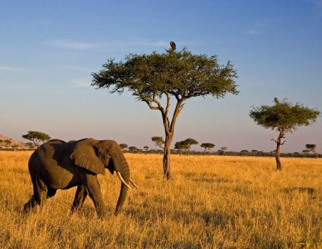
Savannah is a natural area dominated by herbaceous vegetation on red lateritic soils. This zonal (PC) is distributed between humid forests and semi-deserts. More than 40% of Africa's area is occupied by vast savannahs. Reddish soils are formed under tall-grass vegetation with a predominance of grasses, rare specimens of trees and thickets of shrubs.
Tropical forest steppe
Savannahs, except Africa, are common in Australia and the Indian subcontinent. This type of PC includes campos and llanos in mainland South America. Savannah is often compared to the forest-steppe of the temperate zone of Eurasia. There are some similarities, but more differences. The main features that characterize the savannah:
- soils with a low humus content;
- herbaceous xeromorphic vegetation;
- trees and shrubs with an umbrella-shaped crown;
- rich and varied fauna (unlike the steppes, it has survived).
Campos, a savannah in the Brazilian Highlands, is formed by different types of plant communities. Serrados is distinguished by the presence of undersized trees and shrubs. Limpos forms a tall grass steppe. Llanos on either side of South America are covered with dense grass and separate groups of trees (palms).
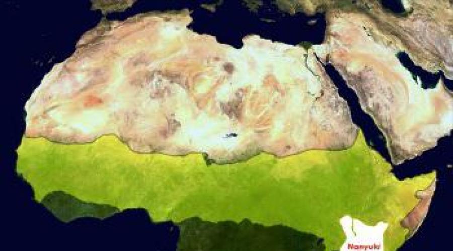
African savannahs. Soils and climate
The tropical forest-steppe zone occupies about 40% of the territory on the hot continent.
In the Northern Hemisphere, savannas reach semi-deserts at a latitude of 16-18 °, close to Lake Chad and the sands of the Sahara. The boundary of the distribution of this zonal PC in the south is the Savannah occupy flat areas and rise to significant heights within the East African Plateau.
The prevailing types of climate are subequatorial and tropical. Two seasons are clearly distinguishable during the year - wet and dry. The rainy period decreases from 7-9 months to 3-4 months when moving from the equator to the tropics. In January, when the wet season begins in the Northern Hemisphere, the dry season begins in the Southern. The total amount of moisture reaches 800-1200 mm / year. Humidification coefficient - less than 1 (insufficient precipitation). Some areas suffer from a meager intake of moisture (K uvl below 0.5-0.3).
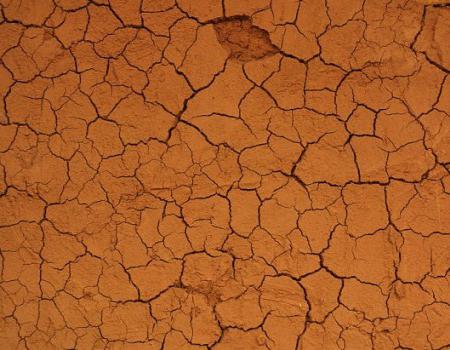
What kind of soil in the savannah is formed in such climatic conditions? During the rainy season, nutrients are intensively washed out by water into the lower horizons. When the dry period sets in, the opposite phenomenon is observed - soil solutions rise.

Vegetation type and climate
Having received moisture, the tropical forest steppe in Africa comes to life. The yellow-brown shades of dry stems are replaced by emerald greens. Leaves grow on those trees and shrubs that have dropped their foliage during a drought, grasses are rapidly stretching out, sometimes reaching 3 m in height. The soil, flora and fauna of African savannahs is formed under the influence of climate. Temperature conditions and humidity depend on the geographic location of the site.
Closer to the border of the equatorial forests, the rainy season lasts about 9 months. A tall grass savanna is formed here; groups of trees and shrubs are more numerous. There are mimosas and palms that form gallery forests along river valleys. The most interesting representative of the flora of the savannah is the baobab. The trunk of a tree often reaches 45 m in girth.
As you move away from the equator and approach the tropics, the rainy period decreases, typical savannahs develop. The territory bordering on semi-deserts receives moisture for 3 months a year. The vegetation that forms in arid conditions belongs to the desert type of savannah. At 50 ° C, it differs little from the desert. The North African peoples call these natural sites "Sahel", the South Africans call them "bush".

What soils prevail in the savannah
The soil of the tropical forest-steppe - which gives it iron compounds. This type is characterized by a low humus content - from 1.5 to 3%. The middle part of the profile contains clays; in the lower part, an illuvial-carbonate soil horizon is visible. The above features are typical for East Africa, the northern part of the Australian continent and certain regions of South America.
What kind of soil forms in the savanna depends on the type of moisture. With a sufficiently long dry period, humus accumulates due to the gradual decomposition of vegetation. More in the dry savannas of Africa and the steppes of South America. With regular moistening, a granular structure or shell (hard crust) forms on the surface of the earth.
Soil types
Within the same natural zone, a different amount of precipitation falls, and dry periods differ in duration. Features of the relief and climatic conditions leave an imprint on the type of savannah vegetation. Soils are formed by the interaction of all elements of the natural complex. For example, plant residues in the wet forest zone do not have time to decompose, nutrients are washed out by abundant precipitation.
Compared to the red-yellow ferralite soils of forests, more humus accumulates in savannas. Due to the dry period, there is a slow decomposition of plant residues and the formation of humus. The intermediate type is red ferralite substrates of variable moisture forests. Under the grass savannas, there are mainly lateritic and red-brown soils. Chernozems are formed under the dry type of this natural zone. As they approach the desert areas, they are replaced by reddish-brown soils. The soil acquires a bright brownish or brick-red color due to the accumulation of iron ions.

Savannah fauna
The fauna of the tropical forest-steppe is surprisingly rich and diverse. Representatives of all groups of the animal world meet. Spiders, scorpions, snakes, elephants, hippos, rhinos, wild boars find food in the savannah, shelter from the heat of the day or rain. Earthen cones of termitic structures rise everywhere, bringing the flat savannah to life. The soils are inhabited by spiders and small rodents, rustles are constantly heard in the grass - snakes and other reptiles scurry about. Large predators - lions, tigers - deftly hide in the tall grass in order to attack their prey unexpectedly.
Ostriches behave cautiously: high growth and long neck allow a massive bird to notice danger in time and hide its head. Most of the inhabitants of the savannah flee from predators. Ungulate herbivores cover considerable distances: zebras, gazelles, antelopes, buffaloes. Giraffes gracefully eat delicate foliage on the tallest trees, and clumsy hippos toss and turn in thickets of grass on the banks of lakes.

Agriculture in the savanna and woodlands
Significant areas of the tropical forest-steppe of Australia and South America are occupied by pastures and the cultivation of cotton, corn, and peanuts. Savannahs and woodlands are also used in Africa. Red-brown soils are fertile when moistened and properly processed. The low culture of agriculture and the lack of land reclamation led to the development of erosion processes. The Sahel zone in Africa is a territory of modern desertification caused by a combination of natural and anthropogenic factors.
Savannah soil conservation issues
The nature of Africa is changing under the influence of man: forests are being cut down, the savannah is plowing up. Vegetation and animals are negatively influenced by anthropogenic factors. The number of predators and ungulates is declining, and the population of primates is under threat. Disruption of the vegetation cover by plowing the savannah or deforestation leads to the rapid destruction of the soil. Showers erode the top fertile layer, exposing a dense mass of clay and iron compounds. It is cemented under the influence of high air temperatures. Such phenomena occur in areas of intensive farming and grazing. The red-brown soils of savannahs need protection and restoration over vast areas in the developing countries of Africa and Latin America.
South America is a unique continent. More than 50% of all equatorial and tropical forests growing on Earth are located in this part of the world. Most of the continent is located in the tropical and equatorial zones. The climate is humid and warm, the temperature in winter and summer does not differ much and is always positive on most of the mainland. The natural zones of South America are unevenly located due to the large differences in the relief of the eastern and western parts. Fauna and flora are represented by a large number of endemic species. Almost all minerals are mined on this continent.
This topic is studied in detail by the school subject of geography (grade 7). "Natural areas of South America" - the title of the topic of the lesson.
Geographical position
South America is entirely in the Western Hemisphere, most of its territories lie in tropical and equatorial latitudes.
The mainland includes the Malvinas Islands, which lie in the shelf zone of the Atlantic Ocean, and the islands of Trinidad and Tobago. The Tierra del Fuego archipelago is separated from the main part of South America by the Strait of Magellan. The length of the strait is about 550 km, it is located in the south.
In the north is Lake Maracaibo, which is connected by a narrow strait to the Venezuelan Gulf, one of the largest in the Caribbean.
The coastline is not very indented.
Geological structure. Relief
Conventionally, South America can be divided into two parts: mountainous and flat. In the west - the fold belt of the Andes, in the east - a platform (ancient South American Precambrian).
Shields are raised sections of the platform, in relief they correspond to the Guiana and Brazilian Highlands. From the east of the Brazilian Highlands, the Sierras - blocky mountains - were formed.
The Orinoco and Amazonian Lowlands are the troughs of the South American Platform. The Amazonian lowland occupies the entire part of the territory from the Atlantic Ocean to the Andes Mountains, in the north it is bounded by the Guiana Plateau, and in the south by the Brazilian Plateau.
The Andes are among the highest mountain systems on the planet. And this is the longest chain of mountains on Earth, its length is almost 9 thousand km.

The earliest folding in the Andes is Hercynian; it began to form in the Paleozoic. Mountain movements are still taking place - this zone is one of the most active. This is evidenced by strong earthquakes and volcanic eruptions.
Minerals
The mainland is very rich in various minerals. It produces oil, gas, bituminous and brown coal, as well as various metallic and non-metallic ores (iron, aluminum, copper, tungsten, diamonds, iodine, magnesite, etc.). The distribution of minerals depends on the geological structure. Iron ore deposits belong to ancient shields, this is the northern part of the Guiana Highlands and the central part of the Brazilian Highlands.
Bauxites and manganese ores are concentrated in the weathering crust of highlands.
In the depressions of the foothills, on the shelf, in the troughs of the platform, the extraction of combustible minerals is carried out: oil, gas, coal.
Emeralds are mined in Colombia.
Molybdenum and copper are mined in Chile. This country ranks second (like Zambia) in the world for the extraction of natural resources.
These are the natural zones of South America, the geography of the distribution of minerals.
Climate
The climate of the continent, like that of any continent, depends on several factors: on the currents washing the continent, macrorelief, atmospheric circulation. Since the mainland is crossed by the equatorial line, most of it is located in the subequatorial, equatorial, subtropical, tropical belts, therefore the amount of solar radiation is quite large.

Characteristics of the natural zones of South America. Zone of humid equatorial forests. Selva
This zone in South America occupies a large area: the entire Amazon lowland, located near the foot of the Andes and part of the nearby eastern coast. Wet equatorial forests or, as the locals call them, "selvas", which translates from Portuguese as "forest". Another name suggested by A. Humboldt is "gilei". Equatorial forests are multi-tiered, almost all trees are intertwined with various types of vines, many epiphytes, including orchids.

Typical representatives of the fauna are monkeys, tapirs, sloths, a huge variety of birds and insects.
Savannah and woodland zone. Llanos
This zone covers the entire Orinoco Lowland, as well as the Brazilian and Guiana Highlands. This natural area is also called llanos or campos. The soils are red-brown and red ferralite. Most of the territory is occupied by tall grasses: cereals, legumes. There are trees, usually acacias and palms, as well as mimosas, bottle trees, kebracho - an endemic native to the Brazilian Highlands. In translation it means "break the ax", tk. the wood of this tree is very hard.
Among animals, the most common are: baker pigs, deer, anteaters and cougars.
Zone of subtropical steppes. Pampa
This zone covers the entire La Plata lowland. The soils are red-black ferralite, it is formed as a result of the rotting of Pampas grass and tree leaves. The humus horizon of such soil can reach 40 cm, therefore the land is very fertile, which is used by the locals.

The most common animals are llama, pampas deer.
Semi-desert and desert zone. Patagonia
This zone is located in the "rain shadow" of the Andes, because mountains block the way for humid air masses. The soils are poor, brown, gray-brown and gray-brown. Sparse vegetation, mainly cacti and grasses.
There are many endemic species among animals: Magellanic dog, skunk, Darwin's ostrich.
Temperate forest zone
This zone is located south of 38 ° S latitude. Its second name is hemigelia. These are evergreen constantly moist forests. The soils are mainly forest burozems. The vegetation is very diverse, but the main representatives of the flora are the southern beech, Chilean cypresses and araucaria.
Altitudinal zonality
Altitudinal zonation is characteristic of the entire Andes area, but it is most fully represented in the equator.
Up to an altitude of 1500 m there is a "hot land". Humid equatorial forests grow here.
Up to 2800 m is a temperate land. It is home to tree ferns and coca bushes, as well as bamboo and cinchona.
Up to 3800 - a zone of crooked forest or a belt of low-growing high-mountain forests.
Paramos lies up to 4500 m - a zone of high-mountain meadows.
"Natural areas of South America" (grade 7) is a topic that shows how individual geocomponents are interconnected and how they influence the formation of each other.
55 56 57 58 59 ..SOILS OF SOUTH AMERICA
FEATURES OF SOUTH AMERICA SOIL COVER
South America occupies 17 684.0 thousand square meters. km, and together with the islands - 17 834.0 thousand square meters. km (11.9% of the earth's land area). Mountain areas make up 12.05% of the continent's area. South America is located mainly in equatorial, tropical and subtropical latitudes. This explains the specificity of the soil cover, in which the processes of tropical soil formation and weathering are of the greatest importance. The macrostructure of the relief has a significant impact on the distribution of soil zones, disrupting their horizontal position.
The usual division of the continent into the Andean west and the Out-Andean east is associated with the great influence of the Andes on the mainland. It manifests itself in the barrier value of the Andes, which fence off the low mountains and plains of the continent from strong westerly winds. Oceanic influence is evident in the east.
The non-Andean east is a vast, complexly constructed high plains and lowlands, within which equatorial and tropical regions are distinguished from north to south, and then humid and dry subtropics. The subtropics alternate from wet to dry in two directions: from east to west (drier Priandian zones in the west) and from north to south.
The general features of the climate within the bioclimatic zones are as follows. The equatorial climate differs in the amount of precipitation: there are more than 2000 mm, and they are evenly distributed throughout the year. The average annual temperature is + 24 °, + 26 °. In the words of French soil scientists, in areas with an equatorial climate, "the soil is rinsed in a bucket of warm water."
The tropical climate is characterized by less rainfall (1140-1600 mm per year) and the appearance of a dry season in winter. The duration of the dry season varies from 2-3 months to 6-7 months a year. Middle-
The new temperature reaches + 22 °, + 23 °. Naturally, the climatic contrast observed in the tropics affects soil formation, creating a complex profile.
The subtropical climate with a general decrease in temperature (average annual temperature + 19 °) and a decrease in precipitation (about 900 mm) is characterized by an unsharp rhythm in the alternation of dry and wet periods. In the east (in Pampa), the climate is uniformly humid and warm, as a result of the influence of the summer monsoons, and in the west, the contrast increases and precipitation falls in colder times. On the southern outskirts of the continent, the climate is temperate, but peculiar, semi-desert and desert with temperatures in January from + 10 ° to + 20 °, and in July from + 1.5 ° to + 8 °; the annual precipitation ranges mainly from 100 to 500 mm.
The climate of semi-deserts and deserts is characterized by low temperatures, constant fogs in the mountains, and poor vegetation. These are the deserts along the western ocean coast.
In general, by the nature of the climate, the location of soil belts (formations) is sharply divided into four types: 1) equatorial and tropical formations occupying the northern part of South America; 2) subtropical and moderately cold formations, elongated from north to south; 3) desert formations; 4) Andes.
The macrostructure of the relief of South America is determined by the meridional position of the Andes, the depth of occurrence of ancient crystalline shields (Guiana, Brazilian), the outpouring of volcanic rocks and the formation of tectonic depressions within the shields and in the Andes zone. Tectonic depressions were filled with both ancient sedimentary Mesozoic and volcanic rocks of different ages (south of the Brazilian Highlands), as well as Quaternary alluvial sediments (Amazonia).
Accumulative landscapes and rocks are widespread not only in depressions, but also within shields covered with Mesozoic and Quaternary rocks, on which erosion processes have created leveling surfaces of different levels. A special accumulative landscape is associated with deposits of loesses and loesslike rocks in Uruguay, Argentina and in the pre-Andean regions. The peculiar ash composition of the loesses should be taken into account. Outcrops of volcanic and Paleozoic crystalline rocks are characteristic of all regions of South America. Soil formation is influenced by volcanic ash.
Zoning of soils in South America
The soil cover of South America is peculiar primarily in that it does not form continuous, homogeneous spaces, such as on the vast glacial and loess plains of Europe and North America. The distribution of soils against the background of general bio-climatic patterns is clearly determined by a combination of tectonic, erosional and accumulative processes and their stages. In view of this, the term "cover" can be applied conditionally and not for all regions of South America. With intense tropical and equatorial weathering, residual weathering products are formed, forming homogeneous sandy spaces with silcrites and ferruginous crusts, which are called weathering covers, or arenas, with undeveloped sandy soils (arenosols).
The soils of the northern third of the continent are up to 10 ° S. sh., located in conditions of an equatorial, tropical climate, belong to the ferralite type; they are combined with tropical red soils (under evergreen deciduous forests) and eutrophic ferralitic ones on basic rocks. All these soils are under forests and are partially reclaimed. Weathering covers characteristic of the tropics are overgrown with savannas, and in some places there are no vegetation.
Soils of a tropical climate with a dry season, ranging from 10 ° to 25 ° S. sh. are transitional from ferralitic to ferruginous tropical soils. In this zone, the soils are very diverse, which is influenced by the preservation of the residual properties of ferrallitization in the soils, the appearance of a dry season of different duration and
weight of rocks. The most widespread are ferruginous tropical, residual lateritic, eutrophic soils. The soils of the subtropical bioclimatic zone - formations (from 25 ° to 40 ° S) are grouped into two facies: eastern with a mild uniform climate and western with a contrasting climate. The soils of the eastern subtropical facies differ from the subtropics of Eurasia in their formation in a mild and non-contrasting climate, although the amount of precipitation in the subtropical steppes of South America is similar to that of Eurasia, but their distribution over the seasons is uniform. There are no sharp temperature differences between the seasons. The characteristic soils of these subtropics are: brunezems, subtropical red soils and black subtropical soils. In the western part of the subtropics, the climate contrasts with hot summers, cool winters and summer precipitation. The soils are of the brown type.
In the south of the mainland (from 40 ° to 50 ° S lat.) Peculiar deserts have formed, in which volcanic rocks and ash are widespread.
Significant volcanic activity in past epochs, as well as in the modern period, has led to the widespread distribution of basic intrusive rocks, ash and lava sheets of various compositions in South America. On these rocks, base-saturated (eutrophic) soils are formed even within the humid tropics and subtropics.
The general laws of soil formation in South America are as follows: widespread development of ferrallitization processes, which are inhibited at the outcrops of basic rocks; the different ages of soils, which is determined by the varying degrees of rock weatheredness; the appearance of saturated soils in subtropical zones; development of fusion processes in dry subtropics; relatively small distribution of saline soils and sands. It is possible that the areas of sand with more detailed mapping will turn out to be large due to sandy weathering covers in tropical zones.
A characteristic result of equatorial weathering is a peculiar mechanical composition of soils - usually a very low content of the dust fraction with a significant content of the fine sand fraction. This type of texture is observed in ferralitic and ferruginous tropical soils. In the latter, this feature can be considered as a relict one, since in many regions ferruginous tropical soils are formed under the influence of a dry climate on previously formed ferralite soils.
Noticeable differences in mechanical composition are observed in the soils of subtropical zones. So, in brunzems and red soils, the content of the dust fraction increases sharply and becomes approximately equal to the fine sand fraction. Loessiness of subtropical soils is widespread in South America.
Along with a change in the type of weathering from acidic ferrallite soils to neutral and alkaline (in the subtropics), changes in humus content and salinity are also observed. In acidic soils, humus is highly mobile, reaching a depth of more than two meters. In neutral and alkaline soils, humus is closely related to the mineral part, is inactive, humid. In the profile of subtropical soils, readily soluble salts are usually not observed; they concentrate in depressions and valleys or on marine saline clays. In desert soils, there is a high carbonate content and salinity.
The complexity in the structure of soil distribution should be emphasized; This is influenced by parent rocks of different ages and mineralogical composition, the presence of various weathering crusts and the accumulation of volcanic rocks, as well as different forms of relief: tectonic uplifts, flattening surfaces, extensive depressions, and erosional dispersion.
The largest areas in South America are occupied by ferralite (4,926.2 thousand sq. Km) and ferruginous tropical soils (1961.1 thousand sq. Km). The best soils are Bruniseem (125.3 thousand sq. Km) and terra rocha (237.6 thousand sq. Km).
Unlike North America, where changes in vegetation cover depend largely on changes in temperature conditions, in South America, with its high temperatures, the nature of the vegetation depends mainly on the degree of moisture. A large amount of solar heat allows the plants of the southern continent to vegetate almost everywhere throughout the year. As in Africa, the main factor that determines the length of the growing season is the degree of moisture. The latter in the hot zone decreases not from the oceans into the interior of the continent, but from the equator to the tropics, and only in the subtropics do the differences between oceanic and inland territories sharply emerge. In this regard, the main forest areas in South America cover the equatorial areas. Wet equatorial forests (giles), including giles with a brief dry period (deciduous-evergreen forests), and monsoon forests cover the Amazon and the adjacent slopes of the Andes and highlands. The climate of these areas has not undergone significant changes since the end of the Mesozoic. And the flora of the equatorial America in its composition, which includes cycads, lymphoids, etc., is the remnant of one of the oldest flora on Earth. It consists of representatives of the neotropical flora, the formation of which began from the Cretaceous or from the end of the Jurassic period, that is, when there were still direct connections with Africa and other parts of the hypothetical Gondwana. Therefore, 12% of the genera of dicotyledonous plants are common to the Neotropical and Paleotropic regions. Long-term isolation of South America in the Tertiary period led to the high endemism of its flora. Not only many genera of plants, but even entire families are endemic or have the center of their species distribution in South America (jug-like - Marcgraviaceae, bromeliads - Bromeliaceae, etc.). Apparently, the flora of savannas, mountain tropical forests and even partly xerophilic flora of semi-deserts originated from the neotropical hygrophilic flora. The cactus, agave, and bromeliad species, for example, originated in humid equatorial forests; ecologically adapting and changing, they penetrated the western desert coast, and the semi-desert of Argentina, and the inter-Andean plateaus. Mostly in the form of epiphytes, they are widespread in the Amazon and at the present time. The equatorial forests have thus become the most important center for the formation of the vegetation cover of South America, most of which is part of the Neotropical Floristic Region. Almost as ancient is the flora of savannas and woodlands. They are located to the north and south of humid equatorial and monsoon forests on the plains and plateaus of the east of the mainland up to 30 ° S. sh., and in the west - between 0-5 ° S. sh., occupying an area approximately equal to the giley and monsoon forests.
Savannahs and woodlands again give way to moist forest formations on the eastern, windward slopes of the highlands and subtropical evergreen mixed (coniferous-deciduous) forests - in the cooler, higher regions of the Brazilian Highlands between 24-30 ° S. NS. Moist forests also cover the slopes of the southern Andes, south of 38 ° S. NS. Up to 46 ° S NS. they are composed of evergreen deciduous and coniferous species (hemihilea). On the western, windward slopes, the forests are denser, on the eastern - sparse and have an admixture of deciduous species. In the extreme south of the Patagonian Andes, on the western slopes, they pass into mixed, deciduous-evergreen subantarctic forests, and in the east, into predominantly deciduous forests. Due to the fact that in the Quaternary period the southern Andes were almost completely covered by glaciers, the settlement of this section of the mountains occurred relatively recently. Apparently, the center of the spread of flora in the southern Andes after the glaciation was the subtropical Andes of central Chile, where during the glaciation there were a number of shelters that allowed many relics to survive. etc., the southern beech (Nothofagus), Alerce (Fitzroya cupressoides var.patagontca) moved southward from the Andes of central Chile. North of 38 ° S lat. (up to 32 °), as on other continents, to in the west of South America, humid forests give way to hard-leaved (Mediterranean) forests and shrubs.Young types of meadow-steppe, semi-desert and desert vegetation prevail in the subtropics in the east of the mainland, including on the eastern slopes of the Andes. Shrub semi-deserts are also widespread in Patagonia, which lies further south in rain shadow of the Andes; the vegetation cover of Patagonia also formed only in the postglacial period from the Antarctic flora.Patagonia and southern Chile belong to Antarctic Floristic Region. The vegetation cover of the intermontane plateaus and western slopes of the Central Andes is very young. Recent uplifts in this area and Quaternary glaciations have caused significant changes in climate and vegetation cover. In the Tertiary time, there existed a meso-philic tropical flora, and now mountain-steppe, semi-desert and desert types of vegetation dominate. Due to the position of South America mainly in low latitudes, it is dominated by various types of lateritic soils. Hot forest areas with constant and abundant precipitation are characterized by podzolized lateritic soils, which are difficult to separate from the very thick weathering crust. In areas with seasonal moisture, red, brown-red and red-brown soils are typical.
Ancient ferruginous crust is widespread. Laterization processes still manifest themselves in the humid subtropics in the east of the continent, where red soils and reddish-black prairie soils are characteristic. Further to the west, as in North America, they are successively replaced by gray-brown soils and gray soils, and in the extreme west by brown soils. Soil types in cool temperate latitudes are represented by brown forest soils in the west, chestnut and brown, desert-steppe soils in the east. In the Andes, the altitudinal zonation is clearly expressed with mountain types of zonal soils. The contrasts of natural conditions and the peculiarities of the paleogeographic development of South America determined the richness and originality of the animal world. The fauna of the mainland is also characterized by great endemism, which made it possible to clearly distinguish the Neotropical zoogeographic kingdom with a single Neotropical region. Three families of the order of edentulous are endemic (armadillos, anteaters and sloths), wide-nosed monkeys, bats (vampires), rodents (guinea pigs, agouti, chinchillas), whole orders of birds (ostriches-rhea, tinamu and goatzin, as well as vultures, toucans , 500 species of hummingbirds, many genera of parrots, etc.) Reptiles are characterized by endemic caimans, iguana lizards and boas-boas, among fish - an electric eel, a double-coding siren and others. Insects are especially diverse and endemism (3400 species out of 5600). Only in the Pleistocene did the jaguar and puma, skunks, otters, tapirs, bakers and llamas migrate from the North to South America and spread widely. South America lacks a number of animals that are widespread on other continents (narrow-nosed monkeys, almost no insectivores, few ungulates). The ecological conditions of the desert-steppe spaces and cool forests of the southern Andes are sharply different from the hot savannas and forests of the more northern parts of the continent. Therefore, the fauna of these territories is also significantly different. The southern regions are united into the Chilean-Patagonian zoogeographic subregion, the northern ones - into the Brazilian one.
Factors that determine the general structure of the soil cover of the continent ………………………………………………………… .. ……… 2-4
Soil-geographical zoning of South and Central America …………………………………………………………………………… ..5
Soil cover in equatorial and tropical wet forest areas …………………………………………………………………… 6-19
Soil cover of savanna-xerophytic-forest areas …………… ... 20-27
South American meadow-steppe sector …………………………… 28-34
Southern Pacific subboreal forest sector …………… ... 35-36
Agricultural use of soils in South America. Agricultural crops …………………………………… .. ……… 37
Bibliography…………………………………………………...……… ..38
FACTORS DETERMINING THE GENERAL STRUCTURE OF THE SOIL COVER OF THE CONTINENT
The general character of the soil cover of South America is determined by: the considerable length of the continent in the meridional direction; the presence of a mountain barrier along the western coasts; the predominance in the equatorial, tropical and subtropical belts of the eastern transport of moisture from the Atlantic Ocean, the presence of the cold Peruvian Current along the Pacific coast; the prevalence of western moisture transport in the temperate zone of South America and the presence of the cold Falkland Current along the coast of Patagonia; the spread in the equatorial and tropical zones of ancient flattening surfaces with a thick ferralite, often strongly lateritized weathering crust; distribution in the subtropical part of the continent of alluvial plains; the presence of active volcanoes and associated volcanic sediments in the northern and southern Andes.
South America is the only continent in the southern hemisphere that extends into the temperate and moderately cold zones. Five geographic zones cross it: northern tropical, equatorial, southern tropical, subtropical and temperate. The largest and widest part of the continent lies in the equatorial-tropical latitudes.
The continent is protected from the west by a high barrier of the Andes, which, along with the direction of humid air masses, determines the nature of the humidification of the adjacent plains. The latter is especially pronounced in the south of the continent, where the western transport of air masses prevails. Western slopes of the Andes in southern Chile receive 2000-5000mm precipitation, and Patagonia lying in the rain shadow - 150-250mm. The arid climate of Patagonia is aggravated by the presence of the cold Falkland Current along the Atlantic coast. Therefore, on the plains of the temperate zone of South America, regardless of the fact that they lie in the eastern coastal sector, landscapes and soils of desert steppes and deserts dominate.
In the subtropical zone, on the contrary, the eastern transport of moisture from the Atlantic Ocean and the maximum amount of precipitation (1000-2000mm) falls on the east coast; inland, as the sea air masses transform, the amount of precipitation decreases to 300-400mm. These are the arid regions of inner Pampa and the Gran Chaco province. The meridional strike of the humidification zones determines the same direction of landscape and soil zones: in the north of the eastern most humid part, there are subtropical humid forests on red earth and tall grass prairies on chernozem soils; in the more inland areas of the dry pampa, there are subtropical chernozems, and in the Andean part, in the Gran Chaco, there are subtropical dry and desert steppes on gray-brown soils in combination with salt licks and salt marshes.
The Pacific coast and the western slopes of the Andes in the subtropical and tropical zones receive the minimum amount of precipitation, as they are influenced by the cold southeastern and southern air masses coming from the eastern periphery of the Pacific anticyclone. The dryness is intensified by the cold Peruvian Current, which runs along the western shores of the continent. Desert landscapes and soils with pronounced salt accumulation phenomena both on the low-lying coasts and on the high highlands dominate here. Only north of the equator, the western slopes of the Andes are more humid than the eastern ones, due to the bringing of moisture from the Pacific Ocean by southwestern winds.
In the equatorial zone, on the plains in the basin of the river. The Amazon, lying east of the Andes and receiving moisture from the Atlantic Ocean, has the wettest climate, with precipitation from 2,000 to 5,000mm, no significant dry period. Humid equatorial rainforests prevail on yellow ferralite soils. To the north and south, somewhat asymmetrically with respect to the equator, are tropical regions, where 2000-1000mm precipitation and a pronounced dry period lasting from 3 to 5 months. These are zones of seasonally moist tropical forests and savannas on red ferralite and alferritic soils, which are no less poor than the soils of permanently moist forests; they are associated in their distribution with the ancient ferralite weathering crust that covers most of the surface of the Brazilian and Guiana Highlands.
On the inland, arid plateaus somewhat isolated from the Atlantic Ocean, in the northeastern part of the Brazilian Highlands, the climate is drier, which is associated with the appearance of xerophytic shrubs and woodlands on red-brown and red-brown soils.
In general, in the equatorial and tropical zones, the zones of moisture coincide with the direction of the thermal zones; therefore, latitudinal zoning of landscapes and soils is expressed in this part of the continent.
The vast alluvial plains of the Amazon and Parana river basins are associated with the distribution of modern super-aquatic and paleohydrogenic landscapes and soils.
Associated with the mountain ranges and highlands of the Andes are a series of mountain soil zones that are significantly different in the northern, central and southern Andes.
SOIL-GEOGRAPHICAL AREA OF SOUTH AND CENTRAL AMERICA
There are seven soil sectors on the territory under consideration: the Equatorial Pacific Wet Forest, the Near Equatorial American-African Wet Forest, the South Pre-Atlantic Wet Forest, the American African Savanna-Xerophytic Forest, the South American Meadow-Steppe, Andean-Patagonian Desert Ocean and Subboreal Near-Boreal Forest. Some of the sectors are closed within the continent and have a short length.
Some of the sectors continue in Africa and form "bridges" between the two continents. The mountainous volcanic regions of Central America and the northern Andes are part of the Equatorial Pacific humid forest sector, which includes Malaysia and New Guinea. The Southern Pacific Forestry Sector unites Southern Chile with New Zealand.
A number of soil areas are distinguished by the nature of the macrostructure of the soil cover:
1) mountainous regions of the Andean belt, with a combination of mountain-zone bioclimatogenic and volcanogenic macrostructures: Central American, Equatorial Andean, Central Andean, Chilean-Ognezemelskaya;
2) areas where there is a combination of elements of lowland and mountain-zone bioclimatogenic structures with paleoclimatogenic and disordered lithogenic: Caribbean, Central Brazilian, East Brazilian, Atlantic;
3) areas where low-zone bioclimatogenic macrostructures are combined with paleohydrogenic and modern hydrogenic ones: Amazonian, Eastern Pampa Region;
4) areas of predominance of bioclimatogenic low-zonalxstructures: Paraguay-Predandian, South-Argentine-Patagonian.
SOIL COVER OF EQUATORIAL AND TROPICAL WET FOREST AREAS
The boundaries of South America include partially or completely three wet forest sectors: the Equatorial Pacific, the Equatorial American-African and the South Atlantic. The equatorial Pacific sector is represented by two mountainous regions: Central American and Equatorial Andean; Equatorial American African sector - one large Amazon region, including several soil districts; South Atlantic sector - Atlantic.
Central American Soil Region
The narrow strip of land in Central America is characterized by a significant variety of bioclimatic and lithological-geomorphological conditions and, accordingly, soils.
By the nature of the relief, this territory is divided into the eastern low-plain part and the western - mountainous. The highest mountain ranges of the South Sierra Madre and the Eastern (volcanic) Sierra Madre, stretching along the Pacific coast, rise to abs. h. 3700-3800 l, and at the highest points exceed 4200-4500m.
The mountain ranges of Central America are composed of a complex of various Cretaceous and Paleogene sedimentary rocks, among which limestones occupy a significant place. By the nature and structure of the soil cover, the Central American region is divided into two subregions: the western mountainous and the eastern mountain-plain. The western mountainous subregion includes the above-mentioned mountain ranges and high plateaus of the Mexican Central Mesa, lying at 2000-2500m.
The composition and structure of the soil cover of this territory are significantly different on the windward, wet and leeward drier mountain slopes and on intermontane high plateaus.
The most humid are the southwestern slopes of the Southern Sierra Madre and the eastern slopes of the Eastern Sierra Madre, covered with deciduous tropical forests, humid mixed forests and occupied by red ferrallite tropical soils, and on the basic rocks with dark red ferralite soils.
The Eastern (Volcanic) Sierra Madre is a country of modern grandiose active volcanoes; the largest of them are Colima, Popocatepetl, Orizaba. Volcanic ash covers mountain slopes and highlands, basaltic lava flows and volcanic mud-stone flows fill intermontane depressions. Water-soluble products of volcanic eruptions, chlorides, sulfates are carried out and accumulate in local relief depressions - hollows filled with lacustrine sediments. The snow line in the Eastern (Volcanic) Sierra Madre is at an altitude of 4500m. The upper vertical zone is formed by subalpine and alpine mountain meadow soils.
On better humidified mountain slopes under forest vegetation, the soils are similar to red and yellow soils. Within the Central Mesa and on the highlands in the basin of the river. Balsac, dark-colored soils are widespread on volcanic ash and on weathering products of major lavas. These soils contain about 5% humus, slightly acidic, in the upper part - neutral or slightly alkaline, in the lower part of the profile, slightly clayey, in places with a horizon of carbonate accumulation. In local depressions of the relief, solonchak dark-colored meadow soils and saline soils of sulfate-chloride-soda and soda composition appear (Gerasimov, 1968). The natural vegetation of the uplands is represented by grassy savannah dominated by gramma grass and aristida with acacias, cacti and agaves in the tree layer.
Central Mesa is the most populated and used agricultural region in Mexico.
The eastern mountain-lowland subregion of the Central American soil region has a more humid climate. Dry periods are not expressed here, forest vegetation dominates everywhere: on the plains - humid tropical forests, on the mountain slopes - mixed, with tree ferns. Both on the plains and in the mountains, thick ferralite weathering crusts with red-yellow and yellow ferralite soils are developed everywhere. In the higher belt of the mountains, poly-humus mountain ferralitic and allitic soils appear. Above 3800m - zone of acidic peaty mountain meadow soils.
On the Yucatan Peninsula, composed of limestones, there are more saturated and richer in humus than the rest of the soils of the foothill plains, dark red ferralite soils. With a close occurrence of limestones, red-brown soils saturated with bases are formed on its eluvium. Here the slopes are terraced in places - these are traces of the ancient agricultural culture of the Mayan Indian tribe.
The coastal lowlands are occupied by ground-water sandy lateritic and boggy soils, moving with sandy illuvial-ferruginous-humus podzols.
The very low economic level of development of the countries of Central America does not allow the use of even the best lands of this vast territory.
Equatorial Andean soil area
This predominantly mountainous region includes a system of mountain ranges that converge near the equator and fan out to the north. Mountains rise above 5000m; the highest peaks are volcanoes. In places, for example, in the Eastern Cordillera, there are extensive leveled surfaces lying on the abs. h. 2500-3000m. Most of the leveled surfaces are covered with thick volcanic ash. There are a number of active or recently extinct volcanoes. In Ecuador, most soils, even on steep slopes, are developed on volcanic ash. They were named "Andosols". These soils have a thick humus dark horizon, with ash interlayers turning deeper into brownish or reddish yellow.
Andosols are characterized by: allophane composition of the clay fraction, high absorption capacity, the ability to absorb not only cations, but also anions, in particularPO4, a large number of movable Al, very low volumetric weight due to the porosity of volcanic glass. In a humid climate, andosols are a stable type, especially with a periodic supply of new volcanic material.
On the plateaus of the Eastern Cordillera, at an altitude of 2200-I 3200 m near the capital of Colombia - Bogota, in a temperate warm climate, with average monthly temperatures of about 14-I16 ° C, corn, wheat, beans, potatoes are grown on Andosols.
Above 3200-3500 and up to abs. high. 4000m there is a "paramo" belt of alpine subalpine and alpine shrub-herbaceous vegetation. Dark-colored mountain-meadow soils with coarse-humus and thick humus horizons are widespread here. A colder climate, and most importantly, sharp fluctuations in daily temperatures impede the cultivation of agricultural crops, these territories are used as pastures. On the flat surfaces of the plateau, significant areas are swampy.
On mountain slopes where there is no significant accumulation of volcanic ash and falls from 3000 to 1000mm precipitation, a number of high-altitude zones are observed.
Upper forest belt (tierra fria), ranging from 3000-2000m, represented by forests of mists (nephelogyleum). Mountain brown and acidic polyhumus brown forest soils, podzolized in places, are confined to this belt. Middle forest belt (tierra templada) - from 1000-1500 to 2000-2800m - This is a mountain gley dominated by mountain humus allitic and mountain humus ferralite soils.
The lower belt of mountains and foothill plains (tierra caliente) is a special soil area, stretching from Guaiaquila in Ecuador to the Isthmus of Panama at the western slope of the Andes.In relief, it is an alternation of low coastal ridges and low foothills of the Andes, alluvial plains of river and marine terraces, estuaries and deltas with alluvial sediments and in some places coastal sand dunes.
In the northern part of this belt, red-yellow ferralite and red-yellow podzolic soils prevail, while podzols appear on well-drained sandy terraces. The coastal plain contains hydromorphic, alluvial and saline soils. In the central and southern parts of the territory, andosols and the accompanying alluvial and hydromorphic soils, containing volcanic ash, stretch in a narrow strip at the foot of the Andes. In the southern part, the soil cover is even more diverse: here, in the conditions of a hilly relief, somewhat more fertile soils are common, transitional between rich brown forest and red-brown Mediterranean soils. Dark red ferralite soils are also widespread here, developing on ancient alluvium on terraces, with a high content of volcanic ash of the basic composition. The level of fertility and the need for fertilizers are very different here, and the economic use is also very diverse. Bananas and cocoa are grown on the most fertile and well-drained soils on alluvium and on ash-volcanic soils (Andosols), on less fertile soils - oil palm and fibrous crops, on poor soils of heavy texture with poor drainage - rice. In some places, in the conditions of hilly terrain, a shifting culture of agriculture is still preserved, but it is gradually being replaced by plantations of cocoa or coffee, although in some places it is unsafe due to steep slopes, thin soil and the possible development of erosion. Areas of hydromorphic soils and black merged soils are used for pastures. Significant areas of fertile soils of river estuaries are not fully utilized due to salinization, close brackish waters, and lack of capital flood protection.
Amazonian soil area
This area - the largest in South America, encompasses one flat near-equatorial soil zone of yellow and red-yellow ferrallite soils of humid equatorial and tropical forests. It stretches across the entire continent - from the eastern foothills of the Andes to the Atlantic coast. The region includes the entire Amazonian lowlands, the Guiana Highlands and the northern part of the Brazilian Highlands flanking the lowlands from the south. Throughout the region, the climate is humid, the annual moisture is uniform, sometimes with one short, somewhat drier period. The most humid is the western pre-Andean, part of the region and its extreme eastern pre-Atlantic part, where the annual precipitation ranges from 2000 to 5000mm in year. The dominant vegetation in the Amazonian soil area is humid equatorial and subequatorial forests. The main background - selva - is interspersed with small islands of grassy savannas, confined to flat surfaces experiencing seasonal flooding by atmospheric waters.
The central part of the region is the Amazonian lowland proper, it is widest in the western part and narrows to the east.
From the north and south, the lowland is framed by ancient shields: the Guiana and Brazilian highlands. In large areas of the raised plains, the surface cloak is represented by quartz sands; along with white quartz sands are widespread pink and red, with ferruginous films on the surface of quartz grains, often with ferruginous nodules. These sands are products of the erosion of the ancient weathering crust of acidic quartz-bearing rocks.
Products of erosion and redeposition of the ancient weathering crust, including quartz sands, cover large areas within the Amazonian lowland.
Only under conditions of a highly dissected relief, on surfaces renewed by erosion, the less poor weathering products have a fersiallite or fersiallite-allite character. The Amazonian soil area is dominated by yellow and red-yellow ferralite soils. They differ mainly in the amount and degree of hydration of iron oxide hydrates: yellow ferralite ones contain less iron oxides and it is more hydrated than in red-yellow ferralite ones. Otherwise, they have similar properties.
These soils are formed on the ferralite weathering crust or products of its erosion and redeposition, which do not contain any primary minerals, except for quartz.
The humus content in the upper soil horizons is about 3.0%; humus penetrates deeply along the profile; at a depth of 100cm its content is about 2%. The humus is very light and, as studies by I.P. Gerasimov and O. A. Chichagova (1964) have shown, has a pronounced fulvate composition. The profile is morphologically poorly differentiated and includes the following horizons: humus (Af) -brownish or yellowish-black, loose, with a capacity of 5-10cm. Beneath it lies a powerful metamorphic mountain. IN T - yellow-brown or red-brown color, loose, well-aggregated, penetrated by termites, well air- and water-permeable, without noticeable signs of muddy particles washing into it. At a depth of 100-150cm the color becomes brighter - red or orange. Low humus content, low absorption capacity, lack of primary minerals - a source of bases, low content of phosphorus, nitrogen and trace elements cause very low fertility of these soils and limit their use in agriculture.
Along with yellow and red-yellow ferralitic soils, other zonal types are also widespread in this zone, the nature of which is closely related to the composition of parent rocks and the stage of relief development.
Where ancient flattening surfaces have undergone strong dissection, for example, in the Guiana Highlands, and the ancient weathering crust is washed away, the weathering products of massive rocks appear somewhat more fertile than red-yellow ferralite soils. Dark red ferralite soils are formed, with a higher humus content, a well-defined structure, a high content of iron oxides, and less acidic. In depressions of the relief with a close occurrence of groundwater, groundwater laterites are widespread - soils with horizons of ferruginous nodules, forming continuous ferruginous plates.
Differences in the topography and parent rocks lead to the differentiation of the soil cover within the region and make it possible to distinguish a number of soil districts: Amazonian lowland, Guiana, Brazilian and Atlantic.
Amazonian Lowland Soil District yellow ferralite, groundwater lateritic, bog soils and sandy podzols. This area lies on abs. altitude below 200m and is an alluvial plain with wide terraces and wide river valleys. The degree of dissection of the relief is small, with the exception of the territories adjacent to the Brazilian Highlands. Most of the territory is covered with tropical rainforest, with small patches of grassy savannas confined to flat, poorly drained surfaces.
The soils of this district are predominantly yellow ferralitic, with a low content of iron oxides, very acidic, highly unsaturated, often of light texture. Poor ground-water laterite soils with accompanying hydromorphic soils are widespread. These soils are of low natural fertility. Somewhat more fertile soils are found in small tracts in places where loose deposits contain the products of weathering of basic rocks and limestones.
A significant part of the territory is occupied by soils on young alluvium. These are peaty-boggy and humus-boggy soils. Low terraces, composed of quartz sandy material, are occupied by very poor, acidic sandy soils.
A large amount of incoming organic remains and a high mobility of humus (mainly its fulvate composition) determine the formation of powerful illuvial-humus podzols on sandy terraces, often with signs of soil moisture. Many rivers and streams in the Amazon Basin are so rich in organic matter that they are dark in color. In some places, on high terraces, they are found in the form of small, slightly elevated patches of spots of black, relatively fertile soils. This is "terrapreta"- cultivated soils created during long-term agricultural cultivation by Indian tribes and now abandoned, but not lost the fertility created by labor. Their dark color is due to the large amount of charcoal inclusions.
Large areas on yellow ferralite and ferruginous-nodule (lateritized) ferralite soils and well-drained alluvial soils are occupied by rubber plantations; tobacco and some fibrous crops are also associated with sandy ferralite soils.
Guiana High Soil District red-yellow ferralite and red-yellow podzolized fersiallite soils, laterites and thin stony soils of mountain slopes.
The territory is an isolated northern section of the Brazilian Shield, has hilly and mountainous terrain, with several levels of ancient denudation surfaces well preserved from erosion and with several younger surfaces forming lower steps. The absolute heights in this area range from 0 to 1500m, and some canteen hills reach 2000m. Natural vegetation is tropical rainforest, and on young Denudation surfaces (Ruppini region) grassy savannas. Small islands of herbaceous vegetation are interspersed with forests, most of them of anthropogenic origin.Red-yellow ferralitic, ferrsiallitic and podzolic soils of the region are developed on sloping and steep slopes, respectively, on mudstones, siltstones and quartz sandstones. The main igneous rocks and their diluvium contain dark red (reddish brown) ferralitic soils. These soils are highly prized by Indian farmers.
In the mountains, there are small areas with a relatively flat relief, where ferralite soils with a high content of ferruginous nodules are common. Poor groundwater laterites, quartz-sandy acidic soils on pink and white sands are common on ancient denudation surfaces, some of which (especially the highest ones) have powerful ancient horizons of true laterites. Thin stony soils are widespread in this area. Livestock raising is developed on unimproved pastures in the grassy savannah areas, and on the slopes of mountain valleys there are small areas of transitional farming.
Brazilian High Soil District red-yellow and dark red ferralite soils and quartz-sandy soils.
This area is predominantly humid, with a short dry season; densely forested. Absolute heights range from 200 to 1000m. The relief is predominantly hilly plateaus, with wide summit surfaces inclined to the north. The soils of the Okrug are poorly studied. According to few observations, there are red-yellow and dark-red ferralite soils on the products of weathering of shale and phyllite. Quartz-sandy acidic soils (quartz regosols) are widespread on slightly undulating surfaces of uplands composed of sandstones. In hilly areas, red-yellow podzolic soils are formed. In depressions, on loose sediments, the formation of yellow ferralite soils is possible. The agricultural development of this territory is very weak; it is crossed by only one road. Some rivers are navigable. The mode of travel is pedestrian or air. The indigenous population is very rare, it is mainly engaged in the collection of natural fruits and plants and hunting, and only in some places is engaged in shifting agriculture to obtain the main food crop - cassava.
The soil has a very low level of fertility; if they are used over large areas, there is a risk of erosion, especially of red-yellow podzolic soils on the slopes. Soils need regular fertilization if they are used consistently.
Atlantic Soil District coastal acidic saline, marsh and sandy soils.
Most of the Primorskaya Lowland lies at altitudes less than 50m above ur. seas; the groundwater level is high, the waters are often saline; the coast is very gentle, in many places with a strip of marches and mangrove forests. The coastal zone is growing due to sediment carried by the rivers, especially the Amazon and Orinoco. The climate is tropical. Natural vegetation is closely related to the nature of the soil. Mangrove swamp forests withAvicenna and Rhizophora , reed (reed) swamps, tropical forests and savannas with rare xerophytic shrubs.
Hydromorphic soils prevail, developing on Holocene sediments and marine sediments: silt-gley, mineral gley and coastal saline. These soils contain minerals of the illite-montmorillonite group, which significantly distinguishes them from most other soils of the Amazon region, which have a kaolinite composition.
Acidic sulphate soils with very low pH values are a distinctive feature of the district. They are confined to the elements of the relief, where the water level periodically drops and the oxidation of sulfides, usually present in the reduced un-drained soils of the coast, occurs. Acidic sulphate soils often contain a lot of mobile aluminum, which, like the high acidity of soils, causes their sterility for a number of years after draining. Most of the bog soils in the lower horizons are saline.
The belt of peaty boggy soils is currently not used; their development is possible only in conditions of drainage. The white and ferruginous sandy soils of the inner lowlands are rough pastures and forest areas. Silt-gley, mineral gley soils and coastal salt marshes about. The Marajos have good natural pastures, but they are not suitable for the cultivation of cereals, except for some varieties of rice.
Most of the poor groundwater laterites are infertile, many areas are swampy or subject to periodic flooding. Livestock grazing on pastures with lateritic soils often suffer from a lack of minerals in their feed.
Atlantic wet forest soil area
The area is located between 5 and 23 ° S. NS. It covers the eastern most elevated, up to the abs. h. 800-2000m, highly dissected part of the Brazilian Highlands and its eastern slopes facing the Atlantic Ocean. This area is well hydrated. Two soil districts are distinguished here: Northeastern Brazilian and Southwestern Parano-Uruguay.
Northeast Brazilian Soil District ... The soil cover is dominated by very poor red-yellow, ferrallitic and red-yellow podzolic ferrallite soils under rainforests. At an altitude of about 2000m deciduous forests appear on humus ferralitic acid soils, and where the peaks reach 2100-2200m, forests disappear and are replaced by mountain peat bogs.
In the lower zone of humid tropical forests, among red-yellow ferralite soils, somewhat more fertile dark red ferralite soils are often associated, either associated with eluvial-diluvium of less acidic rocks, or with relatively dry areas where the degree of soil leaching decreases.
Alluvial and hydromorphic soils are widespread in river valleys.
This district holds a special place in the production of agricultural crops, as it is located between two large cities: Rio de Janeiro and São Paulo. Various crops are grown here, and fertilization increases soil fertility. The remoteness complicates the agricultural use of certain parts of the district, and they are occupied by natural forests. In a number of districts of the Okrug, arable land has been abandoned due to the decline in fertility and the development of soil erosion. Soil erosion, especially of red-yellow podzolic soils, is a factor limiting the development of agriculture. These soils have a compacted horizon with poor water permeability and a less durable structure.
The soils of river valleys were previously poorly developed due to flooding and lack of drainage systems. In connection with the developing agricultural technology, their importance is increasing and at present they are used in agriculture and horticulture.
At the foot of the mountains stretches a narrow strip of the Atlantic coastal lowland, in some places it expands to 50km. Absolute heights range from 0 to 350m. Several geomorphological levels and associated soil combinations are distinguished here:
1) low-lying accumulative surfaces with a close groundwater level are occupied by sod and humus-gley low-humus gley and alluvial soils, which are often combined with well-drained soils of low hills;
2) ancient raised sea terraces, in places significantly dissected, in the northern part of the coastal lowlands of the state of Rio de Janeiro, Espiritu Santo, South Bahia and in places in Pernambuco are occupied by kaolinite yellow ferralite soils, very reminiscent of the soils of the Amazon basin. In the northern part of the region, on terraces, there are also poor red-yellow podzolic soils, highly unsaturated, representing transitional formations to ground-water lateritic soils and in places to podzols;
3) low-hilly relief, developed in igneous rocks and less often in clay shales, is characterized by poor red-yellow podzolic soils, in places with slightly more saturated bases. The latter are widely used for a variety of tropical crops.
Southwest Parano Uruguay Soil District is located within the basalt plateau, the highest parts of which lie at an altitude of 1500m.
Low plateaus are occupied by coniferous-deciduous subtropical forests; the high plateaus are dominated by coniferous araucaria forests( Araucaria angustifolia ); with patches of high-grass prairies. Under the coniferous forests there are dark brown ferralite and fersiallitic soils, acidic, highly unsaturated, with a high content of absorbed aluminum, and a powerful humus horizon. Under the herbaceous vegetation, the reddish-black soils of the subtropical prairies "rubrozems", as they were called by Simonson and Bromao (Simonson, Bromao).
At altitudes between 400-800m under coniferous and mixed forests and prairie areas, dark red ferralite and fersiallitic soils are widespread on the products of weathering of basalts. They are less acidic and have a higher absorption capacity than typical dark red ferralite soils.
In the relatively drier valleys open to the west, siallitic soils appear, similar to the red-brown "Mediterranean" soils; they are more saturated, have clayey metamorphic and well-developed humus horizons. This makes them similar to the reddish-black prairie soils as well.
On acidic rocks, especially on sandstones, poor podzolized red soils and yellow soils appear.
The agricultural use of soils is complicated by a very strong manifestation of erosion processes; and most of the territory is occupied by pasture and forest land. In drier valleys, there are vineyards, tobacco plantations and soybeans.
SOIL COVER OF SAUNA-XEROPHITE-FOREST AREAS
The boundaries of South America include the northern and southern branches of the horseshoe-shaped American-African savanna-xerophytic-forest sector. The northern branch includes one Carnbian soil region, the southern one, covering the Brazilian Highlands and the Pre-Andean plains in the subtropical belt of the continent, - three soil regions: Central Brazilian, East Brazilian and Paraguayan-Pre-Andean.
Caribbean soil area
The region occupies the northern subequatorial part of the continent - the plains of Llanos Orinoco, mountain ranges and the Great and Lesser Antilles.
The plains are dominated by savanna and xerophytic-forest types of vegetation, which are replaced by treeless herbaceous groups on the lowlands, experiencing periodic flooding.
In the continental part of the region, there are three soil districts: Llanos Orinoco, the Northeastern and Caribbean Andes and the Caribbean lowland.
Llanos Orinoco District is a vast, treeless area covered with grassy and palm savannas, located between the Guiana Highlands and the Caribbean Andes and encompassing the Orinoco Basin. By the nature of the relief and soil cover, the district is divided into two parts: the western low-lying and the eastern elevated. Western Llanos - flat alluvial plain with abs. high. about 50m. Boggy and waterlogged soils of varying degrees prevail here, ground-water laterites are widespread. The most elevated and relatively dry areas are occupied by very poor red-yellow ferralite, often highly lateritized soils. Agriculture is not developed, the territory is used as pastures.
Eastern Llanos - elevated plains lying on the abs. high. 200-300m, dismembered by erosion into separate mesas, on the surface of which a lyinginsituferralite weathering crust.
Very poor red ferralite soils are located on the surface of remnant uplands on the ancient ferralite weathering crust. At the outcrops of carbonate rocks, less acidic, often calcium-saturated, red-brown ferciallite soils appear. In places, poor quartz sandy soils are widespread. The area is used as pasture land. In some places, wind erosion of soil is highly developed.
Mountain District of the Northeastern and Caribbean Andes receives a lot of rainfall and is covered with forests; lower mountain belt up to a height of 1000-1500m occupied by mountainous xerophytic forests on red ferciallite and red-brown soils. The higher belt is formed by mesophytic forests and tropical mountain forests on mountain red-yellow and red fersiallitic and ferrallitic humus soils. At 2500 heightsm and above there are mountain moist forests of the cold belt on acidic mountainous polyhumus brown forest soils. Soils are widespread in dry intermontane valleys. The soils of mountain slopes and valleys are mainly used in the zone of mesophytic forests for coffee plantations. At lower levels, cocoa plantations are located along the river terraces.
Caribbean Lowland District northern Venezuela and Colombia is occupied by red ferralitic and ferritic soils of seasonally moist tropical forests and savannas and red-brown soils of dry woodlands. Large areas in the Maracaibo depression and on the alluvial plains of the river. Magdalen is occupied by bog soils. Many soils of the district contain a significant admixture of volcanic ash. These soils are distinguished by a higher level of fertility.
The islands of the West Indies have the same complex and variegated soil cover, which is due to the structure of the relief (many islands are mountainous) and a variety of parent rocks.
The influence of rocks on the character of soils in Cuba has been studied in detail by S.V. Zonn. The island is dominated by sedimentary rocks: Cretaceous and Jurassic limestones, sandstones, shales, Tertiary limestones and marls, in some places ultrabasic igneous rocks - serpentinites. The ancient weathering crust has been washed away over most of the territory. The products of its erosion, mixed with less weathered deluvium of different composition, form the mantle of deluvial and alluvial Quaternary deposits on the foothill trails and coastal plains. In places on the plains montmorillonite clays are widespread, in places carbonate and containing sulfates.
The widespread development of limestones and serpentinites significantly affects the nature of the soil cover. Clayy red ferralitic soils, weakly acidic or neutral, are associated with the weathering products of these rocks. These most fertile soils are widely used in agriculture, especially for the cultivation of sugar cane.
Red ferralitic acidic soils are associated with gneisses, ferruginous sandstones and marbled quartz-bearing limestones.
Dark-colored humus calcareous soils, which boil from the surface, are associated with the weathering products of marls - an analogue of humus-calcareous soils, or "rendzin". These soils are heavily clayey. In some places, they acquire the features of the brown soils of dry forests and shrubs typical of dry subtropics.
On the plains, the soil cover is also very diverse. Dark-colored merged soils (slito soils) are associated with montmorillonite clays. Humic acids prevail in the humus composition. Slito soils are among the most fertile soils of the plains and are widely used in agriculture, mainly for the cultivation of sugar cane.
Clay plains are interspersed with sandy quartz sands piled from the surface, underlain at shallow depth by heavier sediments, and in places by dense rocks. Their formation is associated with the weathering products of acidic quartz-bearing rocks: gneisses, sandstones.
Central Brazilian Soil Region
The area covers the interior of the Brazilian Highlands. The soil cover of this territory is poorly studied. The vegetation is represented by alternating two types of groupings: the arboreal and shrubby vegetation of campos-serrados and open savannas - campos-limpos. Within the region, there are areas of rainforest, confined to river valleys and some isolated, often rocky, uplands.
Campos Serrados dominates the Brazilian Highlands - a xerophytic shrub savannah, with a sparse herbaceous cover of tough turf grasses and low trees and shrubs( Curatella americana , Qualea grandiflora and etc.).
Significant areas are covered with washed, very poor quartz sands.
The soils of the region are represented by the so-called "serra do phase" - red and dark red ferrallite soils of both light and heavy texture. Another widespread group is formed by red and yellow acidic sandy soils.
The red ferralite soils of the savannahs of the Brazilian Highlands are very similar to the red-yellow soils of the rainforests. This is due to the specific composition of the parent rocks - ferralite weathering crusts. Differences from forest soils are: in a brighter red color due to dehydration in dry periods of hydrates of iron oxides, a lower content of humus, similar in composition to the humus of forest soils (fulvic acids prevail), a slightly higher absorption capacity.
In the northern part of the region, red ferralite soils with ferruginous nodules are widespread. In many valleys, especially in the Bananal region, there are meadow gley soils, peaty boggy and groundwater laterites. In the eastern part, there are thin stony soils at the outcrops of quartzites.
Low fertility limits the agricultural use of soils. Agriculture is mostly primitive: with ineffective application of only organic residues from the vegetation "Serrado". To increase soil fertility requires not only the introduction of fertilizers, but also microelements, since plants here need zinc, boron, sulfur.
The soils of the north-eastern part of the region are very poor and infertile.
The most widespread here are laterites and ferralitic soils with a large number of ferruginous nodules. Some of these nodular ferrallites and nodular red-yellow podzolic soils are confined to ancient denudation surfaces, on which red and yellow acidic sands (quartz regosols) are also quite common. In some places, there are red-yellow ferralitic soils without ferruginous nodules.
The soils of the southern part of the Central Brazilian soil region are somewhat fertile.
The most widespread soils are associated with the products of weathering of basalts, sandstones and shales. Dark red ferralite soils (terraroxalegitima) in places where basalts emerge. No less common are soils of the same color, but with a clayey illuvial-metamorphic horizon -ter raroxaestructurada, or reddish-brown ferralitic soils of high saturation. They develop on younger surfaces, traps. There are ferralite soils of medium texture on the products of weathering of sandstones. Poorer red-yellow ferralite soils are formed on gneisses, and red-yellow podzolic soils - on shales and sandstones. Most red-yellow podzolized soils are poor, contain few bases, but on gneisses and sandstones with carbonate cement they are richer in bases and, liketerraroxaestructurada, the most fertile soil of the region. There are massifs of acidic yellow and white sandy soils confined to ancient denudation surfaces with outcrops of sandstones.
The plots developed for agriculture are unstable. Many of them, once cleared from under the forest, were used for coffee plantations, and then, as the soil fertility declined and due to the lack of fertilizers, they were abandoned. Only on dark red ferralitic soils and on some of the least poor red-yellow podzolic soils is it possible to obtain more stable yields of woody crops, for example, coffee. The western part of the state of São Paulo and northern Parana is the main cultivation area for coffee, cotton, sugar cane, soybeans and citrus fruits in Brazil.
East Brazilian soil area
The region occupies a vast depression in the river basin. São Francisco in the northeastern Brazilian Highlands is outside the influence of humid equatorial air masses and is protected from the humid masses of the South Atlantic by the coastal uplift. Most of the territory lies within 500m above ur. seas. The soil cover of this area is represented by combinations of relict strongly leached poor ferralite soils, occupying less eroded areas of the plateau, and soils corresponding to modern arid conditions. The latter in the eastern part of the region are developed on crystalline rocks and are represented mainly by red-brown soils. Very widespread soils of light texture on the products of weathering of sandstones. Sand dunes appear in places. In the depressions of the relief, saline soils and dark-colored merged montmorillonite soils are found. In some places, ancient laterite crusts are exposed on the surface. In the eastern part of the region, on low river and sea terraces, groundwater laterites are found.
Lack of water is the main obstacle to agricultural development of the area. Rare rains are torrential in nature, cause severe soil erosion on the slopes, floods of rivers and streams. But after these short periods of watering, the rivers dry up for a long time.
Paraguay-Predandian soil region
This is the southernmost area of the savanna-xerophytic-forest sector located between 16 and 38 ° S. NS. It is elongated in the meridional direction and occupies the inner dry plains and foothills of the eastern slopes of the Andes. Two soil-bioclimatic provinces are distinguished here: the northern one - red-brown and brown solonetzic soils and solonchaks and the southern one - brown and gray-brown soils.
A province of red-brown, brown solonetzic and saline soils encompasses the Gran Chaco plain. The surface of the plain slopes slightly from the foothills of the Andes to the east. The plain is covered with proluvial-alluvial sediments of rivers, composed of slightly weathered material. There are no ancient weathering crusts and associated relict soils so typical of the Brazilian Highlands.
The El Chaco plains are an area of inland accumulation of not only solid runoff products, but also readily soluble salts. On the foothill plains, in an arid climate, salts accumulate in waters, sediments and soils. Salt lakes, often drying up and turning into vast saline surfaces, are especially common in the center of the province. Strong winds characteristic of this area carry salts from the surface of the salt marshes to the surrounding elevated relief elements.
The vegetation is represented by xerophytic thorny shrubs, with a large number of cacti. In less arid "peripheral areas, there are patches of herbaceous vegetation.
The general alkalization of soils is facilitated by the constant aeolian accumulation of sodium salts on the soil surface and the subsequent washing out of colloids saturated with sodium at the time of the onset of the rainy period. Therefore, even on relatively elevated relief elements, strongly solonetzic brown soils dominate.
Most of the plain is used as seasonal grazing land. For agriculture, irrigation, relief planning, and measures for reclamation of alkaline soils are necessary.
The province of brown and gray-brown soils occupies the western part of the inner dry pampas with xerophytic shrubs. Grains predominate in the grass cover.
Soils of relatively light texture prevail here, formed on loess-like sandy loams, with a large admixture of volcanic glass.
The soils have dark brown humus mountains. And, with a humus content of 2-3%, a well-developed clayey mountains. They are saturated with bases, have a neutral and alkaline reaction. The humus content varies depending on the texture, but in general the soils of the eastern part of the province are more humus and can be regarded as brown soils, while the less humus soils in the western part are gray-brown soils. Saline soils and alkaline soils are common in the western part of the province.
The main disadvantage of these soils for agricultural use is the danger of wind erosion and lack of moisture.
SOUTH AMERICAN MEADOW STEPPE SECTOR
Soil area Eastern pampa
In South America, meadow steppes are confined to the eastern Atlantic part of the continent and are limited in their distribution by the subtropical belt. The meadow-steppe sector includes only one soil region of the Eastern Pampa: brunizem, hydromorphic chernozem-like soils and meadow slito soils, covering the most well-watered eastern regions of the Argentine-Uruguayan pampas. The region extends to the north and south of the mouth of the river. La Plata and is located between 31 and 39 ° S. NS. and 57- 59 ° E. e. This is the largest massif of the most fertile soils in South America.
Almost the entire territory is covered by Quaternary deposits of considerable thickness, represented by loess-like medium and heavy silty loams up to several hundred meters thick.
The parent rocks are aeolian loess-like and alluvial-lacustrine sediments. The mechanical composition of the sediments is the heaviest in the east, lighter in the west. As a rule, these deposits are carbonate and rich in readily destructible minerals like hornblendes, pyroxenes, plagioclases, and contain a lot of volcanic glass; volcanic material is brought by the aeolian route from the Andes, where there are a number of large active volcanoes.
The vegetation of the pampa is a cereal high-grass meadow steppes.
At present, natural vegetation has been destroyed in large areas. Wheat, corn, sunflower, fodder crops are cultivated here: oats, barley, rye, alpha, potatoes. The undeveloped areas are used as highly productive natural pastures.
By the nature of the relief, the pampas are undulating, weakly drained plains with closed saucer-like suffusion depressions. Along the river valleys, especially along Paraguay and La Plata, there are low-lying alluvial plains, periodically flooded. The groundwater level is very close. Many soils of low accumulative levels of the pampa retained in the profile the features of the preceding super-aquatic stage. One of the most striking relics of the former hydromorphic regime is the dense calcareous horizons or, as Argentine soil scientists call them, the "longing" horizons.
The dominant soil type on relatively elevated and better drained elements in the humid eastern pampas is the chernozem-like soils of the prairies, or brunizem.
Argentine brunisems have dark brown (almost black) humus mountains. And with a capacity of 35-40cm, humus content 3.0-3.4% in the upper and about 2% in the lower part, loose, with a granular structure. Below is the transitional mountains. AB, dark, grayish-brown, with a well-pronounced nutty structure, the humus content is about 1.5%, its lower boundary extends togo-70 cm. At a depth of 70-150 cm is a metamorphic mountain. Carbonate horizon up to 150-170cm missing. The soils have a very weakly acidic reaction (pH 6.1-6.2) in the upper part of the profile and neutral or slightly alkaline (pH 7.2-7.5) in the lower part. The degree of soil saturation in the mountains. And about 88-85%, in the mountains. Vsh - 94%; absorption capacity 18-20meq for 100 G; the absorbed bases contain 60-70% calcium, about 25% magnesium and 5-10% potassium; the absorbed sodium is about 1-2%. The silt content in the soil layer is 18-23%, while in the parent rock it is only 7-10%. The dusty and sandy fractions are 60-70% volcanic glass.
Soil formation is accompanied by intensive intrasoil clay formation, which is facilitated by constant soil moisture, a warm climate, and an abundance of roots. Enhances biochemical weathering and compliance with the weathering processes of the initial material (consisting largely of volcanic dust),
Many Brunizem, located on slightly lowered surfaces, have strongly clayey mountains.B m twith a silt content of up to 40% with a content of 10-15% in the rock, and in the mountains. A - 18-25%. This horizon has a lumpy-nutty structure, plastic in the wet state, and solid in the dry state. On the surface of the structural units, clay films are observed, indicating the process of washing out silt from the mountains. A. The absorption capacity in the illuvial horizon increases to 30-35meq, which speaks (as well as physical properties) of the presence of montmorillonite. These soils are also weakly acidic, slightly unsaturated, carbonate-free, and do not contain noticeable amounts of absorbed sodium. It can be assumed that montmorillonitization of these soils is associated with weathering under conditions of a longer stagnation of moisture and the introduction of magnesium and silica with surface and ground waters.
In closed relief depressions, on weakly drained surfaces, on river terraces, real heavy-clay, merged dark-colored montmorillonite soils (slit soils), often gleyed and containing carbonates in deep horizons, appear. Here, in areas of wet meadows subject to periodic surface waterlogging, soils belonging to the "planosal" type are widespread. In terms of morphological and chemical properties, Argentine planosols are meadow malts. In some places there are salt licks and solodized salt licks, significant areas are occupied by meadow gley and meadow-boggy soils. To the north, due to the increasing dryness of the climate, the areas of meadow solonetzes and salt marshes are increasing.
Andean-Patagonian desert-steppe sector
The sector elongated meridionally crosses the southern half of the continent from the coasts of the Pacific to the coasts of the Atlantic Ocean. It stretches from tropical to temperate latitudes and includes territories that are very diverse in relief and soil structure. The tropical part of the sector, facing the coast of the Pacific Ocean, covers the desert and desert-steppe highlands of the central Andesand coastal tropical deserts of Peruand northern part of Chile. In the subtropical zone, the sector under consideration includes the mountainous xerophytic-forest regions of central Chile and the desert-steppe and desert central regions of Argentina, lying east of the Andes. In the temperate zone, this sector includes the desert steppes and deserts of Patagonia, stretching east from the southern Andes to the Atlantic coast. This sector is divided into two large areas: foothill-lowland, South Argentine-Patagonian and mountainous Central Andean.
Central Andean soil region
The region stretches from 18 to 38 ° S. NS. and according to the types of structure, mountain zoning is divided into two soil districts - Puno-Atakama and Subtropical Andean.
Puno-Atacama District alpine and foothill desert, desert-steppe and saline soils actually occupies the Central Andes between 18-30 ° S. NS. and represents one of the greatest mountain deserts in the world. Eastern Cordillera (Cordillera Real) over 6000m protects the territory from humid eastern air masses. Precipitation falls on the eastern slopes of the mountains covered with forests and xerophytic light forests.
Strong winds blow over the surface of the soil, blowing out fine particles, therefore, in large areas, the soil has a light texture and an undeveloped profile. Areas less affected by wind erosion are occupied by reddish-brown desert soils, often saline.
In eastern Pune, the amount of precipitation increases slightly, and alpine cold steppes (chalka) appear here on somewhat more humic alpine steppe soils, with a large amount of volcanic ash.
The western edge of Pune is a chain of high, active and recently extinct volcanoes, rising to an altitude of 5800-6800m. Their tops are covered with snow, but the slopes, composed of lavas, volcanic tuffs and mud-stone (mudflow) deposits, are devoid of vegetation in most of the territory.
On the slopes of the mountains at an altitude of 2500-3500m a scant cover of xerophytic shrubs and cacti appears. Stony, shallow mountain desert soils with an unformed profile prevail here. However, on less eroded and buried under ash areas, the soils have a slightly differentiated profile, in which a small, somewhat more clayey horizon stands out under a loose porous crust. All soils are calcareous, in many soils the calcareous horizon is strongly cemented and acquires the character of a calcareous slab. In river valleys, the soils are saline. The lower part of the western slopes of the mountains and the foothill coastal plains are equally deserted. Precipitation is extremely irregular here, but some of the soil moisture is obtained from the night dews, since the cold Humboldt Current along the coasts contributes to the formation of fogs.
In large areas, the surface is completely devoid of vegetation and is covered with a thick crust of salts - sulfates, chlorides and sodium nitrates (Chilean nitrate). Intensive salt accumulation on the foothill plains is associated with the removal of water-soluble products emitted by volcanoes and their accumulation in an extra-arid climate. Farming is practiced only on small areas of alluvial soils along river terraces. Irrigation is difficult due to lack of water and irregular flow.
Subtropical Andean District mountain brown, red-brown and gray-brown soil is located between 30-38 ° S. sh., covers the Coastal Cordillera abs. high. up to 2300m, Main Cordillera up to 6000-6900m and the Longitudinal Valley between them. Rainfall in the north - 300-400mm, south increases to 800-1000mm.
In the Longitudinal Valley and the Coastal Cordillera, brown soils of dry forests and shrubs predominate; in some places there are reddish-brown soils if they form on eroded ancient red-colored weathering crust. On the most well-moistened slopes of the Main Cordillera mountains, mountain brown forest soils appear under mountain deciduous forests, changing with mountain meadow soils. The Coastal Plains and the Longitudinal Valley are centers of agriculture and horticulture. Here corn, wheat, fiber crops are cultivated. Irrigated agriculture prevails.
South Argentina-Patagonian Soil Region
The region is elongated meridionally and is divided into two provinces: Central Argentine soils of subtropical deserts and semi-deserts and Patagonian cold, brown desert sandy and stony soils.
The South Argentine province of soils of subtropical deserts and semi-deserts covers the foothill plains and intermontane basins of the leading ridges of the Andes (Salta, Tucuman, Catamarca, Sierra de Cordoba). The plains lie on the abs. high. 1000-1500m, going down to the east.
By the nature of the relief, these are undulating plains, representing merged cones of alluvial and proluvial material, significantly processed by the wind. Aeolian processes are highly developed, and most soils have a poorly formed profile. Soils less affected by wind erosion have the following profile: underdeveloped grayish or brownish mountains. And, where the cellular structure is well expressed, passes into the mountains. IN T - heavier texture, brown or reddish brown, without signs of washout. Most of the soils are calcareous. Solonetzic soils appear in depressions of the relief; closed endless depressions, blind river mouths are occupied by salt marshes. Agriculture is not developed here. In small areas where irrigated agriculture is carried out, the soils are highly susceptible to secondary salinization.
The Patagonian province of brown desert, sandy and stony soils covers the Patagonia plateau and lies between 34-50 ° S. NS.
Brown desert-steppe soils dominate. In large areas, the soil surface is covered with a desert shell of rubble or pebble, formed as a result of very intense soil deflation. Under the rocky "pavement", we can hardly distinguish a light gray, thin humus horizon of various texture, usually with a well-pronounced cellularity. It is a carbonate-free and unpopulated horizon. Below it there is a horizon of somewhat heavier texture, but without any signs of silt illuviation. This horizon is brown or reddish-brown in color, usually carbonate-free or very low-carbonate. Carbonates and readily soluble salts are usually present in the parent rock. In the northern part of Patagonia, in the river valleys, there are salt licks and salt marshes. The western high plateaus have a less desert appearance, where the vegetation cover is represented by mountain dry shrub steppes on mountain chestnut soils.
The southernmost part of Patagonia, where the climate is more humid, is also occupied by chestnut soils with a significant participation in the soil cover of sandy soils. Volcanic ash is abundant in all soils.
The soils of the river valleys are used for sowing herbs and gardens, subject to irrigation. A small amount of water and highly developed phenomena of secondary soil salinization limit their agricultural use.
SOUTHERN PRIACOKEAN SUB-REAL FOREST SECTOR
Patagonian-Ognezemelskaya soil area
The extreme southwestern part of the Andean mountain belt belongs to the subboreal forest sector of the southern hemisphere; in South America, it is represented by only one Patagonian-Ognezemelskaya soil region. It stretches from 38 to 56 ° S. sh., i.e. before. the southern tip of Tierra del Fuego. In the northern part of the region, the Cordillera rise to 4000m and higher, in the south they do not exceed 2000m. Powerful glaciers descend along the valleys, which in the south almost reach the sea coasts, the coast is very indented, has a fiord character and abounds in small islands. There are many active volcanoes in the northern part of the province, which determines the nature of the parent rocks in large areas.
The northern part of the province is dominated by poly-humic, acid ash-volcanic soils - "trumao". Red earths appear on ancient surfaces, on the red-colored kaolinite weathering crust of old volcanic ash deposits. Acid brown forest soils are formed on acidic sedimentary rocks - micaceous schists and others. On the terraces of rivers and alluvial cones, poorly drained, there are powerful peaty soils with layers of volcanic ash, called "nadis".
In the northern part of the province - between Valdivia, Puerto Mont and on about. Chiloe - significant areas of alluvial soils, volcanic soils and red soils are used in agriculture for crops of wheat, oats, potatoes, etc. The soils are poor in available phosphorus, they have mobile aluminum, which increases acidity. In many soils of depressions there are dense ferruginous horizons, which impairs their drainage and, consequently, complicates agricultural use.
In the southern part of the Patagonian Andes and on Tierra del Fuego, peaty acid brown forest soils, podzolized in places, are developed under deciduous forests and shrubs. On the slopes of the mountains facing the Patagonia plateau and receiving 300-250mm precipitation, under shrub grass steppes - mountain-steppe, chestnut soils. The steppes also cover the extreme northeastern part of Tierra del Fuego, however, most of the eastern plains of the island are occupied by damp, cryophytic meadows and low-lying sphagnum bogs, with a complex of neutral (on carbonate deposits) and acidic peaty-meadow soils, podzolized in places; on sandy deposits, they are replaced by illuvial-humus podzols. In the depressions of the relief, large areas are occupied by peat-gley soils.
These areas are used as pastures for sheep.
AGRICULTURAL USE OF SOILS OF SOUTH AMERICA. AGRICULTURAL CROPS.
In the sectoral structure of agriculture in the Amazon and La Plata countries, plantations of tropical perennial crops stand out, primarily coffee, for the production of which Brazil traditionally ranks 1st in the world (1.25 million tons), and sugarcane - in Brazil, Guyana, Suriname and French Guiana. Food items include corn and rice, as well as cassava. On the steppe chernozems of the Argentine Pampa, wheat and corn are grown, and since the 60s of the XX century. - soy. The production volumes of industrial crops - cotton, tobacco, tungu, etc. are increasing. Brazil is the world leader in the cultivation of oranges (18.6 million tons), it provides 80% of world exports of orange juice and concentrate.
In many countries, monoculture agriculture still prevails: in Brazil, Colombia, Guatemala, El Salvador, Costa Rica and Haiti, the main crop is coffee, in Ecuador (their main exporter on the world market), Honduras and Panama - bananas, Guyana and the Dominican Republic The republic has sugarcane, Peru and Nicaragua have cotton. In many countries in South America, one of the main crops is corn, for the production of which Brazil and Argentina are second only to the United States. struktura
_
seljskogo _ hozyajstva