Moscow ring road. MKAD: decoding, meanings, use in speech
Read also
As is known, Moscow - the Lord of the Rings... Today, within the city there are Boulevard, Sadovoe, Tretye ring and the Moscow Ring Road, which is actually the city's border (with rare exceptions).
It is the Moscow ring road, as one of the most noticeable, that I decided to devote my next post. Under the cut:
History of the Moscow Ring Road
Ringworld myths
Trunk characteristics
Central Ring Road project in the Moscow region
Third Transport Ring
Fourth transport ring
Comparison chart: Largest ring roads in Russia and the CIS
Useful articles on the Moscow Ring Road
A bunch of pictures of the highway
Humor by topic
History of the Moscow Ring Road
By the beginning of the 70s. the road, originally designed for the passage of 36 thousand vehicles per day, has ceased to meet normal operating conditions. In 1974, a decision was made to reconstruct the Moscow Ring Road in order to increase the throughput to 50,000 vehicles per day. In 1974-77, work was carried out on the section between Entuziastov highway and Volgogradsky prospect. The carriageway was widened for three-lane traffic in each direction, additional pedestrian crossings were built.
MKAD, as it is
The passage of cars was limited by the lack of lighting, a reliable dividing wall, which did not meet the requirements for the operation of roads of this class. The speed of movement on the Moscow Ring Road did not exceed 40-45 km / h. In the early 1990s. the Moscow government developed a program for the reconstruction of the Moscow Ring Road. In 1995, the entire length of the road was illuminated. Over 11 thousand lamps on metal supports are installed along the ring and at traffic intersections. During the reconstruction, the roadbed was expanded to 50 m, the carriageway - up to 30 m, the dividing strip - up to 5 m. A solid reinforced concrete wall with lighting devices was installed in the middle of the road on the dividing strip. New pedestrian crossings have been built, including over the road in corridors with transparent walls; the total number of crossings after reconstruction is 77. Expansion of the carriageway and re-equipment of road junctions allow organizing four-lane traffic in both directions.
The State Traffic Inspectorate posts were re-equipped with electronic equipment. As a result of the reconstruction, the speed on the Moscow Ring Road increased to 75 km / h. By 2001, the work was almost completed.
An unprecedented picture - Empty Moscow Ring Road
Myths of the Moscow Ring Road
There is a legend among Muscovites and residents of the Moscow region that "Luzhkov stole twenty centimeters of the Moscow Ring Road": allegedly when the road was widened, its asphalt shoulders were made on each side 10 cm narrower than it was supposed according to the plan, in accordance with which the estimate was made, which allowed save a significant amount of money allegedly appropriated by Luzhkov. In fact, this figure was announced by the Deputy Head of the Investigative Committee of the Ministry of Internal Affairs of Russia, Major General Mikhail Zotov, in connection with the initiation of a criminal case on embezzlement of funds during the construction of the Moscow Ring Road. According to preliminary data, from 1992 to 1997, 256 billion rubles were stolen. (non-denominated), which corresponds to the narrowing of the canvas on both sides by 10 cm.
In the passage of the Moscow Ring Road (Photo g_d_m_f_s_o_b )
Trunk characteristics
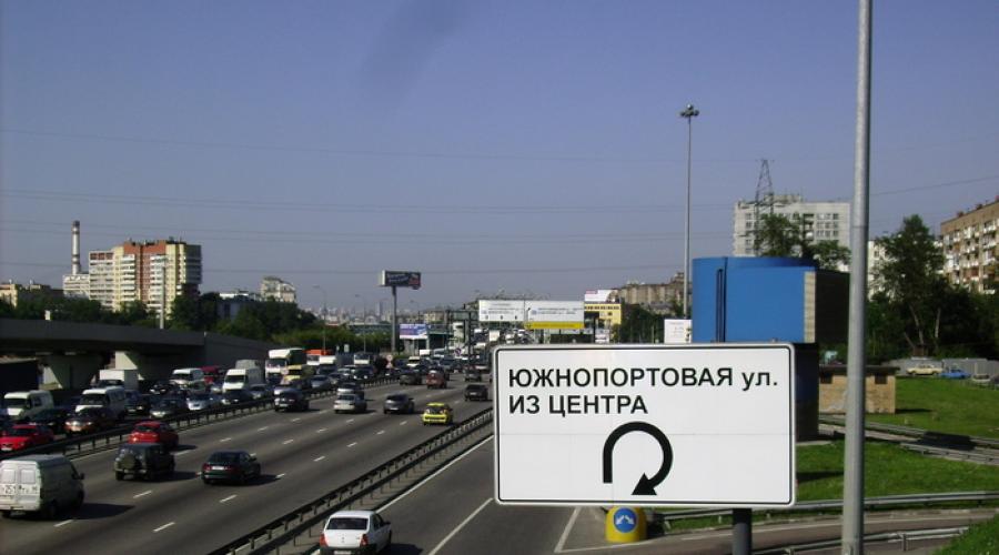
The MKAD is 10 lanes wide; total length - 108.9 km. The mileage on the Moscow Ring Road is counted from the intersection with the Entuziastov highway (the so-called “zero kilometer” is located there) clockwise.
Despite the fact that the Moscow Ring Road is one of the most modern and with the highest throughput roads in the region, it has not been able to cope with the flow of vehicles for a long time. The so-called "traffic jams" are a daily occurrence on the Moscow Ring Road. The reason for traffic jams is the insufficient throughput of exits from the Moscow Ring Road and the lack of special parking spaces for emergency vehicles.
It is assumed that to unload the Moscow Ring Road will help
Central ring road in the Moscow region (TsKAD)
According to the project, the new route will be based on two existing special-purpose automobile rings: the Moscow Small Ring and the Moscow Big Ring (the so-called "betonki"), on the sections of the M-1 "Belarus" highways (Moscow - Minsk, 41.4 km) and M-10 "Russia" (Moscow - St. Petersburg, 38.6 km long).
The total length of the Central Ring Road will be 520 km. The planned number of lanes is from 4 to 8 in each direction. It is planned to build 72 road junctions and 19 railway crossings. The maximum permitted speed is 150 km / h. The construction of the road is planned to be completed in 2012.
Schematic map of the Central Ring Road
The main task of the new route is to relieve transit traffic from Moscow and the Moscow Ring Road. The Moscow Region authorities are already preparing to buy out land plots for the future ring highway. However, according to experts, the process of buying out land under the Central Ring Road may drag on for an indefinite time. In case of disagreement, the owner of the seized plot can start a trial, and economic disputes in Russian courts, according to experts, are usually considered "unhurriedly".
True, the timing of the construction of the new highway will depend not only on the rate of land acquisition. According to representatives of the Federal State Unitary Enterprise "Roads of Russia", even the concept of an investment project for the construction of the Central Ring Road is not yet ready. At present, the employees of the unitary enterprise are studying the documentation prepared by foreign expert companies, and only after that the concept will be finally formed and sent to the Ministry of Transport of the Russian Federation.
Interchange MKAD
The road on high-speed sections was laid taking into account the technical requirements for the construction of a high-speed highway with an estimated speed of 140 km / h. On different sections of the road, from 4 to 8 lanes of traffic are provided, depending on the traffic intensity.
Exits from the Central Ring Road and entrances to it will be carried out only through 34 multi-level transport interchanges. On the Central Ring Road, it is also planned to build 95 overpasses at the intersections with railways and territorial highways. Crossings with rivers, streams and watercourses in order to ensure the connectivity of natural ecological territories are provided with the use of 56 bridges.
For pedestrians, it is planned to build 22 underground and overground pedestrian crossings. The development of the largest logistics centers on the most important rail and road routes is envisaged. A total of 2.5 thousand hectares have been reserved for the development of logistics centers. 4.2 thousand hectares have been reserved for the development of industrial and production and warehouse zones, for the construction of technoparks and business centers. The comprehensive development of territories related to the placement of industrial and industrial-warehouse facilities also provides for the reservation of more than 4 thousand hectares of territories for multi-storey and low-rise housing construction.
Schematic map of the Central Ring Road
3rd Transport Ring (TTK)
The motor road in the city of Moscow, with a total length of about 36 kilometers, of which about 19 kilometers are overpasses, about 5 kilometers are tunnels. The width of the road in the main sections is at least 8 lanes. There are 17 traffic interchanges on the third transport ring. There are no pedestrian crossings and intersections with other roads at the same level, which allows for continuous traffic along the entire length of the highway.
TTK is one of the three ring roads of the city of Moscow, along with the Garden Ring and the Moscow Ring Road. It crosses the Moskva River four times, in the southern part it runs parallel to the Small Ring of the Moscow Railway, contains three tunnels - the Lefortovsky tunnel, the Kutuzovsky tunnel and the Gagarinsky tunnel. Most of the third transport ring was built in the late 1990s - early 2000s, however, separate sections, built during the Soviet era and subsequently reconstructed, are involved in the ring.

Third ring. Photo (taken on the way to work)
Fourth transport ring
Work on the construction of the Fourth Transport Ring and the northern and southern roads in Moscow is in full swing. The city authorities hope that the appearance of these new highways will significantly improve the road situation in the city.
The length of the Fourth Ring will be 74 km. Most of the route will pass through overpasses and deep tunnels, which are not yet available. At the moment, according to Rostislav Gorbanev, deputy director of the Research and Development Institute of General Planning, work is underway on the section from Izmailovsky Prospekt to Entuziastov highway, where traffic will pass along an overpass. The next stage will be the construction of a section of the highway from Izmailovsky Prospect to Otkrytoye Highway, and then they will begin to build a part of the highway from the Entuziastov Highway to Volgogradsky Prospekt and, at the same time, a deep tunnel in the south. The next stage is the section from Otkrytoye to Leningradskoye Highway, and the last one is from Leningradskoye Highway to Bolshaya Filevskaya Street.
Gorbanev added that the tunnels will be built both with the "old" shield with a diameter of 16 meters, with which the Lefortovsky and Serebryanoborsky tunnels have already been dug, and with a new one, whose diameter is about 19 meters. This, he said, is enough to provide normal four-lane traffic in the tunnels. In the near future, the "old" shield is planned to pass three priority tunnel sections: in the area of the Kantemirovskaya metro station, in the VDNKh metro station and the longest in the area of Preobrazhenskaya and Semenovskaya squares.
As stated in the Research and Development Institute of the General Plan, the authorities hope that by 2015 the new highway will be fully ready.
MKAD in bad weather
The largest ring roads in Russia and the CIS
| Full name | Reduction | Length, km |
|---|---|---|
| Moscow Big Ring | MBK | 550 |
| Central ring road (project) | Central Ring Road | 442 |
| Moscow Small Ring | MMK | 320 |
| Great ring road around Kiev | 213 | |
| Bypassing the city of Chelyabinsk | 139 (built 96) | |
Since Soviet times, abbreviations have become part of our speech. Some of them are known to everyone and everyone, some have a meaning known only to a narrow professional circle. Do you know the decoding of the Moscow Ring Road? Let's talk about this in more detail.
Decoding MKAD
What does this phrase mean? The decoding of the abbreviation MKAD can be as follows:
- Moscow Ring Road.
- Minsk ring road.
In our country, the first value is more popular.
How to use an abbreviation?
We figured out the decoding of the Moscow Ring Road. But how to use this abbreviation in speech? Is it he, she, is it? Moscow (Minsk) is a feminine phenomenon. But does this carry over to the combination of letters?

Experts note that earlier the Moscow Ring Road was an exclusively feminine abbreviation. However, at present there is a "drift" of letter combinations towards the masculine gender. Linguists advise the following:
- In official speech, use in the feminine gender. For example: "The Moscow Ring Road was extremely overloaded on a summer Sunday evening."
- In colloquial speech, it is more appropriate to use the abbreviation in the masculine gender. For example: "The Moscow Ring Road appeared in the distance."
Metropolitan ring road
MKAD is the Moscow ring federal highway. In the period 1960-1984. coincided with the administrative boundary of the capital. Hence the popular phrase "There is no life beyond the Moscow Ring Road" - an irony over Muscovites who do not know about life in the provinces, in the rest of Russia. Today, the boundaries of an actively developing metropolis are far beyond the boundaries of this famous highway and only in some places partially coincide with it.
The main function of the Moscow Ring Road in Moscow is to unload the city's central highways. The need to build such a highway arose in the mid-50s of the last century. It was put into operation in 1962. The total length of the route is 109 km, and a five-lane (in each direction) traffic is organized along it. The permitted speed on the Moscow Ring Road in Moscow is 100 km / h. The capacity is estimated at 9 thousand cars per hour.
By now, two road reconstructions have been carried out - in the 1990s and 2010s. Today there are new plans to modernize the track:
- Construction of back-ups near large shopping malls.
- Creation of stripes for acceleration and deceleration in certain areas.
- Construction of "cloverleaf" type interchanges.

Kilometer Zero (reference point) is located at a fork in the Entuziastov highway. The countdown is clockwise. The track is used not only by personal and freight transport, but also by public ones. Buses move in different parts of it. These are both city (serviced by "Mosgortrans") and suburban, intercity flights.
We presented the scheme of the Moscow Ring Road in the photo. Let's also characterize the road in numbers:
- The total width is 10 strips.
- The length is 108.9 km.
- The width of each strip is from 3.5 to 3.75 m.
- The average distance of the highway from the center of Moscow is 17.5 km.
The Moscow Ring Road in Russia is considered one of the most modern and comfortable highways. But although it has the maximum throughput in the region, alas, it has not been able to cope with the flow of transport for a long time. One of the most "painful" characteristics of a highway is traffic jams. Their reasons are different:
- Lack of ramps for emergency vehicles.
- Low throughput of exits from the ring road.
- Frequent blockage of traffic due to the following government corteges.
- Close proximity to the Moscow Ring Road of large shopping centers - they attract many visitors to the car, which additionally load the track.
- Ineffective clover interchanges.
- The use of the ring road as an interdistrict road, etc.
Minsk auto ring
Another decoding of the Moscow Ring Road is the Minsk Ring Road. Or the M9 highway. This is a highway, which, like the Moscow one, is oriented towards the administrative border of the capital. Its total length is about 56 km.
The construction of the Belarusian road took place in 1956-1963. Initially, it was referred to the 3rd category of highways - with a total width of 7.5 m, it had one lane in each direction.

The road also underwent two reconstructions - in 1980 and 2002. After the last change, the track has acquired a first-class level. It was expanded to wide. Arranged 6-lane traffic. Travel speed is limited to 90 km / h. The throughput capacity of the Minsk auto-ring is estimated at 85 thousand transport units per day.
The MKAD is the Moscow and Minsk ring roads. In official speech, the abbreviation is used in the feminine gender, in colloquial it is also allowed masculine.
History
MKAD near Yasenev
Construction of the road began at the end of the year near the Yaroslavl highway. The first section was opened for traffic in the city. Movement around the entire ring was opened in the city. The ring consisted of 2 roads (two lanes in each direction) of 7-meter width, separated by a 4-meter dividing strip. The edge of the road was lined with corrugated slabs. Two bridges were built on the route across the Moskva River:
- Besedinsky bridge, 1960, engineer. R. M. Halperin, architect. G. I. Korneev (in the area of Kapotnya and the village of Beseda)
- Spassky Most, 1962, engineer. V.D. Vasiliev, architect. K.P.Saveliev (in the area of Strogino and the village of Spas).
In total, there were 7 bridges and 54 overpasses on the ring. Initially, the ring road had 33 two-level interchanges with highways leaving Moscow, and in the early 1980s. at the intersection with Simferopol highway, a three-level was built. Initially, the road did not have an asphalt surface. Poured concrete was used. From August 1960 to the beginning of the Moscow Ring Road ROW served as the administrative boundary of the city of Moscow. In December, the first station of the Moscow metro outside the Moscow Ring Road was opened - Dmitry Donskoy Boulevard.

MKAD in the Strogin area

Zero kilometer of the Moscow Ring Road
Reconstruction of the Moscow Ring Road
The rumors of embezzlement were also prompted by the fact that information boards were not installed on the road in the amount required.

Intersection with Yaroslavl highway
Trunk characteristics
The MKAD is 10 lanes wide; total length - 108.9 km. The mileage on the Moscow Ring Road is counted from the intersection with the Entuziastov highway (the so-called “zero kilometer” is located there) clockwise.
Despite the fact that the Moscow Ring Road is one of the most modern and with the highest throughput roads in the region, it has not been able to cope with the flow of vehicles for a long time. The so-called "traffic jams" are a daily occurrence on the Moscow Ring Road. The reasons for traffic jams are: insufficient throughput of exits from the Moscow Ring Road and the lack of special parking spaces for emergency vehicles; and in the winter, moreover, trucks slip at the exits / entrances from / to the Moscow Ring Road.
Public transport
Currently, Moscow city passenger transport routes (bus) run along different parts of the Moscow Ring Road. The list contains routes that have at least one official stop. Unless otherwise stated, the route is operated by GUP Mosgortrans.
- On the section of the Moscow Ring Road from Entuziastov Highway to Ketcherskaya Street there is a bus route No.
- from Volgogradsky Prospect to Verkhniye Polya Street - No. 655;
- from Verkhnie Polya Street to the 16th km of the Moscow Ring Road - No. 54 and 655;
- from the 16th km to the Kashirskoye highway - No. 95 and 995;
- from Kashirskoe highway to Lipetskaya street - No. 37, 37e, 471;
- from Lipetskaya Street to Kulikovskaya Street - No. 37, 37e, 39 (Vidnoe), 40 (Vidnoe), 42 (Vidnoe);
- from Kulikovskaya Street to the 37th km of the Moscow Ring Road (exit from Yasenev) - No. 37, 39 (Vidnoe), 40 (Vidnoe), 42 (Vidnoe), 101, 165, 202, 262, 710;
- from the exit from Yasenev to Profsoyuznaya street - No. 37, 37e, 39 (Vidnoe), 40 (Vidnoe), 42 (Vidnoe), 642;
- from Profsoyuznaya Street to Leninsky Prospect - No. 642, 767, 781;
- from Leninsky Prospect to Ozernaya Street - No. 767, 781, 816;
- from Ozernaya Street to Ryabinovaya Street - No. 779, 781, 816;
- from Ryabinovaya Street to Troekurovsky Proezd - No. 816;
- from Troekurovsky proezd to Skolkovskoye highway - No. 612 (only along the inner side of the Moscow Ring Road), 816;
- from Skolkovskoe highway to Molodogvardeyskaya street - No. 816;
- from Molodogvardeyskaya Street to 3rd Cherepkovskaya Street - No. 660 (only along the inner side of the Moscow Ring Road), 798, 816;
- from the 3rd Cherepkovskaya street to Rublevskoe highway - No. 798, 816;
- from Rublevskoe highway to Lykovsky passage (Khoroshevsky prospect) - No. 626, 798;
- from Lykovsky proezd to Myakininsky proezd - No. 626 (only on the outer side of the Moscow Ring Road), 798;
- from Myakininsky passage to Marshal Katukov street - No. 631, 640, 736 (only on the outer side of the Moscow Ring Road);
- from Marshal Katukov street to Volokolamskoe highway - No. 631, 640, 736;
- from Svoboda Street to Leningradskoe Highway - No. 173, 199, 472, 817;
- from Leningradskoe highway to Bibliotechnaya street - No. 5, 32, 472 (All routes - Khimki / Dolgoprudny);
- from Dmitrovskoe shosse to Yaroslavskoe shosse - No. 24-25 (Mytishchi), 136;
- from Shchelkovskoe highway to Entuziastov highway - No. 133,.
Sections of the Moscow Ring Road from Ketcherskaya Street (4 km) to Volgogradsky Avenue (10-11 km), from Volokolamskoye Highway (67-68 km) to Svoboda Street (73-74 km), from Leningradskoye Highway (75 km) to Dmitrovskoye Highway (81 -82 km), from Yaroslavskoe shosse (94 km) to Shchelkovskoe shosse (104 km) - Moscow city passenger transport routes (bus) are not served. Although during the reconstruction of the Moscow Ring Road (in the mid-1990s), it was planned to organize bus traffic along all sections of the Moscow Ring Road.
Notes (edit)
Links
Moscow ring road (MKAD)
Today the Moscow Ring Road is the most important transport artery of the capital. Meanwhile, few people know that this road has been over 70 years old, several times during its history it has exhausted its resource, has become obsolete, changed beyond recognition and acquired a new life, and today the Moscow Ring Road is a constantly changing, almost living organism. never tired of responding to new challenges of the time.
Unique photo. Construction of the Moscow Ring Road.

Initially, the Moscow Ring Road was laid down in the Stalinist general plan of Moscow in the 1930s, and its design began in the landmark 1937 year. Then it had to perform the same function as the concrete block being reconstructed today - to protect Moscow from the excessive flow of transit vehicles.
The Moscow Ring Road was designed with a large margin. The city boundaries were then at a considerable distance from the Moscow Ring Road. In such super-urbanized districts of today's Moscow as Vykhino, Yasenevo, Medvedkovo, Altufyevo real rural life reigned before the war. It is worth noting that civilization in Zhulebino, located very close to the Moscow Ring Road, came only in the late 80s, so that the designers' calculations were relatively justified, although in general the city's growth turned out to be much more intense than expected in the most daring forecasts.

Already in 1940, all design calculations were completed, the route was taken out to the area and were already ready to start construction, but the Great Patriotic War intervened in the plans of city planners. In view of the need to supply advanced ammunition and equipment in July 1941, the State Defense Committee decided to build a bypass road at the site of the Moscow Ring Road according to a simplified scheme. The problem was solved in a month, and in the fall, the first columns with equipment and manpower went along the prototype of the Moscow Ring Road.
The importance of the Moscow Ring Road in the defense of Moscow was extremely high. The newest road made it possible to quickly and imperceptibly transfer troops to the required sectors of the front, provide food supplies to the armies, and send the main military transport convoys to bypass the city. All this together contributed to the famous winter counteroffensive near Moscow in December 1941, where the Nazis were put to flight for the first time in the history of the Second World War. The movement of military equipment along the Moscow Ring Road in 1941 was so intense that it gave rise to a historical anecdote about the first traffic jams on the Moscow Ring Road during the War.

After 1945, the road, built in an emergency mode and killed by heavy use, was actually rebuilt and rebuilt. Nevertheless, the Moscow Ring Road with an unpaved surface functioned without repair from wartime until 1956. Reconstruction began only at the very end of 1956 on the 48 km section from Yaroslavskoe to Simferopolskoe shosse. Traffic on this site was opened on November 22, 1960, that is, the work took 4 years.
It took two more years to reconstruct the rest of the Moscow Ring Road. The new asphalted MKAD was a 4-lane road (two lanes in each direction) with a width of 7 meters. A 4-meter lawn was laid out in the center. Even in the 70s, the Moscow Ring Road was relatively isolated from the residential areas of Moscow and the suburbs and performed the original function of a rockad, that is, a bypass highway. With the construction of an asphalt road, captive bridges were also erected.

In 1960, the Besedinsky Bridge was built in the Kapotnya area (today it is also called Brateevsky), and in 1962 the Spassky Bridge in Strogino. In total, by 1980, the Moscow Ring Road had 7 bridges and 54 overpasses. It is noteworthy that there were pedestrian crossings and all traffic lights on it.
By the beginning of the 90s, the capacity of the old Moscow Ring Road was almost completely exhausted. Traffic jams, familiar to Soviet people only from the International Panorama, as an indispensable attribute of ill-conceived urban planning under wild capitalism, striving only to extract super-profits and despising the common man, came to the USSR as well. In 1990-1991, the first reconstruction of the Moscow Ring Road and the most unsuccessful one was undertaken.

It was decided to widen the road with a dividing lawn. Meanwhile, the designers did not care at all about bump stops and the provision of traffic lights for ground crossings. This ill-conceived reconstruction led to an unprecedented accident rate of the ring road. Head-on collisions have become a common occurrence on the Moscow Ring Road, at least pedestrians have been hit by the wheels of drivers. Moreover, this measure did not solve the problem of traffic jams.
In 1993, the average speed on the Moscow Ring Road did not exceed 40 km / h. There was an urgent need for new repairs and a radical restructuring of the road. The then mayor of Moscow, Yuri Luzhkov, and his deputy, who directly supervised the course of work, Boris Nikolsky, took up the case. It was then that the Moscow Ring Road acquired its characteristic features today.

The project involved providing lighting along the entire route and installing a barrier that delimits the directions of flows. Then it was planned to significantly expand the highway by increasing its width to five lanes in each direction, as well as to bring the road surface and infrastructure in accordance with international requirements for high-class highways. The work was carried out for about five years and became truly the best embodied project of Yuri Luzhkov.
In addition to the construction of a number of new bridges, tunnels, overpasses, junctions, old junctions and ramps were actually rebuilt. Today it is customary to criticize the Luzhkovsky MKAD, first of all, for the ill-conceived clover interchanges and narrow ramps. Marat Khusnullin has to solve this problem today. Nevertheless, at the time of 1997, namely for the 850th anniversary of Moscow, which was celebrated on an unprecedented scale, the Moscow Ring Road was surrendered, the engineering solutions that were applied during its construction were the most modern and, in relation to the previous state of the road, simply revolutionary.

Any project of this scale, and the length of the Moscow Ring Road exceeds 100 km, is not without certain difficulties, miscalculations and even crimes. Likewise, there were thefts at Luzhkov's reconstruction of the Moscow Ring Road, which was later established by the investigation and the designers again did not guess with the increase in the number of cars in Moscow, but nevertheless, this was the most large-scale and necessary degeneration of the Moscow Ring Road throughout its history.
The main thing that was achieved thanks to the restructuring of the road is the elimination of head-on collisions on the road and the reduction of the death of pedestrians to a minimum. Luzhkov abolished all ground crossings from the Moscow Ring Road and erected overground ones. Today they look unsightly, it is difficult for older people to climb them, often such crossings become places for the needs of marginalized segments of the population, but nevertheless, they are much safer than their predecessors - traffic-free ground ones.

Nevertheless, despite all the revolutionary nature of Luzhkov's changes, the Moscow Ring Road was again morally obsolete in the mid-2000s. The number of cars grew exponentially, and clover interchanges were completely unable to cope with so many of them. In addition, due to the fact that there were no places for emergency vehicles on the Moscow Ring Road, any accident led to many kilometers of traffic jams.
It was the transport problem that became one of the reasons for Luzhkov's dismissal from the post of mayor "due to the loss of confidence." The new mayor of the capital Sergei Sobyanin undertook to radically solve the transport problem. The Moscow Ring Road was again expanded in some areas, “Sobyaninskie pockets” for parking appeared, a massive reconstruction of interchanges and the construction of new ones began.

The next renovation of the ring road is taking place under the direct supervision of Marat Khusnullin, First Deputy Mayor for Urban Development Policy and Construction. Time will tell whether new attempts to solve the transport problem on the Moscow Ring Road will lead to the expected results, but it is already becoming obvious that the construction of interchanges and the expansion of both the Moscow Ring Road itself and the outbound routes will not solve this issue. A number of operational and cardinal measures are required in urban planning, transport links and overcoming the costs of the city's radial planning.
The birthday of Moskovskaya Koltseva has not been clarified.
Tolya is November 22, 1960, when traffic opened on the first section of the legendary Moscow ring road - from Yaroslavskoye to Simferopol highway.
But the ring road became only in 1962.
The design of the ring road began even before the war - in 1937, in 1939 it was tied to the terrain, and in 1940 Soyuzdorproekt completed the design assignment for the construction of the Moscow Ring Road.
But the war came, and in July 1941 the State Defense Committee decided to build a road according to a simplified project - in just one month! In a short time, 30 km of new roads were completed and about a hundred kilometers were reconstructed. Then there was an urgent need for this - it was necessary to transfer troops and military equipment for the defense of Moscow and the counteroffensive.
Initially, the road had no asphalt surface - poured concrete was used. From August 1960 to early 1984, the Moscow Ring Road ROW served as the administrative boundary of the city of Moscow.

Autumn 1941 - on the initiative of G.K. Zhukov, a decision was made to urgently build a circular bypass of Moscow in a simplified version. To speed up the work, sections of already existing highways were connected into a ring, overpasses were built at the intersection with highways and railways, and floating bridges were built over water barriers. This route became one of the main defense belts of the capital and contributed to the successful conduct of the counter-offensive operation and the defeat of the Nazis near Moscow.
Construction of the road (not counting the pre-war and wartime) began at the end of 1956 near the Yaroslavl highway. The first section was opened to traffic in 1960, traffic around the ring - in 1962
Photo of the 1960s in comparison with I. Levitan's painting "Vladimirka", 1892.

On the Moscow Ring Road

MKAD near Profsoyuznaya street

At the stops there were voluminous maps.

Photo taken in 1970


MKAD, north 1972

Patrol helicopter of the State Traffic Inspectorate over the Moscow Ring Road

MKAD in winter 1972


A place somewhere between Mozhaika and Rublyovka

Intersection with Rublyovka

Ground crossing on the Moscow Ring Road

1991 It is not surprising that on such a road, cars constantly converged head-on, mercilessly beat pedestrians. More than two hundred people died on the Moscow Ring Road every year and more than a thousand were injured. For this she received the nickname "road of death".

1992 TPP-22. Separation room on the Moscow Ring Road was arranged in 1993-1994, and in 1995 they began to expand the track (southern and southwestern sectors).

1998 year. The end of the reconstruction. Many legends and scandals are associated with the reconstruction of the Moscow Ring Road. There is a version that Luzhkov stole 10 centimeters from each roadside and earned millions. No less funny story about the pillars - when the Moscow Ring Road was being repaired, when distributing contracts, they had to re-measure it. And it turned out that the kilometer pillars stand as necessary - the largest distance between the kilometer pillars was 1800m, and the smallest - 700m. Despite the absurdity of the situation, they decided to keep the location of the pillars - the police and road services are used to their location and know where it is, and if the message "there is an accident at such and such a kilometer," they know where to go.

MKAD now.
