Black sea and coastal cities map. Map of the black sea coast of russia
Read also
You can see where the Black Sea is on the map above. The sea is located in Europe and belongs to the Atlantic Ocean with which it is connected by straits and seas.
The chain from the Black Sea to the Atlantic Ocean is as follows: in the south-west of the Black Sea through the Bosphorus, the sea connects with the Sea of Marmara, the Sea of Marmara through the Dardanelles Strait connects with the Aegean Sea, the Aegean Sea connects with the Mediterranean, and the Mediterranean Sea in the west through the Strait of Gibraltar connects with the Atlantic Ocean.
One of the most interesting facts about the past of the Black Sea is that this is a former huge freshwater lake, which in just a few decades (according to various estimates from 1 to 50 years) became a salty sea. This happened as a result of the increase in the level of the world ocean and the erosion of the barrier between the Sea of Marmara and the then lake, forming the Bosphorus Strait.
By the way, why is the Black Sea called black?
According to one of the versions, in ancient times, boats and ships that have been in the Black Sea darken and turn black where the tree came into contact with water. A similar effect is obtained due to hydrogen sulfide, which is filled with the Black Sea. When the tree is exposed to hydrogen sulfide, it turns black, of course people paid attention to this and I believe it is from here that the Black Sea got its name.
Hydrogen sulfide in the Black Sea
Hydrogen sulfide, as you probably know, is a colorless gas with the smell of rotten eggs. In large quantities, the gas is poisonous and of course it comes out and sometimes quite violently.
This gas, by the way, is flammable! It was said that lightning striking the sea where there was a sufficient concentration of this gas ignited.
Hydrogen sulfide is contained in large quantities at depths of 100 meters and at the very bottom. Therefore, living organisms are almost absent at depth, and in general there are several times less of them in the Black Sea than in the neighboring Mediterranean.
Brief information about the Black Sea
The sea area is 422 thousand square kilometers. The maximum depth is 2210 meters, and the average is just over a thousand. Seven countries have access to the sea: Russia, Georgia, Abkhazia, Turkey, Bulgaria, Romania and Ukraine. The water border between Europe and Asia runs along the Black Sea.
Krasnodar Territory is located in the southwest of the North Caucasus. The map of Krasnodar Territory clearly shows that the region borders on the sea with the Crimea, overland - with the Stavropol Territory, Rostov Region, the Republic of Abkhazia, Adygea and Karachay-Cherkessia. The region is washed by two seas: the Black and the Azov. The area of the region is 75 485 sq. km.
Krasnodar Territory is divided into 38 municipal districts, 26 cities, 411 villages and 12 urban-type settlements. The largest cities in the region are Krasnodar (administrative center), Sochi, Novorossiysk, Armavir and Yeisk.
The economy of the Krasnodar Territory is based on agriculture and processing industries. Interestingly, the region is the oldest oil-producing region in Russia. In addition, the Krasnodar Territory is the main supplier of valuable tree species. The region's economy has improved significantly thanks to investments related to the 2014 Olympics in Sochi.
Historical reference
In 1860, the Black Sea Cossack army was located on the territory of the modern Krasnodar Territory. In 1917, the Kuban region was formed, which in 1937 was turned into the Krasnodar Territory.

Must Visit
On a detailed satellite map of the Krasnodar Territory, you can see the main resort cities: Sochi, Anapa, Tuapse, Gelendzhik, Adler, Yeisk and others. It is recommended to visit the waterfalls of the Krasnodar Territory - Bolshoi Adegoysky waterfall, Count ruins, Agursky waterfalls, Gebeussky waterfalls and the gorge of 40 waterfalls. Among the natural attractions also stand out: Mount Svintsovaya in Abinsk, Abadzekhskoe gorge near Apsheronsk, mud volcano Akhtanizovskaya volcano, Cape Chugovpas and Dagomys troughs.
It is worth visiting the champagne museum in Abrau-Dyurso, the archaeological reserve "Gorgippia" in Anapa, water parks in Gelendzhik, on the beaches of Dzhemete, in the Old Park in Kabardinka, on Mount Shahan in Krinitsa, on the Witch Lake in the Mostovsky district, in the Riviera park in Sochi and the Lermontov Museum in Taman.
Black Sea- the inland sea of the Atlantic Ocean. The Bosphorus Strait connects with the Sea of Marmara, then, through the Dardanelles Strait, with the Aegean and Mediterranean Seas. The Kerch Strait connects with the Sea of Azov. The Crimean Peninsula cuts deep into the sea from the north. The water border between Europe and Asia Minor runs along the surface of the Black Sea.
Area 422,000 sq. Km. The outlines of the Black Sea resemble an oval with a longest axis of about 1150 km. The greatest length of the sea from north to south is 580 km. Maximum depth - 2210 m, average - 1240 m.
The only large peninsula is the Crimean one. The largest bays are: Yagorlytsky, Tendrovsky, Dzharylgachsky, Karkinitsky, Kalamitsky and Feodosia in Ukraine, Varnensky and Burgas in Bulgaria, Sinop and Samsunsky - near the southern coast of the sea. Estuaries overflow in the north and north-west at the confluence of rivers. The total length of the coastline is 3400 km.
A number of sections of the sea coast have their own names: the southern coast of Crimea, the Black Sea coast of the Caucasus in Russia, the Rumeli coast and the Anatolian coast in Turkey. In the west and northwest, the shores are low-lying, steep in places; in Crimea - mostly low, with the exception of the southern mountainous shores. On the eastern and southern shores, the spurs of the Caucasus and Pontic mountains come close to the sea.
There are practically no islands in the Black Sea. The largest are Berezan and Zmeiny (both with an area of less than 1 sq. Km).
The following major rivers flow into the Black Sea: Danube, Dnieper, as well as smaller Rioni, Kodori, Inguri (in the east of the sea), Chorokh, Kyzyl-Irmak, Ashli-Irmak, Sakarya (in the south), Southern Bug and Dniester (in the north ).
The fauna of the Black Sea is noticeably poorer than the Mediterranean. The Black Sea is home to 2.5 thousand species of animals (of which 500 species of unicellular, 160 species of vertebrates - fish and mammals, 500 species of crustaceans, 200 species of molluscs, the rest - invertebrates of various species), for comparison, in the Mediterranean - about 9 thousand . kinds.
Among the fish found in the Black Sea: various types of gobies (bighead goby, whip goby, round goby, martovik goby, sleeper goby), Azov hamsa, Black Sea hamsa (anchovy), katran shark, gloss flounder, five species of mullet, bluefish, hake, sea ruff, red mullet (common Black Sea sultan), haddock, mackerel, horse mackerel, Black Sea-Azov herring, Black Sea-Azov tulka, etc. There are sturgeons (beluga, Black Sea-Azov sturgeon).
Among the dangerous fish of the Black Sea are the sea dragon (the most dangerous are the poisonous spines of the dorsal fin and gill covers), the Black Sea and noticeable scorpion fish, the stingray stingray (sea cat) with poisonous thorns on its tail.
The largest port cities on the Black Sea:
Burgas, Varna (Bulgaria);
Batumi, Poti (Georgia);
Novorossiysk, Sochi, Tuapse (Russia);
Constanta (Romania);
Samsun, Istanbul, Trabzon (Turkey);
Odessa, Kherson, Ilyichevsk (Ukraine)
Kerch, Sevastopol, Yalta (Crimea)
A river waterway runs along the Don River, which flows into the Sea of Azov, connecting the Black Sea with the Caspian Sea (through the Volga-Don navigable canal and the Volga), with the Baltic Sea and the White Sea (through the Volga-Baltic waterway and the White Sea-Baltic canal) ... The Danube River is connected through a system of canals to the North Sea.
The Black Sea washes several states at once, in each of which it becomes a popular recreational facility. The coast is a quality resort area with a variety of recreational activities.
Geographical position of the Black Sea
The Black Sea washes the coast of Russia, and its waters also belong to six more states. In each country, a considerable number of tourists go to the sea, wishing to sunbathe and swim in warm sea water. It is best to rest here from late May to early October, when the water temperature exceeds 20 degrees, and sunny weather contributes to sunburn. The geographical position is good not only in terms of recreation, it is of great economic, transport and military importance.
In its shape, the Black Sea resembles an oval.
The longest length from coast to coast along the axis is 1,150 km, the greatest depth is 2,210 m. This makes the sea in demand for deep-sea diving enthusiasts. The Crimean Peninsula is located in the northern part of the Black Sea. The sea delimits the European and Asian parts of the continent. An interesting feature is the lack of islands.
The Black Sea had many names, it was called Russian, more than 20 names are known in total. There are several versions of the appearance of the modern name, each culture adheres to its own versions. According to one of the versions, the north on the maps used to be designated in black, and the Black Sea is located just in the north. Another gloomy version connects the name of the object with the history of its appearance - in its present form, the Black Sea was formed 7,500 years ago, with the formation of a connection with the Mediterranean Sea, salty sea water got into it. This led to the extinction of many freshwater inhabitants.
 Scientists associate the name with the fact that objects raised from the bottom are black. The reason is hydrogen sulfide at a depth of 200 meters. Among the reasons are called black silt thrown ashore and strong storms (even desperate sailors found themselves leaving ports in bad weather). Among the Turks, the version is widespread that the sea got its name because of the rebelliousness of the shores; when trying to conquer local cities, they had to face fierce resistance.
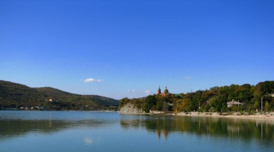
Detailed map of the Black Sea coast of Krasnodar Territory with villages- in this article. Last summer, my whole family decided to make a short trip to the Krasnodar Territory. Before that, we had already been in the south of our country and instead of going to some separate resort, we decided to make a trip along the entire coast. After all, the resorts of the Krasnodar Territory on the map of the coast from Anapa to Adler stretch for 356 kilometers and are numbered in dozens. Moving from one settlement to another, on average, takes from a few minutes to an hour. Thus, you can visit many resorts, staying in each from 1 to 3 days.
Abrau-Dyurso
The next point was the resort village. We reached it in less than an hour and arrived early in the morning. We only planned to spend one day here. We stopped at the guest house "Chocolate" in the village of Dyurso right on the seashore. Abrau-Dyurso itself is located on the shore of Lake Abrau, a few kilometers from the coastline, and the village of Dyurso is right on the shore. There are several beaches, including those with small estuaries, which quickly warm up and are ideal for swimming for children. In the morning we swam on the central beach of Durso. Pebble beach, wide with developed infrastructure. In the afternoon, leaving the car at the guest house, they called a taxi and went to the very center of wine tourism in our country - the Abrau-Dyurso sparkling wines factory.

This is a truly unique place that was founded by Count Golitsyn at the end of the 19th century. Here they show huge areas with vineyards and talk about the art of growing grapes for the production of sparkling wines. We looked at the production process, relatively recently it was completely modernized under the clear guidance of Moet Chandon specialists. Perhaps that is why the usual champagne "Abrau Durso" does not differ at all from the legendary French. We visited huge cellars with wine storage and tasting. The brand store sells products at factory prices, while some rare vintage champagnes are only available here.
In the evening we walked along the embankment of Lake Abrau - one of the best embankments in the resorts of the Krasnodar Territory on the coast map. The embankment is lined with colored paving stones, with many flower beds and lawns and rich infrastructure. We rented a boat on the embankment and rode for an hour along the coast. After having dinner in one of the cafes, we returned to the village of Dyurso to our guest house by taxi to go to the next city early in the morning. A detailed map of the Krasnodar Territory - the Black Sea coast helped us to lay the route.

Detailed map of Krasnodar Territory Resorts: Gelendzhik and Divnomorskoe
The next morning we went to the city located in Bolshoi Gelendzhik. The distance between them on the detailed map of Krasnodar Territory Resorts is only 10 kilometers. Therefore, we decided to stay in Divnomorskoye, since the water in the sea is the cleanest here, and in the afternoon, after lunch, you can go to for entertainment and sightseeing.

A detailed map of Krasnodar Territory Resorts helped us get to Divnomorskoye. We arrived there early in the morning and stayed at the guest house "Alpina", the room rate was 2300 rubles. for four people in June, though I had to bargain a bit. The beach is very nice and well maintained, there is a lot of entertainment for both children and adults. Children happily rode on inflatable slides, miniature electric cars that can be rented on the chic waterfront. I took a ride on a jet ski, after which we had lunch in one of the cozy cafes, and we went to Gelendzhik to the safari park.
The safari park is located right at the foot of the mountain slope, the route along the sea runs near it. At the entrance, we immediately bought tickets not only to the safari park, but also to the cable car to climb to the very top, to the observation deck and visit the terrarium with reptiles. The safari park was liked not only by children, but also by us - adults. It is very well-groomed, and the number of rare animals and especially predators is simply amazing.

There are also areas here, fenced off with durable plexiglass, behind which shooting galleries run a few meters away. There are also cougars, leopards, jaguars, grizzly and Himalayan bears, ostriches and wild boars, monkeys. At the entrance, you can buy dried fruits to feed the animals. The most notorious "beggars" were bears. They stand on their hind legs and tirelessly "beg" for food. Many people buy them ice cream, for which the animals were very grateful.
The views from the observation deck are magnificent, and Gelendzhik Bay, like the city itself, looks like a palm.
After visiting the safari park, we decided to take a yacht ride. We had a choice: sailing on a private sailboat or on a large yacht with a group. We decided to take a ride on a large yacht, where there is an entertainment program during the boat trip, and tickets are cheaper. The two-hour walk from the bay to the open sea is very fun, on the way back you can watch the red sunset and take wonderful photos for memory. They decided to spend the evening on the Gelendzhik embankment. This is the busiest place on the entire coast. There are dozens, if not hundreds of different cafes, restaurants, clubs and discos here. You can walk until late at night, as the embankment is the longest and most beautiful. Its length is about 10 kilometers, with many flower beds, lawns, decorative figures. We dined with the whole family in an excellent restaurant on the territory of the Primorye hotel, after which we visited the amusement park on the embankment next to the stadium. After walking a little more to the steep rock "Krucha", which is as high as a 16-storey building, we decided to return to Divnomorskoye to our guest house, since the next day we were to go to the largest water park in Russia.
The next day, while everyone was asleep, I went to the beach and swam in the clear sea. After that, at around ten o'clock in the morning, we went to Gelendzhik to the water park "Zolotaya Bukhta". The water park is really cool. On the territory of 17 hectares there are 17 swimming pools, 69 slopes, 49 slides, about 10 water attractions, many bars, cafes, pizzerias. The ticket price is 1400 rubles for adults, 650 rubles for children. Free admission only for children under 106 cm in height.

While we were in Divnomorskoye and Gelendzhik, we visited the Old Park in, and took a ride in an off-road vehicle to the valley of dolmens. If there were no children with us, then of course it would be possible to visit one of the most famous and largest clubs in Russia "Formula", but we could not do this. After staying in this place for 4 days, we went further. We studied the resorts of the Krasnodar Territory on the map of the coast, and chose the village of Loo.
Loo
We got from Gelendzhik to about an hour and a half and stayed at the Dolce Gusto mini-hotel. The hotel is located near the sea. We rested on the central beach of the village, which is about 150 meters wide. The infrastructure is well developed here, with many water attractions and entertainment for children. They rode electric cars along the embankment, jumped on trampolines and played on inflatable towns. My wife and I took turns riding a banana, which the organizers dragged on a jet ski at high speed along the beach. The sea water in this resort is very clean and it is a pleasure to swim in it. Before lunch, we rested and relaxed on the beach, and after that, having a bite, we went to see something in the village or the surrounding area. We visited the ruins of an ancient Byzantine temple, which is located on the territory of the village, 33 waterfalls, rode horses in the valley of the Ashe river. The whole family ate in cafes and canteens, of which there are a lot of them, the average bill for four is no more than 600 rubles. After resting in this place for 3 days, we went further in the direction of the southeast of the Black Sea coast. A detailed map of the Krasnodar Territory, the Black Sea coast helped to lay the route.

Dagomys, Sochi, Adler
These resorts of the Krasnodar Territory on the coastal map have no boundaries. The private sector has grown so much that in fact it all constitutes one settlement of Greater Sochi. To save on accommodation, we rented a two-room apartment in advance for 2000 rubles per day at. The apartment had a kitchen, so we decided to cook on our own.
We had a car at hand, so we could go to any beach we liked, and after lunch we could go to any attraction. During our week in this part of Greater Sochi, we rested on the wide pebble beaches of Dagomys and the Riviera beach in Central Sochi. At first, we only went to the Riviera, but because of the huge traffic jams in Sochi, we preferred the central beach of Dagomys. The situation is the same on all the beaches of Greater Sochi. There are many attractions here, the infrastructure is well developed and in most cases the width of the beaches is 20-30 meters.

During the week we visited the amusement park in Adler, the oceanarium in Adler, the Olympic village. We got to these places by public transport, by train. They go often and this is the only way to avoid traffic jams in Sochi during the day. I went rafting alone by taking a tour. Overcame several rifts along the Mzymta mountain river. We visited the Sochi Sky Park with many attractions, here is the highest point for jumbo jumping. We walked along the longest suspension bridge in the world and it is an unforgettable experience. We went to the mountains nearby. From here, not only wonderful views of the sea and mountain peaks open, but there are also old tea houses where you can taste various varieties of tea made from herbs of the Caucasian foothills, many varieties of honey collected from local apiaries.

An excursion to Abkhazia is worth highlighting. We bought an excursion for one day - we drove through all the main cities of this republic. The route includes a visit to Gagra, Pitsunda, the Athos monastery, a mountain cave near the monastery, mountain lake Ritsa, Stalin's summer cottage and a drive through many mountain gorges, including a drive along the edge of a cliff at an altitude of several hundred meters called "Farewell Homeland." To pave the route further, I needed a map of the Krasnodar Territory with cities - the Black Sea coast.
Lermontovo
Lermontovo was the next resort in the Krasnodar Territory on the coastal map. We had only a few days left and, having left Dagomys early in the morning, so as not to get stuck in traffic jams on the highway, we drove back in the direction of the mainland. An hour and a half later we were in a resort village, not far from the M-4 Don highway. Lermontovo is one of the very first and very comfortable villages on the Black Sea coast, where vacationers find themselves, having overcome their way to the sea along the M-4 “Don” highway. On the contrary, we decided to stop here and spend our last day at sea. We stayed in a very nice guest house called "Eden". A room for four people, category "standard" in June cost 2000 rubles. There are quite comfortable living conditions here, but the most important thing for us was to get a cozy and calm place where you can spend the night, since the most important thing on the last day of our stay at the sea was relaxing on the beach. The embankment and the beach in Lermontovo fully correspond to the foundations of an aesthetic and calm beach holiday. The infrastructure is very well developed here and there is a lot of entertainment. First of all, this is the Chernomor water park, horseback riding tours, quad biking, a visit to the African village "Lim-po-po", a trip to the Tengin waterfalls. We just spent time on a great, sandy beach and were completely satisfied with the time we spent on the Black Sea coast.

To travel by car, you need an up-to-date detailed map of the Black Sea coast of Krasnodar Territory with villages... There are many cities on the coast, the distance between some of them is only 1-2 km. A detailed map of the Krasnodar Territory resorts on the Black Sea coast helped us plan our trips. We reached Moscow in the same time as from Moscow to Anapa, in about 27 hours, regularly replacing each other while driving and making stops. Our plans were to visit, on the way back, but in the end we abandoned this idea and left visiting these places until the next time.