Central African countries. Central Africa
Read also
This region is located in the central part of the mainland and consists of nine countries. It includes Angola, Gabon, Democratic Republic of the Congo, Cameroon, Congo, Sao Tome and Principe, Central African Republic, Chad, Equatorial Guinea. In addition, this includes the British possession of St. Helena. In terms of the level of instability and poverty, the countries of this region are inferior only to the states of East Africa. The regional leader is the Democratic Republic of the Congo.
Democratic Republic of the Congo
General information. The official name is the Democratic Republic of the Congo. The capital is Kinshasa (over 5 million people). Area - 2,300,000 km 2 (12th place in the world). Population - more than 55 million people (23rd place). The state language is French. The monetary unit is the Congo franc.
Geographical position. The country is located almost in the very center of Africa in the Congo Basin, hence its name. It has a very narrow outlet to the Atlantic coast (37 km). In the west it borders on Congo (Brazzaville), in the north - with the Central African Republic, in the northeast - with Sudan, in the east - with Uganda, Rwanda, Burundi, Tanzania and Zambia, in the south - with Angola. Different parts of this large state have different assessments of their own geographic location.
History of origin and development. In the pre-colonial times of the Middle Ages, several African states existed on the territory of the present state of the DRC (Congo, Cuba, Luba, Lundos, Kakongo). At the end of the XVI century. the Portuguese appeared on the coast of the last state. Since then, various European states have tried to take possession of these lands. In the end, the territory of the Congo was taken over by Belgium and from the beginning of the XX century. until 1960 it was a Belgian colony. In 1960, independence was proclaimed, followed by a civil war and a military coup. With the coming to power of Mobutu, the central government was strengthened. From 1971 the country was renamed Zaire. More than 30 years of Mobutu's one-man rule ended in another war and victory for the opposition. The country was returned (1997) to its former name.
State structure and form of government. DRC is a unitary state, a presidential republic. The head of state and government is the president. Legislative power is vested in parliament. It is formed by 300 deputies. The country is divided into 11 regions.
Natural conditions and resources. The relief of most of the Congo is flat and elevated (the valley of the Congo River and its many channels). In the east there are mountains with active volcanoes. The highest point is Mount Margarita (5109 m). The climate in the country is equatorial and subequatorial with average monthly temperatures throughout the year from 22 ° С to + 28 ° С.In the equatorial belt, there are 2500 mm of rain per year, in the subequatorial - more than 1000. There are dry and wet periods in this belt. In the equatorial belt, it rains all year round.
The central equatorial part of the country is covered with dense, mostly swampy forests. In the north and south of the country, where there is less precipitation, dry woodlands prevail. The mountains are covered with dense forests with a fairly rich flora and fauna, especially the famous mountain gorillas.
Congo is one of the richest countries in water resources in the world. The second deep river of the planet Congo flows here. It has many large and small tributaries. The eastern part of the country is adjacent to one of the largest and deepest lakes in the world - Tanganyika.
DRC has significant natural resource potential. Mineral resources are allocated: energy carriers and ores of ferrous and non-ferrous metals. The former include oil, natural gas, coal and oil shale, while the latter include deposits of iron and manganese ore. In terms of ore reserves of such strategic metals as tantalum and niobium, Congo ranks first in the world. There is a famous "copper belt" in the country. There are also deposits of bauxite, zinc, nickel, lead, cobalt, tungsten and molybdenum, beryllium and cadmium, etc. No less significant reserves of diamonds, gold, silver, uranium, radium, germanium, as well as potassium salts, asbestos, graphite, sulfur and etc.
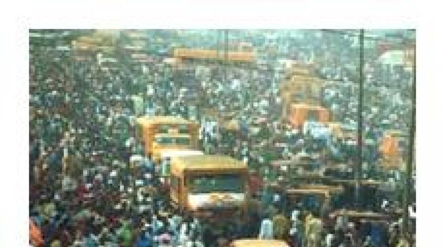
Population. The average population density is low and barely exceeds 24 people per 1 km2. The central and mountainous regions are least populated, in all - the western ones. The birth rate and natural population growth are among the highest on the planet, respectively - 46.5% and 31.5% o. The share of the urban population is still insignificant (30%), but continues to grow rapidly. The ethnic composition of the population is even more variegated than in Nigeria. No nation exceeds 18% of the total population. The religious composition of the country's inhabitants is also variegated. About 50% are Catholics, 20% are Protestants, 20% are adherents of traditional African beliefs. There are also African Christians and Muslims.
Household. The basis of the country's economy is agriculture and industries that process its products. More than 80% of the economically active population is employed here. The cultivation of food crops prevails, which the population consumes for food (sweet potatoes, yams, cassava, corn, taro, rice). Marketable export crops are also grown - peanuts, coffee, cocoa, bananas, cotton, oil palm, sugar cane, and tea. Animal husbandry plays a supporting role. Fishing is developed. Fish are caught in rivers and on the coast of the ocean. Congo is characterized by intensive harvesting of valuable tree species, collection of cinchona bark and hevea sap.
Mining prevails among the industries, in particular the extraction of oil and coal. The exploitation of deposits of gold, silver, diamonds, copper ore, cobalt, zinc, cadmium, etc. is of international importance. On this basis, the oil refining and petrochemical industries, as well as nonferrous metallurgy, are developing rapidly. Machine-building enterprises have appeared recently. Traditional development of light industry enterprises, primarily textile factories, woodworking and food industries.
The transport provision of the state is still insufficient. The length of railways is more than 5 thousand km, motor roads - 150 thousand km (these are also dirt roads, which are the majority). At the mouth of the Congo is the main sea and river port of the country - Matadi. The Congo and its tributaries, although very deep, have many rapids that make navigation difficult. Pipeline transport is developing. The DRC has five international airports, the largest of which is in the capital.
Culture and social development. In the Congo, there are no ancient settlements and traces of prehistoric civilizations. There are 5 sites on the UNESCO list and all of them are national natural parks.
A 6-year education is compulsory. Literate - about 75%. There are just over 180 students per 100 thousand people. Poor health situation. The number of potential patients per doctor (24 thousand people) is striking. This is not often found even in Africa. A very high mortality rate for children under one year old, which in some regions is almost 100%. Congo is also one of the countries with the world's lowest life expectancy rates for its citizens. For men, the average age is 47, for women 52. Congo has one of the highest rates of AIDS in the world. Sleeping sickness is also common, spread by the famous tsetse fly.
Ukraine does not have permanent ties with the DRC. The main foreign economic partners of the latter include, in addition to the former metropolis of Belgium, also the United States, France and Germany.
Questions and tasks
1. Name and show on the map the countries of Central Africa,
2. In what year was the independence of the Democratic Republic of the Congo declared?
3. What do you know about the natural resource potential of the Democratic Republic of the Congo?
4. What is the main economic sector in the Democratic Republic of the Congo?
Central Africa is a subregion that occupies the central part of the continent, from the west coast to the East African rifts in the east. This African region frames the equator, including not only the equatorial strip, but also the subequatorial one.
This area is truly the "heart" of the continent, as it is very rich, mineral raw materials from here are carried all over the world - copper, iron ore, uranium. Wood is especially prized, and some countries produce oil.
In this regard, the countries of Central Africa have amazing potential, only it has not yet been revealed, which is largely due to history. During the colonization period, foreign invaders cared little about the development of the local economy, so its current level is often low. Organized and efficient production facilities exist only locally, which did not exist at the time.
The entire region occupies a quarter of the total area of the continent, however, the population in the countries of central Africa is only one seventh of the total population of the continent.
Within Central Africa, there are, in whole or in part, the following countries: 
- Nigeria;
- Democratic Republic of the Congo (Zaire);
- Cameroon;
- Central African Republic;
- Republic of the Congo;
- Gabon;
- Equatorial Guinea;
- Sao Tome and Principe;
- Angola.
The countries of Central Africa became independent in the period from 1950 to 1974 from the following European colonialists:
- Belgium;
- Spain;
- Portugal;
- France.
The location is positive for further development, since many territories have access to the Atlantic Ocean, through which transport routes leading inland to Africa pass.
All these states are members of the UN, while Gabon is also a member of OPEC.
Nigeria is the largest in this besides its largest population on the mainland. The inhabitants belong to different tribes:
- Yoruba;
- hausa;
- fulbe.
There are other ethnic groups, therefore, feuds between them periodically happen, which was the reason for several military coups in an independent history.
And yet, the development of the economy did not stop, despite the political situation, especially the presence of oil fields in the local lands influenced this.
Tourism also brings great profits, because in the local rainforests and savannas there are various cultural and historical sites of interest.
Democratic Republic of the Congo is also a large country in central Africa, which has experienced many military clashes on political grounds. It was possible to resume a quiet life here with the help of the Europeans, who are interested in this state of affairs. And this is due to the presence of various and numerous natural resources in Zaire.
St  wound Cameroon differs from the background of its neighbors in stability in the internal order. The political system works well, coordinating the general development of the territory.
Cameroon, unlike many other African powers, was able to provide its population with food. This became possible as a result of the orientation towards a market economy and the support of private property. And yet the locals are quite poor due to the underdeveloped industry.
Chad is still an underdeveloped country, where the standard of living is low, as well as the economic one. This is mainly due to constant military coups due to clashes between tribes.
The developed powers, which provide assistance and protection, have a great influence on the country. The development of oil found here ten years ago is considered a particularly profitable investment. There are also other resources exported abroad.
V CAR there are rare natural resources that are valued in the world:
- diamonds;
- gold;
- Uranus;
- oil;
- forests.
And yet the population in the Central African country of the CAR is quite poor, since the level of the economy here remains one of the lowest in the world. Many goods are imported, including food.
Republic of the Congo was able to seriously develop the economy, this became possible due to the presence of numerous natural resources, in particular - the export of oil made it possible to achieve a sufficiently high standard of living for local residents.
The modern political system is oriented towards democracy, and the economy is active and  Uses a market model.
The rest of the countries are small in size. Gabon stands out among them, because it has a very high level of GDP, therefore it is one of the richest countries in Africa, moreover, the situation in it is very stable.
Equatorial Guinea is considered the richest on the continent, which happened after the start of active exploitation of oil and gas fields.
Republic of Sao Tome and Principe is an island state, the smallest in Africa after the Seychelles. Those who are looking for unity with exotic nature like to come here, you can also admire the ancient buildings of the Portuguese colonialists here.
Population in the countries of central Africa
The inhabitants of Central Africa are diverse, moreover, their distribution is not uniform in different countries. The main ones are:
- Yoruba;
- Bantu;
- athara;
- hausa;
- oromo.
Basically, the Negroid race predominates here, representatives of which have similar features of appearance (dark skin, eyes and hair, very curly, wide lips and nose, and so on).
However, some peoples along the northern borders of the region have European features:
- kanuri;
- tuba.
There is in the forests near the equator and a special race - Negril, which includes pygmies, which have a short stature and lighter skin with a yellowish-red tint.
Among the population in the countries of central Africa, southern regions is also found belonging to the Khoisan race.
As a result of the colonial period, Europeans can be found in the sub-region, as well as many mestizos formed after the merger of different races and peoples.
Africa is a part of the world that occupies a fifth of the land mass on planet Earth. In total, there are 60 states on the territory of Africa, but only 55 of them are generally recognized, the remaining 5 are self-proclaimed. Each of the states belongs to a particular region. Traditionally, Africa is divided into five sub-regions: four to the cardinal points (eastern, southern, western, northern) and one central.
Central Africa
The Central African region covers a continental area of 7.3 million square meters. km in an area rich in natural gifts. Geographically, the countries of Central Africa are separated from the rest of the subregions by the East African continental fault in the east; the watershed between the rivers Congo - Kwanza and - Kubangu - from the south. The west of the region is washed by the Atlantic Ocean and the Gulf of Guinea; the northern border of the region coincides with the state border of the Republic of Chad. The countries of Central Africa are located in the equatorial and subequatorial humid and hot.

The richest region with water resources: the high-water Congo River, small rivers Ogove, Sanaga, Kwanza, Kwilu and others. The vegetation is represented by dense forests in the center of the region and small strips of savannahs in the north and south.
The Central African region includes nine countries: Congo, Angola, Central African Republic, Democratic Republic of Congo, Chad, Cameroon, Sao Tome and Principe, Equatorial Guinea, Gabon. It is interesting that two states with the same name have a different form of government. Sao Tome and Principe is located on an island in the Atlantic Ocean.

Cameroon, whose coordinates are close to the West African region, is sometimes ranked among the countries of West Africa.
The uniqueness of Central Africa
Active European penetration into the territory of tropical Central Africa began in the 18th century, when the Europeans' desire for new territories was especially great. The study of equatorial Africa was facilitated by the discovery of the mouth of the Congo River, along which navigable trips inland were made. There is very little information about the ancient peoples who inhabited the places where the modern countries of Central Africa are located. Their descendants are known - the peoples of Hausa, Yoruba, Athara, Bantu, Oromo. The predominant indigenous race in this area is Negroid. In the tropics of the Uele and Congo basin, there is a special race - the pygmies.
Brief descriptions of some states
The Central African Republic is a country located in a territory that has long been unknown to Europeans due to its location in the interior of the mainland. Deciphering of ancient Egyptian inscriptions testifies to the existence of small people on this territory, presumably pygmies. The land of the Central African Republic remembers the days of slavery, which ended only in the middle of the 20th century. Now it is a republic with more than five million people. There are several large national parks in the country, where giraffes, hippos, forest elephants, ostriches, several hundred species of birds and other animals live.
The largest state in Africa is the Democratic Republic of the Congo. The population of the Congo is about 77 million people. It is also one of the richest states in terms of the availability of natural resources. The selves of the Republic are so vast that they account for about 6% of the world's moist forests.

The People's Republic of the Congo is located in western Africa, washed by the Atlantic Ocean. The coastline is approximately 170 km. A significant part of the territory is occupied by the Congo Basin, a marshland. The toponym "Congo" (which means "hunters") is quite common on the African continent: the two states of the Congo, the Congo River, the Congo people and language, and other lesser-known points on the map of Africa are named so.
A country with an interesting history - Angola, for many centuries sent ships with slaves to South America. Modern Angola is a major exporter of fruits, sugar cane and coffee.
The territory of Cameroon has an exceptional relief: almost the entire country is located on the highlands. Here is Cameroon - an active volcano and the highest point in the country.
Far from being the largest, it is one of the most developed and richest countries in Africa. The nature of the country - lagoons and estuaries - is beautiful and poetic.
The northernmost country in Central Africa is Chad. The nature of this state is very different from the nature that other countries in Central Africa have. There are no forests here, sandy deserts and savannas are located on the plains of the country.
Africa is a part of the world with an area with islands of 30.3 million km 2, this is the second place after Eurasia, 6% of the entire surface of our planet and 20% of the land.
Geographical position
Africa is located in the Northern and Eastern Hemisphere (most of it), a small part in the Southern and Western. Like all large fragments of the ancient mainland of Gondwana, it has massive outlines, large peninsulas and deep bays are absent. The length of the continent from north to south is 8 thousand km, from west to east - 7.5 thousand km. In the north it is washed by the waters of the Mediterranean Sea, in the northeast by the Red Sea, in the southeast by the Indian Ocean, in the west by the Atlantic Ocean. Africa is separated from Asia by the Suez Canal, and from Europe by the Strait of Gibraltar.

Main geographic characteristics
Africa lies on an ancient platform, which determines its flat surface, which in some places is cut by deep river valleys. On the coast of the mainland there are few lowlands, the northwest is the location of the Atlas Mountains, the northern part, almost completely occupied by the Sahara Desert, is the Ahaggar and Tibetsi highlands, the east is the Ethiopian Highlands, the southeast is the East African Plateau, the extreme south is the Cape and Draconic mountains. The highest point in Africa is Kilimanjaro Volcano (5895 m, Masai Plateau), the lowest is 157 meters below sea level in Lake Assal. Along the Red Sea, in the Ethiopian Highlands and to the mouth of the Zambezi River, there is the world's largest fault in the earth's crust, which is characterized by frequent seismic activity.

Rivers flow through Africa: Congo (Central Africa), Niger (West Africa), Limpopo, Orange, Zambezi (South Africa), as well as one of the deepest and longest rivers in the world - the Nile (6852 km), flowing from the south to north (its origins are on the East African Plateau, and it flows into the Mediterranean Sea, forming a delta). The rivers are rich in water exclusively in the equatorial belt, due to the large amount of precipitation there, most of them are distinguished by high flow rates, have many rapids and waterfalls. In lithospheric faults filled with water, lakes formed - Nyasa, Tanganyika, the largest freshwater lake in Africa and the second largest lake after Lake Superior (North America) - Victoria (its area is 68.8 thousand km 2, length 337 km, max depth - 83 m), the largest saline closed lake - Chad (its area is 1.35 thousand km 2, located on the southern edge of the greatest Sahara desert in the world).

Due to the location of Africa between two tropical belts, it is characterized by high total indicators of solar radiation, which gives the right to call Africa the hottest continent of the Earth (the highest temperature on our planet was recorded in 1922 in El-Azizia (Libya) - + 58 С 0 in the shadow).

On the territory of Africa, such natural zones are distinguished as evergreen equatorial forests (the coast of the Gulf of Guinea, the Congo depression), in the north and south turning into mixed deciduous-evergreen forests, then there is a natural zone of savannas and light forests, extending to Sudan, East and South Africa, to Sevres and southern Africa, savannahs are replaced by semi-deserts and deserts (Sahara, Kalahari. Namib). In the southeastern part of Africa there is a small zone of mixed coniferous-deciduous forests, on the slopes of the Atlas Mountains - a zone of rigid-leaved evergreen forests and shrubs. Natural zones of mountains and plateaus are subject to the laws of altitudinal zonation.
African countries

The territory of Africa is divided between 62 countries, 54 are independent, sovereign states, 10 dependent territories belonging to Spain, Portugal, Great Britain and France, the rest are unrecognized, self-proclaimed states - Galmudug, Puntland, Somaliland, the Sahara Arab Democratic Republic (SADR). For a long time, the countries of Asia were foreign colonies of various European states and gained independence only by the middle of the last century. Africa is divided into five regions depending on its geographical location: North, Central, West, East and South Africa.
List of countries in Africa
Nature
 Mountains and plains of Africa
Most of the African continent is plain. There are mountain systems, highlands and plateaus. They are presented:
- The Atlas Mountains in the northwestern part of the continent;
- the highlands of Tibesti and Ahaggar in the Sahara desert;
- The Ethiopian Highlands in the eastern part of the mainland;
- Drakensberg mountains in the south.
The highest point in the country is Kilimanjaro Volcano, 5,895 m high, belonging to the East African Plateau in the southeastern part of the mainland ...
 Deserts and savannas
The largest desert zone of the African continent is located in the northern part. This is the Sahara Desert. On the southwestern side of the continent is another smaller desert, the Namib, and from it inland to the east is the Kalahari Desert.
The savannah territory occupies the main part of Central Africa. In area, it is much larger than the northern and southern parts of the mainland. The territory is characterized by the presence of pastures typical of savannas, low shrubs and trees. The height of herbaceous vegetation varies depending on the amount of precipitation. These can be practically desert savannas or tall-grass, with a grass cover from 1 to 5 m in height ...
 Rivers
The longest river in the world, the Nile, is located on the territory of the African continent. The direction of its flow is from south to north.
In the list of large water systems of the mainland, Limpopo, Zambezi and the Orange River, as well as the Congo, flowing through the territory of Central Africa.
On the Zambezi River, there is the famous Victoria Falls, 120 meters high and 1,800 meters wide ...
 Lakes
Lakes
The list of large lakes on the African continent includes Lake Victoria, which is the world's second largest freshwater body of water. Its depth reaches 80 m, and its area is 68,000 square kilometers. There are two more large lakes of the continent: Tanganyika and Nyasa. They are located in the fractures of lithospheric plates.
There is Lake Chad on the territory of Africa, which is one of the world's largest closed relict lakes that have no connection with the world's oceans ...
 Seas and oceans
The African continent is washed by the waters of two oceans at once: the Indian and the Atlantic. Also on its shores are the Red and Mediterranean Seas. On the side of the Atlantic Ocean in the southwestern part of the water they form the deep Gulf of Guinea.
Despite the location of the African continent, coastal waters are cool. This is influenced by the cold currents of the Atlantic Ocean: the Canary in the north and the Bengal in the southwest. The currents from the Indian Ocean are warm. The largest are Mozambican, in the northern waters, and Igolnoye, in the southern ...
 Forests of africa
Forests from the entire territory of the African continent make up a little more than a quarter. There are subtropical forests growing on the slopes of the Atlas Mountains and the valleys of the ridge. Here you can find a stone oak, pistachio, strawberry tree, etc. High in the mountains, conifers grow, represented by Aleppo pine, Atlas cedar, juniper and other types of trees.
Closer to the coast there are forests of cork oak, in the tropical region there are evergreen equatorial plants, for example, mahogany, sandalwood, ebony, etc.
 Nature, plants and animals of Africa
The vegetation of the equatorial forests is diverse, about 1000 species of various types of trees grow here: ficus, ceiba, wine tree, oil palm, wine palm, banana palm, tree ferns, sandalwood, mahogany, rubber trees, Liberian coffee tree, etc. ... It is home to many species of animals, rodents, birds and insects that live right in the trees. Live on earth: bristle-eared pigs, leopards, African deer - a relative of the okapi giraffe, large apes - gorillas ...
40% of Africa's territory is occupied by savannas, which are huge steppe areas covered with forbs, low, thorny shrubs, milkweed, and free standing trees (treelike acacias, baobabs).

Here there is the largest concentration of such large animals as: rhino, giraffe, elephant, hippo, zebra, buffalo, hyena, lion, leopard, cheetah, jackal, crocodile, hyena dog. The most numerous animals of the savannah are such herbivores as: bubal (antelope family), giraffe, impala or black-footed antelope, various types of gazelles (Thomson, Grant), blue wildebeest, in some places there are still rare springbok antelopes.

The vegetation of deserts and semi-deserts is characterized by poverty and unpretentiousness, these are small thorny shrubs, separately growing bunches of grasses. The oases are home to the unique Erg Chebbi date palm, as well as drought and salt tolerant plants. In the Namib Desert, unique plants grow velvichchia and nara, the fruits of which feed on porcupines, elephants and other animals of the desert.

Of the animals, various species of antelopes and gazelles live here, adapted to the hot climate and able to travel great distances in search of food, many species of rodents, snakes, turtles. Lizards. Among mammals: spotted hyena, common jackal, maned ram, Cape hare, Ethiopian hedgehog, Dorcas gazelle, saber-horned antelope, Anubis baboon, wild Nubian donkey, cheetah, jackal, fox, mouflon, there are constantly living and migratory birds.
Climatic conditions
 Seasons, weather and climate of African countries
The central part of Africa, through which the equator line passes, is in an area of low pressure and receives sufficient moisture, the territories to the north and south of the equator are in the subequatorial climatic zone, this is a zone of seasonal (monsoon) moisture and arid desert climate. The extreme north and south are in the subtropical climatic zone, the south receives precipitation brought by air masses from the Indian Ocean, the Kalahari Desert is located here, the north is the minimum amount of precipitation due to the formation of a high pressure area and the peculiarities of the trade wind movement, the largest desert in the world is the Sahara, where the amount precipitation is minimal, in some areas it does not fall at all ...
Resources
 Natural resources of Africa
In terms of water resources, Africa is considered one of the poorest continents in the world. The average annual volume of water is only enough to meet the primary needs, but this does not apply to all regions.
Land resources are represented by areas of significant area with fertile lands. Only 20% of all possible land is cultivated. The reason for this is the lack of adequate water volume, soil erosion, etc.
The forests of Africa are a source of timber, including valuable species. The countries in which they grow, the raw materials are sent for export. Resources are being used unwisely and ecosystems are gradually being destroyed.
There are mineral deposits in the bowels of Africa. Among those exported: gold, diamonds, uranium, phosphorus, manganese ores. There are significant reserves of oil and natural gas.
Energy-intensive resources are widely represented on the continent, but they are not used due to the lack of proper investment ...

Among the developed industrial spheres of the countries of the African continent, one can note:
- the mining industry, which sends minerals and fuels for export;
- the oil refining industry, distributed mainly in South Africa and North Africa;
- the chemical industry specializing in the production of mineral fertilizers;
- as well as the metallurgical and engineering industries.
The main agricultural products are cocoa beans, coffee, corn, rice and wheat. In the tropical regions of Africa, the oil palm is grown.
Fisheries are developed insignificantly and account for only 1–2% of the total volume of agriculture. Livestock indicators are also not high and the reason for this is the infection of livestock with tsetse flies ...
Culture
 The peoples of Africa: culture and traditions
The 62 African countries are home to some 8,000 peoples and ethnic groups, for a total of about 1.1 billion people. Africa is considered the cradle and ancestral home of human civilization, it was here that the remains of ancient primates (hominids) were found, which, according to scientists, are considered the ancestors of humans.
Most of the peoples in Africa can number as many as several thousand people, and several hundred, living in one or two villages. 90% of the population are representatives of 120 peoples, their number is more than 1 million people, 2/3 of them are peoples with a population of more than 5 million people, 1/3 are peoples with a population of more than 10 million people (this is 50% of the total population of Africa) are Arabs , Hausa, Fulbe, Yoruba, Igbo, Amhara, Oromo, Rwanda, Malagasy, Zulus ...
There are two historical and ethnographic provinces: North African (predominance of the Indo-European race) and Tropical-African (the majority of the population is a Negroid race), it is divided into such areas as:
- West Africa... Peoples speaking the languages Mande (Susu, Maninka, Mende, Vai), Chad (Hausa), Nilo-Saharan (Songhai, Kanuri, Tubu, Zagawa, Mawa, etc.), Niger-Congolese languages (Yoruba, Igbo, Bini, nupe, gbari, igala and idoma, ibibio, efik, kambari, birom and jukun, etc.);
- Equatorial Africa... Inhabited by Buanto-speaking peoples: Douala, Fang, Bubi (Fernandians), Mpongwe, Teke, Mboshi, Ngala, Como, Mongo, Tetela, Cuba, Congo, Ambundu, Ovimbundu, Chokwe, Luena, Tonga, Pygmies, etc .;
- South Africa... Rebellious peoples, and speaking the Khoisan languages: Bushmen and Hottentots;
- East Africa... Bantu, Nilot and Sudanese groups;
- Northeast africa... Peoples speaking Ethiosemitic (Amhara, Tiger, Tiger.), Kushite (Oromo, Somalis, Sidamo, Agau, Afar, Konso, etc.) and Omot languages (Ometo, Gimirra, etc.);
- Madagascar... Malagasy and Creoles.
In the North African province, the main peoples are the Arabs and Berbers, belonging to the southern European minor race, mainly professing Sunni Islam. There is also an ethno-religious group of Copts who are direct descendants of the Ancient Egyptians, they are Christians-Monophysites.
Beautiful and vibrant Africa is the second largest continent in the world. More than 1 billion people live in its open spaces. And its lands are conventionally divided into 5 regions. Traditionally, African countries, the list of which consists of 62 items, are referred to the following regions:
- South.
- Western.
- North.
- East.
- And Central.
This division is due to different geographic and climatic conditions, differences in cultures and forms of government of states.
There are dependent and independent territories in Africa. There are 37 countries with access to the seas and oceans. Present (10 units). And 16 countries in the interior of the continent.
Countries in Africa: list of states in the Southern region
South Africa carries with it the memories of the colonization period. Nuclear weapons were developed on its territory, which the government then abandoned. It includes countries such as:
- Zimbabwe;
- Mozambique;
- Comoros;
- Seychelles;
- Mauritius Island;
- Reunion;
- Madagascar;
- Lesotho;
- Botswana;
- Swaziland;
- Namibia.
The largest country on this earth is South Africa (South Africa). Almost the entire population of the Southern Region lives and works there. 11 languages are officially accepted in this territory. The ethnic composition of South Africa is a diverse group of numerous religious communities.
The proximity of the Atlantic and Indian Ocean make South Africa attractive for tourism. The southern part of the continent is warm and humid all year round. But the climate is temperate, so the heat is tolerated quite easily.
Countries in Africa: list of states in the Western Region
The humid and windy climate of West Africa directly depends on the capricious trade winds. This territory consists of the following countries:
- Sierra Leone;
- Senegal;
- Benin;
- Burkina Faso;
- Gambia;
- Ghana;
- Togo;
- Guinea;
- Guinea-Bissau;
- Cape Verde;
- Cameroon;
- Mauritania;
- Nigeria;
- Niger;
- Mali;
- Liberia;
- Ivory Coast;
- Saint Helena Islands.
The western region is home to many African languages. Oral folklore is still highly valued on its territory. And ceremonial dances are included in the program of every significant holiday.
The natural border of this land in the east is the Cameroon Mountains. In the south of the region itself, the legendary Sahara Desert begins. And in the west, the natural border is formed by the Atlantic Ocean.
The Federal Republic of Nigeria received the status of the largest oil producer several years ago. Most of the population speaks several dialects at once. In this country, 527 languages are officially recognized. Among them there are 11 "dead" dialects; English and several other languages of the local ethnic group are taught in schools of the state.
Abuja is the Nigerian capital, chosen by the government as the most ethnically neutral place in the Western Region. Following the completion of major construction stages in 1976, Abuja became Nigeria's main city in place of the overcrowded Logos.
Countries in Africa: list of states in the Northern region
Much of the Northern Region is occupied by the sands of the Sahara Desert. The largest states of the entire African continent border the endless sandy sea:
- Sudan;
- Tunisia;
- Algeria;
- Morocco;
- Libya;
- SADR;
- Egypt.
The Mediterranean natural area is considered very comfortable to live in. Therefore, there are located large tourist sites of the African continent, which are known throughout the world.
The region's economy is doing better than other parts of Africa. The proximity of Europe affects not only the development of the region, but also its cultural heritage.
Tunisia is the country with the most competitive economy of any African country. Tunisia is home to about 10 million people, most of whom speak Arabic. Almost the entire population of the northern state is Muslim. The Mediterranean climate makes Tunisia an important tourism sector. The culture of the country contains many different trends that are organically intertwined with the daily life of the Tunisian people.
Countries in Africa: list of states in the Eastern Region
To the East of the mysterious Nile, there are several countries that make up the Eastern Region. Among them are states such as:
- Ethiopia;
- Eritrea;
- Uganda;
- Tanzania;
- Somalia;
- Mayotte;
- Kenya;
- Djibouti;
- Zambia;
- Comoros;
- Malawi.
The climate of the eastern part of Africa is arid in the central regions. But on the coast, it quickly changes to tropical. Former colonists set the boundaries of states rather arbitrarily. Due to the fact that cultural and religious trends were not taken into account, the development of the Eastern region is proceeding at a very slow pace.
Kenya is not only a favorite tourist destination, but also a place that has amazing flora and fauna. On the territory of Kenya there are a large number of reserves that are protected by the international organization UNESCO.
In Nairobi, the capital of Kenya, people speak English and local Swahili. For a long time this country was a colony of Great Britain.
Countries in Africa: list of states in the Central Region
In the heart of Africa are the following states:
- Angola;
- Congo;
- Sao Tome;
- Equatorial Guinea.
These countries are endowed with a subequatorial climate. Thanks to the vast river system, it is there that you can see endless forests consisting of evergreen and deciduous trees.
The Republic of the Congo is extremely rich in minerals. This circumstance several centuries ago contributed to the emergence of the African "gold" rush in the country.
The capital of the country with the unusual name Brazzaville is quite developed in terms of education. The literacy of the population there reaches 82%. The state's economy is based on oil production and agriculture. The cultural sector is represented by folk art. The direction of contemporary art is also well developed.
All African countries listed above are considered officially recognized states. Meanwhile, many territories of the African continent have recently embarked on the path of international recognition and are not yet real states. But they still have boundary symbols on some maps.
Anthropologists call Africa the cradle of civilization. According to research, human culture first appeared there. Paradoxically, in the place of origin of all living things there are still corners where no man's foot has stepped. Of the 29 million square meters, only a small part is inhabited by people. The rest of the space is deserts and rainforests. The African fauna is unique. this continent is not found anywhere else.
Exploring the countries of Africa, the list of which is so diverse, it is difficult to imagine that the Sahara Desert covers an area larger than the entire territory of the United States. Also, half of the world's gold is mined on the continent. And the name of this part of the world comes from one of the most ancient tribes "Afri".