The most significant geographical discoveries. Great geographical discoveries
Read also
It is conditionally divided into two parts:
Spanish-Portuguese discoveries the end of the 15th century and the entire 16th century, the list of which includes the discovery of America, the discovery of the sea route to India, Pacific expeditions, the first circumnavigation
Anglo-Dutch-Russian discoveries the end of the 16th century to the middle of the 17th century, which includes English and French discoveries in North America, Dutch expeditions to the Indian and Pacific Oceans, Russian discoveries throughout North Asia
A geographic discovery is a visit by a representative of a civilized people to a new part of the earth, previously unknown to cultural mankind, or the establishment of a spatial connection between already known parts of the land
Why did the era of great geographical discoveries come?
- Growth of European cities in the 15th century
- Active development of trade
- Active development of crafts
- Depletion of European mines of precious metals - gold and silver
- The discovery of book printing, which led to the spread of new technical sciences and knowledge of antiquity
- Spreading and improving firearms
- Navigation discoveries, the appearance of a compass and an astrolabe
- Advances in cartography
- The conquest of Constantinople by the Ottoman Turks, which interrupted the economic and trade relations of Southern Europe with India and China
Geographical knowledge before the start of the Age of Discovery
In the Middle Ages, the Normans discovered Iceland and the shores of North America, European travelers Marco Polo, Rubruk, André from Longjumeau, Benjamin Tudelsky, Athanasius Nikitin, Karpini and others established land connections with the countries of Far Asia and the Middle East, the Arabs explored the southern and eastern shores of the Mediterranean Sea , shores of the Red Sea, western banks of the Indian Ocean, identified roads connecting Eastern Europe through Central Asia, the Caucasus, the Iranian Highlands - with India
The beginning of the era of great geographical discoveries
The beginning of the era of the great geographical discoveries can be considered the activities of the Portuguese navigators of the 15th century and the inspirer of their achievements, Prince Henry the Navigator (03/04/1394 - 11/13/1460)
At the beginning of the fifteenth century, the geographical science of Christians was in a deplorable state. The knowledge of the great scientists of antiquity has been lost. The impressions of traveling alone: Marco Polo, Carpini, Rubruca - did not become public knowledge and contained many exaggerations. Geographers and cartographers used rumors in the production of atlases and maps; discoveries made by chance were forgotten; the lands found in the ocean were lost again. The same applied to the art of sailing. The skippers did not have maps, instruments, knowledge of navigation, they were terrified of the open sea, huddled to the shores.
In 1415, Prince Henry became Grand Master of the Portuguese Order of Christ, a powerful and wealthy organization. At her expense, on the isthmus of Cape Sagresh, Henry built a citadel, from where until the end of his days he organized sea expeditions to the west and south, created a navigational school, attracted the best mathematicians, astronomers from Arabs and Jews, collected information where and from where he could about distant countries and voyages , seas, winds and currents, bays, reefs, peoples and shores, began to build more advanced and larger ships. The captains went out to sea on them, not only inspired to search for new lands, but also well prepared theoretically.
15th century Portuguese discoveries
- Madeira island
- Azores
- the whole western berg of Africa
- mouth of the Congo River
- Cape Verde
- Cape of Good Hope
The Cape of Good Hope, the southernmost point of Africa, was discovered by the expedition of Bartalomeu Dias in January 1488
Great geographical discoveries. Briefly
- 1492 —
- 1498 - Vasco da Gama opens the sea route to India around Africa
- 1499-1502 - Spanish discoveries in the New World
- 1497 - Newfoundland and Labrador Peninsula discovered by John Cabot
- 1500 - opening of the mouth of the Amazon by Vicente Pinson
- 1519-1522 - Magellan's first circumnavigation of the world, discovery of the Strait of Magellan, Mariana, Philippine, Moluccan Islands
- 1513 - Discovery of the Pacific Ocean by Vasco Nunez de Balboa
- 1513 - Discovery of Florida and the Gulf Stream
- 1519-1553 - discoveries and conquests in South America by Cortes, Pizarro, Almagro, Orellana
- 1528-1543 - Spanish discoveries of the interior regions of North America
- 1596 - Discovery of Spitsbergen by Willem Barents
- 1526-1598 - Spanish discoveries of the Solomon, Caroline, Marquesas, Marshall Islands, New Guinea
- 1577-1580 - second circumnavigation of the world by the Englishman F. Drake, opening of the Drake Passage
- 1582 - Ermak's campaign to Siberia
- 1576-1585 - British search for the northwest passage to India and discovery in the North Atlantic
- 1586-1629 - Russian campaigns in Siberia
- 1633-1649 - discovery by Russian explorers of East Siberian rivers up to Kolyma
- 1638-1648 - discovery of Transbaikalia and Lake Baikal by Russian explorers
- 1639-1640 - exploration by Ivan Moskvin of the coast of the Sea of Okhotsk
- The last quarter of the 16th century - the first third of the 17th century - the development of the eastern shores of North America by the British and French
- 1603-1638 - French exploration of the interior of Canada, discovery of the Great Lakes
- 1606 - the discovery of the northern coast of Australia by the Spaniard Kyros the Dutchman Janson independently of each other
- 1612-1632 - British discoveries of the northeastern coast of North America
- 1616 - Cape Horn discovered by Schouten and Le Mer
- 1642 - Tasman discovered the island of Tasmania
- 1643 - Tasman opens New Zealand
- 1648 - the opening of the Dezhnev Strait between America and Asia (Bering Strait)
- 1648 - discovery of Kamchatka by Fedor Popov
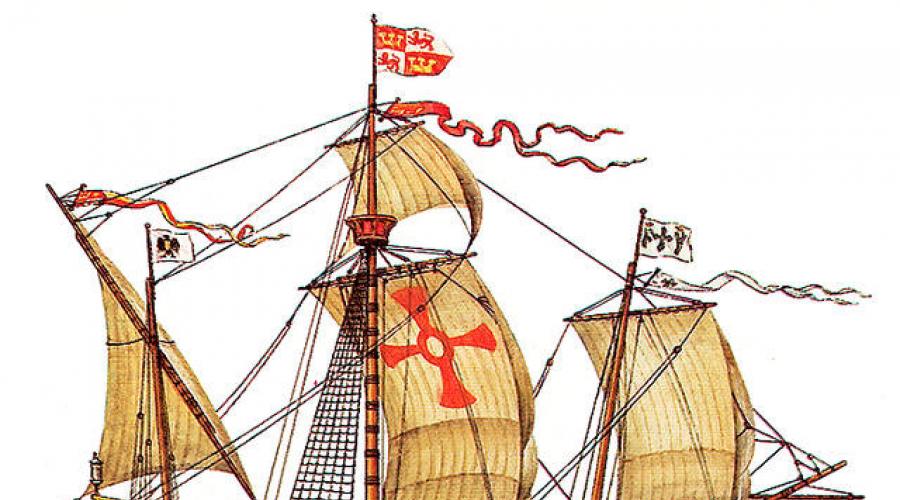
Ships of the era of great geographical discoveries

In the Middle Ages, the sides of ships were sheathed with planks, the upper row of planks overlapped the lower one. This sturdy casing. but the ships are heavier from this, and the edges of the plating belts create unnecessary hull resistance. At the beginning of the fifteenth century, the French shipbuilder Julien proposed to sheathe ships end-to-end. The boards were riveted to the frames with copper stainless rivets. The joints were glued with resin. This skin was named "caravel", and the ships were called caravels. Caravels - the main ships of the era of the great geographical discoveries were built at all shipyards of the world for another two hundred years after the death of their designer.

At the beginning of the 17th century, the flute was invented in Holland. Fleite in Dutch means to flow, flowing. These ships could not be overwhelmed by any of the largest ramparts. They, like traffic jams, took off on a wave. The upper parts of the sides of the flute bent inward, the masts were very high: they were one and a half times the length of the hull, the yards were short, the sails were therefore narrow, easy to maintain, which made it possible to reduce the number of sailors in the crew. And, most importantly, the flutes were four times longer than wide, which made them very fast. In flutes, the sides were also installed end-to-end, the masts were made up of several elements. The flutes were much more capacious than the caravels. From 1600 to 1660, 15,000 flutes were built and sailed the oceans, displacing caravels
Navigators of the Age of Discovery
- Alvise Cadamosto (Portugal, Venice, 1432-1488) - Cape Verde Islands
- Diego Caen (Portugal, 1440 - 1486) - West African coast
- Bartalomeu Dias (Portugal, 1450-1500) - Cape of Good Hope
- Vasco da Gama (Portugal, 1460-1524) - path to India around Africa
- Pedro Cabral (Portugal, 1467-1526) - Brazil
- Christopher Columbus (Genoa, Spain, 1451-1506) - America
- Nunez de Balboa (Spain, 1475-1519) - Pacific Ocean
- Francisco de Orellana (Spain, 1511-1546) - Amazon River
- Fernando Magellan (Portugal, Spain (1480-1521) - first circumnavigation of the world
- John Cabot (Genoa, England, 1450-1498) - Labrador, Newfoundland
- Jean cartier (France, 1491-1557) east coast of Canada
- Martin Frobisher (England, 1535-1594) - polar seas of Canada
- Alvaro Mendanha (Spain, 1541-1595) - Solomon Islands
- Pedro de Quiros (Spain, 1565-1614) - Tuamotu Archipelago, New Hybrids
- Luis de Torres (Spain, 1560-1614) - the island of New Guinea, the strait that separates this island from Australia
- Francis Drake (England, 1540-1596) - second voyage around the world
- Willem Barents (Netherlands, 1550-1597) - first polar navigator
- Henry Hudson (England, 1550-1611) - explorer of the North Atlantic
- Willem Schouten (Holland, 1567-1625) - Cape Horn
- Abel Tasman (Holland, 1603-1659) - Tasmania Island, New Zealand
- Willem Jansson (Holland, 1570-1632) - Australia
- Semyon Dezhnev (Russia, 1605-1673) - the Kolyma river, the strait between Asia and America
This term is used in relation to the most important geographical discoveries made by European travelers between the 15th and 17th centuries. Geographical discoveries are the search and discovery of new lands previously unknown to people. These are the reasons that prompted people to make great geographical discoveries, starting from the end of the 15th century.
First, at the end of the 15th - beginning of the 16th centuries, commodity production began to grow rapidly in Europe, which led to an increase in demand for raw materials. But since there was not enough raw material in Europe, it became necessary to import it from other countries.
Secondly, the existing trade routes through the Mediterranean Sea, as well as the Great Silk Road that connected Asia with Europe, became extremely dangerous. Control over these routes passed to the Ottoman Empire (Turkey). The challenge facing the Europeans of opening new sea trade routes has become a historical necessity. The modern ships and weapons that existed by this time fully made it possible to implement the plan. The invention of the astrolabe, which began to be used in navigation along with the compass, was also of great importance. During this period, the Italian scientist P. Toscanelli, proceeding from the fact that the Earth is round, created a map of the world. On it, the shores of the Asian continent reached the western part of the Atlantic Ocean. P. Toscanelli believed that by sailing from Europe to the west, one could get to India.
The beginning of great geographical discoveries.
The initiators of the great geographical discoveries were sea travelers from Portugal and Spain. To implement such a grandiose idea, fearless sailors were needed. One of these travelers was the Genoese Admiral Christopher Columbus (1451-1506). He planned to pave the way to India across the Atlantic Ocean.
Columbus managed to conclude an agreement with the royal family of Spain to equip an expedition to find the shortest sea route to India. The king took over the financial support of the expedition. On August 6, 1492, Columbus went to sea in three caravels, leading an expedition.
Discovery of America.
On October 12, 1492, Columbus's expedition landed on an island in the Caribbean. Columbus named this island San Salvador (now the territory of the state of the Commonwealth of the Bahamas). Thus, the search for the shortest sea route to India led to the discovery of America. This happened as a result of the mistakes of scientists of the 15th century, in particular Toscanelli, who made a map of the world. The fact is that when determining the length of the equator, P. Toscanelli made a mistake in calculating by 12 kilometers. Subsequently, scientists called this mistake "the great mistake that led to the great discovery."
However, Columbus himself did not understand that in 1492 he sailed not to India, but to America. He believed he had arrived in India. Therefore, he called the indigenous population of America Indians. Columbus subsequently equipped four more expeditions to India (actually to America). As a result of these expeditions, many new lands were discovered, on which the Spanish flag was raised. These territories became the property of Spain. Columbus was appointed viceroy of these lands. The fact that the new continent was named not Colombia, but America, is associated with the name of the Italian navigator and astronomer Amerigo Vespucci (1454-1512). In 1499 - 1501, as part of a Portuguese expedition, he explored the shores of Brazil and came to the conclusion that the lands discovered by Columbus were not India, but a new part of the world. Subsequently, he named the continent named after him the New World. In 1507, the scientist-cartographer M. Waldseemüller proposed to name the new part of the world discovered by Columbus in honor of Amerigo Vespucci - America. This name suited everyone. The first globe on which the New World was named "America" was created in Germany in 1515. Subsequently, on other maps, the lands discovered by Columbus began to be called "America".
Subsequent discoveries.
Marine Fernand Magellan. the path across the Atlantic Ocean leading to India was opened in 1498. The Portuguese sea traveler Vasco da Gama, who sailed from the coast of Spain. In 1519, another Portuguese Fernand Magellan, who also began his sea voyage from the coast of Spain, rounded the American continent, opened a new sea route to India. This trip around the world ended in 1522 and finally proved that the Earth is round and most of it is covered with water. And the JI.B. de Torres discovered Australia in 1605.
Significance of great geographical discoveries. The great geographical discoveries played an important role in the development of many sciences. Geography, history, ethnography, oceanology were replenished with new information and conclusions. Thanks to these discoveries, new trade sea routes were laid. The main sea trade routes that ran through the Mediterranean have now moved into the Atlantic Ocean. These factors contributed to the formation of further world trade.
So, thanks to the Great Geographical Discoveries, the foundation of a global civilization was laid.
Admiral (from the Arabic "amiralbakhr" - "lord of the sea") - a military rank in the navies.
Astrolabe is an astronomical instrument used to determine geographic latitudes and longitudes, as well as the rising and setting of stars.
Vice - assistant, deputy by position.
Discovery is a search, an achievement that makes fundamental changes in the level of knowledge.
- Hello Lord! Please support the project! It takes money ($) and mountains of enthusiasm to maintain a website every month. 🙁 If our site helped you and you want to support the project 🙂, then you can do this by transferring funds in any of the following ways. By transferring electronic money:
- R819906736816 (wmr) rubles.
- Z177913641953 (wmz) dollars.
- E810620923590 (wme) euro.
- Payeer Wallet: P34018761
- Qiwi Wallet: +998935323888
- DonationAlerts: http://www.donationalerts.ru/r/veknoviy
- The received help will be used and directed to the continuation of the development of the resource, Payment for hosting and Domain.
GREAT GEOGRAPHICAL DISCOVERIES, the term adopted in the literature to denote the largest geographical discoveries made by European travelers in the period from the end of the 15th century (when the idea of an uninterrupted sea route to the countries of the East first appeared in Europe) to the middle of the 17th century (when some sea routes to these countries were have already been discovered, and with respect to others it has been established that, if they exist, they cannot have practical significance). In foreign literature, there are other dates, usually the middle of the 15th - the middle of the 16th centuries. The term “Great geographical discoveries” is conditional, but there are grounds for its use: never have the most important geographical discoveries been made with such intensity and were not so important for the development of Europe and the whole world as during this period. Since the end of the 20th century, on the eve and during the celebration of the 500th anniversary of the discovery of America and the sea route to India, a sharp controversy has developed around the role of the Great Geographical Discoveries. In particular, public figures and scientists from a number of countries in Latin America, Asia and Africa refused to “celebrate the beginning of their oppression” and denied the very term “discovery”, replacing it with “meeting of cultures” or “concealment” of one culture by another.
Preconditions for the Great Geographical Discoveries. A number of reasons contributed to the great geographical discoveries. The growth of cities and the development of commodity-money relations in Europe led to a shortage of precious metals, which made it necessary to search for new lands, where they hoped to find gold, silver, as well as spices, ivory (in southern countries), valuable furs and walrus tusks (in the north ). The development of the European economy presupposed closer trade ties with the East, which was considered the center of all wealth. In the middle of the 15th century, trade routes to the East through Asia Minor and Syria were closed as a result of the Ottoman conquests; there was an urgent need to open direct sea routes for trade without intermediaries. Religious and political reasons also played a role. After the fall of Byzantium, the Ottomans threatened all of Europe, and in their search for allies, Christians hoped to find co-religionists in the East. The legend about the Christian state of Presbyter John, known since the 12th century, was revived, which from the 15th century began to be identified with Christian Ethiopia. The Europeans sought to find this power and conclude a military alliance with it against the Muslims in order to stop the Ottoman offensive, recapture Constantinople and, renewing the crusades, return the Holy Sepulcher.
Great geographical discoveries became possible thanks to the achievements of European science and technology. High-speed and maneuverable sailing ships - caravels were created; instruments and tables that made it possible to plot the desired course and determine the location of the vessel (astrolabe, compass, Regiomontana tables). Geographic maps have become more accurate. An important role was played by the assumption that the Earth had the shape of a ball, which had spread by the end of the 15th century. At the same time, the invention of printing in Europe in the middle of the 15th century made the reference literature on navigation and descriptions of the latest discoveries relatively accessible, provoking further searches. The successful expansion was facilitated by the naval superiority of the Europeans over the peoples they faced.
During this period, the most prepared for the great geographical discoveries were Spain and Portugal, which had convenient ports, long and rich maritime traditions; their geographic location facilitated navigation in the Atlantic Ocean. Portugal, having completed the Reconquista on its territory in the middle of the 13th century, was ready for a significant maritime expansion by the beginning of the 15th century. By the end of the 15th century, with the completion of the Spanish Reconquista and the unification of the country, Spain also prepared for sea voyages, using the captured Canary Islands, which became a convenient base for further expeditions.
Traditionally, the Great Geographical Discoveries are divided into 2 periods: the end of the 15th - the middle of the 16th century - the period of the most important discoveries, in which Portugal and Spain played the main role; mid-16th - mid-17th century - the period of dominance of geographical discoveries in England and Holland. At the same time, Russian explorers made outstanding discoveries in Siberia and the Far East.
First period... By the beginning of the 1st period of the Great Geographical Discoveries, the Portuguese, already for several decades moving south along the western coast of Africa, mastered the riches of the occupied territories (reached the Gulf of Guinea). Enrique the Navigator played an outstanding role in organizing their voyages for 40 years (until 1460). Perhaps, the very idea of a sea route to the countries of the East, which contradicted the views of the ancient geographer Claudius Ptolemy, was connected with the turn of the coastline to the east at the entrance to the Gulf of Guinea, which was not foreseen on the maps of that time. In the 1460s and 70s, the advance of the Portuguese to the south temporarily stopped, since it took time to develop the riches of the coast of the Gulf of Guinea (gold, ivory, etc.); it resumed in the 1480s at a faster pace. In two expeditions in 1482-84 and 1484-86 (or 1487), D. Kahn moved to the south for 2500 km, reaching the coast of the Namib Desert (22 ° South latitude). In 1487-1488 B. Dias rounded the southern tip of Africa and entered the Indian Ocean.
In the 1480s, H. Columbus put forward a project for a western route to the countries of the East. In a voyage of 1492-93 under the Spanish flag, he first crossed the Atlantic Ocean in subtropical latitudes and discovered lands overseas - the Bahamas, Cuba, Haiti. 10/12/1492, when he first landed in the Bahamas, is considered the official date of the discovery of America. Later Columbus made 3 more voyages (1493-96, 1498-1500, 1502-04), during which the discovery of the Greater Antilles was completed, many Lesser Antilles were discovered, as well as sections of the mainland coast near the mouth of the Orinoco River and from the Yucatan Peninsula to Darien Bay. Disagreements between Spain and Portugal regarding the rights to open lands were settled by the Treaty of Tordesillas in 1494. However, other countries, whose interests the treaty ignored, did not want to recognize it, in 1497 England joined the Great Geographical Discoveries: J. Cabot, seeking to reach Japan and China, discovered the island of Newfoundland (1497) and the coast of North America (1498).
Further discoveries are associated, first of all, with Portuguese expeditions in the Indian Ocean basin, Spanish and Portuguese expansion in Latin America. In the voyage of 1497-99 Vasco da Gama discovered a continuous sea route from Western Europe around South Africa to India (1498). In 150, the Portuguese P. Alvaris Cabral, on his way to India, discovered a stretch of the coast of Brazil, after which its colonization by the Portuguese began; on the same voyage, the island of Madagascar was discovered. Having established themselves under the Viceroys of Almeida and Albuquerque on the east coast of Africa and the west coast of India, suppressing Egyptian resistance in the naval battle of Diu (1509), the Portuguese captured Malacca in 1511, which became a base for further advancement. In 1512 they reached the Spice Islands (Moluccas) and later China and Japan. The Spaniards were more active in the New World: A. de Ojeda and A. Vespucci (1499-1500), V. Janes Pinson (1499-1500), D. de Lepe (1499-1500), R. de Bastidas (1500-1502) et al. traced the coast of South America from Darien Bay to 16 ° north latitude. In 1509-28, the Spaniards explored the coast of the Yucatan Peninsula and the Gulf of Mexico; in 1513, J. Ponce de Leon, in search of the legendary "source of eternal youth", discovered the Florida Peninsula and the Gulf Stream. A. Alvarez de Pineda in 1519 walked along the entire northern coast of the Gulf of Mexico. But already at the beginning of the 16th century, it became obvious that the lands discovered overseas were not Asia, but a new, previously unknown, part of the world. But while America's wealth was not yet discovered, it was perceived as an obstacle on the way to the countries of the East. In 1513 V. Nunez de Balboa crossed the Isthmus of Panama and reached the Pacific Ocean, which he called the South Sea. In search of a strait leading to this sea, D. Diaz de Solis in 1515-16 explored the bay of La Plata. The Spanish expedition of F. Magellan managed to find the strait, whose ships then crossed the Pacific Ocean and reached the Philippines and the Moluccas, carrying out Columbus's plan - to pave the western route to the countries of the East. After the death of Magellan, part of his companions, led by JS Elcano, returned to Spain through the Indian and Atlantic oceans, making the first round-the-world voyage in history (1519-22).
At the same time, the conquest unfolded in America. After the expeditions of F. Hernandez de Cordova and J. Grijalva in 1517-18 explored the way to Mexico, the Aztec power located in its central part was conquered by E. Cortez (1519-21). In the 1520s and 30s, the Spaniards (Cortes, P. de Alvarado, C. de Olid, and others) conquered other regions of Mexico, Guatemala and Honduras, traced the Pacific coast of Central America from the California peninsula to modern Panama. In 1527-29 A. de Saavedra sailed from Mexico to the Moluccas and China, he could not return back due to headwinds, but discovered part of the Admiralty, Marshall and Caroline islands. A. Nunez Cavez de Vaca (1529-36), E. de Soto (1539-42), and F. Vasquez de Coronado (1540-42) surveyed the southern part of the modern United States. In the 1526-35s, the conquistadors led by F. Pizarro reached the Tahuantinsuyu Inca power and conquered its central regions. In 1535-37, D. de Almagro made a campaign to the south from Peru, the first of the Europeans to cross the Andes and reached 36 ° south latitude. In 1540-53 P. de Valdivia, trying to conquer Chile, moved south to 40 ° south latitude. In 1536-37 G. Jimenez de Quesada, in search of a country rich in gold, Eldorado discovered and conquered mountainous Colombia, where the highly developed civilization of the Chibcha Muisca was located. The lower and middle reaches of the Orinoco River were explored in 1531-32 by D. de Ordaz, and F. de Orellana in 1541-42 - across the Amazon crossed South America in its widest part. Other conquistadors, moving from the Gulf of La Plata, surveyed the course of the Parana and Uruguay rivers.
Since the 1520s, French explorers have been involved in the Great Geographical Discoveries. In search of a passage from the Atlantic Ocean to the Pacific Ocean, G. Verrazzano in 1524 walked along the eastern coast of North America from 34 to 46 ° north latitude, and in 1534-36, J. Cartier explored the Gulf and the St. Lawrence River (before the Ottawa). After receiving information about the Great Lakes, he decided that we are talking about the Pacific Ocean or about the passage to it. The lakes were discovered by the French in the 1620s and 1930s (S. Champlain and others).
Second period... At the beginning of the 2nd period of the Great Geographical Discoveries, Spain and Portugal, having seized vast territories, began to develop them and yielded to the initiative of England, and then Holland. Since the already open sea routes to the countries of the East around Africa and America were controlled by Portugal and Spain (and the latter was also too long and risky), at this time the search for the Northwest Passage and the Northeast Passage was especially active. In 1553, the English expedition of H. Willoughby and R. Chancellor was sent in search of the Northeast Passage, establishing trade relations with Russia. At the end of the 16th century, Holland was actively searching for the Northeast Passage, equipping three expeditions in a row (1594, 1595, 1596-97). V. Barents played a key role in them, although he did not officially lead them. However, the Dutch could not advance further than Novaya Zemlya (where the first known polar wintering took place in 1596-97), and sailing in this direction was stopped. In search of the Northwest Route, the British M. Frobisher, J. Davis, G. Hudson, R. Bylot, W. Baffin, L. Fox and others discovered in the circumpolar part of North America from the 1570s to the early 1630s many islands, straits, bays, including Hudson Bay (1610). However, they did not manage to find either a passage to the Pacific Ocean, or special riches. In the 1630s and 40s, navigators came to the conclusion that the Northwest Passage, if it exists, has no commercial value. In general, the search for the North-East and North-West passages, although not crowned with success (they were discovered only in the 19th and 20th centuries), contributed to the accumulation of knowledge about the northern seas and lands; rich fishing and whaling areas were discovered. The English pirate F. Drake made his contribution to the great geographical discoveries: having made the second round-the-world voyage after Magellan in the 1577-80s, he discovered the strait separating Antarctica from Tierra del Fuego, and a section of the Pacific coast of North America.
The Spaniards in the second half of the 16th - early 17th century organized three voyages from Peru across the Pacific Ocean in search of the biblical country of Ophir, as well as the Unknown Southern Land (which, as it was then believed, occupies vast spaces in the inaccessible southern latitudes). In 1568 A. Mendanha de Neira discovered the Solomon Islands, but determined their longitude by mistake, and therefore tried in vain to find them in 1595. During the 1605-07 expedition that was also looking for them, led by P. Fernandez de Quiros, the New Hebrides archipelago was discovered, and the commander of the two ships L. Vaez de Torres first passed the strait between New Guinea and Australia, mistaking the latter for the northeastern ledge Unknown Southern Land. The discovery of Torres was classified and became known only in the 18th century. An important discovery was made by members of the expedition of M. Lopez de Legazpi, which marked the beginning of the colonization of the Philippines: in 1565, when he returned to Mexico, A. de Urdaneta found that about 40 ° north latitude, in contrast to southern latitudes, winds and currents favor the crossing of the Pacific Ocean in eastward direction. Thanks to this, regular connections between Asia and America became possible.
At the turn of the 16th and 17th centuries, the Dutch drove the Portuguese out of Indonesia. In the voyage of 1605-06, the Dutchman V. Janszon was the first to reach the shores of Australia, mistaking it for the island of New Guinea. In search of convenient routes from southern Africa to the island of Java, H. Browver in 1611 discovered an optimal route that ran south of the previous one. Using it, the Dutch from time to time reached the western coast of Australia and in 1616-36 discovered a significant part of it. In 1642-43, the Dutchman A. Tasman rounded Australia without approaching its shores, established that it was not part of the Unknown Southern Land, and discovered an island later named after him. During the voyage, the South and North Islands (New Zealand) were also discovered. In the voyage of 1644, Tasman traced the uninterrupted line of the northern coast of Australia for 5500 km, proving the existence of a new continent. But these lands did not interest the Dutch, and further searches were stopped.
Simultaneously with the sea expeditions of the countries of Western Europe, Russian explorers at the end of the 16th century penetrated into Siberia, crossed all of North Asia in the first half of the 17th century and reached the Sea of Okhotsk, tracing the course of all the great Siberian rivers, and Russian sailors bypassed the entire northern coast of Asia. In 1648 the expedition of F. Popov - S. Dezhnev for the first time passed from the Arctic Ocean to the Pacific Ocean through the Bering Strait. It was proved that Asia never connects with America, but this discovery did not receive wide recognition and was later re-made by V. Bering.
The significance of the great geographical discoveries. As a result of the Great Geographical Discoveries, the Europeans' view of the world has significantly expanded. The Europeans discovered two parts of the world, America and Australia, as well as the Pacific Ocean, and basically defined the contours of all inhabited continents. As a result of the first round-the-world trip, it was proved in practice that the Earth has the shape of a ball, it was established that all continents are washed by a single World Ocean, and many of its currents are open. It became obvious that, contrary to the opinion of ancient scientists, there is much more water on the earth's surface than land. At the same time, many of the interior regions of America, Africa and Australia, as well as the depths of the oceans, remained unexplored.
The great geographical discoveries provided extensive new material for the natural sciences, ethnography, and history. Learning about the life of societies with different religions and customs, the Europeans became convinced of the diversity of the world. Reflections on the golden age and the unspoiled faith of the inhabitants of America echoed the ideas of the Renaissance, the Reformation, and a social utopia. At the same time, acquiring the experience of communicating with overseas residents, the Europeans were more clearly aware of their cultural and historical identity. The information received about distant countries enriched European literature and art.
The great geographical discoveries had a profound impact on the socio-economic processes in Europe, contributed to the initial accumulation of capital. The colonies served as sources of raw materials and markets for European goods. With the movement of the main trade routes from the Mediterranean to the Atlantic, some regions fell into decay (Italy, southern Germany), while others, on the contrary, increased markedly (Spain and Portugal, later England and Holland). The large-scale import of American precious metals doubled the amount of gold in circulation in Europe and tripled the amount of silver, contributed to the rapid rise in prices for basic necessities throughout Europe, ruining some segments of the population and enriching others (see Price Revolution). The expansion of trade links, first between Europe and other parts of the world, then between America, Asia and Africa, led to the formation of the world market. An important part of international relations was the rivalry for control over trade routes, the desire of the strengthened powers to acquire their own colonies, and the struggle for their redistribution. Thanks to the wealth of the colonies, the metropolises strengthened their positions in Europe. At the same time, the rate of economic development depended on the method of using imported wealth. As a result, England and Holland began to go ahead, while Spain and Portugal lagged behind. However, the Great Geographical Discoveries also had a negative meaning for the Europeans: mass emigration to the colony led to an outflow of productive forces from Spain and Portugal. Europeans got acquainted with new agricultural crops (potatoes, corn, tomatoes, tea, coffee, cocoa, tobacco, cotton), which significantly changed their diet. Especially great was the importance of potatoes, which, partly replacing bread for the poor, noticeably reduced the threat of hunger in Europe in the modern era.
The colonial system that emerged during the Great Geographical Discoveries as a whole united the world, at the same time dividing it into two main groups of countries: on the one hand, the rapidly growing metropolises, on the other, colonies, the impact on which of European expansion was rather destructive. The influence of the great geographical discoveries and colonial conquests on the fate of the peoples of Asia, Africa and America was not the same. In Asia, until the 18th century, Europeans established their control only over strategically important points, but their influence gradually went far beyond these territories. The trade monopoly regime established by the Portuguese was based on inciting and maintaining political and religious contradictions, which influenced the situation in Western Asia and South Asia as a whole. The most destructive was the impact of European expansion in Africa, where the slave trade devastated entire regions, increasingly influencing the historical path of the continent's development. In Latin America, the cruelty of the conquistadors and the diseases introduced by Europeans initially led to a noticeable decrease in the local population. Subsequently, a more reasonable policy led to the emergence of Latin American society and culture, which absorbed both European and Native American features, but reworked them into a new whole.
The great geographical discoveries contributed to noticeable changes in the geography of religions. Christianity, as a result of the grandiose activities of European missionaries, spread widely in Asia, Africa, and especially in America. Where the Spaniards and the Portuguese preached, Catholicism was established, where the British and the Dutch were different reformation currents, mainly of the Calvinist persuasion.

Lit .: Peshel O. History of the era of discoveries. 2nd ed. M., 1884; Atlas of the history of geographical discoveries and research. M., 1959; Hart G. Sea route to India. M., 1959; Light Ya. M. History of discovery and exploration of Australia and Oceania. M., 1966; Bakles J. America through the eyes of discoverers. M., 1969; First images of America: The impact of the New World on the Old / Ed. F.Chiappelli. Berk. a. o., 1976. Vol. 1-2; Chaunu R. European expansion in the later Middle Ages. Amst. a. o., 1979; Sanz C. Descubrimientos geogrâficos. Madrid, 1979; Godinho V. M. Os descobrimentose and economia mundial. Lisboa, 1981-1983. Vol. 1-4; Magidovich I. P., Magidovich V. I. Essays on the history of geographical discoveries. M., 1982-1983. T. 1-2; Albuquerque L. de. Navegadores, viajantes e aventureiros portugueses: séculos XV e XVI. Lisboa, 1987. Vol. 1-2; Gil J. Mitos y utopias del descubrimiento. Madrid, 1989. Vol. 1-3; Cortesdo J. Os descobrimentos portugueses. Lisboa, 1990; Three caravels on the horizon. M., 1991; Découvertes et explorateurs: Actes du colloque international, Bordeaux 12-14 juin 1992. P .; Bordeaux, 1994; Implicit understandings: observing, reporting and reflecting on the encounters between Europeans, and other peoples in the early modern era / Ed. S. B. Schwartz. Camb. 1994; El Tratado de Tordesillasu su época. Valladolid, 1995; Pagden A. Lords of all the world: Ideologies of empire in Spain, Britain and France. L., 1995; La época de los descubrimientos y las conquistas, 1400-1570 / Ed. J. Perez. Madrid, 1998; Martinez Shaw S., Alfonso Mola M. Europa y los nuevos mundos: siglos XV-XVIII. Madrid, 1999; Parry J N. The age of reconnaissance: discovery, exploration and settlement, 1450-1650. L., 2000; Randles W.G.L. Geography, cartography and nautical science in the Renaissance: the impact of the great discoveries. Aldershot, 2000; Voyages and exploration in the North Atlantic from the Middle Ages to the XVIIth century. Reykjavik, 2001; Kofman A. F. America of unfulfilled miracles. M., 2001; Ramsay R. Discoveries that never happened. SPb., 2002; Soler I. El nudo y la esfera: el navegante como artifice del mundo moderno. Barcelona, 2003.
GEOGRAPHICAL DISCOVERIES, finding new geographic features or geographic patterns. In the early stages of the development of geography, discoveries related to new geographic objects prevailed. A particularly important role was played by ... ... encyclopedic Dictionary
Geographical discoveries- (exploration), search and research of unknown lands. At the time of the pioneers of travel (expedition) in the main. carried out by sea, less often by land. Phoenician merchants (Phyneans) often committed pestilence. sailing to the shores of Spain, Brittany and, ... ... The World History
Geographical discovery is the finding of new geographical objects or geographical patterns Contents 1 Introduction 2 Periodization of geographical discoveries ... Wikipedia
Geographical discoveries- Russians finding new geographic. objects as a result of land or sea travel and expeditions. Even before the formation of Dr. Russian state va east Slavs were izv. certain districts of Byzantium, adjacent to the Black Sea. In the 9-11th century, thanks to earlier ... ... Russian humanitarian encyclopedic dictionary
Planisphere Cantino (1502), the oldest surviving Portuguese navigational chart showing the results of the expeditions of Vasco da Gama, Christopher Columbus and other explorers. It also shows the meridian, section ... Wikipedia
A complex of the most significant discoveries on land and sea, made during almost the entire written history of mankind. Traditionally, the great geographical discoveries are identified only with discoveries in the so-called era of the great geographical ... ... encyclopedic Dictionary
Discovery of the conquest of Europeans in the early 15th - mid-17th century. in Africa, Asia, America and Oceania. The term "geographical discoveries" in relation to the complex of overseas expeditions of Europeans in the 15-17 centuries. rather arbitrary, because it covers two different ... ... Geographical encyclopedia
Great geographical discoveries- GREAT GEOGRAPHICAL DISCOVERIES, designation of a complex of the most significant discoveries on land and sea, made during almost the entire written history of mankind. Traditionally, the Great Geographical Discoveries are identified only with discoveries ... ... Illustrated Encyclopedic Dictionary
In zap. European and Russian. pre-revolutionary. lit re under the era of V. g. about. usually means a hundred-year (approx.) period from mid. 15 to mid. 16th century, center. moments to rogo were: the discovery of the tropical. America by H. Columbus, the discovery of a continuous sea. paths from Zap. Europe ... ... Soviet Historical Encyclopedia
A set of the most important geographical discoveries made by European travelers in the 15th and 17th centuries. The development of trade and industry in the countries of Western Europe, the formation of capitalist relations caused in 15 - early. 16th century striving for ... ... Geographical encyclopedia
Books
- Geographical discoveries, Deram, Sylvia. Why did people strive to unknown distances? Where did the ancient Greeks go? Which countries did Alexander the Great conquer? What was Ptolemy's mistake? When did you first see a giraffe in China? ...
- Geographical Discovery, Sylvia Deram. Why did people strive to unknown distances? Where did the ancient Greeks go? Which countries did Alexander the Great conquer? What was Ptolemy's mistake? Who invented the "solar sector"? When in…
Many important geographical discoveries date back to the last centuries of the feudal period, mainly the Renaissance. In 982 by the Icelandic Viking Eiriko Raudi(Red) Greenland was discovered, on the coast of which he developed a settlement. Eirik's son Leif Erickson, nicknamed the Happy, reached, most likely, in 1001 the coast (was beaten by a storm) of North America at 40 degrees s. sh., that is, in the area of modern Philadelphia.
End of the 15th century and the beginning of the 16th century. were marked by geographical discoveries made by the famous navigators Columbus, Magellan, Amerigo Vespuccia, Vasco da Gama and others.
Christopher Columbus(1452-1506) was born in Genoa. Even at a young age, he determined the goal of his life: to pave the shortest (as he thought) path from Europe to India, moving not as usual, to the east, but to the west. Columbus knew, of course, that the Earth was spherical. In 1485 he settled in Castile, which by that time had just been incorporated into Spain, and obtained an agreement to equip a naval expedition. In total, Columbus managed to conduct four expeditions.
The first expedition dates back to 1492-1493, 4 ships and about 90 people took part in it. Columbus 'ships sailed from Cape Palos (near the town of Karhatena) on August 3, 1492 and after more than two months' voyage found themselves near the coast of Central America. During the maiden voyage, Columbus did not manage to reach the American mainland. His expedition discovered the island of San Salvador and a number of other islands in the Bahamas, Cuba and Haiti. October 12, 1492 - the day of the discovery of the island of San Salvador and the landing on its coast - is considered the official date of the discovery of America. On March 15, 1493, the ships returned to Europe.
The second expedition, consisting of 17 ships and 1.5 thousand people, took place in 1493-1496. Its participants again failed to set foot on the American mainland. The islands of Dominica and Guadeloupe, a number of other islands of the Lesser Antilles archipelago, the Jardines de la Feina archipelago, the islands of Puerto Rico, Jamaica, and Pinos were discovered. Columbus undertook campaigns of conquest deep into the island of Haiti and on June 11, 1496 returned to Spain.
The third expedition (1498-1500), consisting of 6 ships, was marked by the fact that the coast of South America was reached in the Orinoco delta region (the territory of modern Venezuela). The islands of Trinidad and Margarita were also discovered.
The fourth, last, expedition took place in 1502-1504, 4 ships took part in it. Columbus was still seeking to find a western route to India. The shores of Central America were reached (the territory of modern Honduras, Nicaragua, Costa Rica and Panama), the island of Martinique was discovered.
Columbus's discoveries were used to create Spanish colonies in new lands. The local population, called by Columbus the Indians, was ruthlessly exterminated. This was the first consequence of the great geographical discoveries of Columbus.
The name of the new part of the world - America - comes, as you know, from the name of the navigator Amerigo Vespucci(approx. 1451-1512) - a contemporary of Columbus, a native of Florence. In 1499 - 1504, i.e. during the third and fourth voyages of Columbus, he participated in several Spanish and Portuguese expeditions to the region of South America. His letters about these travels, addressed to the Italian poet, the ruler of Florence Lorenzo Medici and a certain Piero Soderini, which were reprinted several times, became very widely known. Amerigo Vespucci suggested the discovery of a new continent and named it the New World. In 1507, the Lorraine cartographer Waldseemüller named the continent America in honor of Amerigo Vespucci. The name gained recognition and was later extended to North America.
Portuguese sailor Vasco da Gama(1469-1524) for the first time paved the sea route from Europe to the countries of South Asia. Unfortunately, he is also known for his cruelty and plundering of the population of the countries he conquered.
In 1497, an expedition of 4 ships under the command of Vasco da Gama set off from Lisbon to India. The ships rounded the Cape of Good Hope, made anchorage in the Somali port of Molindi, where they took on board the Arab sailor Ahmed ibn Majid, who knew the Indian Ocean, and reached the city of Calicut (now called Kozhikode) on the coast of South India. In 1499 the expedition returned to Lisbon.
During the second expedition (1500-1502), which already included 20 ships, strong bases were formed on the coast of India, north of the city of Calicut, the city of Calicut was captured, plundered and ruined. For these "merits" in 1524 Vasco da Gama was appointed Viceroy of India. During the third expedition, he died.
Fernand Magellan(approx. 1480-1521) - Portuguese and Spanish navigator, whose expedition circumnavigated the world for the first time, made important geographical discoveries, showed that the greatest ocean on Earth, which she called the Pacific, is located between Asia and America.
Magellan's expedition, consisting of 5 ships, in September 1519 set off from the Spanish port of Sanluccar de Barrameda (in southern Spain) and in January 1520 reached the Gulf of La Plata on the coast of South America (in this bay there is Buenos Aires ). The voyage was accompanied by great difficulties, there was no agreement between the Portuguese and Spanish sailors who were part of the expedition. From there the ships moved south, along the east coast of South America. Their eyes saw a huge unknown land - a vast plateau, which they called Patagonia.
After wintering in San Julian Bay (in the southern part of the Atlantic coast of South America), the expedition, which already included 4 ships, moved further south. The expedition managed to make an important geographical discovery - to find a strait connecting two oceans (Atlantic and Great, or Pacific), located between the southern end of the South American continent and the Tierra del Fuego archipelago, which was later named the Strait of Magellan.
Having passed through it, Magellan's expedition, which consisted of only three ships, went out into the ocean called the Pacific Ocean, and after four months full of hardships (lack of food and fresh water), the voyage reached the Philippine Islands, which turned out to be fatal for Magellan - here he was killed in fight with the locals.
The round-the-world voyage was completed by only one ship from the composition of Magellan's expedition - the vessel "Victoria", led by Captain Elcano, who also became the head of the expedition after the death of Magellan. "Victoria" crossed the Indian Ocean, circled the Cape of Good Hope, entered the Mediterranean Sea and returned to the port of Sanluccar de Barrameda. Of the 265 people - the original members of Magellan's expedition, only 18 people returned.
Magellan's expedition, in addition to geographical discoveries, the most important of which were said, convincingly confirmed that the Earth has the shape of a ball, proved that most of the Earth's surface is covered with water from the oceans and seas, which together make up a single world ocean.