Political map of the world with capitals of all countries. What is a political map
A POLITICAL MAP OF THE WORLD
A POLITICAL MAP OF THE WORLD
a map of the globe, which shows states, capitals, large cities, etc. In a broad sense, it is a collection of information about the nationality of territories, the subject of study of political geography. The process of formation of P. to. M. Has several millennia. There are several periods. Ancient (until the 5th century AD) is associated with the development and collapse of the first states on Earth - Ancient Egypt, Carthage, Ancient Greece, Ancient Rome, etc. In the medieval (V-XV centuries) large land masses (in particular, Europe) were completely divided between different states. The new period (from the turn of the XV-XVI centuries until the end of the First World War) corresponds to the beginning of European colonial expansion and the spread of international economic ties throughout the world. The newest period (from 1917 to the present day) is divided into three stages: the first is characterized by the emergence of the USSR, changes in borders in Europe, the expansion of the colonial possessions of Great Britain, France, Belgium and Japan; The second is associated with the collapse of the colonial empires in Asia, Africa, Latin America and Oceania and the beginning of the socialist experiment in a number of countries in Europe and Asia; The third stage is characterized by the unification of Germany, the proclamation of independence by the republics of the former USSR and Yugoslavia.
Concise Geographical Dictionary... EdwART. 2008.
A political map of the World
1) a geographical map of the globe or its parts, which reflects the territorial and political division.
2) A set of information on the political geography of the globe or a large region: location, borders, capitals of states, forms of government, administrative-territorial structure, interstate. relationship. The political map of any region is not constant in time, that is, it is a historical category. Changes to the political map can be of two types: quantitative and qualitative. Quantitative associated with the state. ter. and borders. Qualitative changes are associated with transformations in the political system of the state.
Quantitative changes in the political map include territorial gains or losses. These processes can proceed peacefully (for example, the development of Siberia by the Russians in the 17th century, the purchase of Alaska by the United States from Russia in 1867, the voluntary concession by France of some districts of its African colonies in favor of Germany in 1911), or they can proceed in the form of military operations (changes in state borders as a result of the 1st and 2nd world wars, the conquest of Mexican Texas by the US army in 1845, etc.). The unification and disintegration of states can also be attributed to quantitative changes: these transformations are clearly visible on the geographical map.
Geography. Modern illustrated encyclopedia. - M .: Rosman. Edited by prof. A.P. Gorkina. 2006 .
See what "POLITICAL WORLD MAP" is in other dictionaries:
A political map of the World - … Geographic Atlas
CIA USA (as of 2011) Political map of the world geographic map, reflec ... Wikipedia
In the narrow sense of the word, a geographical map of the globe, on which all countries of the world are indicated. In a broad sense, a set of information about the political geography of the world. The modern political map of the world includes St. 200 countries. Political Science: ... ... Political science. Dictionary.
In the narrow sense of the word, a geographical map of the globe, on which all countries of the world are indicated. In a broad sense, a set of information about the political geography of the world. The modern political map of the world includes St. 200 countries ... Big Encyclopedic Dictionary
a political map of the World- A map showing all the countries that exist on the globe; in a figurative sense, a historically established system of state borders and relationships between countries ... Geography Dictionary
In a narrow sense, a geographical map of the globe, which indicates all the countries of the world. In a broad sense, a set of information about the political geography of the world. The modern political map of the world includes over 200 countries. * * * POLITICAL MAP ... ... encyclopedic Dictionary
World map A geographic map that depicts the entire globe. The most commonly used political and physical map of the world, thematic maps of the world are also widely used: tectonic, climatic, geological, ... ... Wikipedia
WORLD MAP, a reduced generalized image of the earth's surface on a plane with the display on it of natural and socio-economic objects (for example, relief (see RELIEF (set of irregularities)), water bodies (see WATER BODIES), ... ... encyclopedic Dictionary
Political geography is a scientific discipline that studies the formation of a political map of the world, geopolitical structures, the location and territorial combinations of political forces, their relationship with the spatial organization of political life in ... ... Wikipedia
Political geography is a social geographic science that studies the territorial differentiation of political phenomena and processes. The author of the term "political geography" is considered the Frenchman Turgot, who pointed back in the middle of the 18th century to ... ... Wikipedia
Can be viewed in two aspects. The first is a simple publication on paper that displays how the world works in terms of the alignment of political forces. The second aspect considers this concept from a broader perspective, as about the formation of states, their structure and split, about the rearrangement of forces in the political world, about the advantage and influence of large and powerful states on the world economy. The past gives us a picture of the future, which is why it is so important to know the stages in the formation of the political map of the world.
general information
Any state has its own life cycle. It is a hump-like curve. At the beginning of its journey, the country is being built and developed. Then comes the peak of development, when everyone is happy and everything seems to be good. But sooner or later, the state loses its strength and power and begins to gradually fall apart. It has always been, is and will be. That is why, over the centuries, we have seen the gradual rise and fall of great empires, superpowers and huge colonial monopolies. Let's consider the main stages of the formation of the political map of the world. The table is shown in the figure:
As you can see, many historians identify exactly five stages in modern history. In various sources, you can find only 4 main ones. This dilemma has arisen a long time ago, since the stages of the formation of the political map of the world can be interpreted in different ways. The table of the main sections, proposed by us, contains the most reliable information to date.
Ancient period
In the ancient world, the first great states entered the arena of major events. You all probably remember them from history. This is glorious Ancient Egypt, powerful Greece and the invincible Roman Empire. Simultaneously with them, there were also less significant, but also quite developed states in Central and East Asia. Their historical period ends in the 5th century AD. It is generally accepted that it was at this time that the slave system was becoming a thing of the past.

Medieval period
In our minds, during the period from 5 to 15 centuries, there have been many changes that cannot be covered with one sentence. If historians of that time knew what a political map of the world was, the stages of its formation would have already been divided into separate parts. After all, remember, during this time Christianity was born, Kievan Rus was born and disintegrated, and large feudal states are gaining strength in Europe. First of all, these are Spain and Portugal, which are vying with each other to make new geographical discoveries.

At the same time, the political map of the world is constantly changing. The stages of the formation of that time will change the further fate of many states. The mighty Ottoman Empire will survive for several more centuries, conquering the states of Europe, Asia and Africa.

New period
From the late 15th - early 16th centuries, a new page begins on the political arena. This was the time when the first capitalist relations began. Centuries when huge colonial empires began to emerge in the world that conquered the whole world. The political map of the world is often changed and altered. The stages of formation are constantly replacing each other.
Spain and Portugal are gradually losing their power. It is no longer possible to survive by robbing other countries, because more developed countries are moving to a completely new level of production - manufacturing. This gave impetus to the development of such powers as England, France, the Netherlands, Germany. After the American Civil War, they are joined by a new and very large player - the United States of America.
The political map of the world changed especially often at the turn of the 19th and 20th centuries. The stages of formation during that period depended on the outcome of successful military campaigns. So, if back in 1876 the European countries captured only 10% of the territory of Africa, then in just 30 years they managed to conquer 90% of the entire territory of the hot continent. The whole world has entered the new 20th century, already practically divided between the superpowers. They ruled the economy and ruled alone. Further redistribution was inevitable without war. This is how the new period ends and the newest stage in the formation of the political map of the world begins.

Newest stage
The redistribution of the world after the First World War made huge adjustments to the First of all, four powerful empires disappeared. These are Great Britain, the Ottoman Empire, the Russian Empire and Germany. Many new states were formed in their place.
At the same time, a new trend appears - socialism. And on the map of the world there is a huge state - the Union of Soviet Socialist Republics. At the same time, such powers as France, Great Britain, Belgium and Japan are strengthening. Some of the lands of the former colonies were transferred to them. But this redistribution does not suit many, and the world is again on the verge of war.
At this stage, some historians continue to write about the newest period, but now it is generally accepted that with the end of World War II, the modern stage of the formation of the political map of the world begins.

Modern stage
The Second World War outlined for us those borders, most of which we see today. First of all, this concerns the states of Europe. The war brought the greatest result by the fact that it completely disintegrated and disappeared. New independent states appeared in South America, Oceania, Africa, Asia.
But the largest country in the world, the USSR, still continues to exist. With its disintegration in 1991, another important stage appears. Many historians identify it as a subsection of the modern period. Indeed, after 1991, 17 new independent states were formed in Eurasia. Many of them decided to continue their existence within the borders of the Russian Federation. For example, Chechnya defended its interests for a long time until, as a result of hostilities, the power of a powerful country defeated.
At the same time, changes continue in the Middle East. Some Arab states are uniting there. In Europe, a unified Germany appears and the FRY Union collapses, as a result of which Bosnia and Herzegovina, Macedonia, Croatia, Serbia and Montenegro appear.

Continuation of a story
We have presented only the main stages of the formation of the political map of the world. But the story doesn't end there. As the events of recent years show, soon it will be necessary to allocate a new period or redraw the maps. After all, judge for yourself: two years ago Crimea belonged to the territory of Ukraine, and now it is necessary to completely redo all the atlases in order to change its citizenship. And also troubled Israel, drowning in battles, Egypt on the verge of war and a redistribution of power, incessant Syria, which can be wiped off the face of the Earth by powerful superpowers. All this is our modern history.
Most of us regularly watch news on TV or the Internet. For those who do not look, they, one way or another, reach from relatives, friends, acquaintances and colleagues. In my opinion, it is really important to know what is happening in the world at the current time. And now, once again, turning on the news channel, we hear a lot of information about such large countries as Russia, America, China. Few people think and remember that there are many more countries in the world, how can one find out this or that information about them? The political map helps me with this!
What is a political map
In simple terms, this is a geographic map of the Earth, on which the entire list of countries existing in the world at a given point in time is indicated. In broader terms, we can say that this is a physical or electronic map, which contains all the most relevant information about the political situation of all countries of the world. Today, in the modern version of this source of knowledge, I counted 236 territories and states. Here is a list of what important data about them can be found on the political map:
- The disintegration of the country into different territories.
- The merger of several different states.
- Change of country names.
- Forms of government and state structures.
- Change of territories.
- Change of capitals.

As you can see from the list above, such a tool is really important for understanding various global political processes. It displays a large amount of important information, and since this is an official source, there is no doubt about its quality and reliability.

The importance of political knowledge
You may ask, if I am not a professional politician, why would I need to know all this? How will this help me in my life? To which I will give you an answer with all confidence. The global and local political situation affects the life of absolutely every person, without exception. Knowing about certain events in another large state, you can assume what will happen to the rate of your national currency and conclude whether it is worth buying an apartment at the moment or later. You can also calculate in what currency at the moment it is better for you to keep your savings or take out a loan. Sometimes, as a last resort, realizing that the economic situation in your country will be in a deplorable state, you will be able to make a prompt decision and immigrate to another state on time.
The political map of the world is a geographical map that reflects the countries of the world, their form of government and state structure. The political map reflects the main political and geographical changes: the formation of new independent states, a change in their status, the merger and division of states, the loss or acquisition of sovereignty, a change in the area of states, the replacement of their capitals, a change in the name of states and capitals, a change in the forms of government, etc. ...
In a broad sense, the political map of the world is not only the state borders of countries, plotted on a cartographic basis. It carries information about the history of the formation of political systems and states, about the correlation of states in the modern world, about the originality of regions and countries in their political structure, about the influence of the location of countries on their political structure and economic development.
At the same time, the political map of the world is a historical category, since it reflects all changes in the political structure and borders of states that occur as a result of various historical events.
Colorful political map of the world in English

All changes that have arisen on the political map over the long history of its formation are of a different nature. Among them, there are quantitative and qualitative changes. The quantitative ones include: accession of newly discovered lands; territorial gains or losses during wars; unification or disintegration of states; concessions or exchange between countries of land areas. Other changes are qualitative. They consist in the historical change of socio-economic formations; the country's acquisition of political sovereignty; the introduction of new forms of government; the formation of interstate political alliances, the appearance and disappearance of "hot spots" on the planet. Quite often quantitative changes are accompanied by qualitative ones. Recent events in the world show that quantitative shifts on the political map are increasingly giving way to qualitative ones, and this leads to the understanding that instead of war, the usual means of resolving interstate disputes, the path of dialogues, the peaceful settlement of territorial disputes and international conflicts comes to the fore.
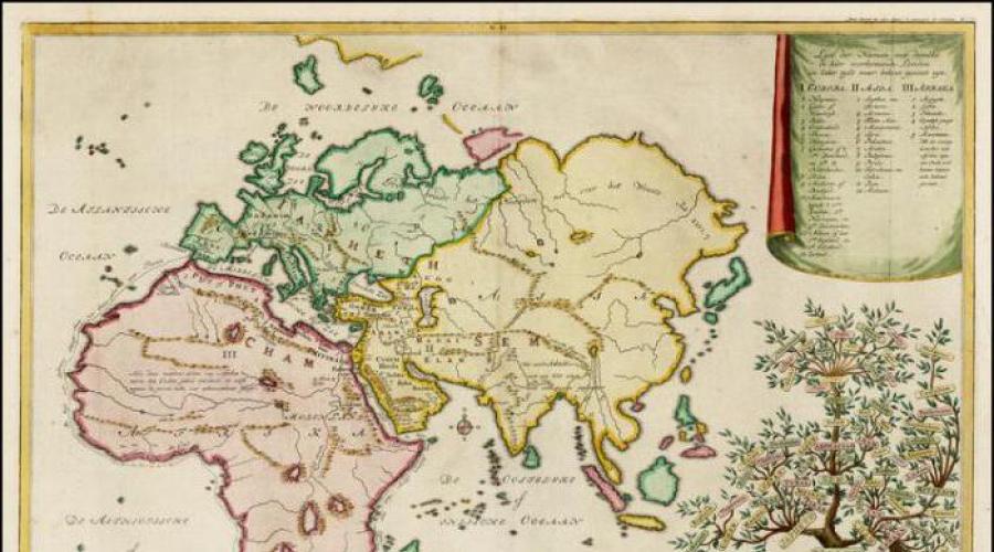
Political map of the world before the collapse of the USSR in Russian

Large detailed political map of the World in Russian

2012 World Political Map

Political map of the world with real proportions of the areas of states

Political map of the world in Ukrainian

Large political map of the World

Political map of the world (Russian)

World Dependent Territories Map

Very large and detailed political map of the world

Old school, nostalgic political map of the world

Political World Map English


Political world map (relief)

Political / Physical Map of the World

Political World Map

Political map of the Earth

Political World Map in Russian - Political World Map

Political World Map

Political World Map

According to experts, in the near future the political map of the world will undergo major changes. The trend towards an increase in the number of states based on ethnic principles continues. At the same time, state borders that do not correspond to the nations living within them will lose their significance. On the other hand, international political alliances will play an even more important role.